


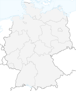


Trekking hiking parking lot Malschbach - Kreuzfelsen - Camp Grimbach
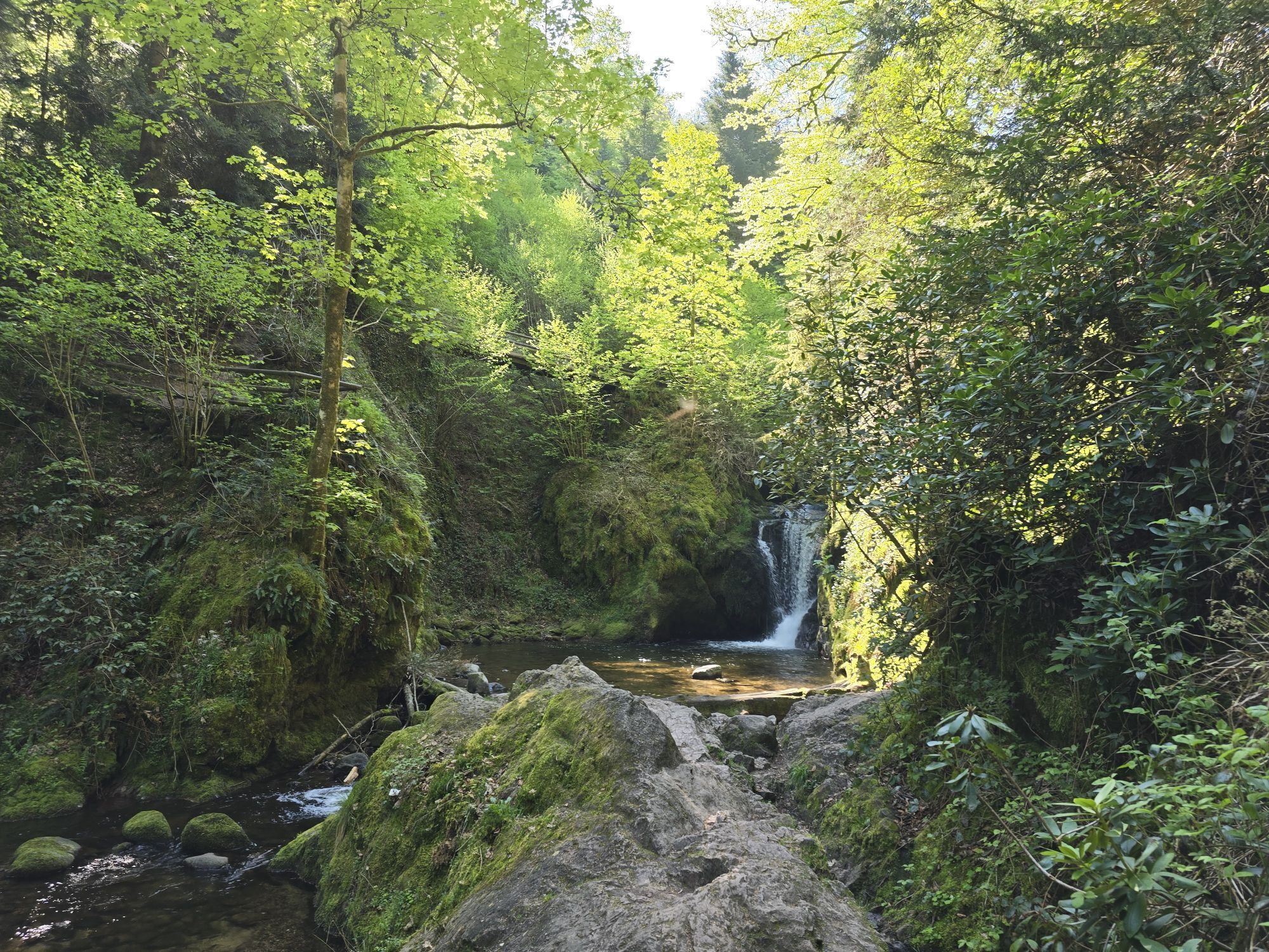
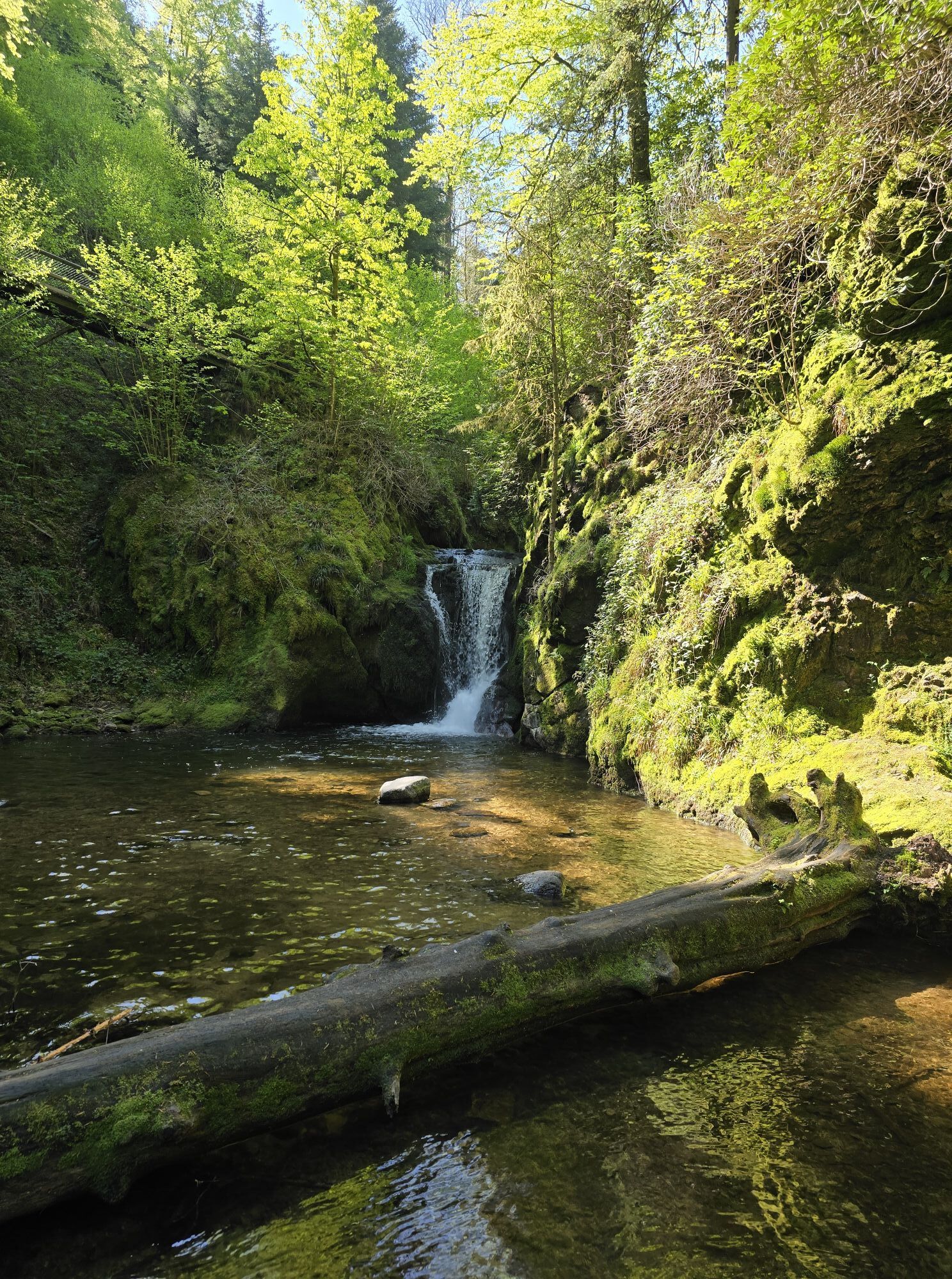
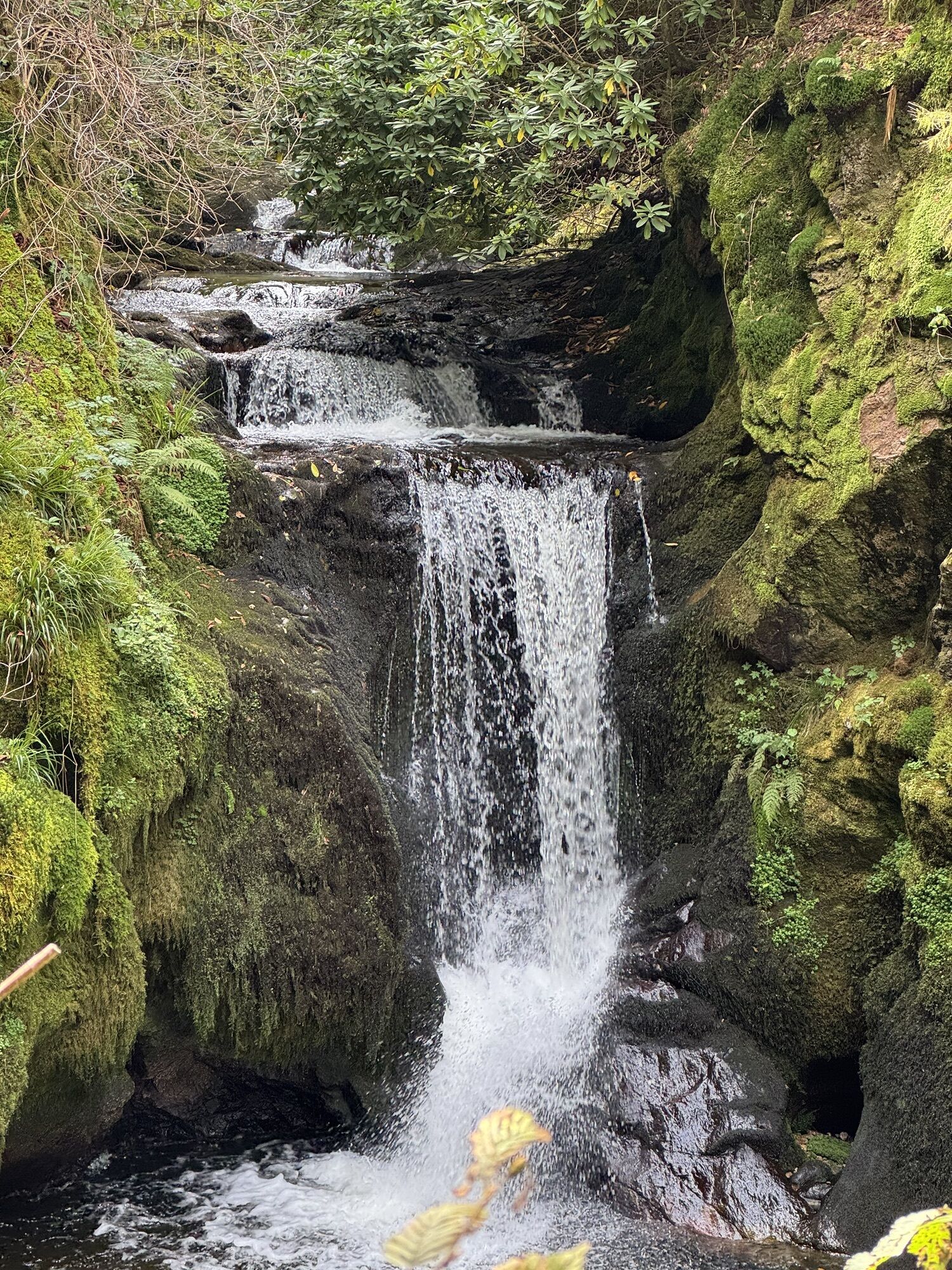
The impressive Geroldsauer Waterfall, the exposed Kreuzfelsen with its magnificent view, narrow paths, and the sparse forest landscape of the high elevations of the Northern Black Forest: The approach...
The impressive Geroldsauer Waterfall, the exposed Kreuzfelsen with its magnificent view, narrow paths, and the sparse forest landscape of the high elevations of the Northern Black Forest: The approach from the Malschbach hiking parking lot via the Kreuzfelsen up to Camp Grimbach is long, varied, and strenuous. It leads steeply from the Geroldsauer Waterfall up to the Kreuzfelsen and over the ridge to the Murg valley through varied high forest almost to the Badener Höhe (detour possible). From Herrenwieser Sattel the descent to the camp is over the Mittelfeldhütte.
From there it is about 1.8 km to Camp Grimbach (beautiful path) or 1.1 km on the direct path. (You will receive the exact route description to the camp with the booking confirmation.)
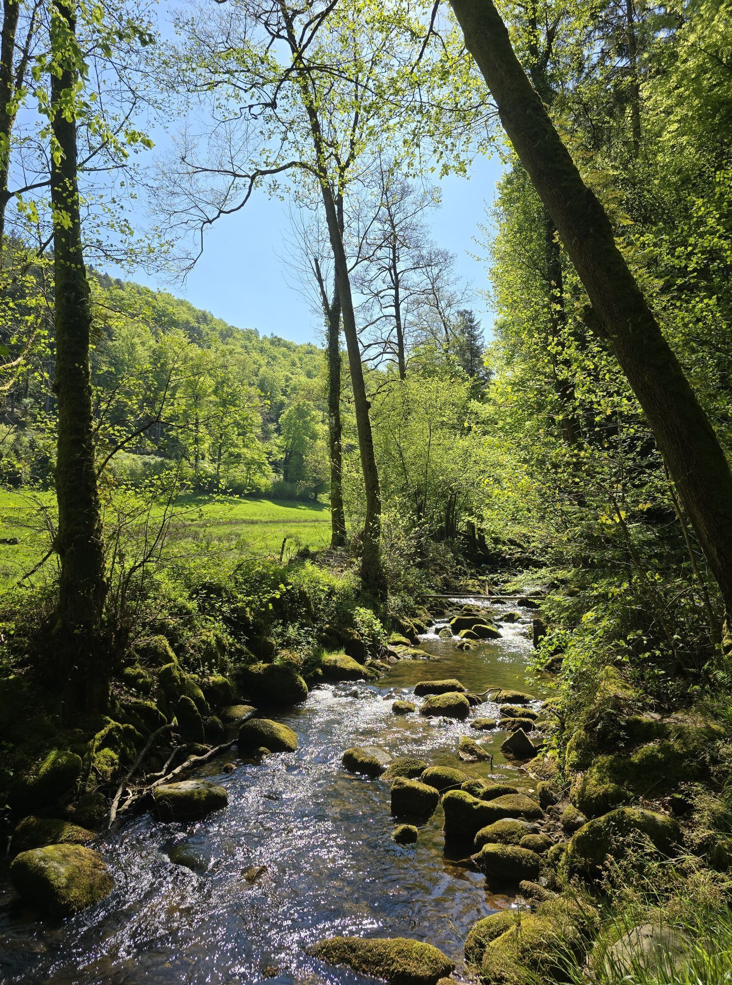
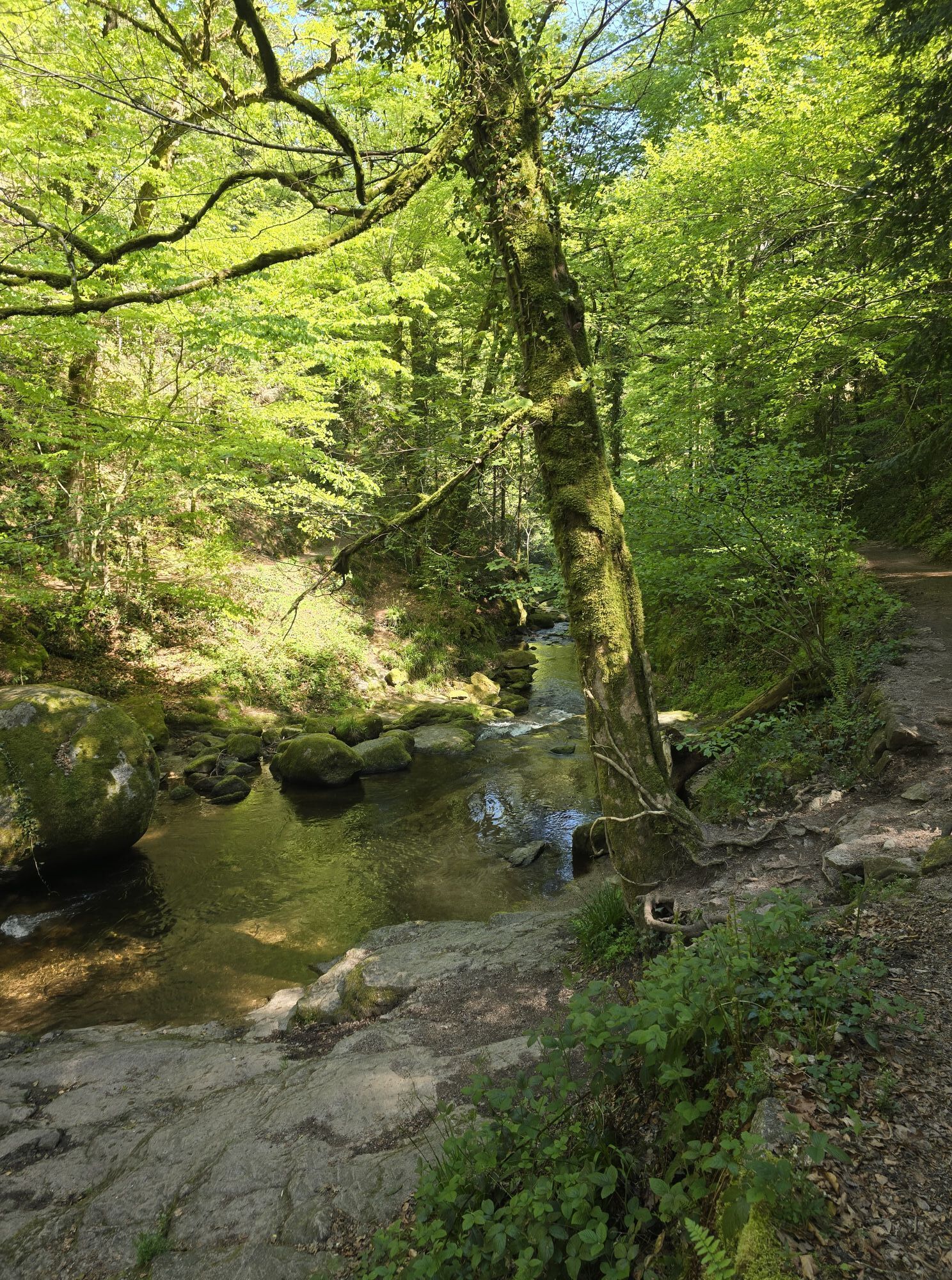
From the hiking parking lot, follow the sign Geroldsauer Waterfall down to the footbridge over the Grobbach. Then, in the narrow valley, follow upstream on the left bank to the waterfall. From the waterfall hut, ascend left of the waterfall to the Bütthof (inn).
Immediately at the Bütthof, turn left up to the parking lot and from there continue on the steep zigzag path to the Kreuzfelsen (yellow diamond). Over the Herrgottstannenweg with gentle ups and downs, finally steeply up to the Scherrhof. At the parking lot, follow right the blue diamond with destination Badener Höhe. Past the Harzbrunnen and over the Badener Sattel to the signpost "Badener Höhe / Hang" on the northwest slope of the Badener Höhe (from here ascent to the Badener Höhe possible, approx. 600 m).
A short stretch on the Westweg to the Herrenwieser Sattel and then further on the yellow diamond to the Mittelfeldhütte. From there a beautiful path leads about 1.8 km to Camp Grimbach. The direct path (1.1 km) follows a short stretch of the forest road.
For a trekking tour in the Black Forest, you usually don't need extensive expedition equipment. However, you should be well prepared and have the essentials with you. Therefore, we have compiled a few equipment tips.
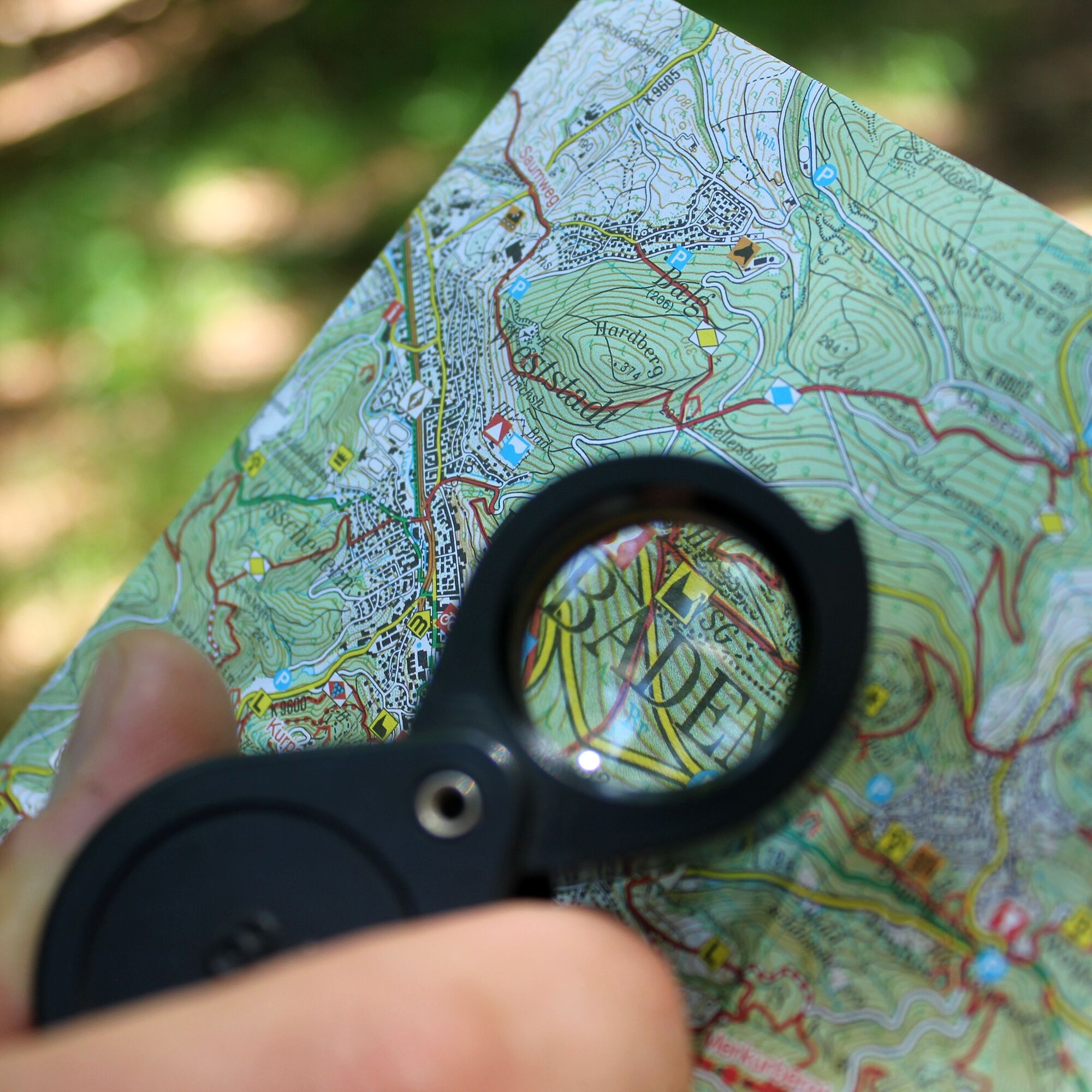
Hiking maps
The Black Forest has an extensive and very well-marked network of trails. Our suggested routes mainly follow narrow paths that do not always connect the camps directly. We therefore recommend carrying a suitable hiking map that shows additional sights, roads, and other important points. You can find a selection of suitable hiking maps in our Nature Park Shop.
GPS
With your booking confirmation, you will receive a detailed route description to the respective camp. In addition, each site has GPS coordinates (UTM WGS 84). For safety reasons, we therefore recommend a GPS device. Especially in the summer months, with dense shrubbery, it can sometimes be more difficult to find the camp right away.
Booking confirmation
With the booking, you will receive an invoice, the terms and conditions, and the booking confirmation by email. The booking confirmation also contains the route description for the last mile and the access code for the toilet cabin. The booking confirmation must be shown on request to the caretaker of the respective site as well as to employees of the forestry administration.
Water
There is no water supply at the camps! The surrounding streams also do not carry drinking water or are often dried up in the summer months. So bring enough water and replenish it again and again on the way. Better a few liters too many! Also think of water for cooking and washing. 4-5 liters per person per day should be carried!
Other
The following should also not be missing in the backpack:
Clothing: rain jacket, sweater, and sturdy footwear Sleeping gear: tent, sleeping mat, sleeping bag Washing items: toothbrush, toothpaste, soap, towel, … Provision: water container, thermos flask, cutlery, pocket knife, pot, … Health: first aid kit, personal medication, sunscreen, insect repellent, … Toilet paper Trash bags Mobile phone Identity card If necessary: camping stove, can opener, tealight, rope, string, flashlight, …The trekking camps are located away from the towns and can only be reached on foot. In the vicinity, you will generally find nothing – except wild nature. To ensure that nothing goes wrong on this adventure and that the trekking tour becomes a safe pleasure, the most important safety rules should be observed.
Forest fire hazard
The main cause of forest fires is careless, negligent behavior in the forest. We therefore ask you to make fires exclusively at the designated fire sites and to observe the instructions in the user regulations. Empty glass bottles should not be thrown away as they can also start fires. Current information on the forest fire hazard can be found at www.dwd.de/waldbrand.
In an emergency, immediately alert the fire brigade: Emergency number 112
Storms
Entering the forest involves risks. Falling branches and slippery forest floor are not uncommon there. Especially during storms, there is a risk of life-threatening injuries.
Use of the natural campsites is at your own risk. No liability is accepted for possible damages, especially caused by falling branches or trees in the forest. Every user must inform themselves especially about storm warnings.
We recommend not using the natural campsites during storm warnings!
You can find the current situation and forecasts at http://www.unwetterzentrale.de/uwz/badenwuerttembergindex.html.
In an emergency
To help rescue teams from mountain rescue, fire department, or Red Cross find you quickly in an emergency, an information board is attached inside each camp's toilet cabin indicating the nearest rescue point. Remain calm in an emergency, provide first aid and make an emergency call at 112!
Give the following information:
Where did it happen? (Name of the camp and nearest rescue point) What happened? (Type and severity of injury) How many injured people are there? Who is reporting? (Give your name and your own mobile number) Wait for further questions!If something happens to you on the way, it is important to know that all signposts along with the altitude indication have a location name that can be given as a rescue point when placing the emergency call. Via an online tool from the Digital Trail Management of the Black Forest Association, emergency control centers can then locate the emergency location in difficult terrain where road navigation is no longer feasible. https://www.schwarzwaldverein.de/schwarzwald/wanderwege/wegweiser-sind-rettungspunkte
Closest stop Malschbach:
Geroldsau Malschbacher Straße: Bus line x 45 from Baden-Baden
Closest stops Camp Grimbach:
Bus stop Bühlerhöhe/ Plättig: Bus line X45 from/to Baden-Baden
Bus line 263 from/to Bühl
www.baden-baden.de
A detour to Badener Höhe (approx. 600 m) is possible from the signpost "Badener Höhe/Hang". From the tower you have a wonderful panoramic view over the Northern Black Forest.
Refreshment options: Bütthof, Scherrhof
Obľúbené výlety v okolí
-
3,9
Schnapsbrunnenweg 2
strednáTuristika 12,8 km -
5,0
Bannwald-Tour
Turistika 13,3 km -
4,5
Schnapsbrunnenweg 1
svetloTuristika 7,45 km -
4,7
premium hiking trail Enzquellenpfad
strednáTuristika 19,9 km -
4,0
Kaltenbronn Circular Route No. 1 - Wildsee Moor Loop
svetloTuristika 8,30 km -
4,3
Nature experience tour Kaltenbronn
strednáTuristika 14,2 km -
4,0
Eiszeit-Tour
Turistika 11,7 km -
2,6
Genießerpfad zum Panoramastüble
Turistika 10,6 km -
4,0
Gertelbacher Wasserfälle
ťažkéTuristika 18 km -
4,8
Weisenbacher Steig (Rechts der Murg)
strednáTuristika 17,6 km
Turistika a stopovanie


Nenechajte si ujsť ponuky a inšpiráciu na ďalšiu dovolenku
Vaša e-mailová adresa bol pridaný do poštového zoznamu.