


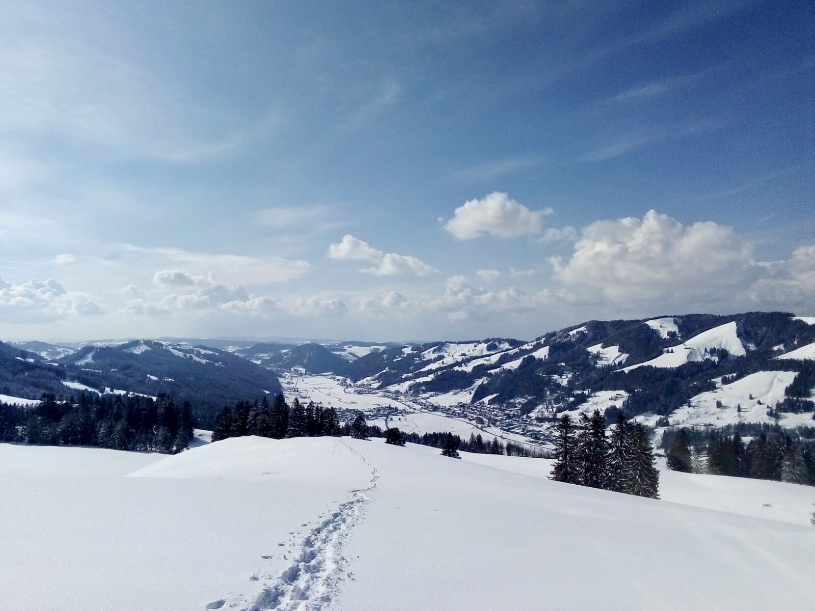
Thalkirchdorf–Schwand area
We go past the church without snowshoes until the Keller carpentry. Here we put on our snowshoes and walk uphill across the open field. After about 100 m, slightly left follow the snow markers towards...
We go past the church without snowshoes until the Keller carpentry. Here we put on our snowshoes and walk uphill across the open field. After about 100 m, slightly left follow the snow markers towards the Naturfreundehaus (Schönblick). We leave the hut on the right and continue on the path to the Anger Alpe (not managed). Before the hut, turn right across the open field until the path leads into the forest. Follow the path further west, crossing the slope with a gentle incline. At the edge of the forest in gentle switchbacks to the Ratholzer Alpe. From here the summer track begins again. The path takes us past the Alpe Bärenschwändle to the alpine path towards Schwandalpe. Here follow the hiking trail signs towards Thalkirchdorf. At the path crossings with the ski slope, always keep to the right edge until the path leaves the slope again. Before the Moosalpe, turn right along the ski slope until the path leads into the forest again. At Schwändle there is the possibility to stop for refreshments. Descending towards the valley we follow the hiking trail signs to Thalkirchdorf. Shortly before reaching the valley, we cross the Schmidstobelbach on an iron footbridge and then already see the church and our starting point.

Adjust your equipment to the winter conditions and the specific tour destination. Off marked hiking trails, avalanche transceiver, probe and shovel as well as their safe handling are standard. Also first aid kit, bivouac sack and mobile phone (European emergency number 112). Map, app and GPS support orientation.
Inform yourself thoroughly about the avalanche danger before the tour! What is the danger level, where are the hazard spots, what are the current avalanche problems? Avoid tours at danger level 4 and 5.
Coming from Immenstadt towards Oberstaufen, turn left in Thalkirchdorf towards Kirchdorf. The Festsaal is located at the entrance to the village. Coming from Oberstaufen towards Immenstadt, then turn right towards Thalkirchdorf.
Parking lot directly at the Festsaal or alternatively at the village hall/church (center of Kirchdorf)
Good to know:
This route tip is not signposted.
Webové kamery z prehliadky
-
Oberstaufen
-
Oberstaufen - Biohotel Schratt
-
Oberstaufen - Biohotel Schratt
-
Oberstaufen
-
Alpe Hohenschwand
-
Oberstaufen
-
Oberstaufen
-
Oberstaufen
-
Oberstaufen
-
Oberstaufen
-
Thaler Höhe
-
Oberstaufen
-
Oberstaufen - Rosenalp
-
Hündlebahn Bergstation
-
Thaler Höhe
-
Oberstaufen
-
Alpsee Bergwelt
-
Alpsee Bergwelt
-
Alpsee Bergwelt - Bärenfalle
Obľúbené výlety v okolí
-
4,5
Hittisau | Wasserwanderweg
svetloTematická trasa 7 km -
4,6
Steibis - Buchenegger Waterfalls
strednáTuristika 6,47 km -
5,0
Nagelfluh ridge route Hochgrat - Mittag
ťažkéTuristika 14,0 km -
4,7
Rindalphorn und Hochgrat
strednáTuristika 15,6 km -
5,0
Siedelalpe Runde von See - Immenstadt
svetloTuristika 10,3 km -
4,5
Immenstädter Horn - Gschwender Horn
svetloTuristika 10 km -
3,8
Hörner Panoramatour
strednáTuristika 17,3 km -
5,0
HörnerPanoramaTour
svetloTuristika 5,34 km -
3,5
Rundtour Mittag
svetloTuristika 15,7 km -
4,5
Grasgehren - Riedberger Horn - Berghütte Grasgehren
svetloTuristika 4,51 km
Turistika a stopovanie


Nenechajte si ujsť ponuky a inšpiráciu na ďalšiu dovolenku
Vaša e-mailová adresa bol pridaný do poštového zoznamu.