


Sassauna - descent Fanas


Thanks to the aerial cableway to the 'Eggli' (Seilbahn Fanas ), the Sassauna (2308 m a.s.l.) is easily accessible. From the mountain station of the cableway, you first ascend over the Ochsenberg with a...
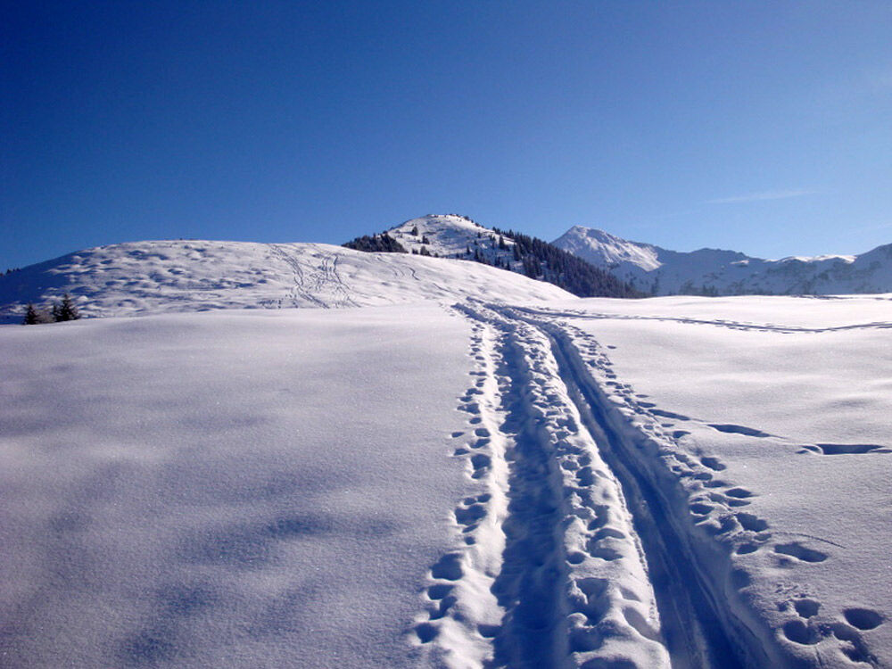
Thanks to the aerial cableway to the 'Eggli' (Seilbahn Fanas ), the Sassauna (2308 m a.s.l.) is easily accessible. From the mountain station of the cableway, you first ascend over the Ochsenberg with a pleasant incline, from about 2000 m a.s.l. it becomes increasingly steeper. It is possible to follow the SSW ridge or ascend further east on the flank to the summit of the Sassauna (2308 m a.s.l.). Nevertheless, a challenging ski tour with steep terrain near the summit to a magnificent viewpoint. Nowhere do the Rätikon peaks stand in more beautiful formation than when viewed from the Sassauna!
Descent to Fanas: From the summit along the ascent route to the cable car mountain station and further to the alpine huts of Furner (1709 m a.s.l.). Then across the wonderful southern slopes of Fatans down to the connecting road southwest towards Casällas. Traverse on the snow-covered road westwards to Pajös and then down the last slopes into the village of Fanas. (Variant: It is also possible to descend slightly below the cable car along the summer path, more worthwhile in the lower part, but less nice for skiing in the upper part.)
Alternatively, there is the descent to Schiers.
Attention! On the descent to Fanas you cross from Casällas to Pardiel through the wildlife sanctuary Forztobel-Casällas - from 1.2 to 15.4 path obligation applies. Thanks for respecting nature!

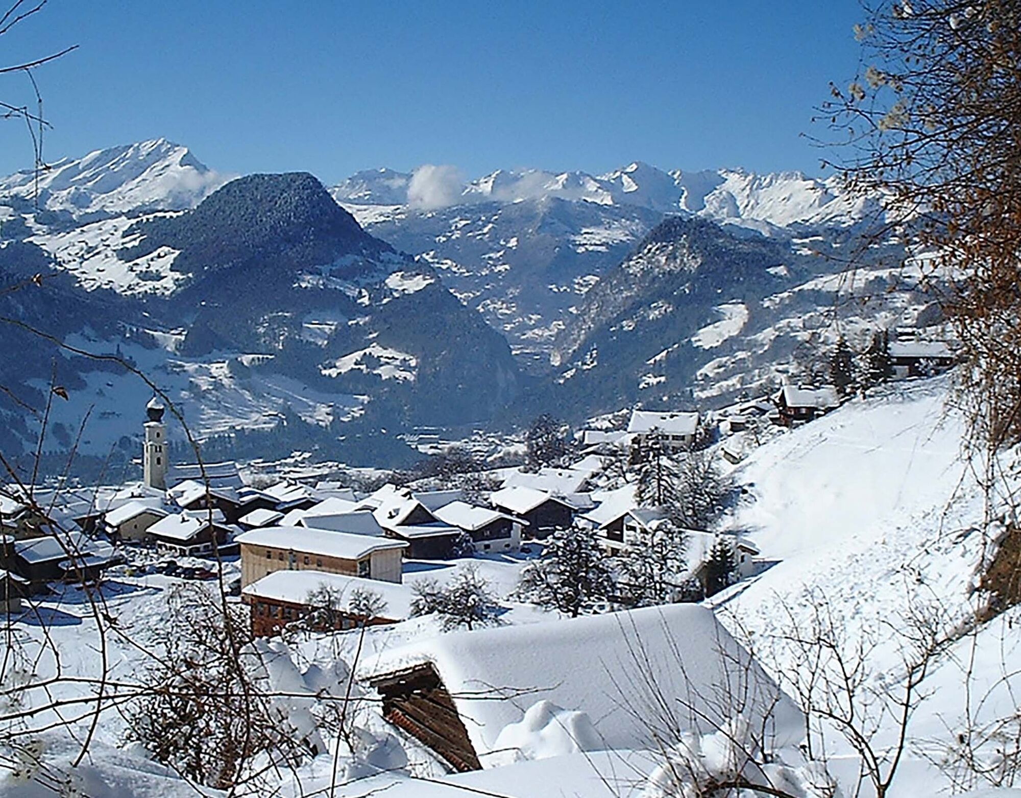
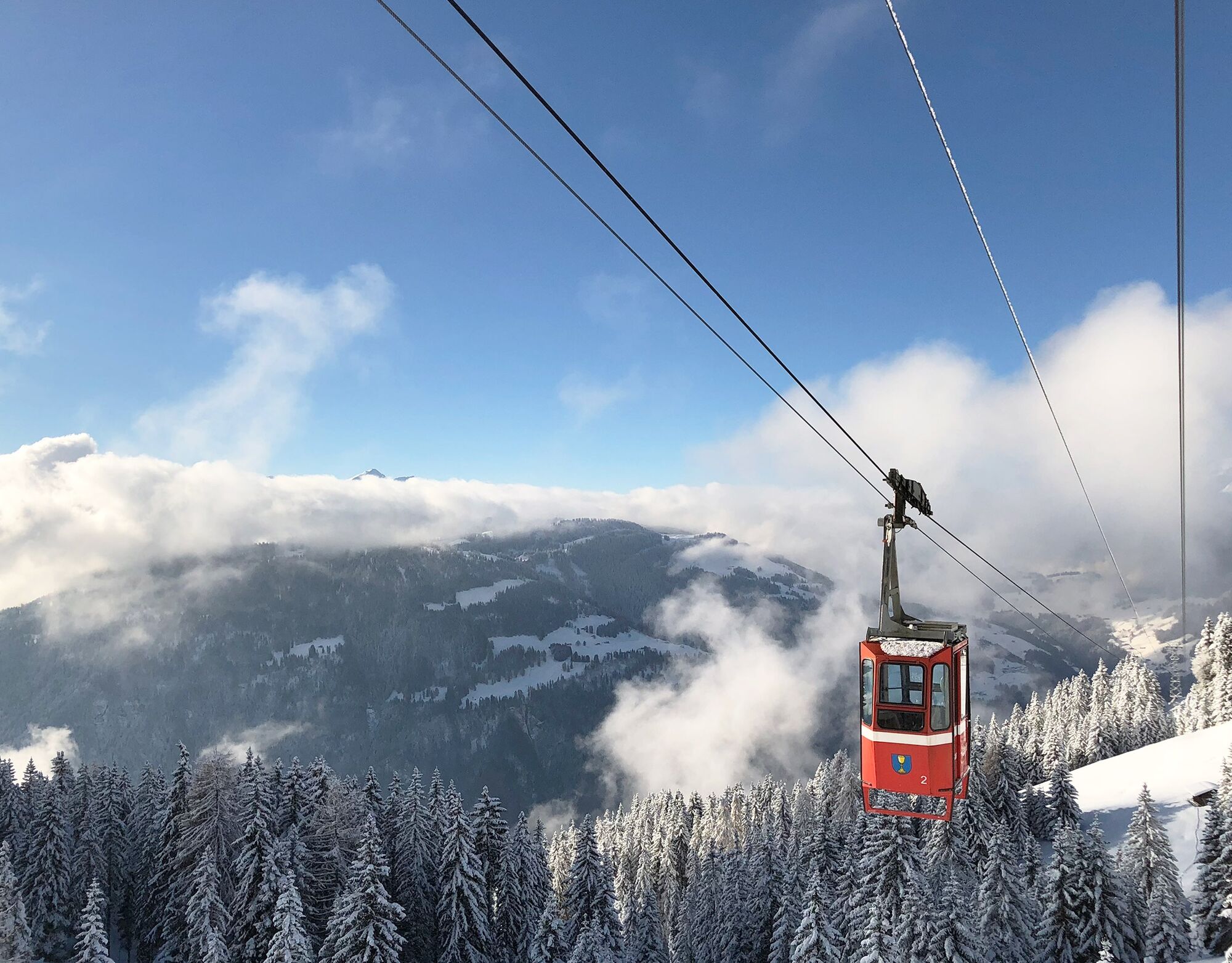

Valley station cable car Fanas - Eggli (mountain station, 1700 m a.s.l.) - Ried - Tschafiel - Grappalazär - Sassauna (2307 m a.s.l.)
Áno
Áno
Full alpine ski tour in unsecured terrain. Complete safety equipment (avalanche transceiver, avalanche shovel, avalanche probe, mobile phone) and knowledge of proper handling are essential.
The ski and snowshoe routes are to be understood as general directional indications. Depending on conditions, ascent and descent routes must be adjusted. No guarantee is given for the accuracy, completeness and timeliness of the information.
Practicing ski touring in open terrain is at your own risk. Every tourer is strongly advised to prepare thoroughly, plan routes and obtain current information on snow and avalanche conditions. Avalanche report and snow information: www.slf.ch
No liability is accepted for accidents resulting from the use of the published information and route descriptions.
If in doubt, be accompanied by experienced tourers or by a mountain guide: www.praettigau.info/bergfuehrer
Via A13 and A28 to Grüsch. At Grüsch turn towards Fanas.
By the Rhaetian Railway (RhB) to Grüsch or Schiers (timetable field 910 or 941) and then by post bus to Fanas (timetable field 90.203 from Grüsch or 90.211 from Schiers).
Free for 12 hours at the valley station of the cable car. If you leave your car longer, please contact the cable car staff.
Prättigau Marketing
Feldweg 19
CH-7233 Jenaz
Tel. +41 (0)81 325 11 11
info@praettigau.info
www.praettigau.info
Enjoy a tasty "platter" at the mountain inn Sassauna near the mountain station.
Webové kamery z prehliadky
Obľúbené výlety v okolí
-
5,0
Douglasshütte, Lünersee, Gafalljoch Brand bei Bludenz, Vorarlberg
svetloTuristika 9,16 km -
4,4
Golm-Rundwanderweg im Rätikon
strednáTematická trasa 7,28 km -
4,5
Fürstin-Gina-Weg
strednáTuristika 12,0 km -
5,0
Ski tour to the Lindauer Hut (1,744 m)
svetloSkitour 14,0 km -
4,8
From Malbun to the Schönberg
strednáTuristika 12,4 km -
4,3
Golmer, Höhenweg und Golmer Seenrundweg
strednáHorská turistika 7,62 km -
4,8
Pizalun circular route
svetloTuristika 7,18 km -
4,8
From Latschau through the Gauertal to the Lindauer Hütte
strednáSnežnice 14,0 km -
3,5
Golmer Höhenweg
strednáTuristika 13,8 km -
4,6
Wanderung Malbun - Sass-Seeli - Sassförkle - Drei Kapuziner - Schönberg - und Talstation Täli wieder zurück nach Malbun
strednáTuristika 10,8 km
Turistika a stopovanie


Nenechajte si ujsť ponuky a inšpiráciu na ďalšiu dovolenku
Vaša e-mailová adresa bol pridaný do poštového zoznamu.