
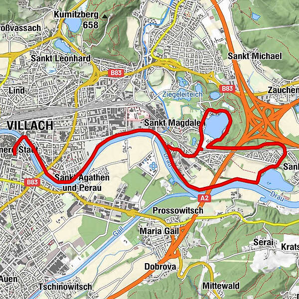
Údaje o túre
10,71km
485
- 505m
56hm
03:00h
- Stručný popis
-
Ebene Strecke, leichte Steigung
Gehzeit je nach Routenwahl zwischen 3 und 4 Stunden - Hodnotenie
-
- Východisko
-
Villach Rathausplatz
- Trasa
-
Innere Stadt0,1 kmVillach (501 m)0,4 kmWasenboden1,5 kmSt. Magdalen3,6 kmSilbersee Stub`n6,4 kmGasthof Hopf10,1 km
- Najvyšší bod
- 505 m
- Zvyšok/Ústup
-
Silberseeranch, Gasthof zur Post bzw. Gasthof Hofer in St. Magdalen
GPS Downloads


Podmienky na trase
Asfalt
Štrk
Lúka
Les
Skala
Exponovaný
Ďalšie prehliadky v regiónoch


