Alta Via dell'Anfiteatro Morenico di Ivrea - AMI
stredná
Získajte túto prehliadku v mobilnom telefóne
Alta Via dell'Anfiteatro Morenico di Ivrea - AMI
stredná
Mountainbike
108,12
km
Naskenujte kód QR a spustite navigáciu v aplikácii bergfex

Turistika a stopovanie


Alta Via dell'Anfiteatro Morenico di Ivrea - AMI
stredná
Vzdialenosť
108,12
km
Trvanie
12:10
h
Ascent
1 533
hm
Hladina mora
213 -
930
m
Stiahnutie skladby
Alta Via dell'Anfiteatro Morenico di Ivrea - AMI
stredná
Mountainbike
108,12
km
The Alta Via of the Morainic Amphitheatre of Ivrea is an impressive circular route that runs clockwise from Andrate to Brosso along the morainic amphitheatre formed in the Quaternary period by the glacier...
Opis
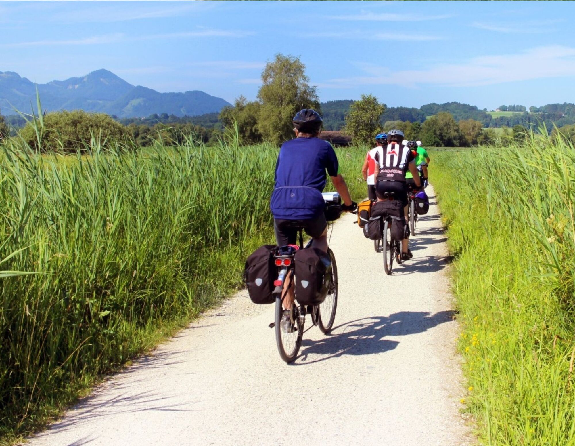
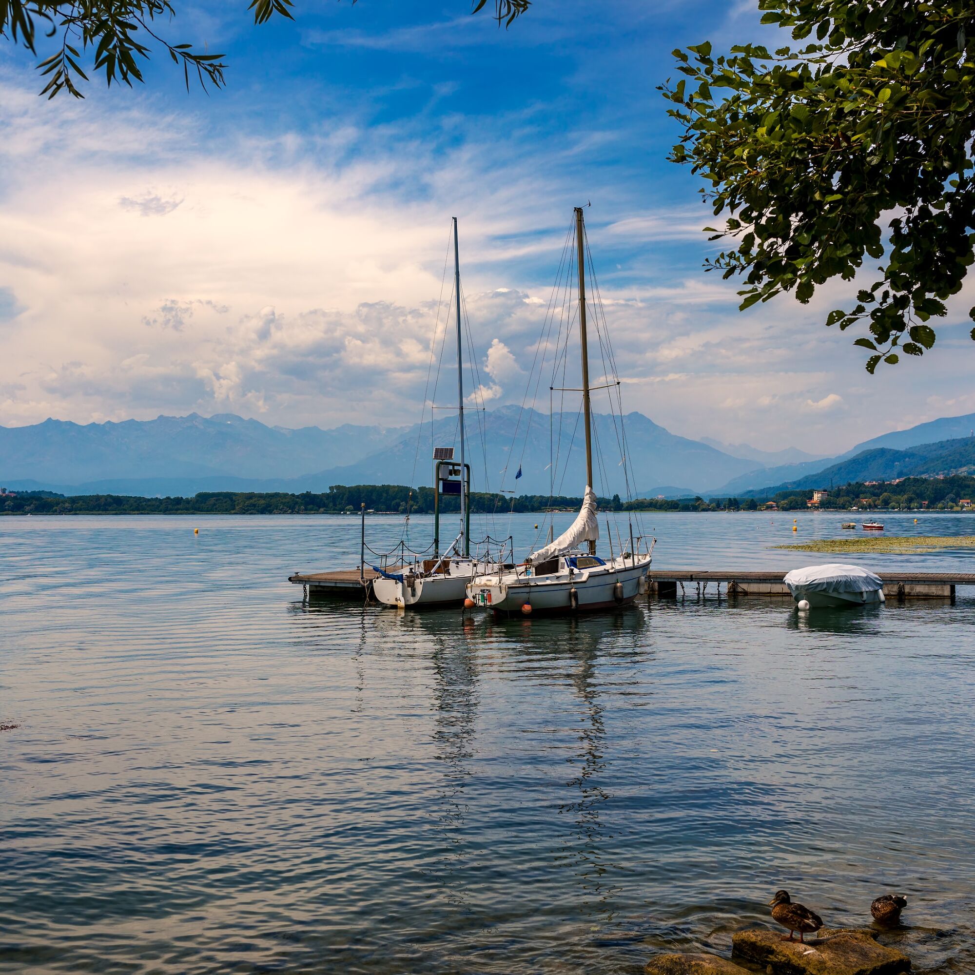
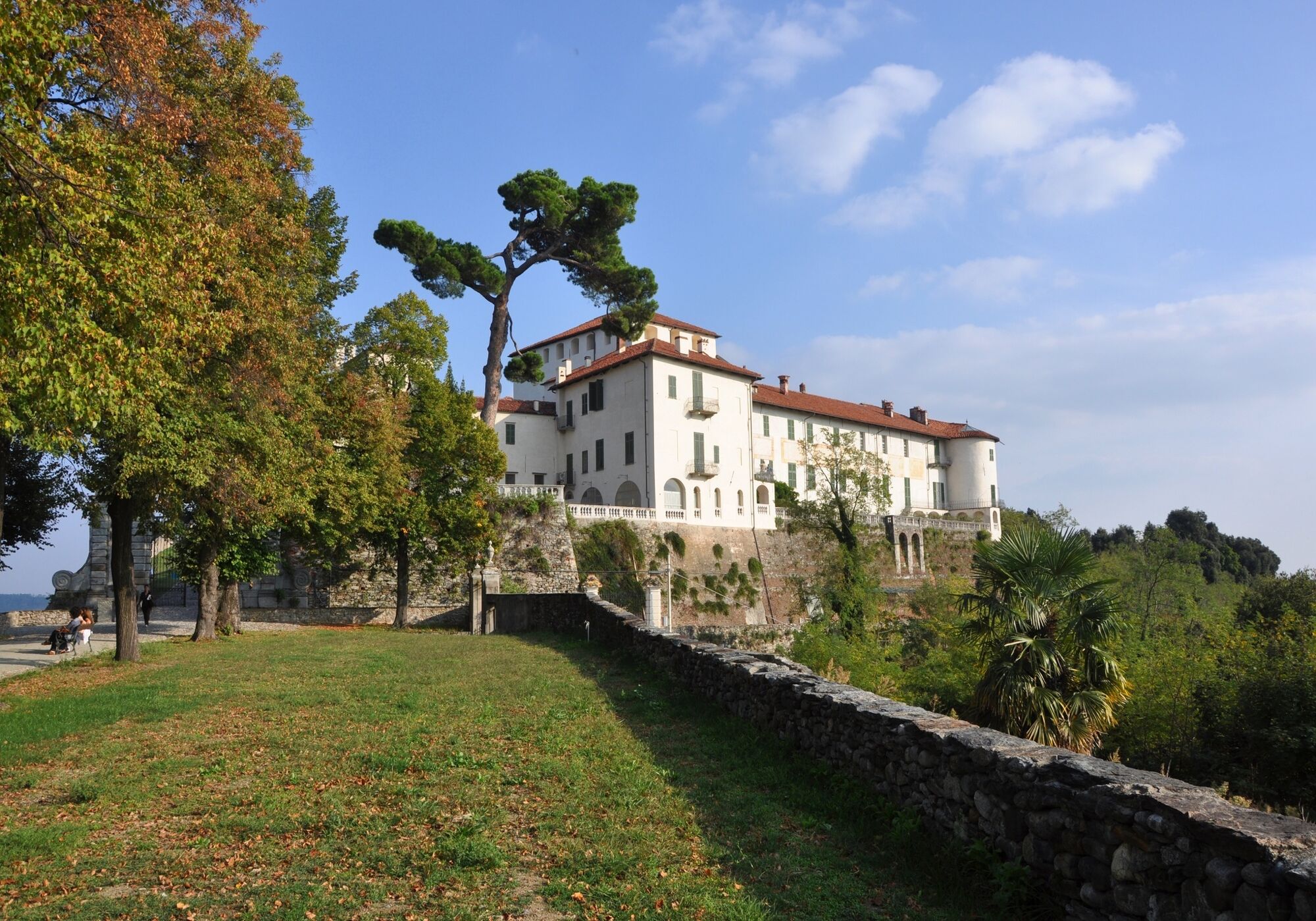
The Alta Via of the Morainic Amphitheatre of Ivrea is an impressive circular route that runs clockwise from Andrate to Brosso along the morainic amphitheatre formed in the Quaternary period by the glacier that occupied the Dora Baltea valley, at its outlet onto the Canavese plain.The glaciation has left us a structure of great geomorphological interest. Its excellent conservation has provided us with an open-air book where we can read the effects of the succession of ice ages and interglacial periods in the Pleistocene era, from 1.65 million to 130,000 years ago. Lakes nestled amid lush greenery, from Lake Viverone to the 5 lakes of Ivrea to Lake Candia, castles such as the one in Masino, admirably managed by Italy's national trust, the FAI, charming villages, woods and vineyards where excellent wines such as Erbaluce are produced: the extraordinary landscape, historical and cultural value of this rich and varied itinerary means you can combine the pleasure of a hike with countless opportunities to visit and discover the area.
The itinerary was promoted within the platform as part of the PITEM M.I.T.O. project. – Outdoor OFF - Interreg Italy-France Cross-Border Cooperation Program ALCOTRA 2014-2020.
Trasa
Chiesa di San Grato
(491 m)
Miesto uctievania
18,2 km
Sapel da Bras
(340 m)
Horské sedlo
32,7 km
Chiesa Parrocchiale di San Maurizio
(308 m)
Miesto uctievania
49,0 km
Monte Chiaro
(354 m)
Summit
70,3 km
Monte Riolo
(492 m)
Summit
83,7 km
Chiesa di San Martino
(376 m)
Miesto uctievania
89,1 km
Cappella di Nonani
(642 m)
Miesto uctievania
99,2 km
Trasa
Alta Via dell'Anfiteatro Morenico di Ivrea - AMI
stredná
Mountainbike
108,12
km
Andrate
(825 m)
Dedina
0,2 km
Mangia e Bevi
(827 m)
Reštaurácia
0,2 km
Croce Serra
(853 m)
Koridor/terén
2,7 km
Rebbia
(782 m)
Zúčtovanie
3,0 km
Broglina
(518 m)
Zúčtovanie
11,2 km
Magnano
(536 m)
Dedina
14,5 km
Chiesa di San Grato
(491 m)
Miesto uctievania
18,2 km
Zimone
(441 m)
Dedina
19,0 km
Bertignano
(383 m)
Zúčtovanie
22,1 km
Cappella della Madonna di Oropa
(385 m)
Miesto uctievania
22,3 km
San Vitale
(385 m)
Zúčtovanie
23,5 km
Castello
(356 m)
Dedina
24,2 km
Chiesa di San Rocco
(348 m)
Miesto uctievania
24,3 km
Roppolo
(311 m)
Dedina
24,5 km
Morzano
(298 m)
Zúčtovanie
29,1 km
Sapel da Bras
(340 m)
Horské sedlo
32,7 km
Chiesa dei sette dolori e di San Rocco
(391 m)
Miesto uctievania
39,8 km
Masino
(400 m)
Dedina
39,9 km
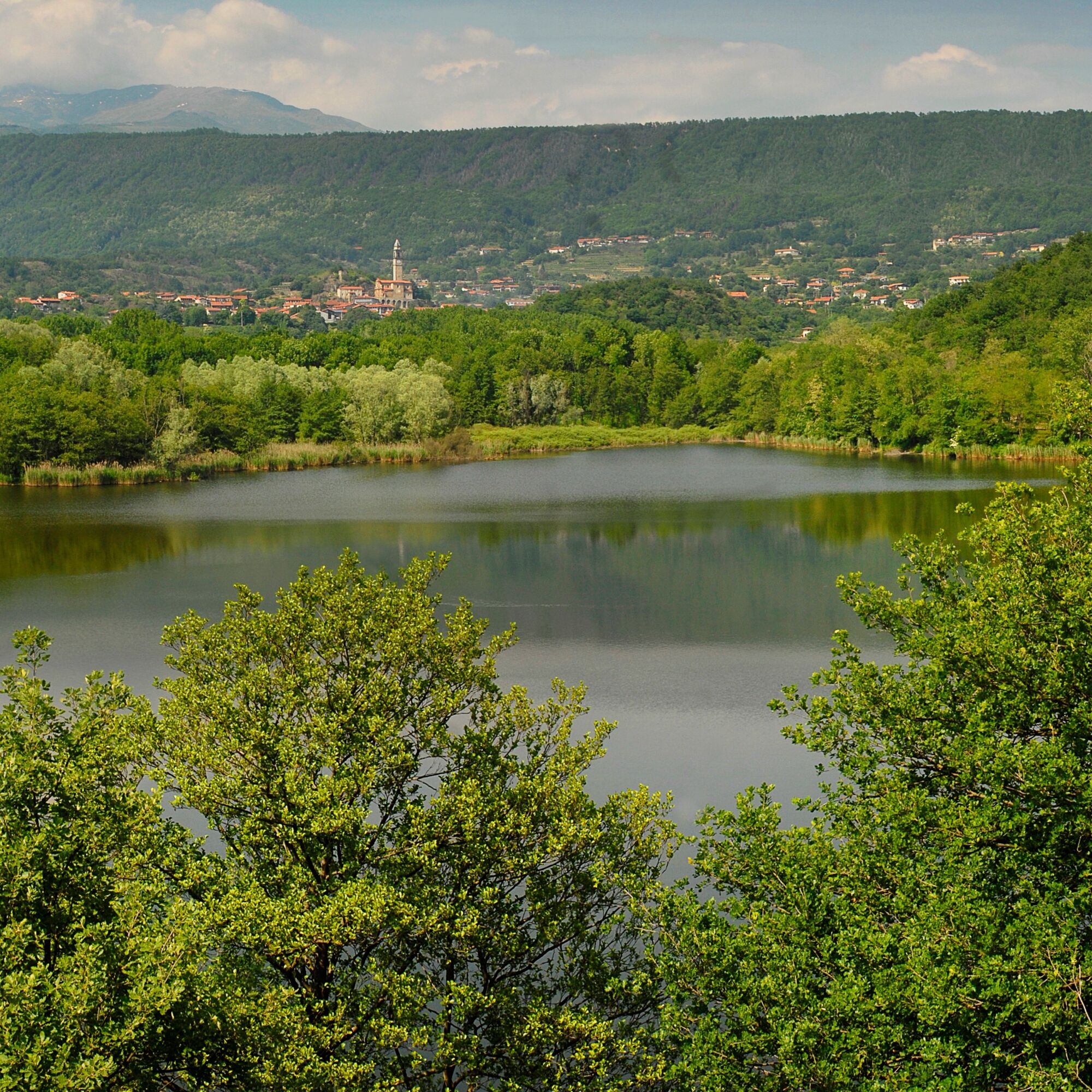
Veduta dell'anfiteatro morenico di Ivrea
(401 m)
Uhol pohľadu
40,0 km
Chiesa di San Lorenzo Martire
(413 m)
Miesto uctievania
40,1 km
Maglione
(291 m)
Dedina
48,7 km
Chiesa Parrocchiale di San Maurizio
(308 m)
Miesto uctievania
49,0 km
Moncrivello
(304 m)
Dedina
52,3 km
Chiesa di San Francesco
(308 m)
Miesto uctievania
52,7 km
Chiesa di San Rocco
(309 m)
Miesto uctievania
52,9 km
Caluso
(288 m)
Dedina
67,7 km
Monte Chiaro
(354 m)
Summit
70,3 km
Candia Canavese
(290 m)
Dedina
70,9 km
Chiesa di Santo Stefano del Monte
(419 m)
Miesto uctievania
71,9 km
Villate
(310 m)
Dedina
77,2 km
Vialfrè
(478 m)
Dedina
82,6 km
Chiesa dei Santi Pietro e Paolo
(474 m)
Miesto uctievania
82,6 km
Chiesa di San Michele
(472 m)
Miesto uctievania
82,7 km
Risorante Fricandò
(469 m)
Reštaurácia
82,8 km
Monte Riolo
(492 m)
Summit
83,7 km
Silva
(442 m)
Dedina
85,4 km
Bar Trattoria San Giovanni
(402 m)
Reštaurácia
88,4 km
San Giovanni Canavese
(403 m)
Dedina
88,4 km
Chiesa di San Giovanni Battista
(402 m)
Miesto uctievania
88,5 km
Cantone Pricco
(391 m)
Zúčtovanie
88,7 km
Cantone Piana
(377 m)
Zúčtovanie
89,0 km
Chiesa di San Martino
(376 m)
Miesto uctievania
89,1 km
Ponte Preti
(333 m)
Dedina
90,8 km
Chiesa della Madonna delle Grazie
(326 m)
Miesto uctievania
91,0 km
Strambinello
(382 m)
Dedina
91,8 km
Scala
(361 m)
Dedina
95,4 km
Regione Luvera
(513 m)
Zúčtovanie
95,7 km
Zucca
(385 m)
Dedina
96,8 km
Vigna Bella
(554 m)
Koridor/terén
97,0 km
Lugnacco
(563 m)
Dedina
98,9 km
Cappella di Nonani
(642 m)
Miesto uctievania
99,2 km
L'incontro
(721 m)
Reštaurácia
105,6 km
Regione Ceresano
(700 m)
Zúčtovanie
106,8 km
Chiesa del Gesù
(768 m)
Miesto uctievania
108,1 km
Brosso
(797 m)
Dedina
108,1 km
Autor
Prehliadku Alta Via dell'Anfiteatro Morenico di Ivrea - AMI zabezpečuje outdooractive.com.
Informácie o trase
Jednosmerná prehliadka
Áno
Bezpečnostné pokyny
Cell coverage
Partial
Informácie o príchode
Verejná doprava
All stages allow connections with public transport
Ďalšie informácie a tipy
Ďalšie informácie
City of Metropolitan Turin: www.cittametropolitana.torino.it/cms/...
Zatiaľ žiadne recenzie
Obľúbené výlety v okolí
-
BALDISSERO CANAVESE The Monti Pelati nature reserve
strednáTuristika 7,19 km -
3,0
Via Francigena Etappe 5
strednáTuristika 36,7 km -
VALCHIUSELLA Lakes of Alice Superiore and Meugliano
svetloTuristika 7,99 km -
CANDIA Lake Candia MTB loop
svetloMountainbike 10,8 km -
MONTALTO DORA Terre Ballerine - In search of Lake Coniglio
svetloTuristika 5,35 km -
Chiaverano - Church of Santo Stefano di Sessano
strednáMountainbike 27,4 km -
TORRE CANAVESE Nature Route
svetloTuristika 6,71 km -
Erratic boulders trail of Vialfré
svetloTuristika 7,15 km -
Ancient Balteo Glacier Ring - stage 1
strednáDiaľková cyklotrasa 49,0 km -
CHIVASSO Multi-stage loop of the ancient Balteo Glacier
strednáDiaľková cyklotrasa 195,4 km
Turistika a stopovanie

Viac ako 550.000 návrhov výletov, podrobné mapy a intuitívny plánovač trás robia z aplikácie povinnú výbavu pre všetkých nadšencov prírody.

Nenechajte si ujsť ponuky a inšpiráciu na ďalšiu dovolenku
Prihlásiť sa k odberu noviniek
Chyba
Vyskytla sa chyba. Prosím, skúste to znova.
Ďakujeme za vašu registráciu
Vaša e-mailová adresa bol pridaný do poštového zoznamu.
Zájazdy po celej Európe
Rakúsko
Švajčiarsko
Nemecko
Taliansko
Slovinsko
Francúzsko
Holandsko
Belgicko
Poľsko
Lichtenštajnsko
Česko
Slovensko
španielsko
Hrvaška
Bosna a Hercegovina
Luxembursko
Andorra
Portugalsko
Island
Spojené kráľovstvo
Írsko
Grécko
Albánsko
Severné Macedónsko
Malta
Nórsko
Čierna Hora
Moldavsko
Kosovo
Maďarsko
San Maríno
Rumunsko
Estónsko
Lotyšsko
Bielorusko
Cyprus
Litva
Srbsko
Bulharsko
Monako
Dánsko
Švédsko
Fínsko