


Via Francigena of the Susa Valley from Monginevro | Stage 4 Chiusa San Michele-Sant'Ambrogio
Úroveň náročnosti: T1
Just half an hour of flat walking allows you to get to know the municipalities of Chiusa San Michele and Sant'Ambrogio, right at the foot of Mount Pirchiriano. Located at the narrowest point of the valley,...
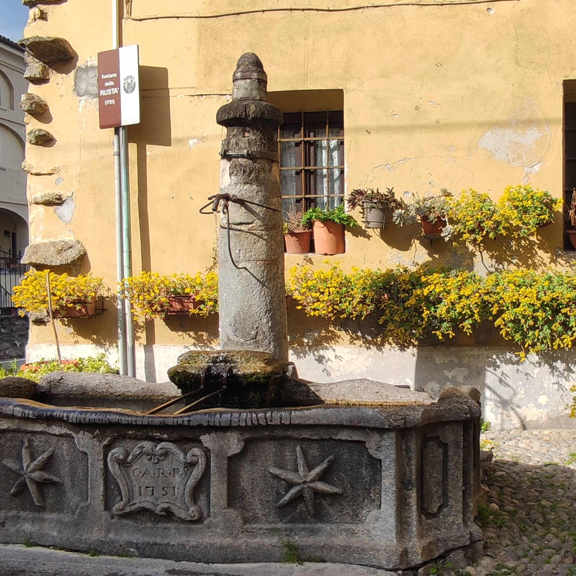
Just half an hour of flat walking allows you to get to know the municipalities of Chiusa San Michele and Sant'Ambrogio, right at the foot of Mount Pirchiriano. Located at the narrowest point of the valley, the first is remembered in the history of Italy for the "Battle of the Chiuse" between the Lombards of Desiderio and the Franks of Charlemagne in 773 AD. To see: the Church of S. Pietro Apostolo, the chapel of S. Giuseppe, the remains of the Lombard locks and the Ethnographic Museum. Even Sant'Ambrogio owes its development to the events of the legendary Sacra di San Michele. Must see: the city walls, the Abbey Castle, the Church of San Giovanni Vincenzo, the Maglificio Bosio. Both celebrate corn, which has always been intensely cultivated in the area and is the basis for some typical products, respectively on the second and third weekends of September.

Áno
Autoroute de Fréjus, sorties Avigliana/Almese. Strada Provincia 24 et Strada Statale 25.
Chiusa San Michele et S.Ambrogio sont tous deux reliés à la ligne ferroviaire SFM3 avec des trains toutes les heures.
www.sfm.it
T1
Obľúbené výlety v okolí
-
4,7
On the summit of the magical Musiné
svetloTuristika 6,94 km -
Avigliana Lakes - Easy route, ideal for families with children
svetloTuristika 9,25 km -
CASELETTE - Monte Musiné
strednáTuristika 7,52 km -
COLLE DEL LYS Partisan Trail
strednáTuristika 11,6 km -
GIVOLETTO Madonna della Neve on Monte Lera
strednáTuristika 6,11 km -
5,0
Unspoiled woods and ancient hamlets in Valsangone - Selvaggio Loop - Bagaggera
svetloTuristika 9,08 km -
Easy route - Monte Cuneo (Moncuni) Loop route from Reano
svetloTuristika 7,97 km -
COLLE DEL LYS Monte Arpone loop
svetloTuristika 4,50 km -
A walk in the Megalithic - The Menhirs of Pietraborga - Direct route from the Torrioni
strednáTuristika 9,30 km -
4,0
The Giro dell'Orsiera G.O. Trail Stage 1: Molè - Rifugio Balma
strednáTuristika 4,52 km

Turistika a stopovanie


Nenechajte si ujsť ponuky a inšpiráciu na ďalšiu dovolenku
Vaša e-mailová adresa bol pridaný do poštového zoznamu.