


Dream loop "Nahe Rock Trail"
The trail starts directly in the old town of Oberstein – dining options and sights such as the Rock Church, the German Mineral Museum, or the Jakob Bengel Industrial Monument are in the immediate vicinity....
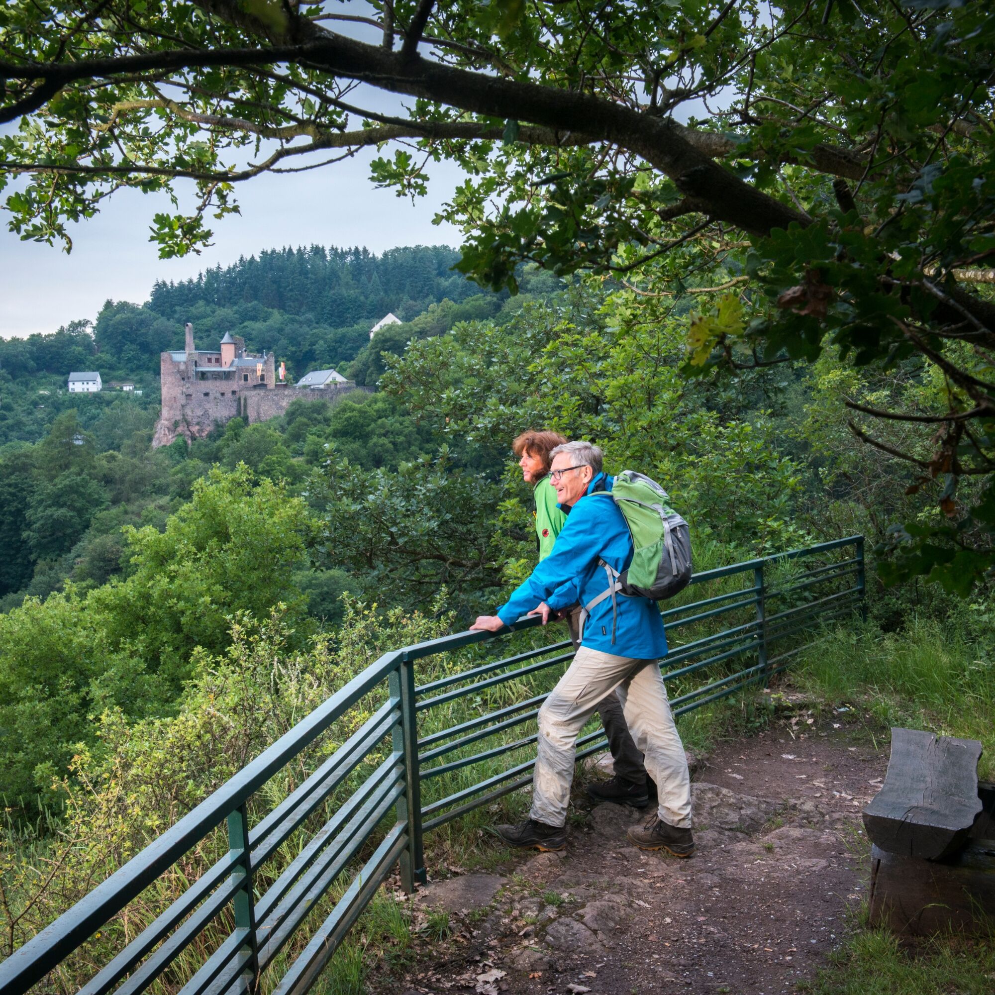
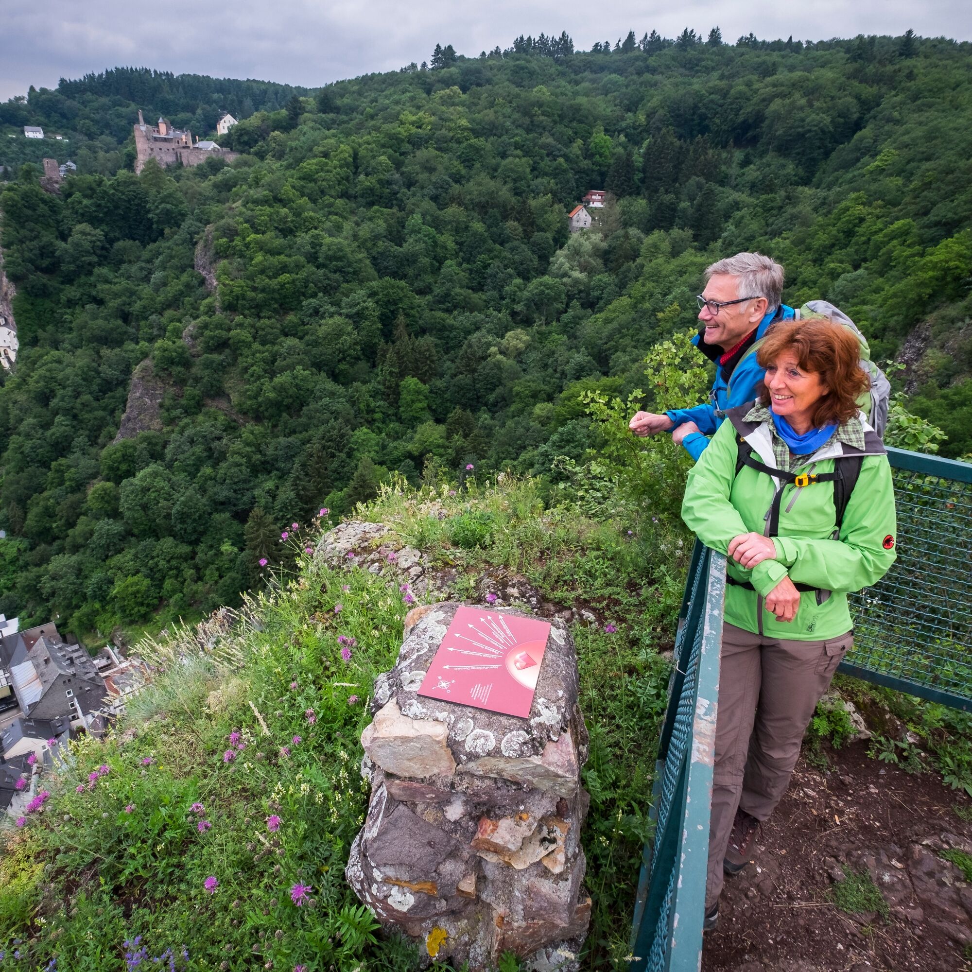
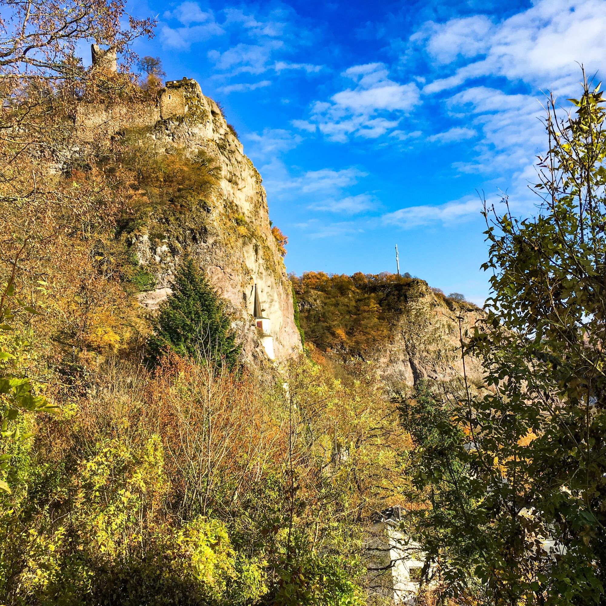
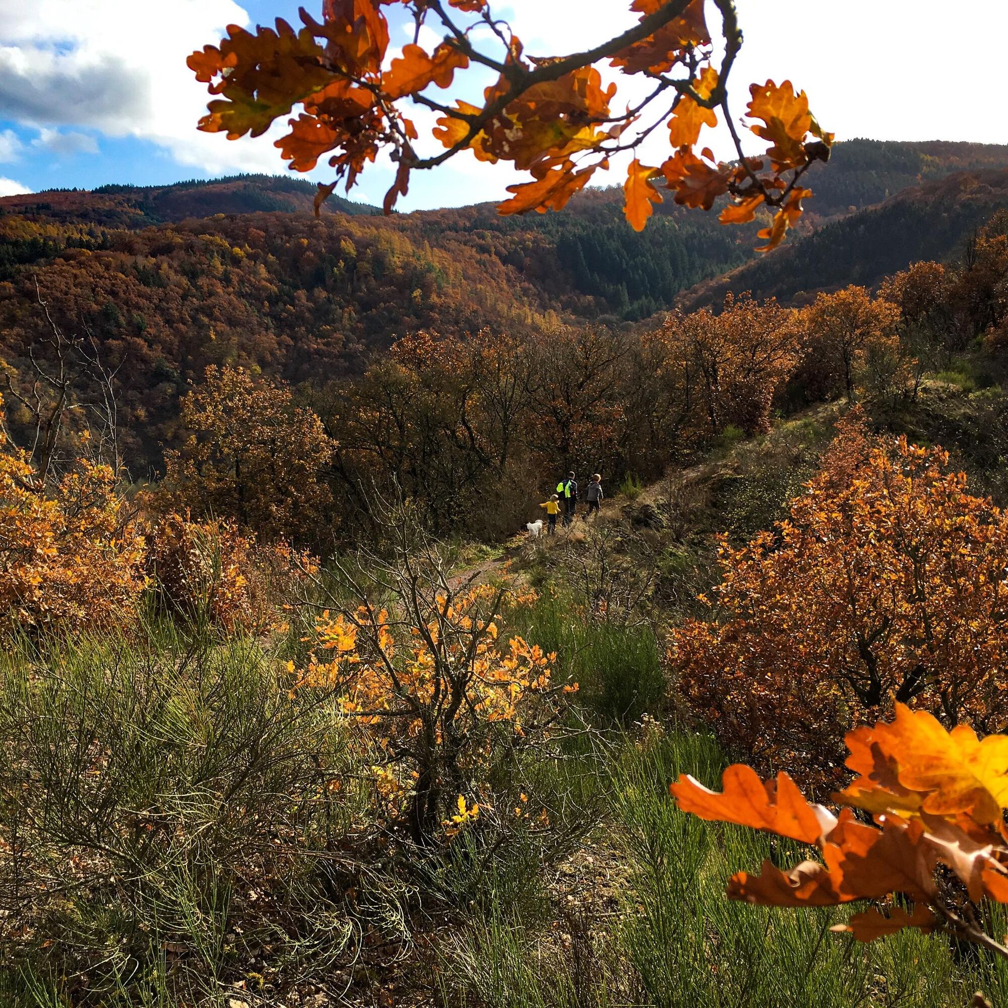
The trail starts directly in the old town of Oberstein – dining options and sights such as the Rock Church, the German Mineral Museum, or the Jakob Bengel Industrial Monument are in the immediate vicinity. Here the path passes right at the beginning by the Rock Church and the castle complexes. From the castle courtyard, there is a fantastic view over the town. In the large forest area around Idar-Oberstein, one walks along narrow paths, passes deeply incised stream valleys, and climbs several elevation meters via the Himmelsleitern (heaven ladders). Steep ascents and descents alternate with flat sections through dense beech high forest. From the viewpoint "Homersfelsen" far above the town, photography enthusiasts come to their own: unusual viewing angles over the town and to the castle.
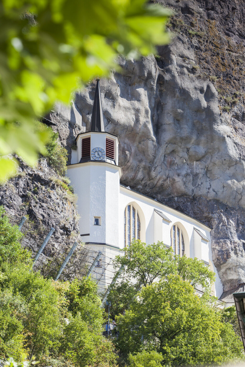
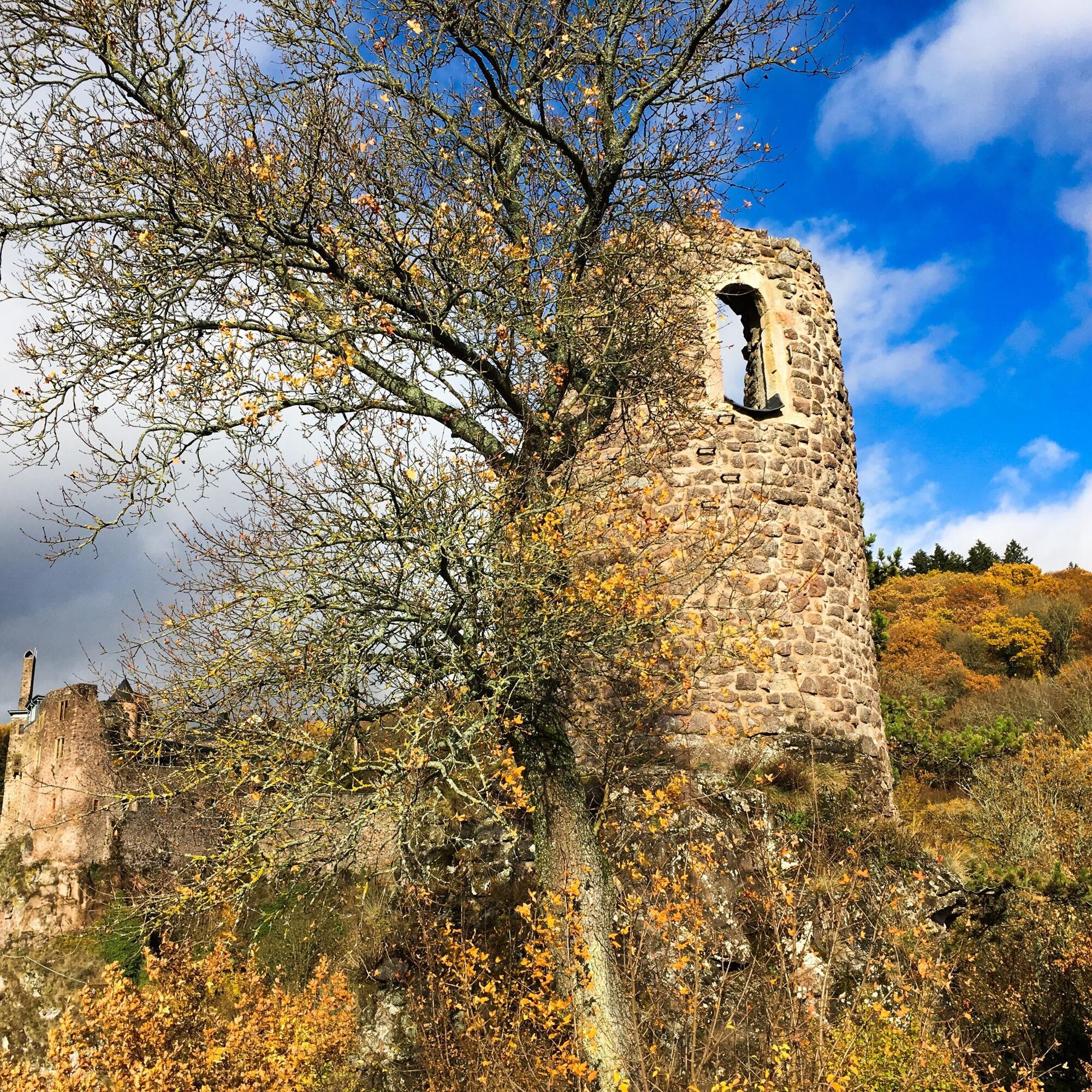

Entry and exit to the circular hiking trail can be made at various points; however, the Tourist Information at the marketplace in Oberstein (the access path to the starting point at the hiking car park at Schlossweiher is marked) is recommended. From here, after visiting one of the numerous cafés and restaurants or the German Mineral Museum, we can first reach and visit the unique Rock Church via a steep footpath, which is marked as an access route. After some switchbacks and through dense forest, we then reach the castle complexes Oberstein Castle and Bosselstein Castle high above the old town of Oberstein.
Viewpoints of the Nahe Rock Trail
Our effort to climb is rewarded with a fantastic view over the city center and the forested heights of the "Prussian Mountains." At the "Schlossweiher", only a few hundred meters away, a barbecue hut and several benches and tables invite you to a short or longer break. From here, we take the northern route to continue the circular hike, as it runs again through dense forest without steep sections. The path leads past partly deeply incised stream valleys to the "turning point" of the route, another viewpoint with a view of the Nahe valley and the districts of Nahbollenbach and Weierbach.
Most scenic part
From this point, we reach the most scenic part of the hike via a path that gently descends into the valley, first over the Himmelsleiter (Heaven's Ladder) close to the Nahe, to the nature reserve (NSG) "Altenberg". It stretches along a convex slope of the Nahe on south-facing rock faces and is known for its species-rich animal and plant communities. Numerous rare birds such as eagle owls, jackdaws, linnets, and kestrels breed in the rock faces, which we can observe - with some patience and good binoculars - from the rest benches set up here.
Panoramic view of the Nahe valley
Within the nature reserve, we have to overcome several elevation meters again. Shortly after the summit point, again accompanied by a wonderful panoramic view, we hike steeply down into the Nahe valley through dense forest after a short, flat section. This path also leads past dry slopes at Heinzenberg, where you can observe numerous butterfly species and other heat-loving animals and plants in early summer.
A winding path leads from here into the Seitzenbach valley. Over Götzplatz, designed as an orchard meadow and equipped with a sensory bench with a view of "Oberstein Castle," it goes to the viewpoint "Homersfelsen" high above the city. From here we hike towards the castle complexes and reach again the path into the historic old town of Oberstein, the starting point of your circular walk.
Hiking shoes required!
Our tips for an enjoyable hiking experience
Hiking is the perfect sport. With the right clothing and the right shoes, it’s twice as fun. Functional clothing, poles, and breathable backpacks are pleasant while hiking. But good shoes are indispensable. Sturdy jogging or leisure shoes are only suitable for short distances on flat paths. For longer routes, we recommend sturdy hiking boots with a grippy, non-slip sole. Also think about sun protection and bring a drink. One liter of water is ideal.
The dream loops have partly steep, difficult, and slippery sections in rainy or winter weather. Therefore, hiking boots, surefootedness, and good fitness are absolute requirements for hiking these premium circular trails.
A61 exit Bad Kreuznach, direction B41 Idar-Oberstein exit "Tourist Information", follow city parking guidance system
A 62 to exit Birkenfeld, then direction Birkenfeld B41 to Idar-Oberstein exit "Festhallenknoten", follow city parking guidance system
Idar-Oberstein train station, then continue by city bus lines 801/802/805/806/870 to Stadttheater; timetable at www.rnn.info.
Or a 500-meter walk from the station. From the Idar-Oberstein Tourist Information at the Oberstein marketplace (near the German Mineral Museum), the access path to the starting point above Oberstein Castle is marked.
A direct ride from Idar-Oberstein station to Oberstein Castle is possible via demand bus 829.
Timetable at www.rnn.info.
Parking garage "Old Town" and parking garage "Stadttheater", parking lots "Festhallenknoten" and "Austraße"
Áno
Tourist Information EdelSteinLand:
Office Idar-Oberstein
Hauptstraße 419
55743 Idar-Oberstein
Phone + 49 6781 – 64 60 40
Office Herrstein
Brühlstraße 16
55756 Herrstein
Phone: + 49 6785 – 79 1400
Be sure to plan a visit to the German Mineral Museum or the Jakob Bengel Industrial Monument.
Obľúbené výlety v okolí
-
4,6
Dream Loop "Köhlerpfad am Steinbach"
strednáTuristika 13,4 km -
4,3
Dream loop "Medieval Path"
strednáTuristika 8,46 km -
5,0
National Park Dream Loop "Kirschweiler Festung"
strednáTuristika 9,08 km -
4,5
Dream loop "Around the Kama"
svetloTuristika 6,18 km -
2,5
Dream Loop "Between the Forests"
strednáTuristika 10,7 km -
Dream Loop "Gemstone Grinder's Path"
strednáTuristika 16,0 km -
4,0
Dream Loop "STUMM Ironworks Route"
strednáTuristika 15,5 km -
4,3
Kirn - Kallenfels - Oberhausen bei Kirn
strednáTuristika 13,7 km -
5,0
Circular hiking route Hildebrecht's Homeland
Turistika 7,20 km -
Mackenrodt forest art circular route
strednáTematická trasa 6,12 km
Turistika a stopovanie


Nenechajte si ujsť ponuky a inšpiráciu na ďalšiu dovolenku
Vaša e-mailová adresa bol pridaný do poštového zoznamu.