
- Stručný popis
-
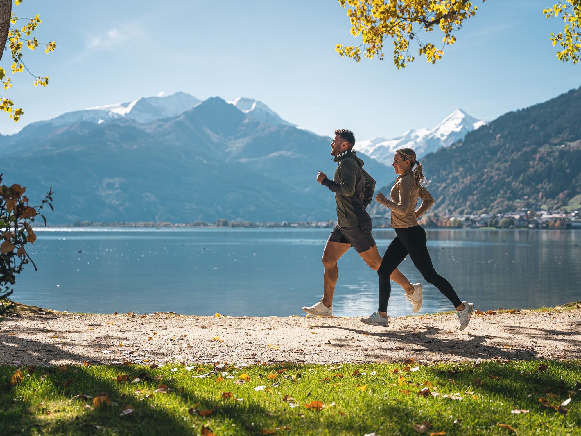
on the track of the Ironman
- Obtiažnosť
-
ťažká
- Hodnotenie
-
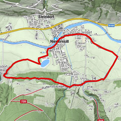
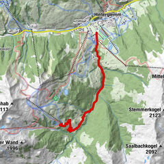
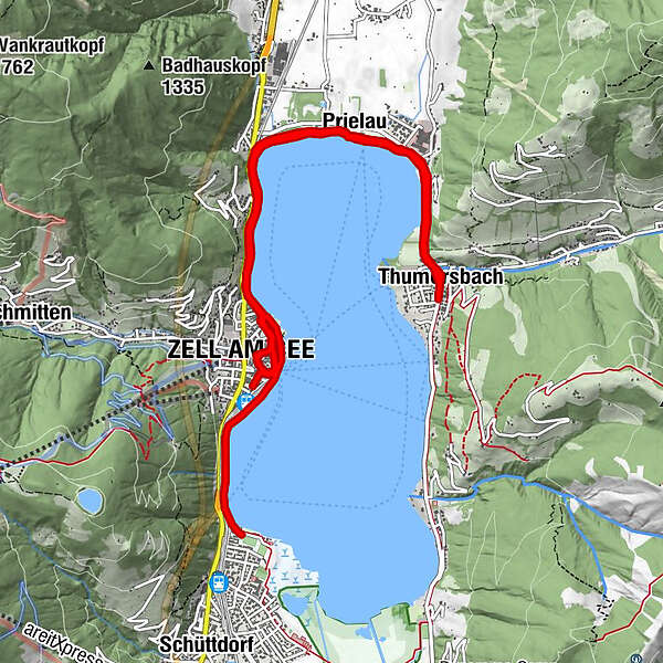
- Trasa
-
Seespitz0,1 kmSeespitz0,2 kmHeldenhain0,5 kmZell am See1,1 kmEsplanade1,5 kmMarienkapelle2,5 kmStadtpfarrkirche St. Hippolyt2,6 kmAltstadt2,7 kmInnenstadt2,7 kmZell am See (750 m)2,7 kmEsplanade3,2 kmGrinzing3,9 kmEinöd4,1 kmSeewirt - Das Restaurant4,4 kmAbdeckerfeld4,5 kmPrielau5,3 kmGasthof Wieshof5,7 kmThumersbach6,8 kmLohninghof7,2 kmWiesenlehen8,2 kmGasthof Wieshof8,4 kmPrielau8,8 kmAbdeckerfeld9,5 kmSeewirt - Das Restaurant9,7 kmEinöd10,1 kmGrinzing10,2 kmEsplanade11,0 kmEsplanade11,5 kmMarienkapelle11,7 kmStadtpfarrkirche St. Hippolyt11,7 kmAltstadt11,8 kmInnenstadt11,8 kmGrinzing13,0 kmEinöd13,2 kmSeewirt - Das Restaurant13,5 kmAbdeckerfeld13,6 kmPrielau14,3 kmGasthof Wieshof14,9 kmLohninghof15,9 kmThumersbach16,2 kmWiesenlehen17,3 kmGasthof Wieshof17,4 kmPrielau17,9 kmAbdeckerfeld18,6 kmSeewirt - Das Restaurant18,8 kmEinöd19,1 kmGrinzing19,3 kmEsplanade20,1 kmEsplanade20,6 kmMarienkapelle20,8 kmInnenstadt20,8 kmStadtpfarrkirche St. Hippolyt20,8 kmAltstadt20,8 km
- Najlepšia sezóna (ročné obdobie)
-
janfebmaraprmájjúnjúlaugsepoktnovdec
- Najvyšší bod
- 767 m
- Cieľová destinácia
-
Sports field Zell am See, Sportplatzstraße
- Profil nadmorskej výšky
-

-

-
AutorPrehliadka IRONMAN 70.3 Weltmeisterschaftsstrecke používa outdooractive.com na stránke ..
GPS Downloads


Ďalšie prehliadky v regiónoch