


Rear Tumpen Alm - Umhausen
The start is in Tumpen at the parking lot by the primary school. From there, follow the road towards Grube – to the left, a forest path leads up past the Tumpen Waterfall. At the last crossroads, turn...
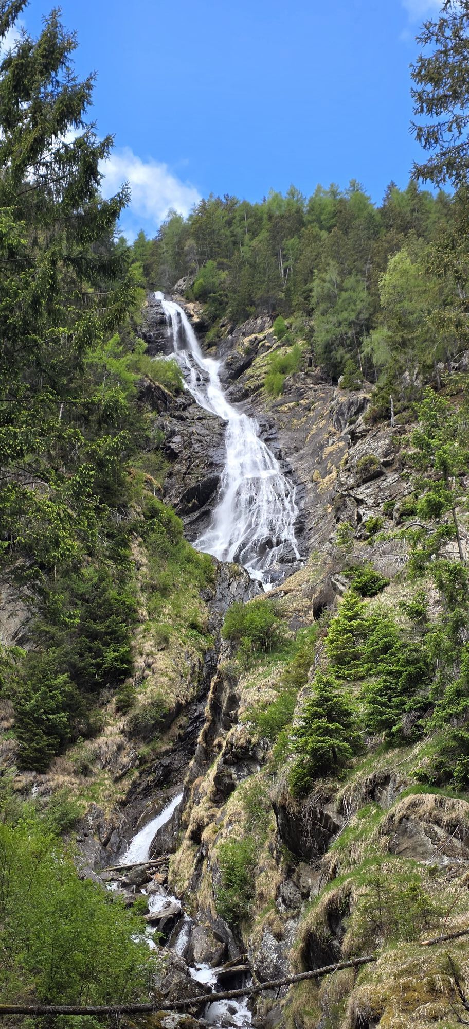
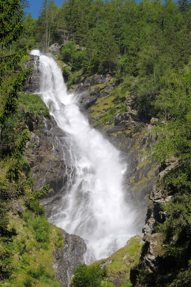
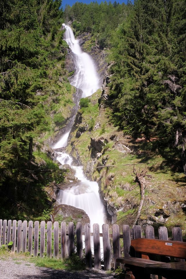
The start is in Tumpen at the parking lot by the primary school. From there, follow the road towards Grube – to the left, a forest path leads up past the Tumpen Waterfall. At the last crossroads, turn left towards the sidewalk or the Front Tumpen Alm. Follow the forest path past the Front Tumpen Alm to the Rear Tumpen Alm. The Alm is not managed! The highlight on this quiet and varied path is the Tumpen Waterfall. The Front Tumpen Alm offers a place to stop halfway for a break.

The start is in Tumpen at the parking lot by the primary school. From there, follow the road towards Grube – to the left, a forest path leads up past the Tumpen Waterfall. At the last crossroads, turn left towards the sidewalk or the Front Tumpen Alm. Follow the forest path past the Front Tumpen Alm to the Rear Tumpen Alm. The Alm is not managed! The highlight on this quiet and varied path is the Tumpen Waterfall. The Front Tumpen Alm offers a place to stop halfway for a break.
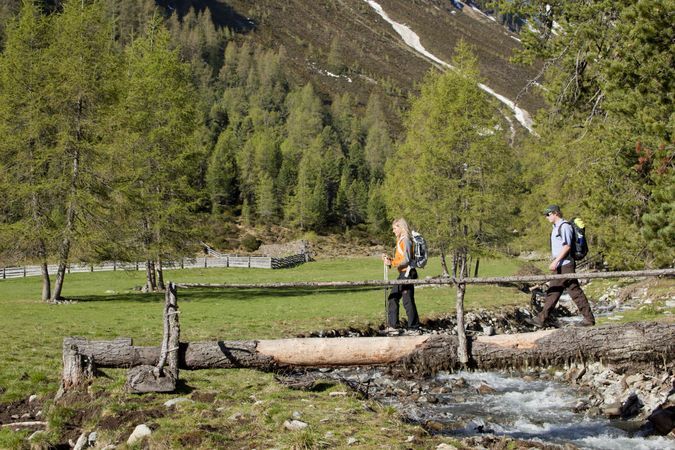
Appropriate equipment such as breathable and weather-appropriate outdoor clothing, ankle-high hiking boots, wind, rain and sun protection, hat, and possibly gloves are required for all hikes and routes. It is necessary to carry a first aid kit, a mobile phone, and possibly a hiking map, as well as sufficient provisions for hikes without a possibility to stop for food.
The car trip to ÖTZTAL. Located in Tyrol, the Ötztal branches off southwards as the longest side valley of the Eastern Alps. Car travellers reach the valley via the Inn Valley to the valley entrance and continue along the Ötztal. Besides the toll motorway, country roads can also be used. Using the route planner, you can quickly and conveniently determine your trip.
Route planner: https://www.google.at/maps
Travel comfortably and safely by train to the Ötztal train station. The final stop or exit point is ÖTZTAL station. Afterwards, you can quickly and conveniently continue with public transport or local taxi companies through the entire valley to your desired destination! The current bus schedule is available at: http://fahrplan.vvt.at
In Tumpen, the following parking options are available to you:
Parking lot Primary School Tumpen | free of charge

Obľúbené výlety v okolí
-
4,6
Trip Tirol ➤ Hike to the Blue Grotto in Rosengarten Gorge Imst
strednáTuristika 4,86 km -
4,4
Stuibenfall Umhausen circular hike
svetloTuristika 9,32 km -
4,2
Hike Stuibenfall - Umhausen
svetloTuristika 2,95 km -
4,5
Oetz - Piburger See - Oetz
strednáTuristika 7,16 km -
4,4
Rundwanderung Hängebrück3
svetloTuristika 6,32 km -
4,7
Winter circular route Brandalm/Burgstein - Längenfeld 204
strednáZimná turistika 5,44 km -
4,6
Umhausen - Stuibenfall - Umhausen
strednáTuristika 7,94 km -
4,6
Summit route Faltegartenköpfl
strednáTuristika 4,04 km -
4,7
Circular hike Bergmahderweg - Niederthai
svetloTuristika 7,60 km -
4,8
lake Piburger See
svetloTuristika 2,75 km

Turistika a stopovanie


Nenechajte si ujsť ponuky a inšpiráciu na ďalšiu dovolenku
Vaša e-mailová adresa bol pridaný do poštového zoznamu.