


Hittisau - Über Brücken und durch die Schlucht
Fotografie našich používateľov
/Along the Bolgenach, the water ramble takes you across a suspension bridge, past the wild yet romantic Engenloch gorge. This circular track starts with a march to a magnificent view (Känzele). You will...
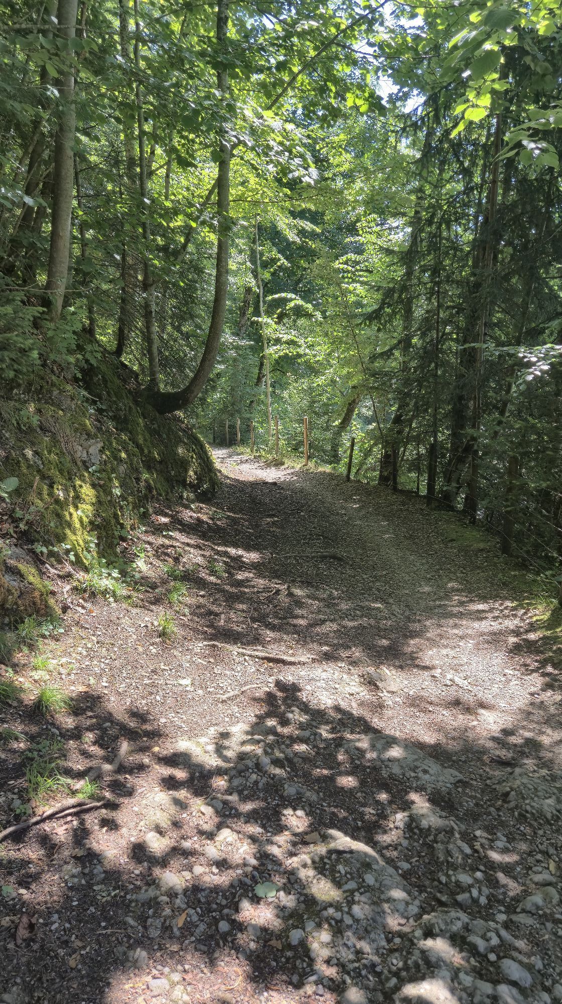
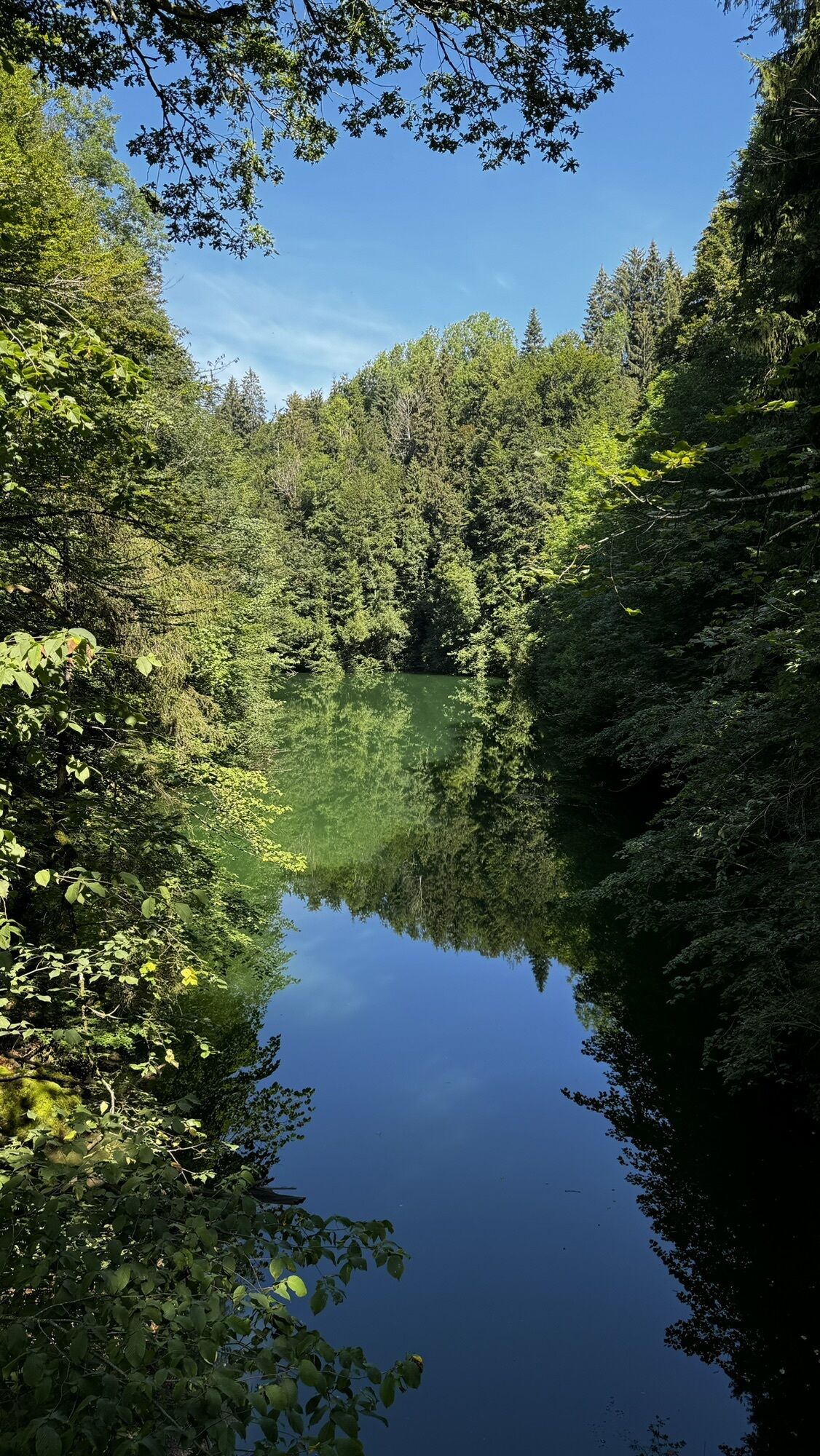
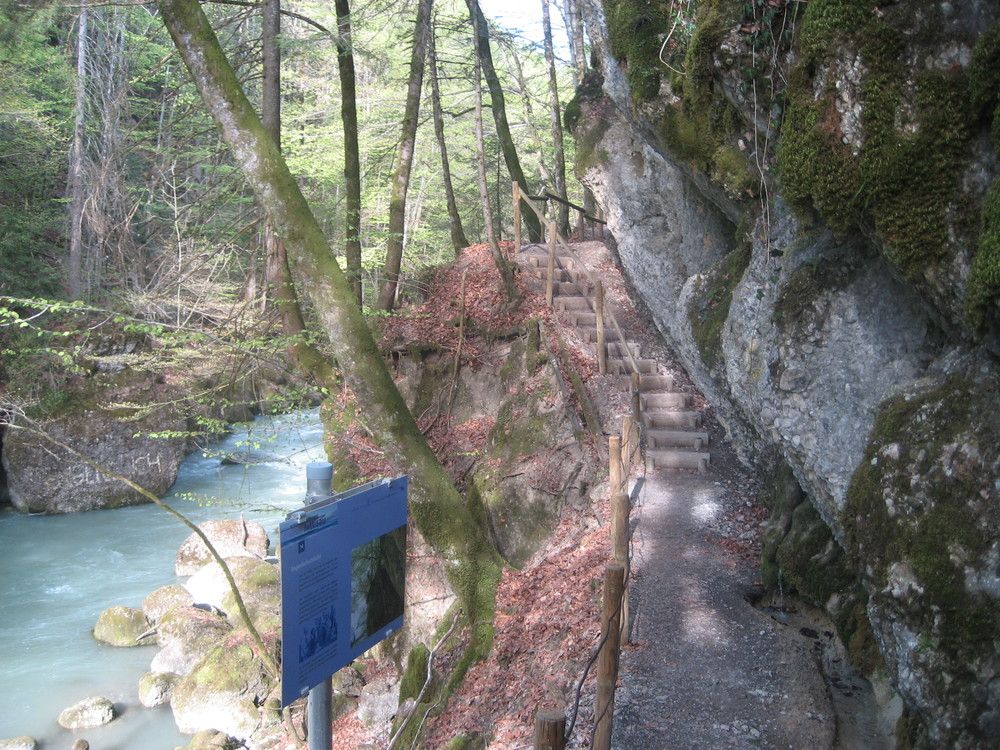
Along the Bolgenach, the water ramble takes you across a suspension bridge, past the wild yet romantic Engenloch gorge. This circular track starts with a march to a magnificent view (Känzele). You will pass the chapel of Fatima and then walk along the Bolgenach, upstream to the Engenloch gorge with interesting rock formations. After passing the gorge, a route will lead you back to the centre of Hittisau.
Itinerary:
Hittisau - centre of town (790 m) - Känzele View (Häleisen, 820 m) - Kommabrücke (760 m) - Engenlochschlucht - Hittisau

Gasthöfe und Restaurants in Hittisau
Chances to stop off for a drink or for food: Inns in Hittisau
Bregenzerwald I
Áno
Áno
Mit dem öffentlichen Bus Linie 25
Public Bus 25
Webové kamery z prehliadky
Obľúbené výlety v okolí
-
4,6
Hochälpele 1464m, Bödele
svetloTuristika 9,87 km -
5,0
Winterstaude
strednáTuristika 9,30 km -
4,5
Hittisau | Wasserwanderweg
svetloTematická trasa 7 km -
4,6
Steibis - Buchenegger Waterfalls
strednáTuristika 6,47 km -
4,2
Sonntagsrunde
strednáTuristika 7 km -
4,8
Panoramarundweg Baumgarten - Niedere
svetloTuristika 3,76 km -
4,7
Rindalphorn und Hochgrat
strednáTuristika 15,6 km -
4,3
Circular route Steibis to Dreiländerblick
strednáTuristika 7,95 km -
5,0
Circular route Hochgrat - Falkenhütte
ťažkéTuristika 14,2 km -
4,0
Nagelfluh-Überschreitung
ťažkéTuristika 22,7 km

Turistika a stopovanie


Nenechajte si ujsť ponuky a inšpiráciu na ďalšiu dovolenku
Vaša e-mailová adresa bol pridaný do poštového zoznamu.