


Via Valais Cabane des Becs de Bosson - Cabane de Moiry (Stage 4)


After three intense stages in terms of distance and elevation gain, this fourth section offers you a day of rest. Although somewhat shorter than the others, this route is nevertheless remarkable. It begins...
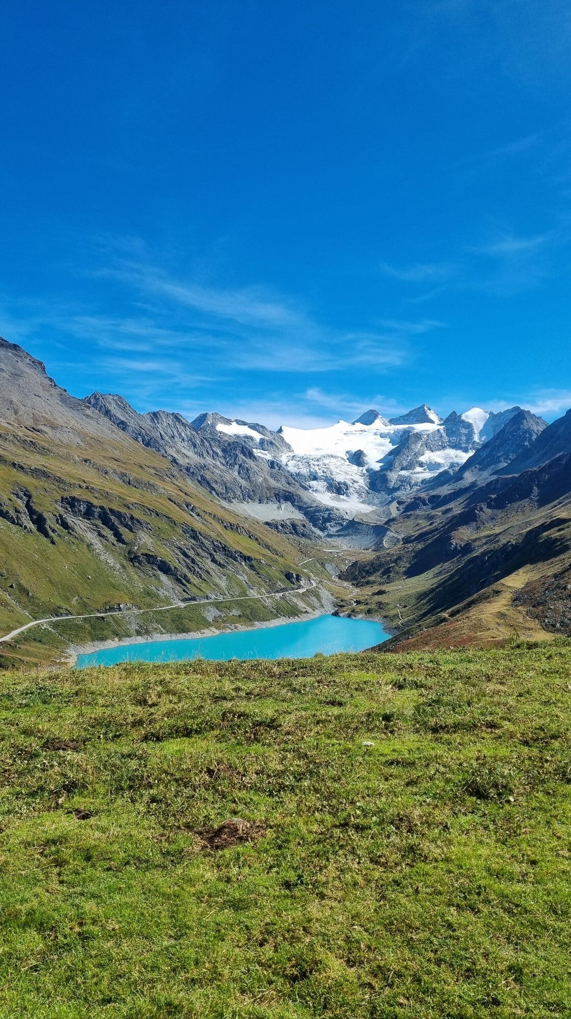
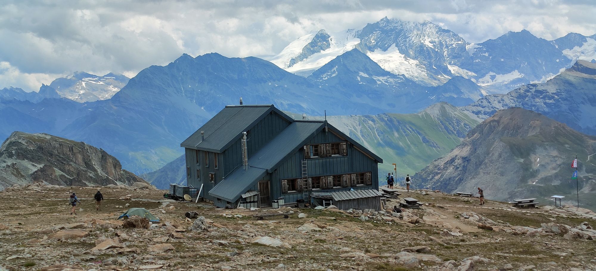
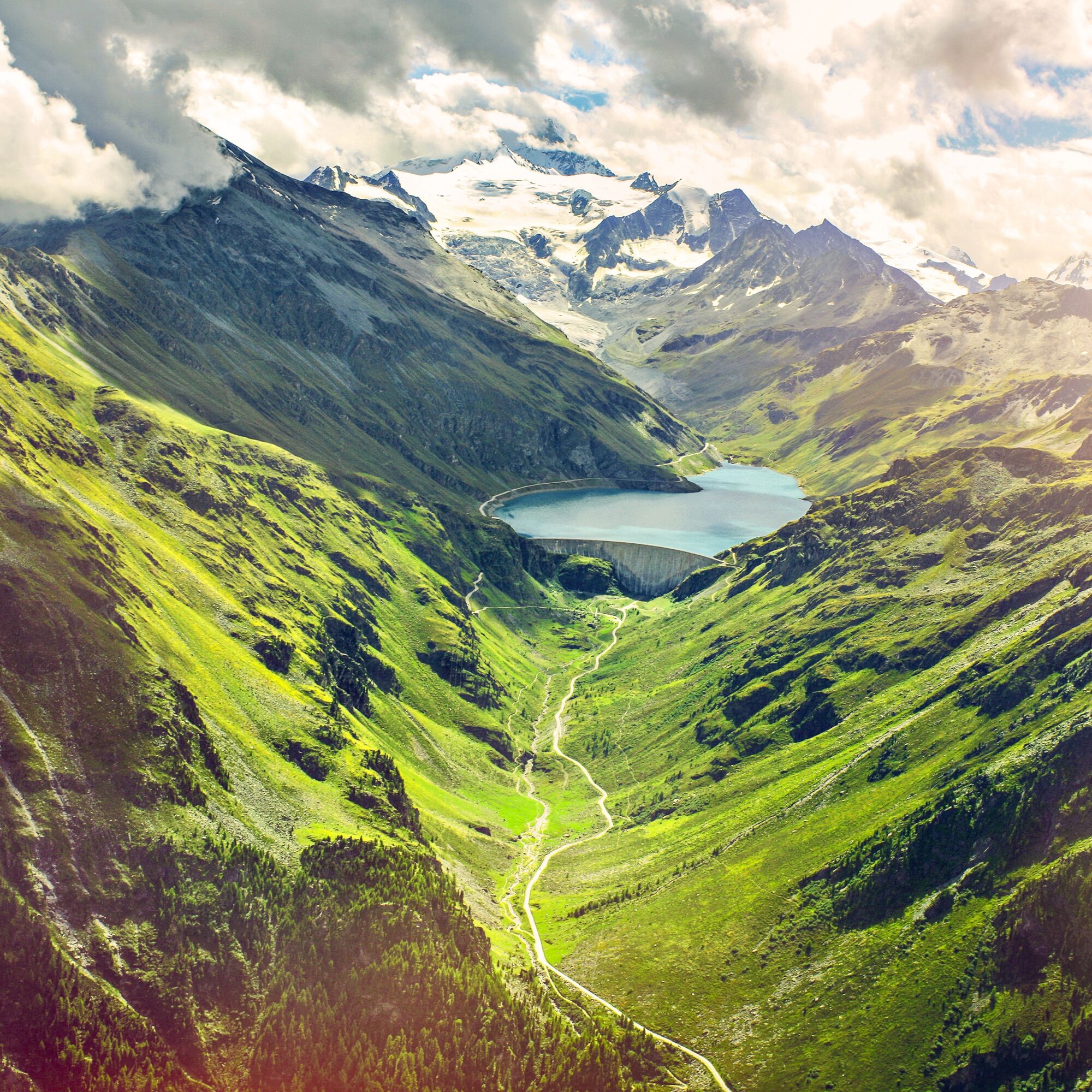
After three intense stages in terms of distance and elevation gain, this fourth section offers you a day of rest. Although somewhat shorter than the others, this route is nevertheless remarkable. It begins and ends at altitude, in cozy huts, passing through a variety of different landscapes. The path takes you from the beige, moss-green, and coral-colored tones of the ground around Lac de Lona to the turquoise waters of Lac de Moiry. Upon arriving in Val d'Anniviers, it offers a wonderful view of the surrounding majestic 4000-meter peaks. The terrace of the Cabane de Moiry is an ideal place to enjoy this panorama. This hut is located at 2825 m above sea level and lies directly beside the Moiry Glacier. Don’t miss admiring the sunset on the nearby peaks during dinner.
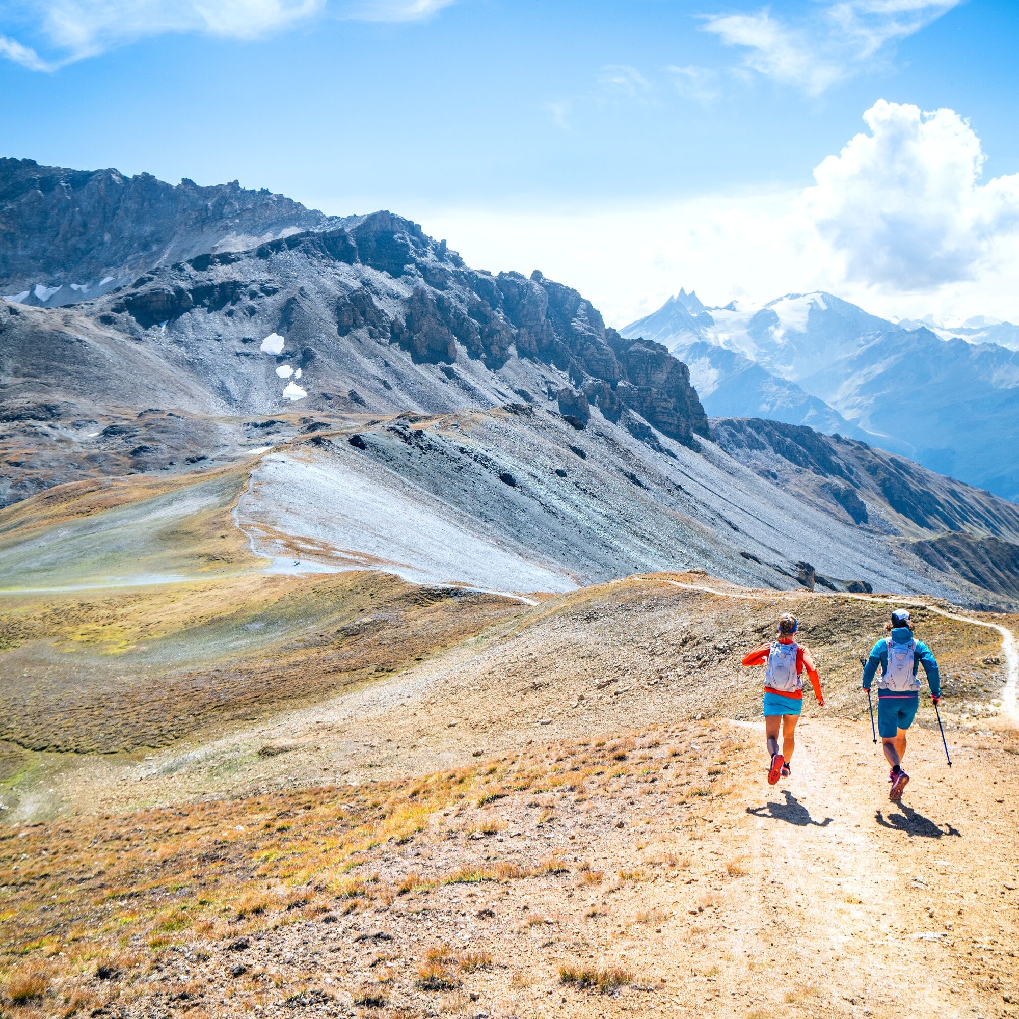
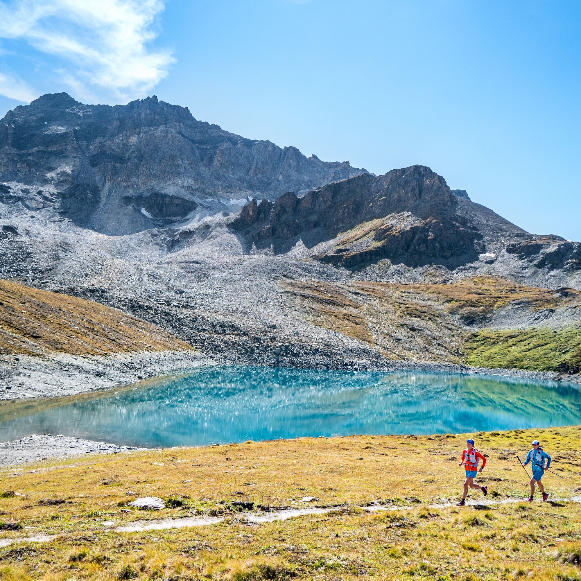
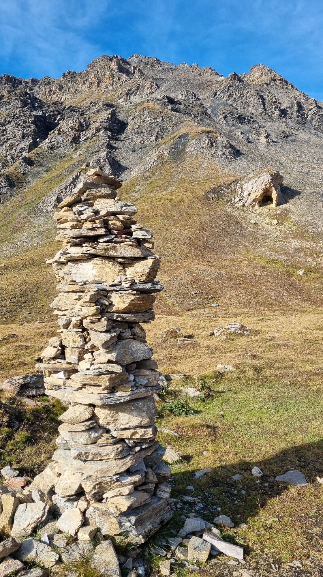
From the Cabane des Becs de Bosson, the path descends in sharp curves to Lac de Lona. This is followed by a short ascent to the Basset de Lona, from where you can have a view of the next stages and the next passes to be climbed. Descend to Lac de Moiry on a wide gravel path that leads you to the water's edge. After walking along the lake, you reach the moraines via a final, especially challenging ascent and then arrive at the Cabane de Moiry.
Cabane des Becs de Bosson - Pas de Lona - Basset de Lona - Alpage de Torrent - Lac de Moiry - Lac de Châteaupré - Cabane de Moiry
Áno
We recommend:
Good running shoes Weather-dependent clothing: always carry a waterproof vest Headwear Sunscreen Water bottle Trail poles
Use of the trail paths and information on this website is at your own risk. Local conditions may cause route changes. Valais/Wallis Promotion assumes no responsibility for the accuracy and completeness of the information on this website.
For all trails:
Use only marked trail paths and follow all signs and instructions - for your own safety, to protect grazing animals, and out of respect for wildlife. Close gates after passing through. Be considerate towards other trail users, plants, and animals.
For mountain trails:
Take additional sunscreen. UV rays can be very strong at high altitudes, even in cloudy weather. Plan your trail carefully: consider the required fitness level of all participants, weather forecasts, and seasonal conditions. Weather conditions in the mountains can change very quickly and without warning. Proper clothing and provisions (food and drink) are very important. In unstable weather, it is better to turn back early. Inform your family about your trail route. Avoid going alone if possible. Observe warning signs indicating dangers at riverbanks, along watercourses below dams and reservoirs: Water levels can rise quickly and without warning.
For the 1st stage Via Valais: Take the A9/E62 motorway to Martigny, then continue on the Grand-Saint-Bernard Route/Route 21 via Sembrancher to Le Châble. However, it is advisable to use public transport as this is a multi-stage run ending in Zermatt.
For the 1st stage Via Valais: Take the train to Martigny station, then to Le Châble. Access to the start of the path is provided by a first cable car between Le Châble and Verbier and a second one from Verbier to Les Ruinettes.
For the 1st stage Via Valais: A free parking lot with 240 spaces is available at the Le Châble cable car for up to ten days.
More information about the destination:Val d'Hérens
End the day on the terrace of the Cabane de Moiry. Have a drink, play table tennis, and enjoy an ideal view of the glacier.
Obľúbené výlety v okolí
-
5,0
Bella-Tola
strednáVysoké turné 6,72 km -
4,0
Belvédère via ferrata
strednáVia ferrata 1,81 km -
2,0
Circular hike to Cabane des Aiguilles Rouges and Lac Bleu
ťažkéTuristika 14,1 km -
Tour du Lac de Moiry
strednáTuristika 13,4 km -
Zum Fuss des Gletschers und zurück nach Les Hauderes
strednáTuristika 12,3 km -
5,0
Sentier des bouquetins
strednáTuristika 8,73 km -
5,0
Tour of Val d’Anniviers: Zinal–Grimentz (Stage 3)
strednáTuristika 14,5 km -
Val d’Annivier
svetloTuristika 17,6 km -
Pic d'Artsinol, Evolène, Valais/Suisse
strednáTuristika 13,0 km -
Roc de la Vache - Zinal
strednáTuristika 18,9 km
Turistika a stopovanie


Nenechajte si ujsť ponuky a inšpiráciu na ďalšiu dovolenku
Vaša e-mailová adresa bol pridaný do poštového zoznamu.