


Péz da Vrin with snowshoes
Úroveň náročnosti: WT3


The GPS track shows a circular route, but we recommend it as an out-and-back. That means either starting in Vrin (public transport connection) or from Sogn Giusep by car.
The route from the village of...
The GPS track shows a circular route, but we recommend it as an out-and-back. That means either starting in Vrin (public transport connection) or from Sogn Giusep by car.
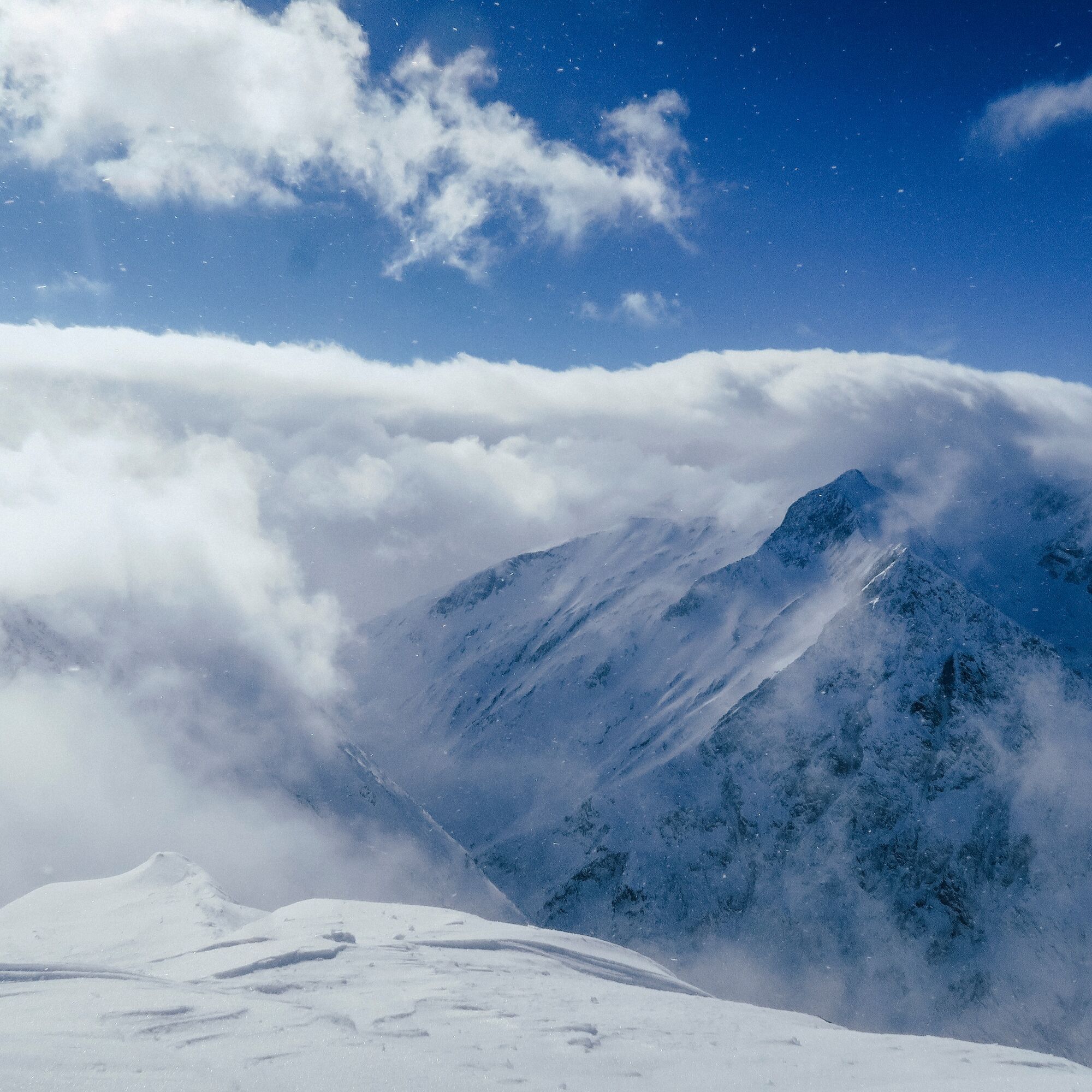
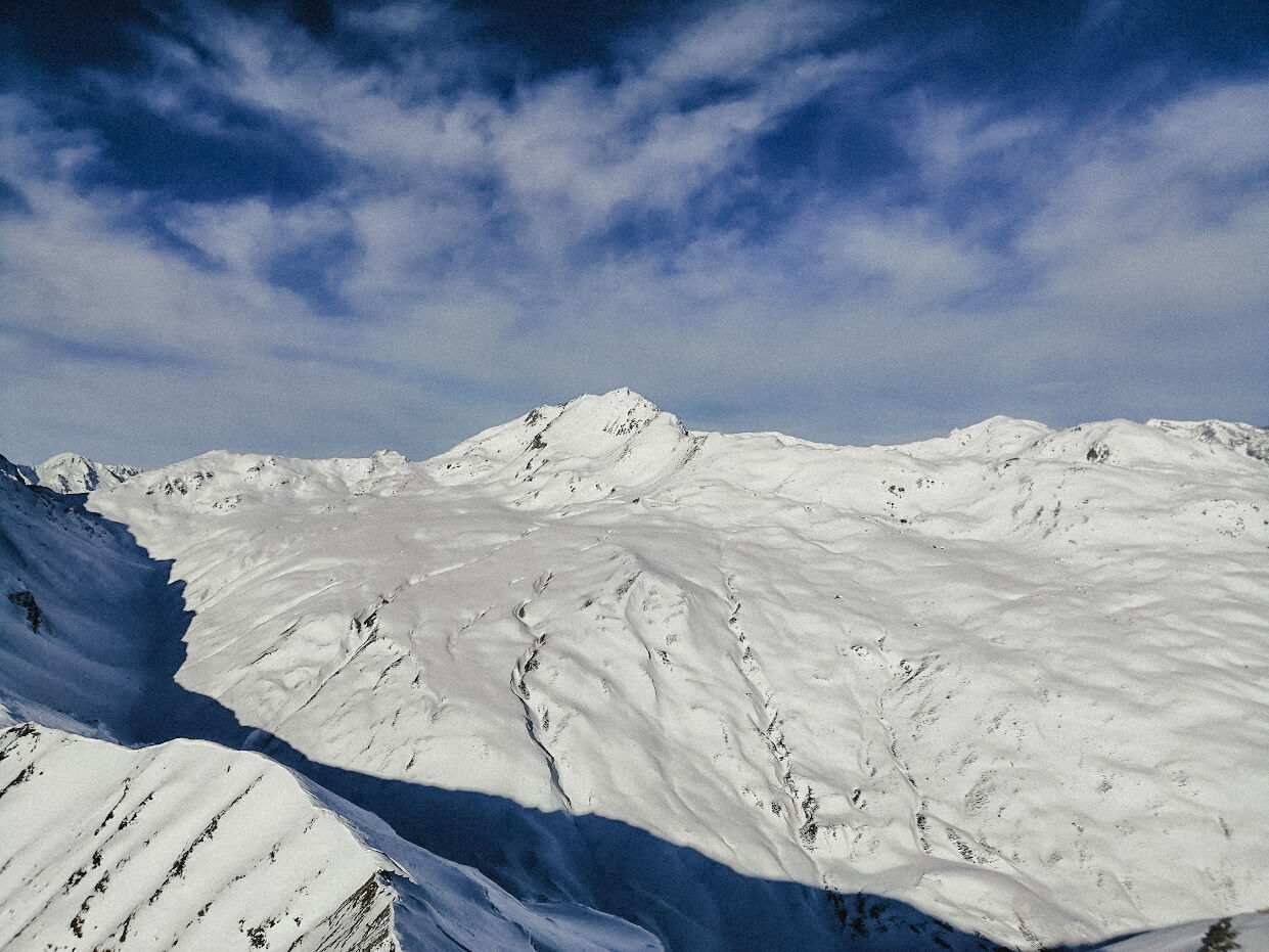
The route from the village of Vrin is somewhat more demanding near the summit. You climb directly over the alpine meadows of Prada and reach Alp Dado after about 500 meters elevation. It then becomes more demanding in terms of avalanche risk as steep slopes must repeatedly be traversed or you move within the influence area of steep slopes. The ascent to the summit is fairly steep and requires good walking technique. Space at the highest point is limited, but the panorama is certainly not. You can either descend along the ascent track or take the route via Sogn Giusep. The downside is that you have to walk finally along the valley road.
The ascent from Sogn Giusep requires arrival by car. This route is somewhat easier but still has some steeper sections. Up to the height of Stavel Liung, it goes over alpine meadows—just right for warming up. Continuing over Puozas up to below the summit. The summit ridge is regularly blown free of snow. Theoretically, you could now descend via Alp Dado. However, if you have your car in Sogn Giusep, you must solve this logistical problem.
The temptation to descend via Alp Cuolm is great. However, this area is a wildlife protection zone and closed from 01.12. to 15.04. Please strictly observe this!


From Vrin
Vrin - Alp Dado - Stavel Sura - Summit - Descent via ascent route
From Sogn Giusep
Sogn Giusep - Stavel Liung - Puozas - Summit - Descent via ascent route
Áno
Áno
See safety instructions
Ski and snowshoe hikes in unsecured terrain require good knowledge in assessing avalanche danger and tour planning. Furthermore, a complete safety kit must always be carried - regardless of the current avalanche danger.
We recommend the WhiteRisk app and website for preparation and planning of the tour.
For carefree enjoyment, we recommend our mountain guides and snowshoe hiking leaders of the Surselva.
From Ilanz to Vrin
If you choose the route from Sogn Giusep, you continue over a narrow road to Sogn Giusep.
From Ilanz by post bus to Vrin, recommended. Some services continue to Sogn Giusep (reservation required)
During the winter season, the post bus on the Ilanz – Vrin line as well as other lines throughout the Lumnezia municipality can be used free of charge by everyone.
Vrin: Parking at the schoolhouse. Somewhat hidden, from the village center turn left near the restaurant Casa Leon.
Sogn Giusep: There is an official parking lot below the small village.
WT3
This route is long and alpine for a snowshoe hike. Those with sufficient technique and fitness will experience a magnificent route.
Be sure to take a walk through the village of Vrin, awarded the Wakker Prize.
Obľúbené výlety v okolí
-
5,0
Hiking route Suspension Bridge Val da Tersnaus
strednáTuristika 3,24 km -
3,3
3-lake hike
strednáTuristika 12,8 km -
5,0
2-Tages-Wanderung Greina Hochebene
strednáTuristika 14,9 km -
Panoramic hike between Piz Mundaun and Péz Sezner
strednáTuristika 6,75 km -
Piz Terri, 3.149 m
strednáVysoké turné 6,92 km -
5,0
Breil/Brigels - Val Frisal Rundwanderung
strednáTuristika 20,8 km -
4,5
Die Puntegliashütte am Fusse des Tödimassivs
ťažkéTuristika 13,5 km -
5,0
Kronenwanderung: Vrin - Terrihütte (Etappe 8)
strednáTuristika 10,8 km -
Furggelti 2712m
ťažkéTuristika 18,7 km -
3-Tagestour Greina-Lucomagno: Vrin - Capanna Scaletta (Etappe 1)
ťažkédiaľková pešia trasa 17,2 km
Turistika a stopovanie


Nenechajte si ujsť ponuky a inšpiráciu na ďalšiu dovolenku
Vaša e-mailová adresa bol pridaný do poštového zoznamu.