


E.-T.-Compton Hut (1,650 m) via Kreuzwirt


Fotografie našich používateľov
-

 © Richie67Vytvorené dňa 18.05.2023
 -

 © Sabine PfeifferVytvorené dňa 15.06.2025
 -
 © Sabine PfeifferVytvorené dňa 15.06.2025
 -
 © Sabine PfeifferVytvorené dňa 15.06.2025
 -
 © Richie67Vytvorené dňa 18.05.2023
 -
 © Richie67Vytvorené dňa 18.05.2023
 -
 © Heinz SperlVytvorené dňa 18.07.2024
 -
 © Heinz SperlVytvorené dňa 18.07.2024
 -
 © Heinz SperlVytvorené dňa 18.07.2024
 -
 © Heinz SperlVytvorené dňa 08.07.2023


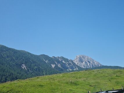
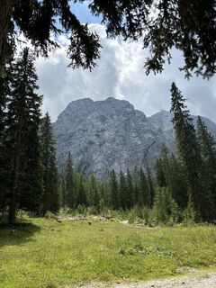
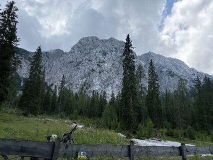
Via Fostweg and hiking trail to the E.-T.-Compton Hut, standing on the Schönboden, named after the famous Alpine painter who called his favorite place one of the most beautiful spots in the Eastern Alps....
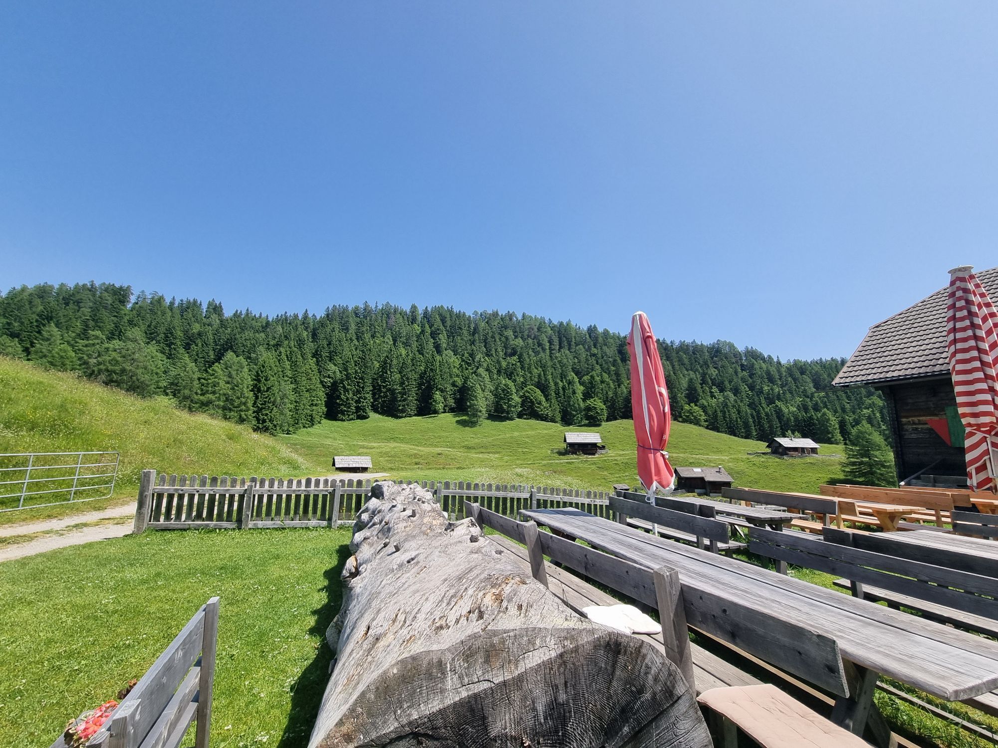
Via Fostweg and hiking trail to the E.-T.-Compton Hut, standing on the Schönboden, named after the famous Alpine painter who called his favorite place one of the most beautiful spots in the Eastern Alps. The lovely shelter has 11 beds, 16 mattress dormitories and is staffed from June to September.


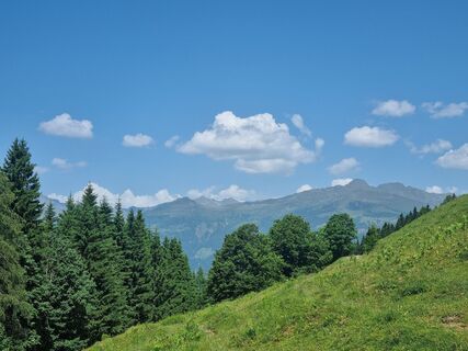
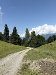
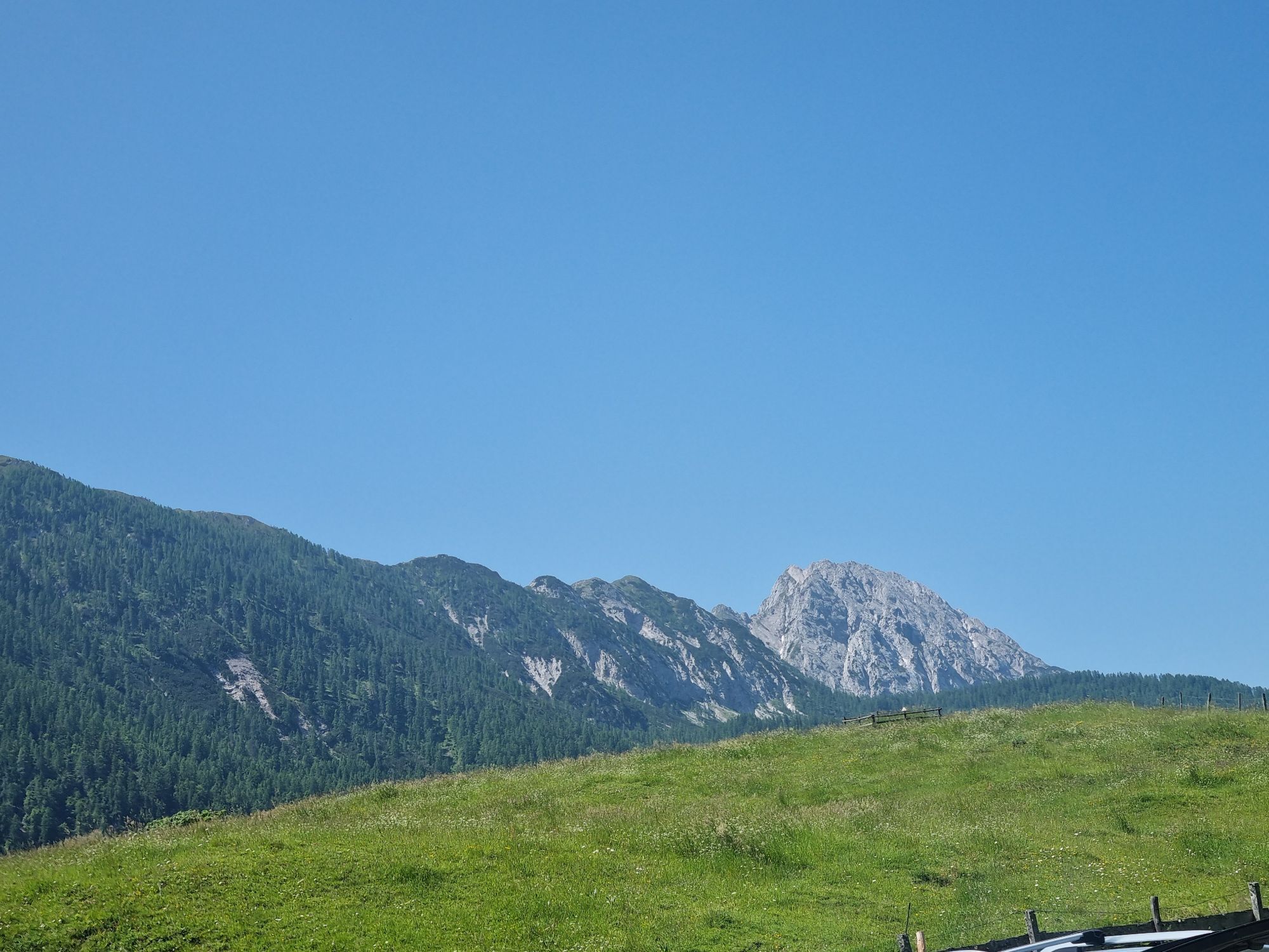
Starting from the Hotel-Gasthof Kreuzwirt, the path first leads to the Waisacher Alm (approx. 2 ½ hours). From there, the path descends southwest to Pfarreben. We descend steeply westward to the pasture fence. In front of us is the Eggeralm with the Reisskofel mountain range. The trail turns moderately uphill southwest through a mountain forest mainly of larches toward the “Schönboden”. (On the right, the red marked trail coming up from Bruggen in the Drau Valley.)
Notes: Return either via the Waisacher Alm and Tschrischen to Weißbriach (approx. 3 hours) or via Pfarreben-Gössering to Weißbriach (approx. 3 hours).
Good footwear and hiking poles.
Bring enough to drink.
..by car
From the north (D, NL, B, L, DK, SK):
Munich - Salzburg - Tauern motorway (A10) - Spittal junction - Greifenburg - Weissensee
Munich - Salzburg - Bad Gastein (train loading Tauern lock) - Mallnitz - Möllbrücke - Greifenburg - Weissensee
Munich - Grossglockner High Alpine Road - Heiligenblut - Winklern - Iselsberg - Oberdrauburg - Greifenburg - Weissensee
Munich - Mittersill - Felbertauern road - Lienz - Oberdrauburg - Greifenburg - Weissensee
From the west (CH, F, I):
Innsbruck - Mittersill - Felbertauern road or Brenner motorway - Lienz - Oberdrauburg - Greifenburg - Weissensee
From the east (A, H):
South motorway (A2) - Villach - Spittal - Greifenburg - Weissensee or Villach - toward Italy to Hermagor/Gailtal exit - Hermagor - Weissensee
West motorway (A1) - Salzburg - Tauern motorway (A10) - Spittal junction - Greifenburg - Weissensee
From the south (I, SLO, HR):
Udine - Tarvisio - Hermagor/Gailtal exit - Hermagor - Weissensee
Ljubljana - Karawanks tunnel - Villach - toward Italy to Hermagor/Gailtal exit - Hermagor - Weissensee
...by train
Travel comfortably and stress-free by train! Use the train station shuttle service - it takes you from the Greifenburg station to the Nature Park Weissensee, 10 km away. Shuttle reservations at: www.naturparkshuttle.com (reservation by 6 p.m. the day before at the latest)
At the public parking lot in Praditz. (subject to charge)
Beautiful long-distance hike with great views.
Obľúbené výlety v okolí
-
4,9
Weissensee Ost- nach Westufer
svetloTuristika 10,2 km -
4,8
Slow Trail Weissensee
strednáTuristika 6,69 km -
5,0
RW_N9 Weißenbachklamm
ťažkéTuristika 8,16 km -
4,0
Emberger Alm - Hochtristen
strednáTuristika 9,50 km -
4,6
W5 - Naggler Alm Round Weissensee
strednáMountainbike 15,8 km -
4,5
Bergstation Weißensee bis Golz
strednáTuristika 14,8 km -
4,8
Drau Cycle Path R1
svetloCyklistika 75,9 km -
5,0
Weissensee Steinwandpfad
strednáTuristika 9,10 km -
5,0
Möselalm - Weißbriach/Gitschtal
svetloTuristika 5,12 km -
4,7
Two Lakes – Hochtristen
strednáTuristika 9,80 km
Turistika a stopovanie


Nenechajte si ujsť ponuky a inšpiráciu na ďalšiu dovolenku
Vaša e-mailová adresa bol pridaný do poštového zoznamu.