


Monte Scale Loop
Úroveň náročnosti: T3
Fotografie našich používateľov
-
 © Roberto PasoliniVytvorené dňa 06.08.2025
 -
 © Roberto PasoliniVytvorené dňa 06.08.2025
 -
 © Roberto PasoliniVytvorené dňa 06.08.2025
 -

 © Baszler FritzVytvorené dňa 03.09.2025
 -

 © Fabio SalviniVytvorené dňa 01.05.2025
 -
 © Fabio SalviniVytvorené dňa 01.05.2025
 -
 © Fabio SalviniVytvorené dňa 26.04.2024
 -
 © Fabio SalviniVytvorené dňa 26.04.2024
 -
 © Fabio SalviniVytvorené dňa 26.04.2024
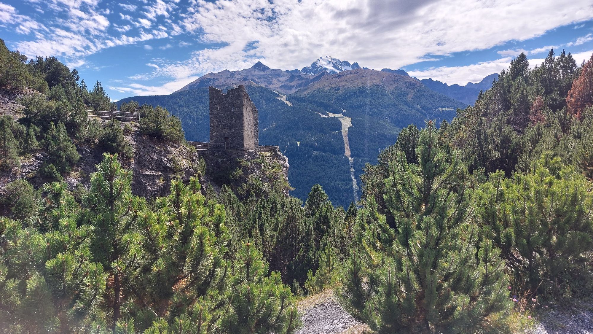

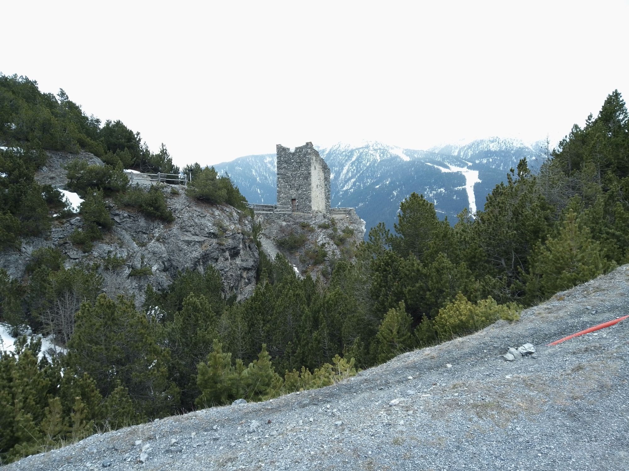
From the Fraele Towers, ascend the military mule track N197.1 through a dense Swiss pine forest until reaching a shoulder at the foot of a rock face. Follow a ledge horizontally then ascend among rocks,...
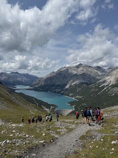
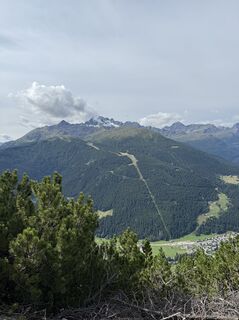
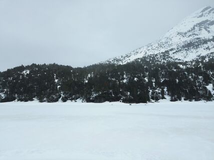
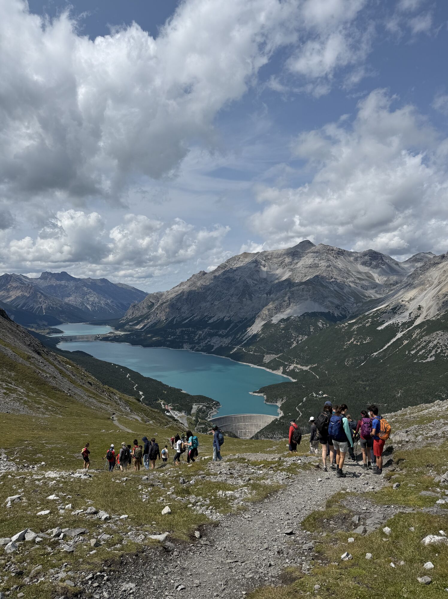
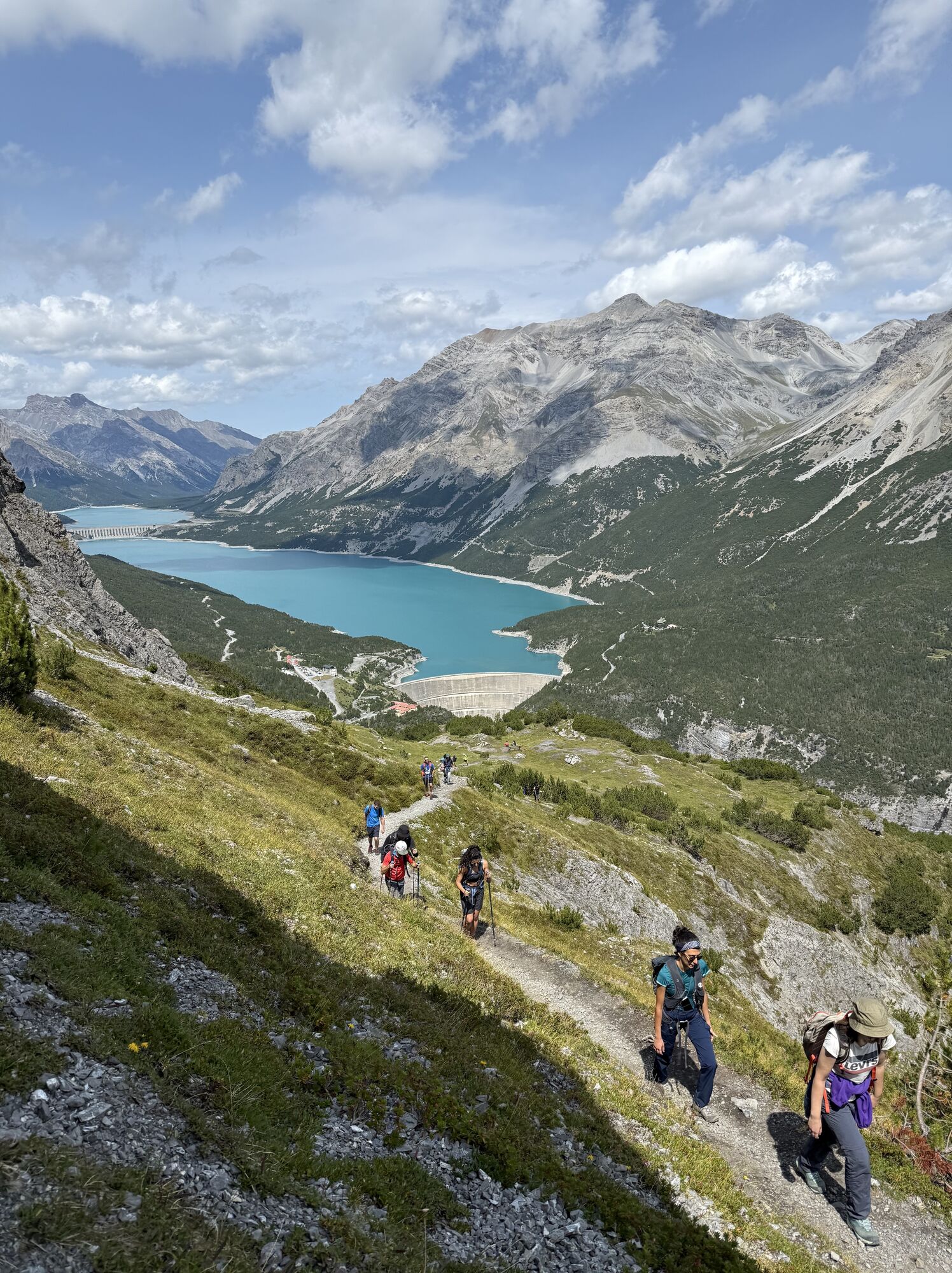
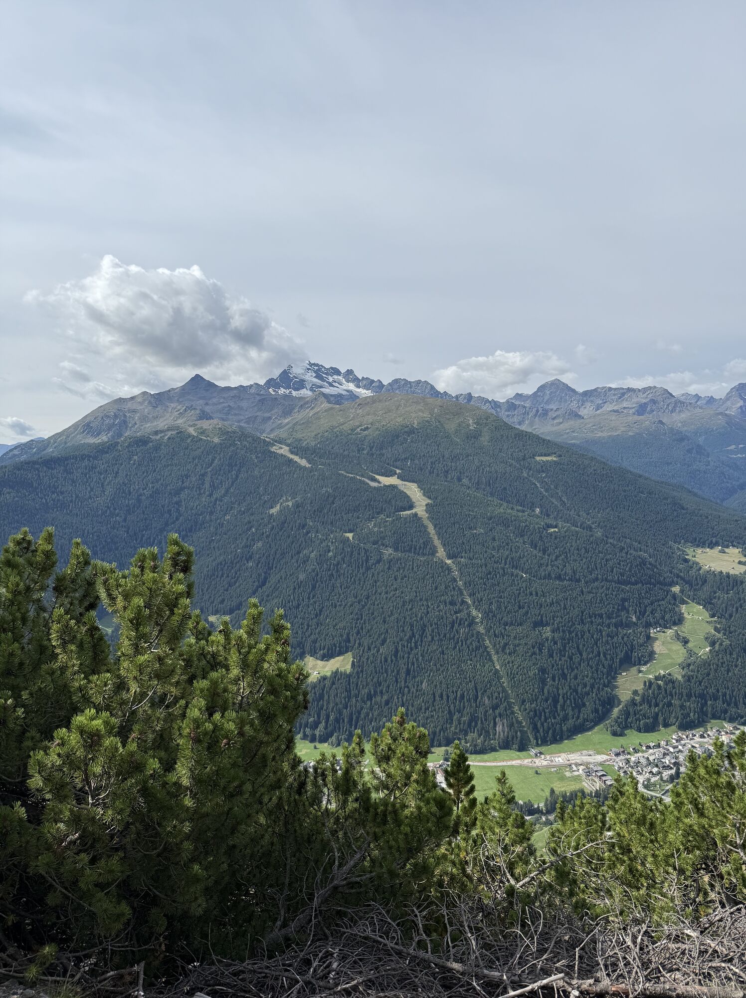
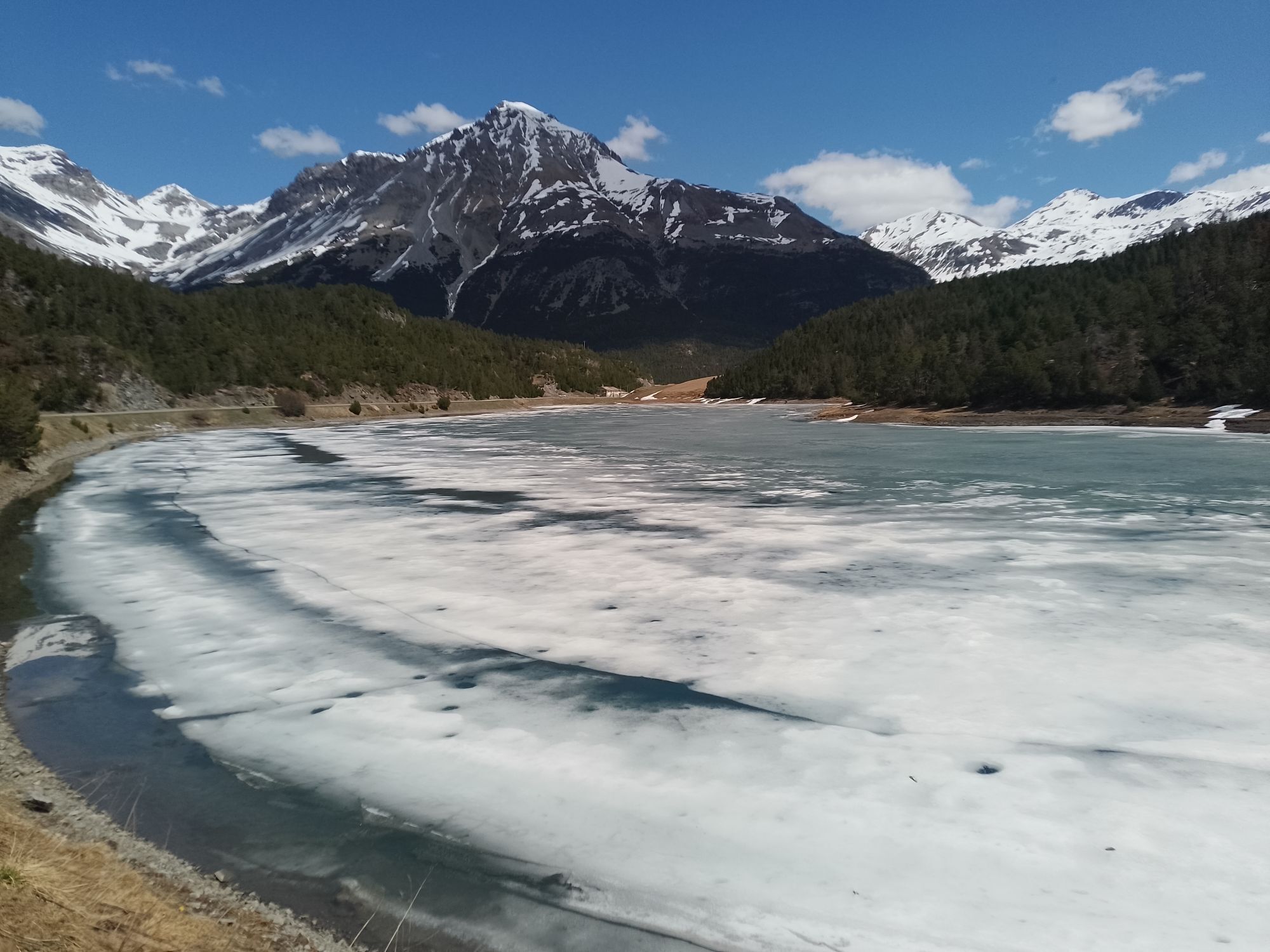
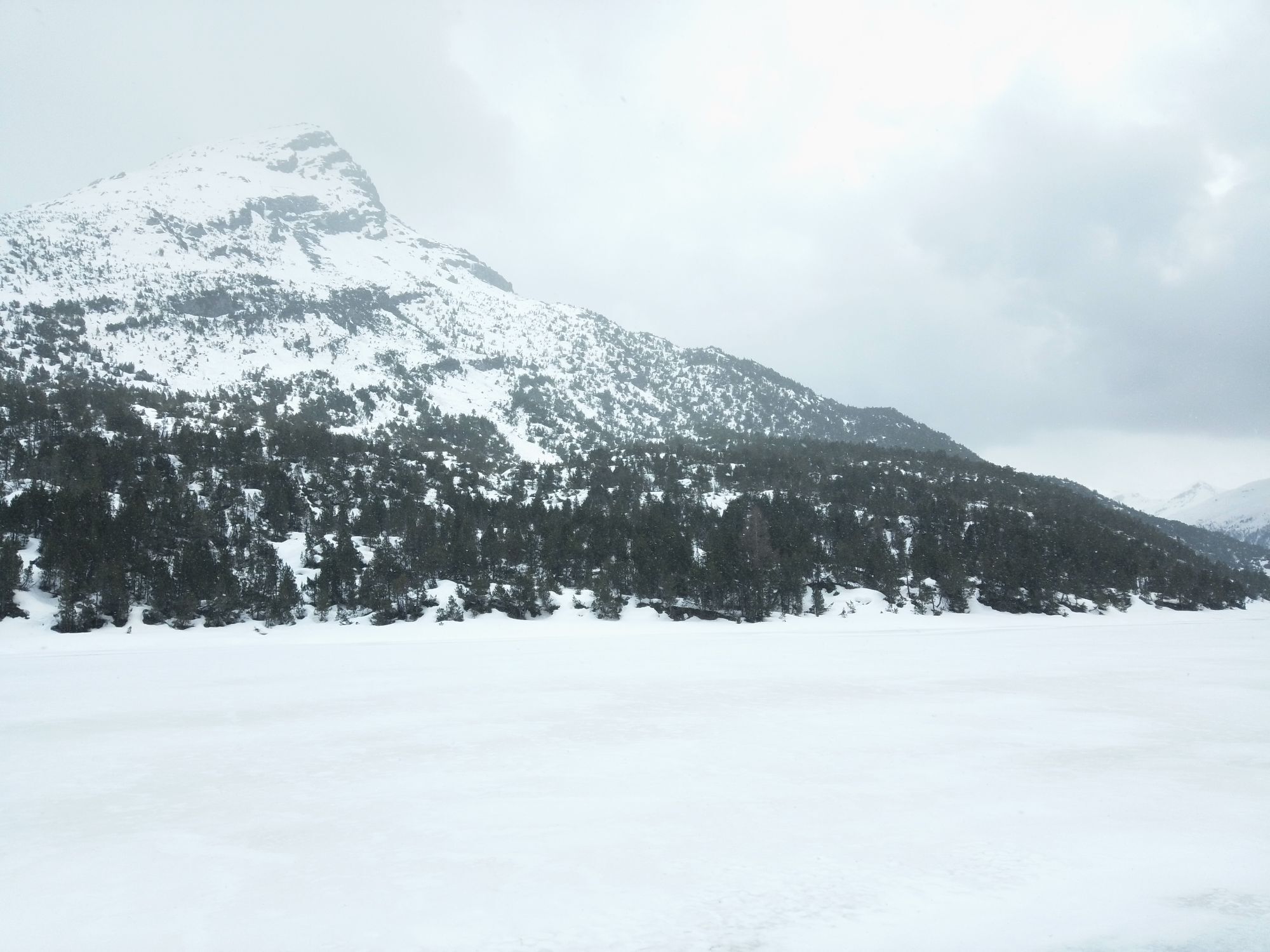
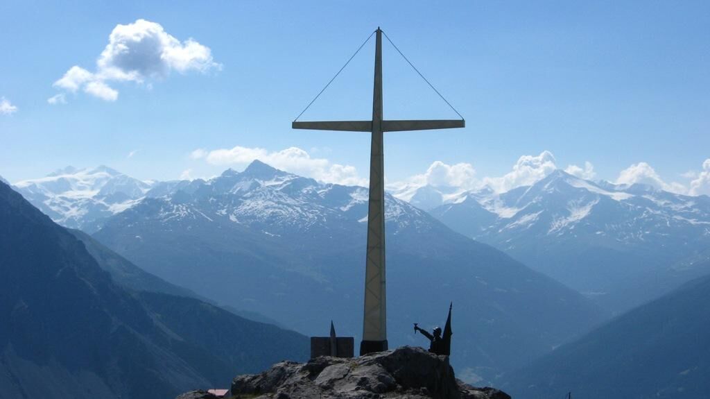
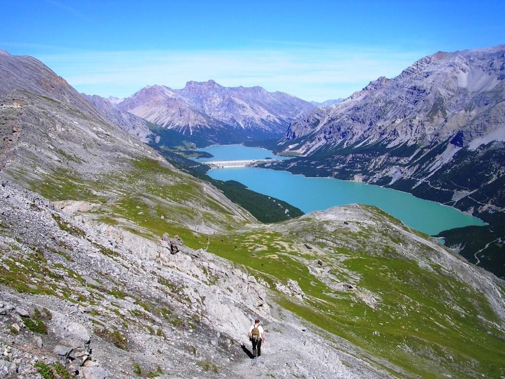
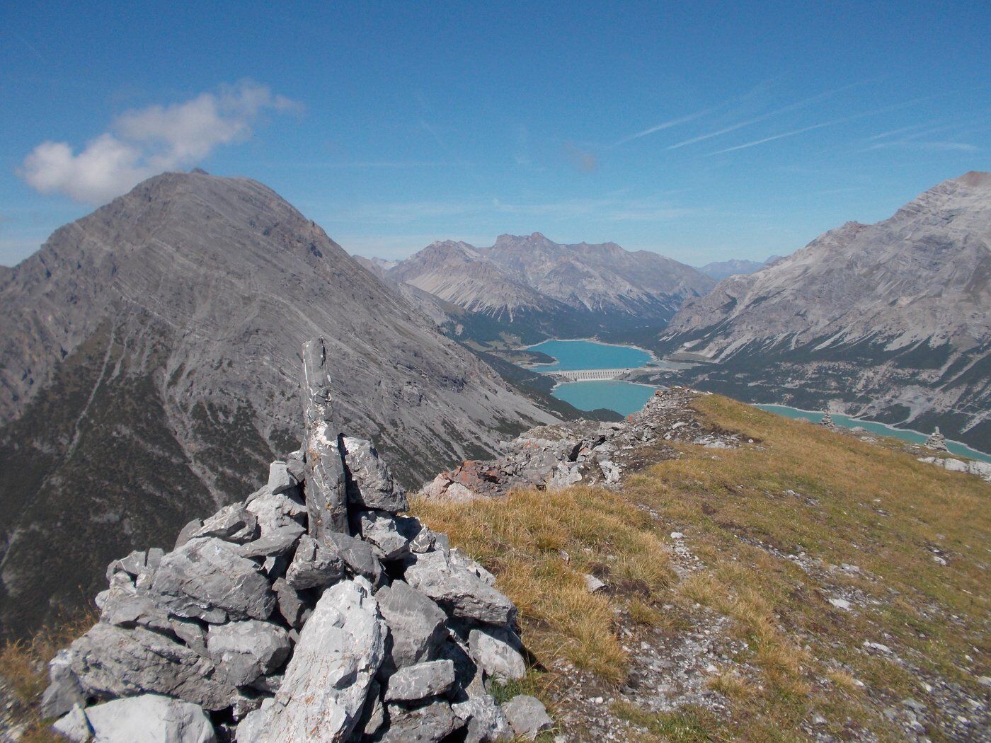
From the Fraele Towers, ascend the military mule track N197.1 through a dense Swiss pine forest until reaching a shoulder at the foot of a rock face. Follow a ledge horizontally then ascend among rocks, channels, and scree along the path. With a final hairpin turn you reach the clearing overlooking the Monte Scale Barracks. Inside the Barracks, a gallery with two hut-shaped powder magazines allows to cross the saddle and emerge on the opposite side of the mountain. Through a rather narrow path you reach the Monte Scale Cross which offers an excellent panoramic view of the entire Bormio area. The return follows the northern side of Monte Scale along path N197. Initially, the trail crosses sparse pastures then enters a very dense Swiss pine forest until reaching the Casina del Lago, now a private shelter for fishermen on the peaceful Lago delle Scale. Following the lakeshore along the paved road, you return to the starting point.


Follow the signs to the Fraele Towers. Here, park the car and continue on the military mule track N197.1
Áno
A good pair of hiking boots or trekking shoes is recommended.
There are no refreshment points along the route, so it is advised to have enough water and food supplies according to your needs.
Follow the signs for Fraele Towers and Cancano Lakes
Public transport to Cancano
Near the Fraele Towers, upon payment of the ticket at the Sasso Prada location.
T3
Route to be undertaken exclusively in the summer months.
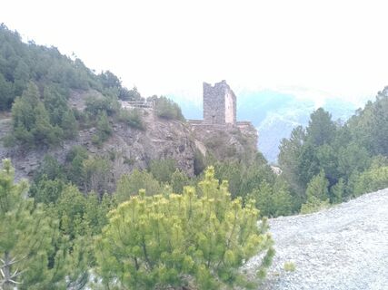
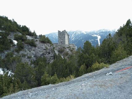
Monte Scale Barracks. Called during the Great War 'Monte Scale summit shelter', it was built in 1911-1912 to support the artillery positions of the Oga Fort. Already in 1914, before Italy entered the war, it was equipped and armed to serve as a strategic observation and defense point.


Obľúbené výlety v okolí
-
4,3
Sonnenaufgang auf der Rötelspitze im Nationalpark Stilfserjoch
Turistika 2,02 km -
3,4
Sta.Maria, Prà da Vau - Lai da Rims - Alp Sot - Prà da Vau
ťažkéTuristika 14,7 km -
3,3
Watervallen wandeling
svetloTuristika 4,95 km -
4,8
Wanderung: Heilige drei Brunnen zur Berglhütte
svetloTuristika 5,51 km -
5,0
Crap da la Pare' with Joëlette
svetloTuristika 4,58 km -
4,5
Stelvio Epic Rides: Passo dello Stelvio
ťažkéCestný bicykel 20,9 km -
5,0
TIP Panorama Road Tyrol ➤ Stelvio Pass
svetloMotorrad 40,8 km -
2,0
Military Historical Hiking Trail "Scorluzzo"
strednáTuristika 9,52 km -
4,0
Ortler Höhenweg
ťažkéVysoké turné 123,2 km -
5,0
Piz Umbrail und Abstieg zum Lai da Rims
ťažkéVysoké turné 15,0 km

Turistika a stopovanie


Nenechajte si ujsť ponuky a inšpiráciu na ďalšiu dovolenku
Vaša e-mailová adresa bol pridaný do poštového zoznamu.