Boucle de Pech de Turelure
ťažké
Navigácia na stránke
Navigácia na stránke
Získajte túto prehliadku v mobilnom telefóne
Boucle de Pech de Turelure
ťažké
Turistika
7,09
km
Naskenujte kód QR a spustite navigáciu v aplikácii bergfex

Turistika a stopovanie


Boucle de Pech de Turelure
ťažké
Vzdialenosť
7,09
km
Trvanie
02:08
h
Ascent
205
hm
Hladina mora
83 -
292
m
Stiahnutie skladby
Boucle de Pech de Turelure
ťažké
Turistika
7,09
km


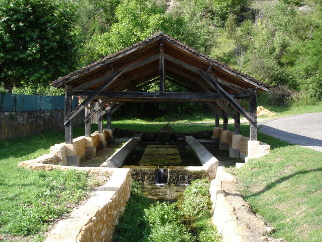
During this walk, you will discover the typical vegetation of the causses of the Périgord Noir, while passing by some beautiful points of view on the Valley of the Dordogne.
The topoguide containing the...
Opis
During this walk, you will discover the typical vegetation of the causses of the Périgord Noir, while passing by some beautiful points of view on the Valley of the Dordogne.
The topoguide containing the route of this hike is available for purchase in our tourist offices in Carlux and Salignac.
Trasa
Peyrillac-et-Millac
(93 m)
Dedina
0,2 km
Église Sainte-Anne
(96 m)
Miesto uctievania
0,2 km
Chapelle Saint-Barthélemy
(268 m)
Miesto uctievania
3,3 km
Peyrillac-et-Millac
(93 m)
Dedina
6,9 km
Trasa
Boucle de Pech de Turelure
ťažké
Turistika
7,09
km
Peyrillac-et-Millac
(93 m)
Dedina
0,2 km
Église Sainte-Anne
(96 m)
Miesto uctievania
0,2 km
Chapelle Saint-Barthélemy
(268 m)
Miesto uctievania
3,3 km
Peyrillac-et-Millac
(93 m)
Dedina
6,9 km
Autor
Poskytuje Office de Tourisme Sarlat Périgord Noir
Prehliadku Boucle de Pech de Turelure zabezpečuje outdooractive.com.

Informácie o trase
Vhodné pre invalidné vozíky
Áno
Ďalšie informácie a tipy
Ďalšie informácie
Dordogne-Périgord le Département
Tipy
Yellow
Zatiaľ žiadne recenzie
Obľúbené výlety v okolí
-
Randonnée
strednáTuristika 11,2 km -
Boucle de Montfort
svetloTuristika 7,85 km -
Chemin des meuniers - L'Inval
svetloTuristika 7,65 km -
Boucle du Paluel
strednáTuristika 10,3 km -
Carlux en écomobilité - Plein les yeux à la gare Doisneau
svetloCyklistika 16,8 km -
Groléjac en écomobilité - Une halte fraicheur et nature sur la voie verte
svetloCyklistika 12,3 km -
Autour des produits laitiers à Sainte Nathalène
strednáTuristika 17,7 km -
Boucle de Carsac
svetloTuristika 11,7 km -
5,0
Jardins et villages du Sarladais
ťažkéCyklistika 53,1 km -
Chemin d'Amadour : étape 20 De Saint Julien de Lampon à Souillac
strednáTuristika 16,8 km
Turistika a stopovanie

Viac ako 550.000 návrhov výletov, podrobné mapy a intuitívny plánovač trás robia z aplikácie povinnú výbavu pre všetkých nadšencov prírody.

Nenechajte si ujsť ponuky a inšpiráciu na ďalšiu dovolenku
Prihlásiť sa k odberu noviniek
Chyba
Vyskytla sa chyba. Prosím, skúste to znova.
Ďakujeme za vašu registráciu
Vaša e-mailová adresa bol pridaný do poštového zoznamu.
Zájazdy po celej Európe
Rakúsko
Švajčiarsko
Nemecko
Taliansko
Slovinsko
Francúzsko
Holandsko
Belgicko
Poľsko
Lichtenštajnsko
Česko
Slovensko
španielsko
Hrvaška
Bosna a Hercegovina
Luxembursko
Andorra
Portugalsko
Island
Spojené kráľovstvo
Írsko
Grécko
Albánsko
Severné Macedónsko
Malta
Nórsko
Čierna Hora
Moldavsko
Kosovo
Maďarsko
San Maríno
Rumunsko
Estónsko
Lotyšsko
Bielorusko
Cyprus
Litva
Srbsko
Bulharsko
Monako
Dánsko
Švédsko
Fínsko