


Via Geoalpina | Stage 4 Alpe Pian di Boit - Alpe Scaredi


From the Pian di Boit bivouac, go up a steep track in the direction of Bocchetta di Terza, along the VBAP12 path, in the beech wood up to Alpe Terza (1428 m), then through wild pastures, colonised by broom,...
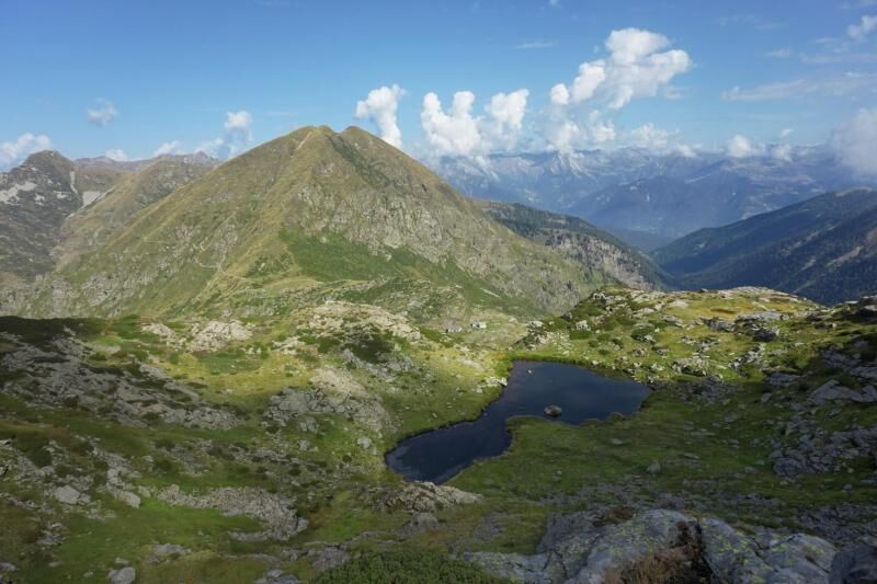
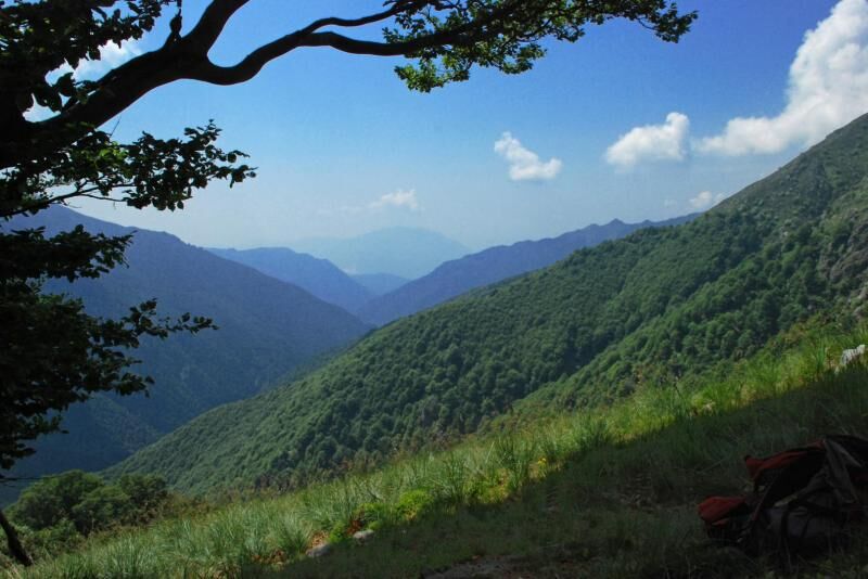
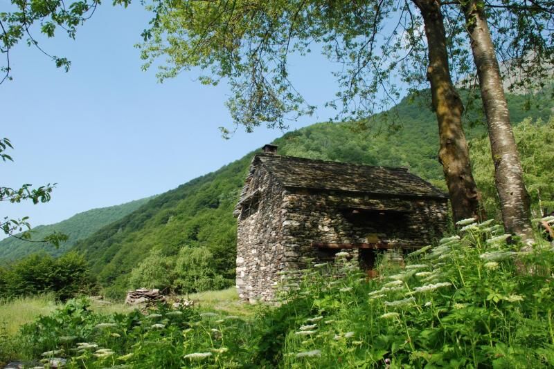
From the Pian di Boit bivouac, go up a steep track in the direction of Bocchetta di Terza, along the VBAP12 path, in the beech wood up to Alpe Terza (1428 m), then through wild pastures, colonised by broom, alder and rhododendron. When you reach Bocchetta di Terza (1836 m), descend into Valle Cannobina along the VBAS27 path, which, with a clearly visible track, reaches Alpe Val Viccio (1440 m), at the upper edge of the beech wood and, crossing it, intersects the VBAS99 path. At the crossroads, take the VBAS99 path on the left, which climbs towards Alpe Cortechiuso. Walk along the upper Cannobina valley passing Alpe Uovo (1308 m) and Alpe Zucchero (1407 m), cross the Cannobino stream at an altitude of about 1460 m and continue uphill along a visible path along the northeast ridge of Cimone di Cortechiuso, up to the homonymous mountain pasture at an altitude of 1883 m. One of the rural buildings of Alpe Cortechiuso is used as a bivouac. The structure, unattended and always open, provides about 8 beds, living space and fountain in the appurtenant area. For information please refer to the Town Hall of Malesco, the owner at no. 0324/92261. From Alpe Cortechiuso, the stage of the itinerary continues along the VBAS29 path, going up to the Bocchetta di Cortechiuso at about 2066 metres altitude. Leaving Valle Cannobina, continue in the upper Valle Loana along the VBAM14 path, which, with a long and not always well marked traverse, reaches Alpe Scaredi and the homonymous bivouac of the Park, which concludes the stage of the itinerary. The bivouac, unattended and always open, offers space for about 10 beds on planking in the attic, is heated with a stove and has a fountain in the appurtenant area. Additional beds on planking are available in the attic of the large barn nearby. For information please refer to the Park Authority at no. 0324/87540.

Áno
Obľúbené výlety v okolí
-
3,5
Cannobio zu Sant’Aagata
svetloTuristika 5,85 km -
4,0
Cicogna, Strada Sutermeister, Alpe Pogallo, Alpe Pra, Cicogna
strednáTuristika 9,83 km -
5,0
Himmel
strednáTuristika 12,7 km -
Monte Faiè
strednáTuristika 6,37 km -
4,3
Pian Cavallone
svetloTuristika 7,55 km -
Alpe Faievo - Monte Tignolino - Alpe Faievo
strednáTuristika 15,6 km -
Val Pale - Pizzo Pernice, Piemonte/Italia
strednáTuristika 6,14 km -
4,0
Mt Mater
ťažkéTuristika 6,98 km -
Montofano - Mergozzo, Piemonte/Italia
strednáTuristika 8,61 km -
Camedo-Bordei-Terra Vecchia-Rasa
strednáTuristika 10,9 km
Turistika a stopovanie


Nenechajte si ujsť ponuky a inšpiráciu na ďalšiu dovolenku
Vaša e-mailová adresa bol pridaný do poštového zoznamu.