


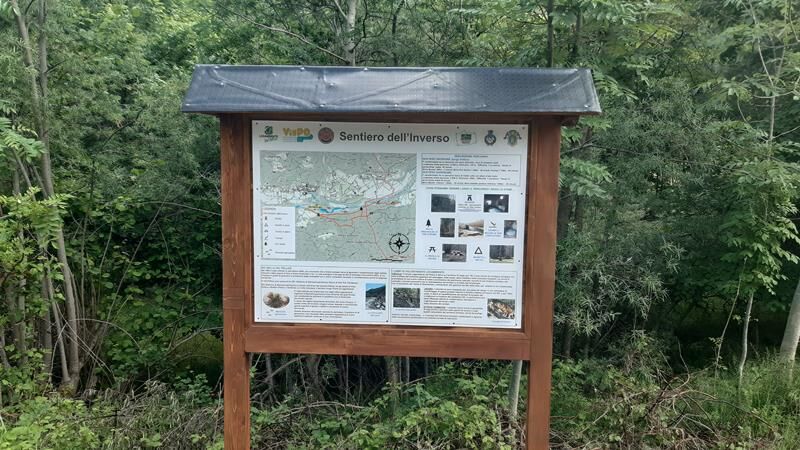
VILLAR PELLICE Inverso path


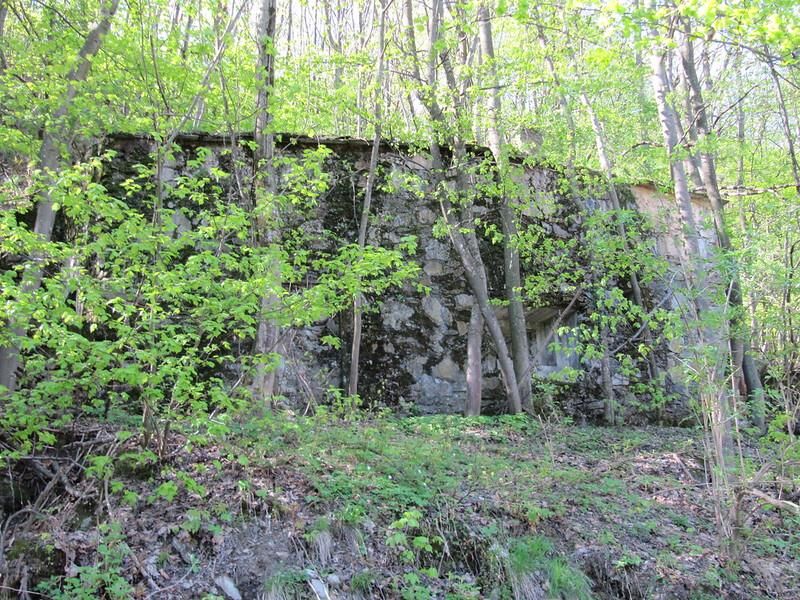
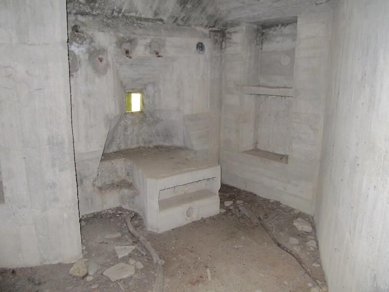
Leaving the Cros pond of Villar Pellice, follow the forest road "della Fusinassa" following the signs for the "Shepherds' Way". Upon reaching a World War II bunker (Opera 204 – rear barrier Villar Pellice),...
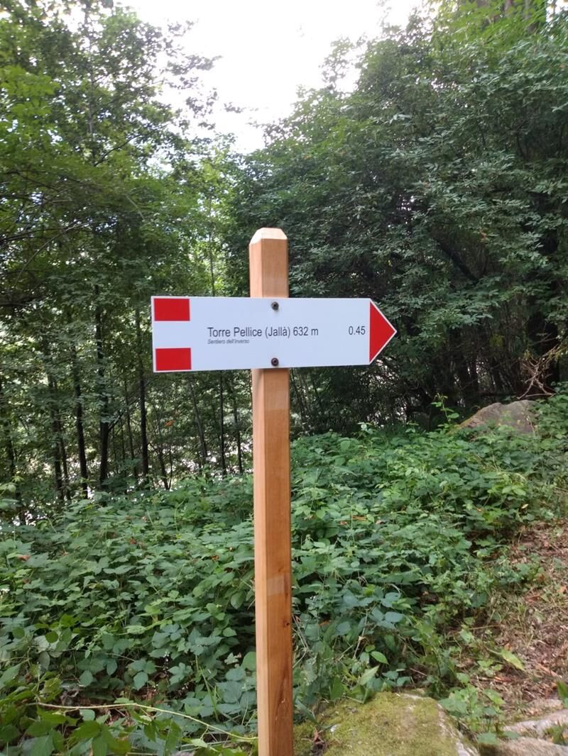
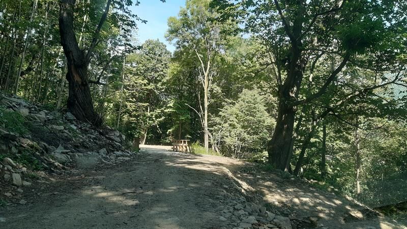
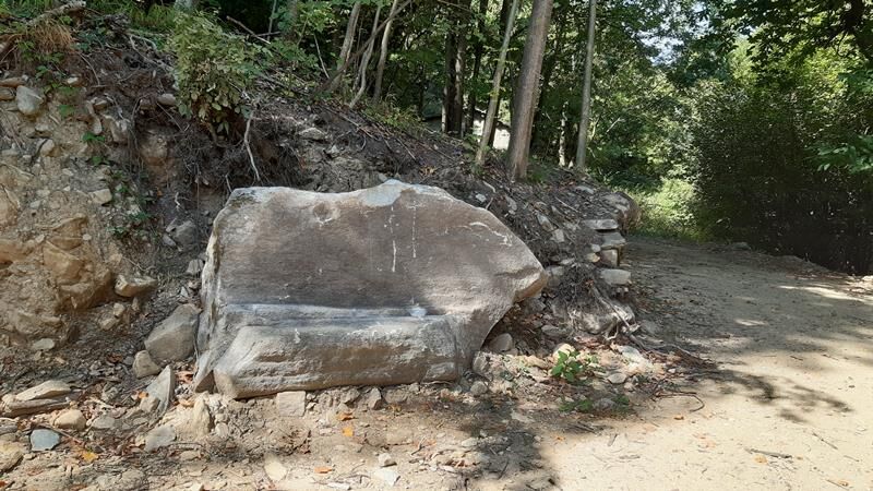
Leaving the Cros pond of Villar Pellice, follow the forest road "della Fusinassa" following the signs for the "Shepherds' Way". Upon reaching a World War II bunker (Opera 204 – rear barrier Villar Pellice), continue right on the track crossing a stream and then proceed up to the Inverso Rolandi of Torre Pellice, at the "stone table" height.
Shortly before, there is a junction of a path descending to the “lower path”, where there is an abandoned stand of strobus pines. Continue along the Pellice until the ancient mill and the "tumpi" of San Cristoforo, then climb slightly to reach the Jallà hamlet, where you find some peculiar dry stone walls, called “Nuraghe” of Val Pellice.
The return is made along the “lower path”, which runs along the Pellice stream and the S.I.C. "Myricaria Germanica Station". Then continue until rejoining the "Shepherds' Way", more or less at the bunker height.

Áno
Adequate clothing and equipment are recommended.
Arriving at Villar Pellice is easy, following the A55 towards Pinerolo, if coming from Turin. Near Pinerolo, follow the signs for Val Pellice and then for Villar Pellice.
By bus
www.cavourese.it
At the Cros pond there are numerous free parking spaces
Before undertaking any hike, it is advisable to check the weather reports or ask for information at local Tourist Offices.
It is good practice not to embark on a hike alone, always inform someone of your destination.
Do not throw waste into the environment but carry it with you, possibly collecting those left by others.
The indicated travel times are approximate and may vary depending on weather conditions and personal abilities.
The path was restored by volunteers from Legambiente Val Pellice in the years 2020-2021.
The S.I.C. (Site of Community Interest) "Myricaria Germanica Station" was established to preserve one of the last regional populations of a rare tamarisk of riverbeds, with pioneering characteristics, balanced with natural flood dynamics.
Obľúbené výlety v okolí
-
5,0
BOBBIO PELLICE Upslowtour - Ring 2 of the refuges
ťažkéCyklistika 37,6 km -
PRALI Rocca Bianca Loop
ťažkéMountainbike 17,9 km -
TORRE PELLICE Hike to Bars d'la tajola (and Monte Castlus)
strednáTuristika 4,40 km -
PRAROSTINO From Piani to Sonagliette and back - SLOWLY TOGETHER
svetloTuristika 6,60 km -
PERRERO The Lakes of Conca Cialancia
ťažkéMountainbike 21,6 km -
LUSERNA S.G. Upslowtour - Luserna Stone Loop 9
strednáCyklistika 38,1 km -
PRALI Thirteen Lakes - Colle Giulian - Villanova
strednáMountainbike 19,0 km -
BOBBIO PELLICE Trail of the Invincibles
strednáTuristika 19,1 km -
PRAROSTINO Faro della Libertà Walk
svetloTuristika 3,60 km -
BRICHERASIO Upslowtour - Loop 13 of the Ridges
strednáCyklistika 38,2 km
Turistika a stopovanie


Nenechajte si ujsť ponuky a inšpiráciu na ďalšiu dovolenku
Vaša e-mailová adresa bol pridaný do poštového zoznamu.