


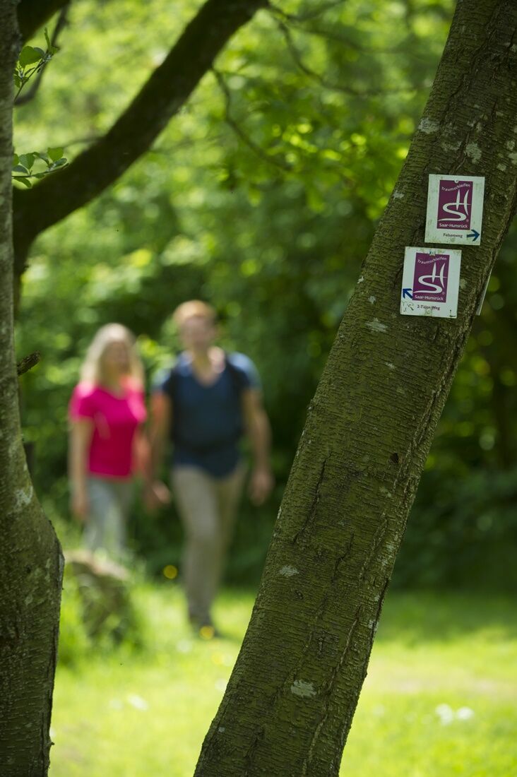
Dream Loop Wilderness Trail Weiskirchen
Úroveň náročnosti: T1


Passing the natural monuments "Iltisfels" and "Hoher Fels," the path steadily climbs. Sometimes steep, sometimes less so, you hike on narrow forest paths towards Schimmelkopf. Below Schimmelkopf, with...
Passing the natural monuments "Iltisfels" and "Hoher Fels," the path steadily climbs. Sometimes steep, sometimes less so, you hike on narrow forest paths towards Schimmelkopf. Below Schimmelkopf, with 694 meters one of the highest elevations in Saarland, the trail winds through the forest. Solitude and silence prevail in this seemingly endless forest area.
Via a path you enter the Wahnbachtal nature reserve. The narrow gorge of the low mountain stream is also called the "soul protection area Wahnbachtal." You leave the valley via a steep path upwards along the so-called Behlengraben.
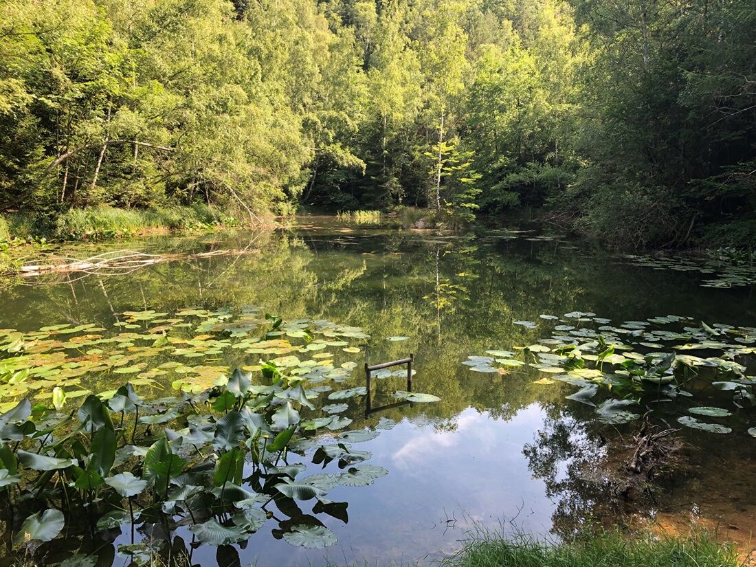
Past old quarries, the trail reaches the Schlittentaler stream. For a considerable time, it means hiking uphill again. The dreamlike scenery at Herberloch awaits. In the hollow of a former quarry, recognizable by its ocher-colored rock, lies a small, almost mirror-smooth lake with a fairy-tale atmosphere.
Along another forest stream and over several bridges, we initially descend from Herberloch before the dream loop leads back to Weiskirchen via further forest paths.
The path was rated with 60 experience points by the German Hiking Institute.


The first 2.5 kilometers lead through the wild romantic Holzbachtal. The path always runs close to the brook and changes sides twice. Along the way, you encounter 2 impressive rock formations. After the last brook crossing, there is a short path section on a forest road. Turn right uphill on a steep, partly rocky and root-covered path along the state border to Rhineland-Palatinate.
After about 3.5 km, turn right again. The incline becomes somewhat gentler, and the path mostly runs on trails, through ever-changing forest formations along the slope of the "Schimmelkopf."
After about 6.5 km, the path turns sharply right downhill into a small hollow way. This leads further along a trail through a bright beech forest section. After a bend, the path widens and leads to a large trail junction. The wider forest road leads directly downhill along a nature reserve into the Wahnbachtal.
Turn left, and the path runs over root-strewn natural paths and along the fern and montane mixed forest-covered brook bank downhill towards Weiskirchen. At the lower valley section, the brook is crossed on a bridge.
The path continues straight uphill, parallel to a small ravine (gorge). At the end of the ravine, the profile flattens again somewhat, but the path continues slightly uphill to the next larger junction.
Continue straight at the same altitude through a coniferous forest section and then sharply left downhill past an old quarry to a small brook. Here, following the brook to the right, it goes slightly uphill.
After a short section on a forest road, turn left again into a beautiful trail section through the forest uphill (a small steeper section follows), which leads directly to the "Herberloch." A small idyllic pond in an old quarry.
Again, follow the trail along the Schlittentaler brook. After that, the path leads over wider trails and paths downhill back to Weiskirchen and the starting point of the route.
Report trail condition
We appreciate feedback on the trail condition.
To do this, click on the compass symbol at the top left in the app’s map view.
Simply send your current location coordinates with the "Share" button to wegezustand@tz-s.de
Photos and description texts are also gladly accepted.
Thank you for your support!
Attention:
Entering the forest and hiking the trails is fundamentally at your own risk!
Due to seasonal or weather conditions, increased surefootedness is required on certain trail sections. Please wear clothing and hiking shoes with appropriate tread adapted to the season and weather. Caution is required due to breaking branches and damaged trees. With stronger wind and in winter due to snow and ice, the dangers of falling trees and falling branches increase.
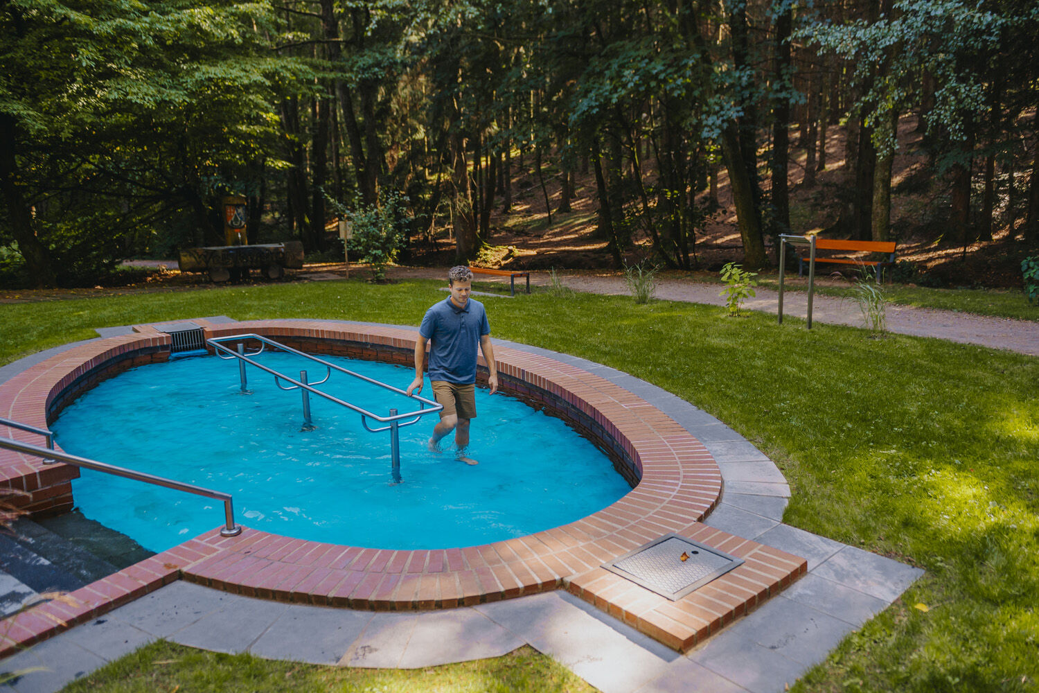
You can reach Weiskirchen from the A8 motorway from Merzig via Losheim. Via the A1 motorway exit Primstal towards Wadern. In the town center of Weiskirchen, follow the signs towards the spa center. On the way there, you will reach the outdoor swimming pool, the starting point of this route.
By bus R1, 470, 204, 211, 216, 470 to Weiskirchen church, about 20 minutes on foot.
Parking lot at the Weiskirchen outdoor swimming pool
T1
Website of the municipality of Weiskirchen - www.weiskirchen.de
Tourism Center Saarland
Tel.: 0681 - 9 27 20 - 0
Gastronomy is available in the town center of Weiskirchen, 2 km from the starting point.
Do you like this route? Then help us maintain the trail with your hiking cent!
Send an SMS with "TRAUM" to 81190 to donate €2 - Thank you very much!
Obľúbené výlety v okolí
-
5,0
Dream loop rock path
ťažkéTuristika 13,7 km -
4,0
Traumschleife Almglück
strednáTuristika 6,46 km -
Stausee Tafeltour
strednáTuristika 10,1 km -
5,0
Dream Loop Two-Valleys-Path
ťažkéTuristika 12,2 km -
5,0
Dream Loop Way of Water
ťažkéTuristika 12,9 km -
4,0
`Himmels Gääs Paad´
strednáTuristika 7 km -
5,0
Traumschleife Oppig-Grät Route
ťažkéTuristika 13,2 km -
Hochwald-Pfad Dream Loop
ťažkéTuristika 12,1 km -
4,0
Dream loop Erzgräberweg
strednáTuristika 11,6 km -
4,7
Dream Loop The Bergener
strednáTuristika 11,1 km
Turistika a stopovanie


Nenechajte si ujsť ponuky a inšpiráciu na ďalšiu dovolenku
Vaša e-mailová adresa bol pridaný do poštového zoznamu.