


Dream loop Erzgräberweg
Úroveň náročnosti: T1


The water power of the Prims, the enormous timber stocks, and the ore deposits caused iron smelters to be established from 1700 onwards from Schmelz upwards throughout the entire Primstal.
On the ascent...
The water power of the Prims, the enormous timber stocks, and the ore deposits caused iron smelters to be established from 1700 onwards from Schmelz upwards throughout the entire Primstal.
On the ascent along the Solbach, former ore pits are passed. On both sides of the forest path, remains of former surface excavations called the "Lebach Eggs" can be seen. After the ascent, you reach the natural monument "Thick Oak", whose sapling is said to date back to the time of the Thirty Years' War. An information board on the "Robber Knight's Path" recalls the former "Birg" of the robber knight "Birg-Peter."
The former Celtic refuge castle was built roughly 100 years BC. The two-hectare mountain plateau of the "Birg" drops steeply on three sides. The fortification was used both in Celtic times, late Roman times, and the Middle Ages. From the "Birg" it goes downhill to the Hoxfels. From the rocky ledge, there is a wonderful view into the Primstal.
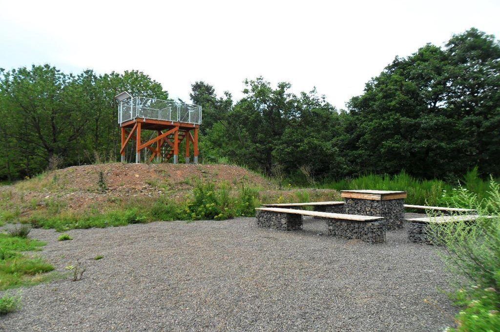
Another dream view at the "Großer Horst." On safe terrain stands a small observation tower, from which you have a great view into the quarry and a panoramic view far over the Primstal.
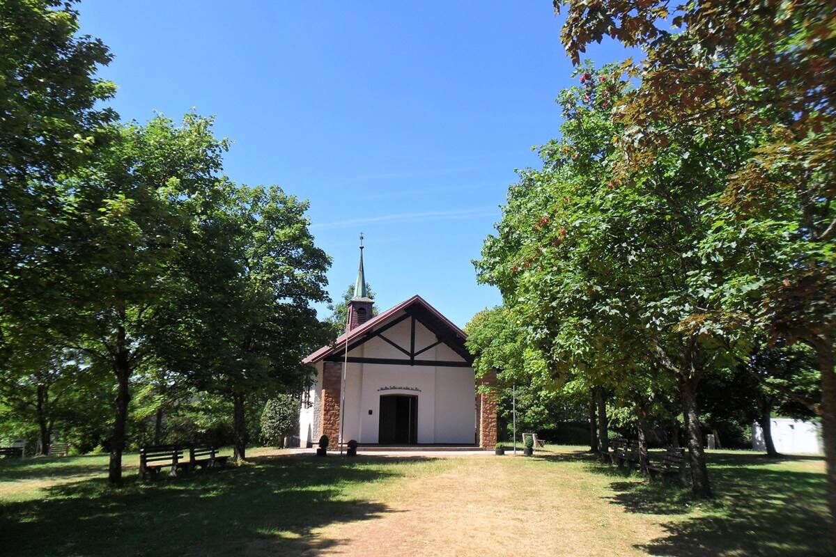
The way back goes past the Marian Chapel on the Rengeskopf high above Schmelz.
The trail was rated with 62 experience points by the German Hiking Institute.


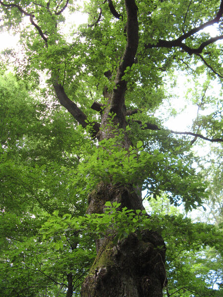
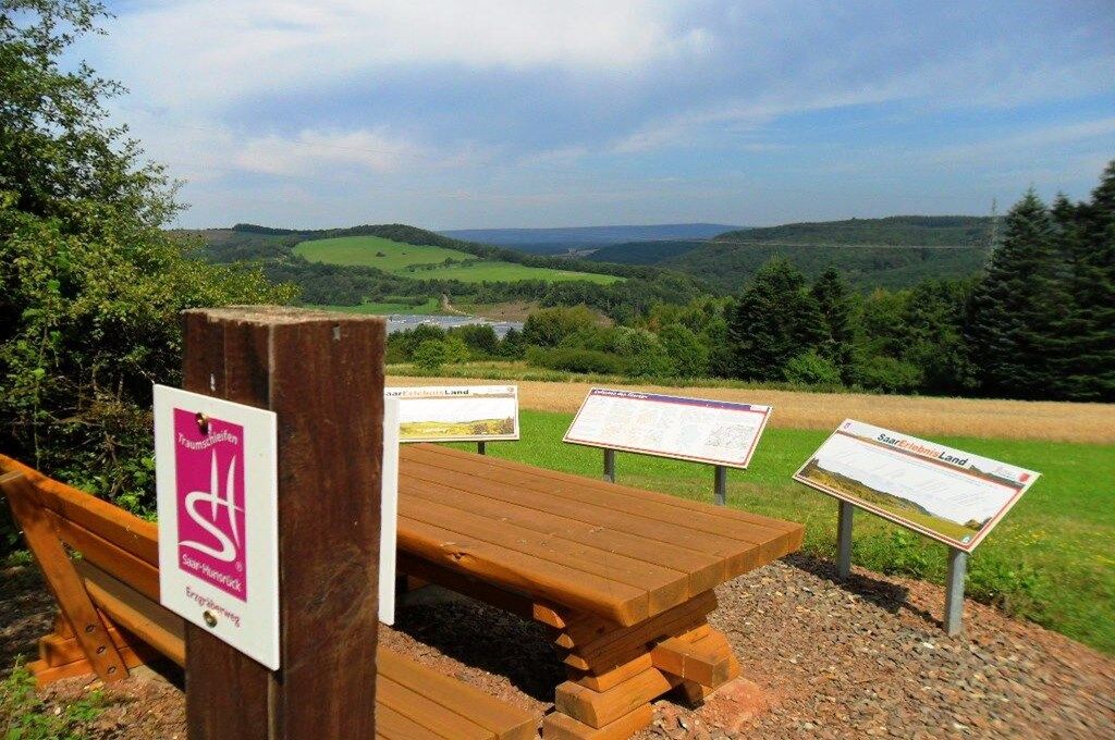

The starting point is the hiking car park "Dreihausen" at the end of Ambetstraße, corner Goldbacher Street. We follow Goldbacher Street about 300 m and turn left into Sollbachstraße. The path runs along the Sollbach and then left up a steep ascent to the old ore pits. Once at the top, it goes right on a forest path to the "Thick Oak," a tree giant more than 380 years old. Shortly after passing the natural monument, you reach charcoal pile sites and a charcoal kiln, testifying to the work of the charcoal burner families who lived and worked in the forest "Großer Horst." You meet a broad forest path again and continue hiking to the "Bildstöckchen." Here the forest opens, and we have a beautiful view.
Past a parking lot and a pond, you enter the forest again. On the hillside path at the edge of the Großer Horst, the trail continues to the Birg. In between, the path again offers wonderful views. Along the edge of the "Großer Horst," the path leads on a trail with great views of Limbach to the "Birg," a fortification founded in pre-Roman times and repeatedly rebuilt until the 7th or 8th century AD, serving to protect the population in times of unrest.
We leave the Birg and continue to the Hoxfels, a rock cliff made of latite andesite (age 280 – 290 million years), which opens a grand view of the narrow Primstal and the opposite volcanic origin high plateaus. The path now goes downhill on a forest path. At the Rengertskopf, turn right to the chapel. On a steeper descent, a cross path, the trail leads back to Goldbacher Street and back to the parking lot and the starting point of the route.
Áno
Report trail conditions
We appreciate feedback on trail conditions.
Click on the compass symbol at the top left in the map view of the app.
Simply send your current location coordinates with the "Share" button to wegezustand@tz-s.de
Photos and descriptions are also welcome.
Thank you for your support!
Attention:
Entering the forest and hiking the trails is fundamentally at your own risk!
Seasonal or weather-related increased surefootedness is required on some trail sections. Therefore, wear clothing and hiking boots adapted to the season and weather with appropriate soles. Be cautious of breaking branches and damaged trees. In strong winds and in winter due to snow and ice, the dangers from falling trees and dropping crown parts increase.
Schmelz can be reached via the motorways A1 (exit Hasborn) and A8 (exit Dillingen-Mitte). From Hasborn, drive via L145 through the Bohnental to Schattertriesch. There turn left onto the L 268, on which you reach Schmelz after 2 km.
From Dillingen, orient yourself in the city center towards Lebach (L269). In Körprich, keep left towards Schmelz.
In the town center, head towards Lebach; after crossing the railway line, leave the main street and turn left into Ambetstraße. About 1 km later, the starting point of the route is reached at the Goldbacher Straße, which branches off to the right.
By train to the Lebach-Jabach stop
By bus R3 to Schmelz Bridge, 10 min walk via Ambetstr.
By bus R5 (from Dillingen station) to Lebach Seminarweg or Knorscheid Zollstock.
Hiking car park "Dreihausen" corner Ambet-/Goldbacher Street
T1
Dining options
Gasthaus Erlenhof
Goldbacher Street 101
66839 Schmelz
Tel.: +49 (0)6887 / 4272
Schmelzer Brauhaus
Am Erzweg 12
66839 Schmelz
Tel.: +49 (0)6887 / 88 91 09
Official website of the municipality of Schmelz - www.schmelz.de
Tourism Central Saarland
Tel.: 0681 - 9 27 20 - 0
Do you like this route? Then help us with your Wandercent to maintain the trail!
Send an SMS with "TRAUM" to 81190 to donate 2 € - Thank you very much!
Obľúbené výlety v okolí
-
4,9
Dream loop Litermont summit route
svetloTuristika 8,79 km -
5,0
Dream loop rock path
ťažkéTuristika 13,7 km -
5,0
Dream Loop Wilderness Trail Weiskirchen
ťažkéTuristika 17,1 km -
Stausee Tafeltour
strednáTuristika 10,1 km -
5,0
Trail loop The Bietzerberger
ťažkéTuristika 18,5 km -
5,0
Dream Loop Two-Valleys-Path
ťažkéTuristika 12,2 km -
5,0
Dream Loop Way of Water
ťažkéTuristika 12,9 km -
5,0
Dream trail Beckinger Saarblicke
ťažkéTuristika 14,4 km -
5,0
Litermont Mythical Path
ťažkéTuristika 18,8 km -
4,0
`Himmels Gääs Paad´
strednáTuristika 7 km
Turistika a stopovanie


Nenechajte si ujsť ponuky a inšpiráciu na ďalšiu dovolenku
Vaša e-mailová adresa bol pridaný do poštového zoznamu.