


Dream Loop Wehinger Viezpfad
Úroveň náročnosti: T1


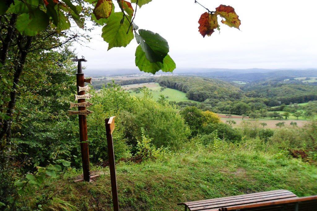
Directly behind Wehingen, the path rises over meadows with old orchard trees on the slopes of the Kewelsberg. From a sensory bench, views open to the Merzig basin and the high ridges of the Schwarzwälder...
Directly behind Wehingen, the path rises over meadows with old orchard trees on the slopes of the Kewelsberg. From a sensory bench, views open to the Merzig basin and the high ridges of the Schwarzwälder Hochwald.
The later descent leads through a sea of limestones in all size variations. Every single stone and rock is wrapped in a thick carpet of moss. Hedges, bushes, and trees are also covered with moss. The path winds in countless bends and loops, sometimes uphill, sometimes downhill, through the primeval forest along the slope.
Below the Wehingen cemetery stands the Semmer hut with outdoor seating.
Later, the path leads through a large forest area. The valley of the Bonnersbach is also hiked as well as a burned pond in the middle of the forest and the viewpoint "Rehchenskopf".
Across field, meadow, and forest sections and some uphill passages, the path returns to Wehingen.
The path was awarded 78 points by the German Hiking Institute.


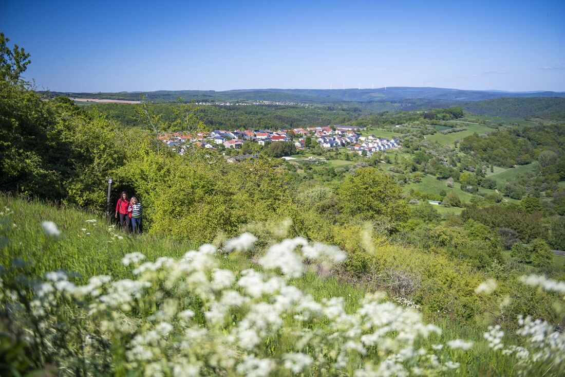
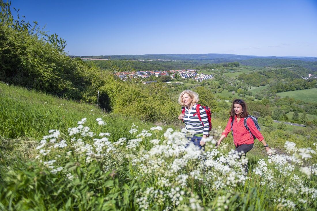
From the parking lot of the community center, head towards the L 170. The country road is crossed, and after a few meters on an asphalted path, the route turns left past pasture areas towards "Pellinger Berg." After a small curve, you cross a field path and pass through a forest area on narrow trails. It goes towards "Kewelsberg," and densely vegetated sections open up repeatedly until you reach a resting place with a beautiful view.
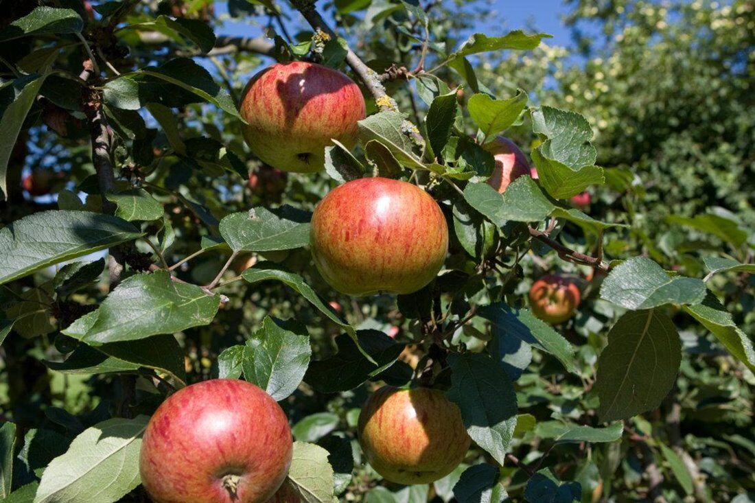
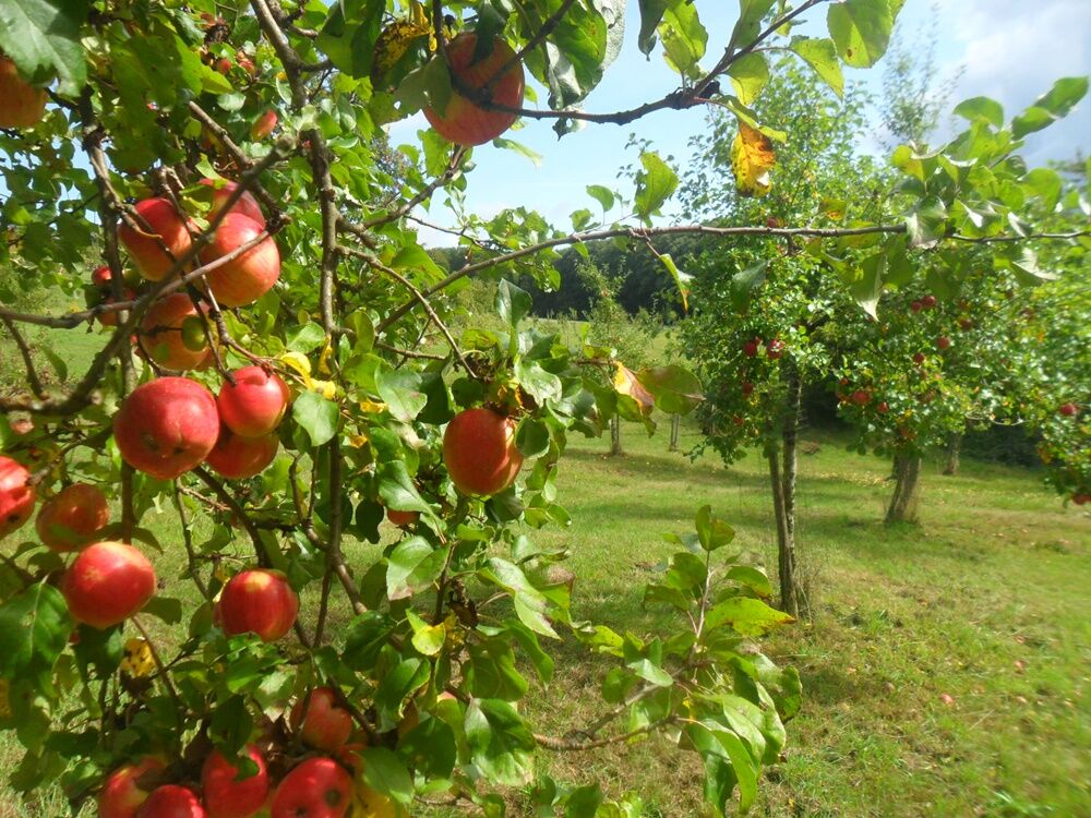
From here it goes downhill, and after crossing the L 170 again, the route leads past orchards to the "Semmer Hut."
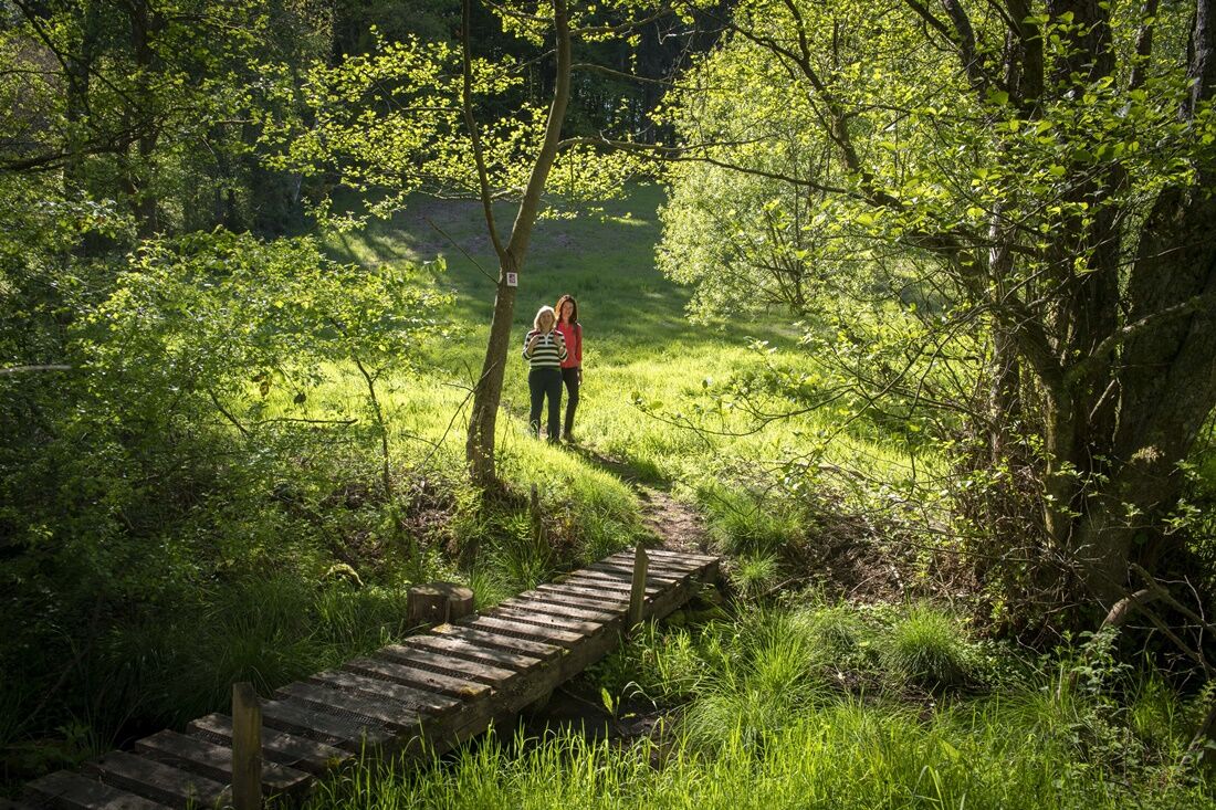
After the rest, the path ascends over meadows and field paths again past orchards and down into the Buchwald. Shortly after turning into the forest, it goes right downhill into the Fröhnbach valley. The path along the brook gradually becomes more of a trail. At the pond, it continues left uphill. On the height, the forest opens up and leads down to a wider forest path.
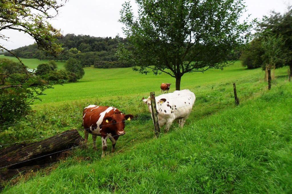
On the forest path along the Tünsdorfer Creek, it goes on past pasture areas for cows and horses. Always along the forest edge, it goes towards Blechmühle. The path now turns sharply right into a narrow steep path also called "Grät." At the top, the path still runs through a forest for a while before a play of open and forest areas alternates. On the last part up to the "Eichwald," beautiful views open again. Pasture areas and orchards alternate.
On the last section, it briefly goes through a forest again. Shortly before the riding stable, it goes past apple trees on paths, and Kapellenstraße leads back to the starting point of the route.
Report trail condition
We appreciate feedback on the trail condition.
To do this, click on the compass symbol at the top left in the map view of the app.
Simply send your current location coordinates with the "Share" button to wegezustand@tz-s.de
Feel free to include photos and description text.
Thank you for your support!
Note:
Entering the forest and walking the hiking trails is fundamentally at your own risk!
Due to seasonal or weather conditions, increased surefootedness is required on certain trail sections. Therefore, wear clothing and hiking shoes suitable for the season and weather with appropriate tread. Care is needed due to breaking branches and damaged trees. In stronger winds and in winter due to snow and ice, the risks are increased by falling trees and dropping branches.
A 8 exit Merzig-Wellingen, then via L 170 to Wehingen
From Merzig train station with bus 260 to the center of Wehingen. About 1 minute on foot.
At the community centre in Wehingen
T1
Places to eat:
Bistro Alte Schule
Markusstraße 2
66693 Mettlach-Wehingen
Phone: +49 6868 9349004
https://www.bistroalteschule.com/
Tourism Center Saarland
Tel.: 0681 - 9 27 20 - 0
Do you like this route? Then help us maintain the path with your hiking cent!
Send an SMS with "TRAUM" to 81190 to donate 2 € - Thank you very much!
Obľúbené výlety v okolí
-
5,0
Saarschleife Tafeltour
ťažkéTuristika 16,5 km -
4,0
Dream loop Panorama Trail Perl
strednáTuristika 11,5 km -
5,0
Trail loop The Bietzerberger
ťažkéTuristika 18,5 km -
5,0
Traumschleife Kastel-Staadt Felsenpfad
ťažkéHorská turistika 10,2 km -
5,0
Wolf’s Way
strednáTuristika 10,2 km -
4,7
Dream Loop Cloefpfad
strednáTuristika 8,03 km -
5,0
Saarschleifen Classic Round
strednáCyklistika 31,6 km -
4,0
Montclair Tafeltour 01.08.2021
svetloTuristika 9,17 km -
4,0
Saar-Hunsrück-Steig - Stage 01: Perl - Hellendorf
strednádiaľková pešia trasa 16,9 km -
Moselsteig Stage 01: Perl – Palzem
ťažkédiaľková pešia trasa 23,6 km
Turistika a stopovanie


Nenechajte si ujsť ponuky a inšpiráciu na ďalšiu dovolenku
Vaša e-mailová adresa bol pridaný do poštového zoznamu.