


MTB Tour Nani & Mariedl Round (Tour 10)


Fotografie našich používateľov
-

 © feinschmeckerontourVytvorené dňa 04.07.2024
 -
 © feinschmeckerontourVytvorené dňa 04.07.2024
 -
 © feinschmeckerontourVytvorené dňa 04.07.2024
 -
 © feinschmeckerontourVytvorené dňa 04.07.2024
 -
 © feinschmeckerontourVytvorené dňa 04.07.2024
 -
 © feinschmeckerontourVytvorené dňa 04.07.2024
 -
 © feinschmeckerontourVytvorené dňa 04.07.2024
 -
 © feinschmeckerontourVytvorené dňa 04.07.2024
 -
 © feinschmeckerontourVytvorené dňa 04.07.2024
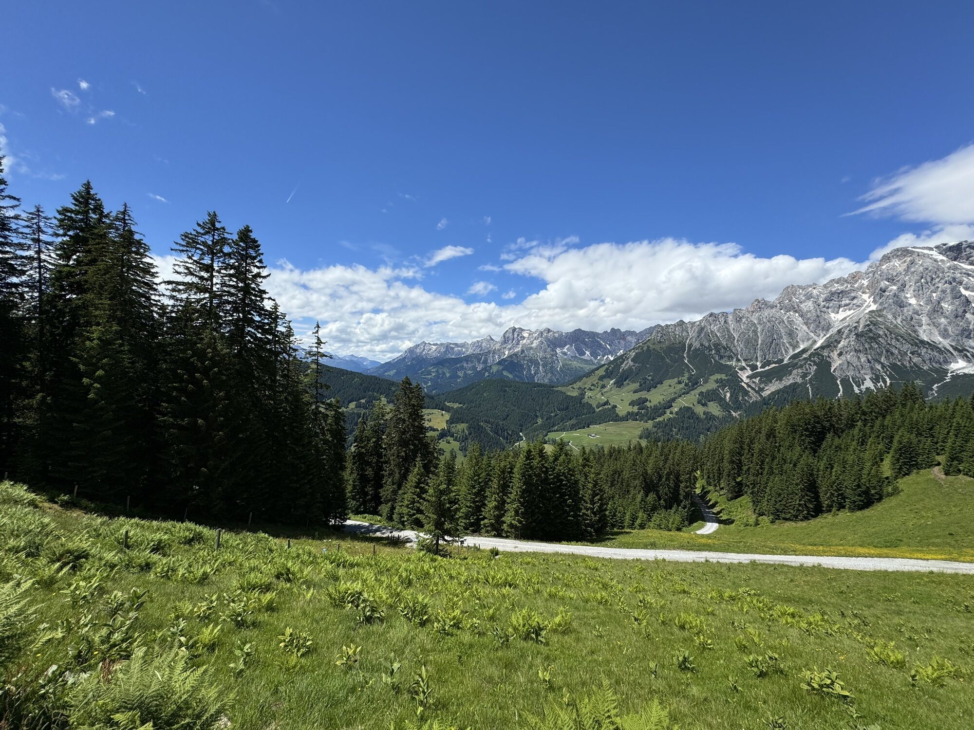


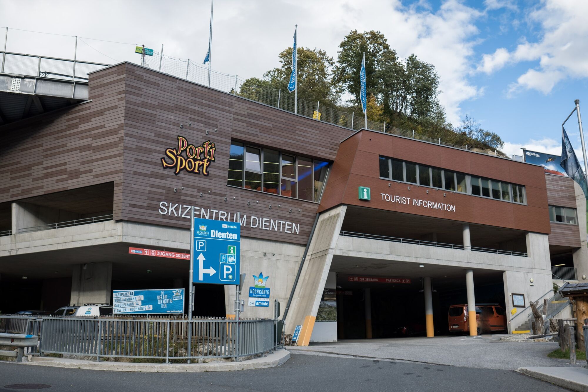
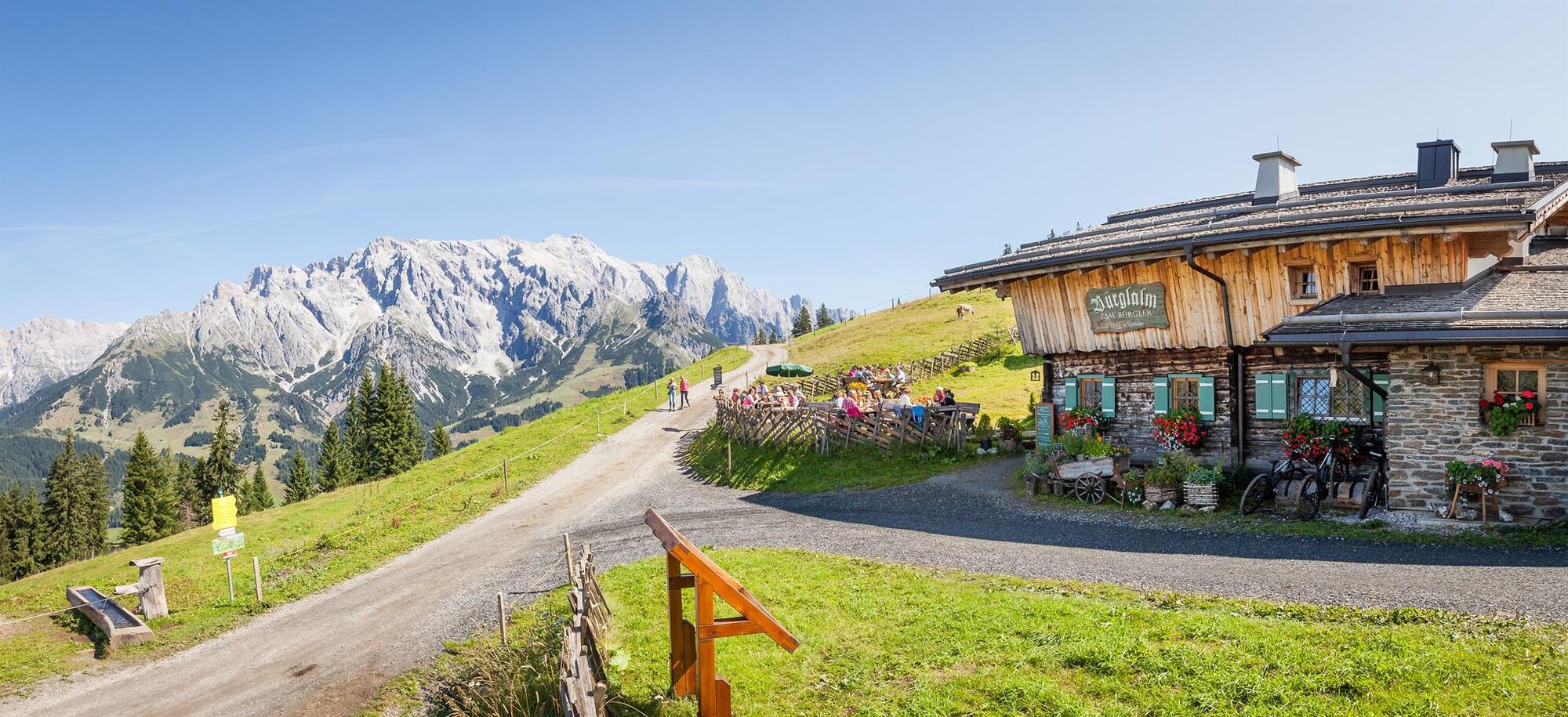
We cross the parking deck in the ski centre (MTB, eBike rental and eBike filling station) through the tunnel - past the barrier - and come to the "Reizegg" neighbouring road. Follow this road uphill for...
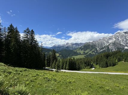
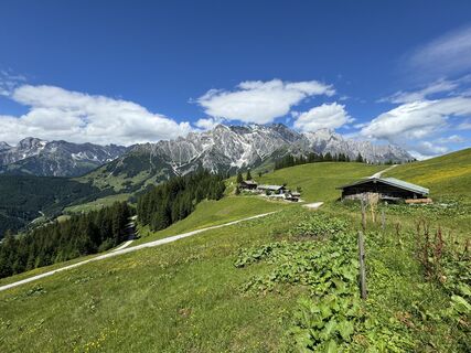
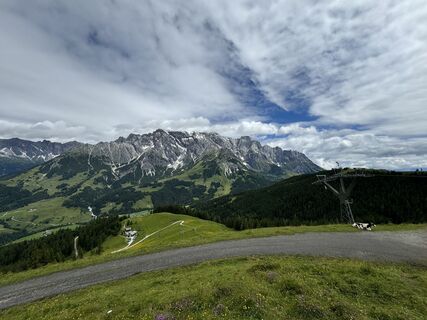
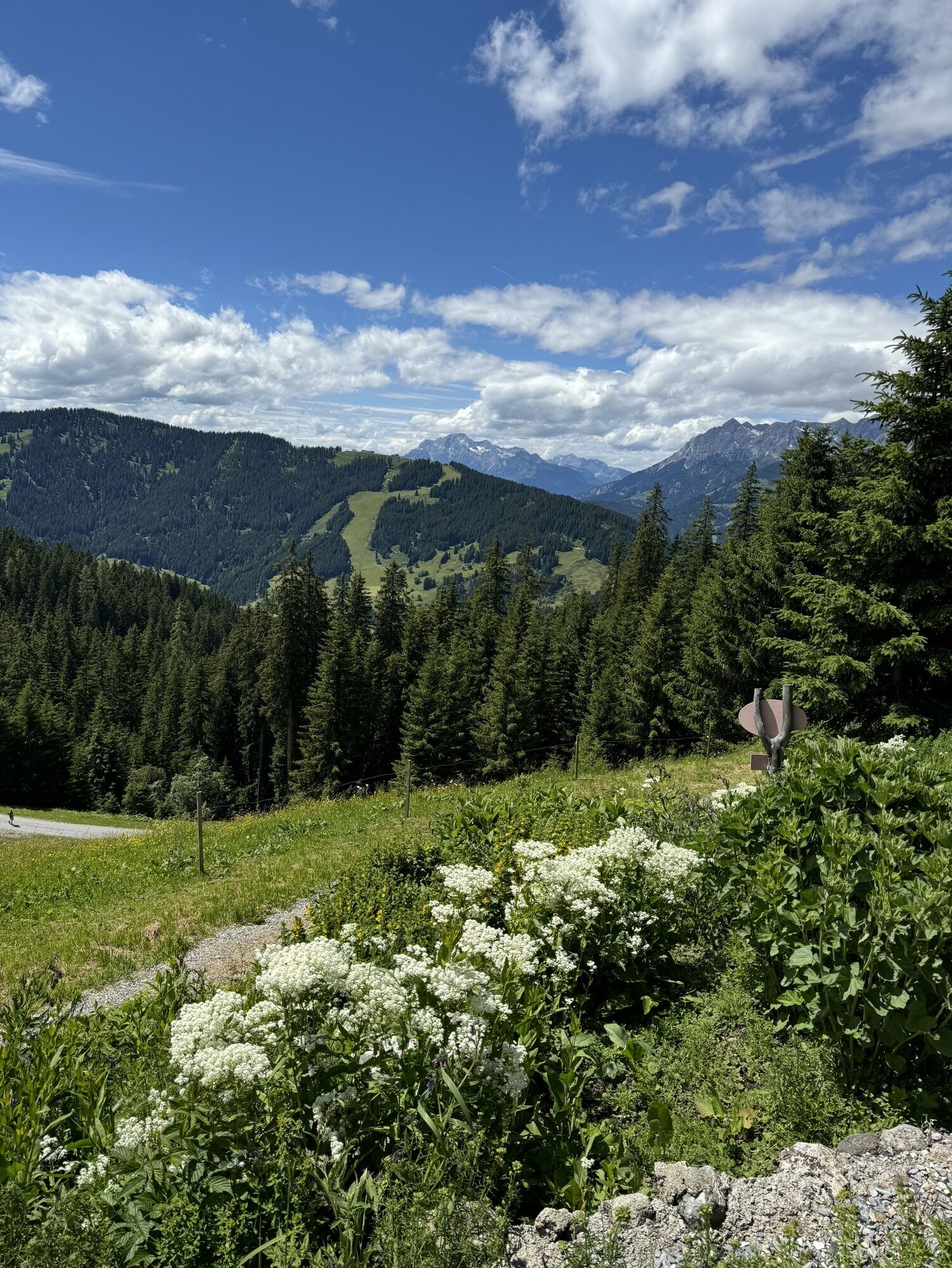
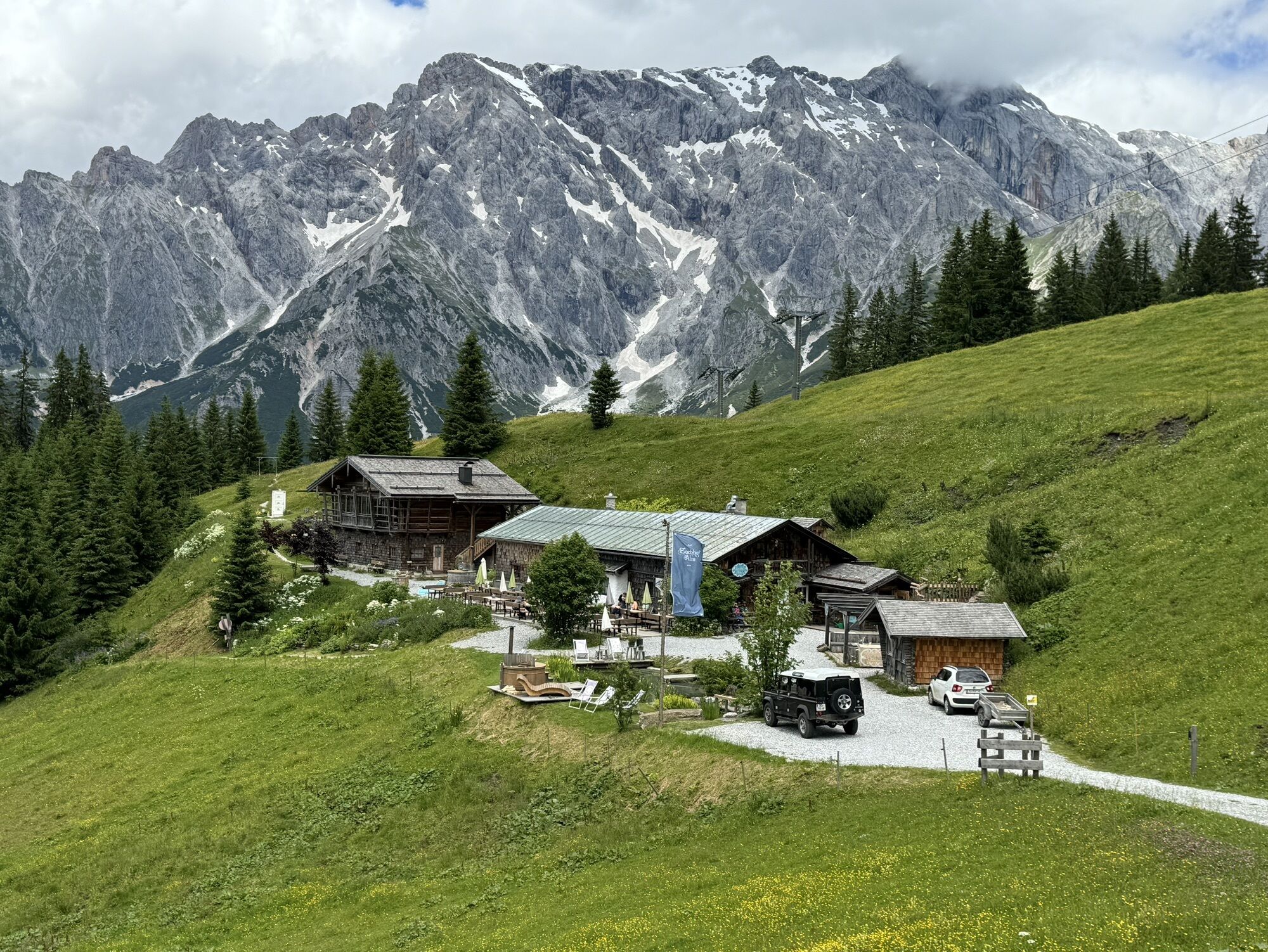
We cross the parking deck in the ski centre (MTB, eBike rental and eBike filling station) through the tunnel - past the barrier - and come to the "Reizegg" neighbouring road. Follow this road uphill for approx. 500 m until you reach the main road (B164) in the direction of Mühlbach/Bischofshofen. Follow this road uphill for another 500 m until you turn right onto trail no. 63 - to the Bürglalm (eBike filling station) and on to the Bürglalmbahn mountain station. From here, the trail continues uphill for approx. 300 m towards Wastlhöhe - from here we ride downhill on the two single trails Nani & Mariedl. Both trails are of medium difficulty and are suitable for all mountain bikers. We then return on the main road (B164) to the Zachhof (oldest farm in Dienten / Bründl district) and continue via the "Reizegg" road to the starting point, the ski centre in Dienten.

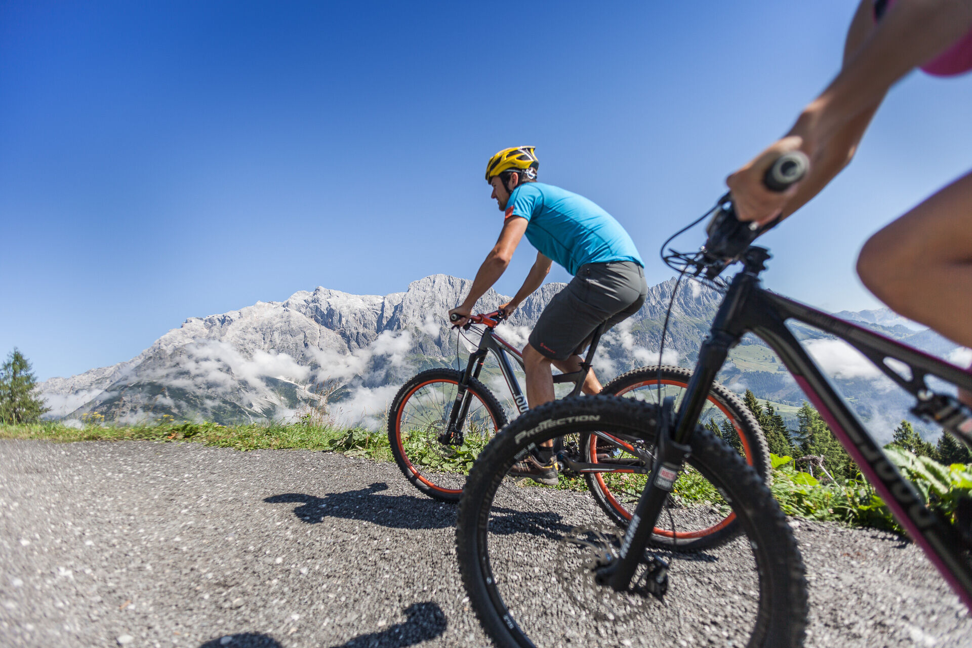
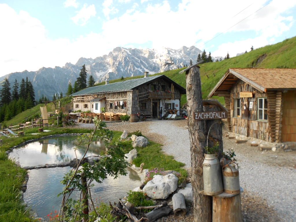
We cross the parking deck in the ski centre (MTB, eBike hire and eBike filling station) through the tunnel - past the barrier - and come to the "Reizegg" road. Follow this road for approx. 500 metres uphill to the main road (B164) in the direction of Mühlbach/Bischofshofen. We continue uphill along this road for a further 500 m until we turn right onto the path to the Bürglalm (eBike petrol station) and continue to the Bürglalmbahn mountain station. From here, it's another 300 metres uphill towards Wastlhöhe - from here we then ride downhill on the two single trails Nani & Mariedl. Both trails are of medium difficulty and are suitable for all mountain bikers. We then return along the main road (B164) to the Zachhof (the oldest farm in Dienten / Bründl district) and continue along the neighbouring road "Reizegg" to the starting point, the ski centre in Dienten.
Controlled bike equipment with helmet
Sunglasses
Sun protection
Rain protection
Drinks and a snack
Necessary medication
First aid kit
Bike map
Fair play!
Drive only on marked paths! Close all gates, barriers and pasture gates! Observe the road traffic regulations! Overtake only at walking pace! Behave respectfully towards other nature users! and the forestry and hunting staff! Be considerate of animals! Do not leave waste in nature! Act responsibly! Check the weather forecast. Fog and bad weather can come surprisingly quickly.
Emergency numbers: Alpine emergency call: 140, International emergency call: 112, Rescue: 144
Coming from Salzburg: Take the A10 freeway to the Bischofshofen exit, then take the B311 in the direction of Bischofshofen. Follow the Hochkönig Bundesstraße/B164 to Mühlbach and further to Dienten.
Coming from Innsbruck/ Kufstein: On the Loferer Straße/B178 in the direction of St. Johann i.T., then on the Hochkönig Bundesstraße/B164 via Saalfelden and Maria Alm to Dienten or to the Filzensattel.
A valid vignette is required to use the Austrian motorway and motorway network. It is also compulsory to carry a first-aid kit, warning triangle and high-visibility waistcoat. Further information can be found under Asfinag.
ÖBB-Scotty: Timetable information
Bus line 620: Timetable information
Bus line 631: Timetable information
Hiking bus: Timetable information
Free parking at the Dienten Ski Centre
Further information on bike tours and activities in the Hochkönig region:
For detailed information about hiking maps, the opening hours of the cable cars and the huts and mountain pastures in summer, we recommend you visit the local service centre. There you will not only receive the hiking map, but also valuable tips on the best hiking routes and current conditions.
Opening hours of the mountain lifts in summer: The mountain lifts offer different opening hours during the summer months, which can vary depending on the weather and season. Please check the current operating times in advance.
Opening hours of huts & mountain huts in summer: The huts and mountain huts in the region are ideal rest stops for hikers. Here, too, opening hours may vary depending on the season and day of the week. Ask the friendly hosts for advice about the offers and specialities on site.
For more information, please visit our website: www.hochkoenig.at.
If you have any questions or require specific information, please do not hesitate to contact us:
- E-mail: region@hochkoenig.at
- Telephone: +43 (0)6584 20388
We look forward to helping you and hope you enjoy exploring the beautiful Hochkönig hiking region!
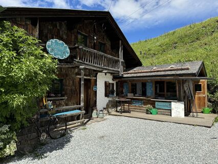
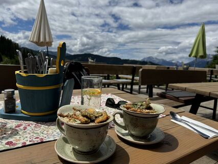
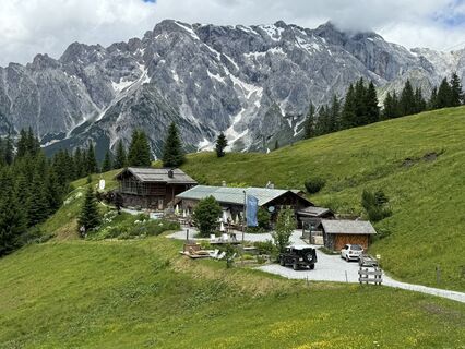
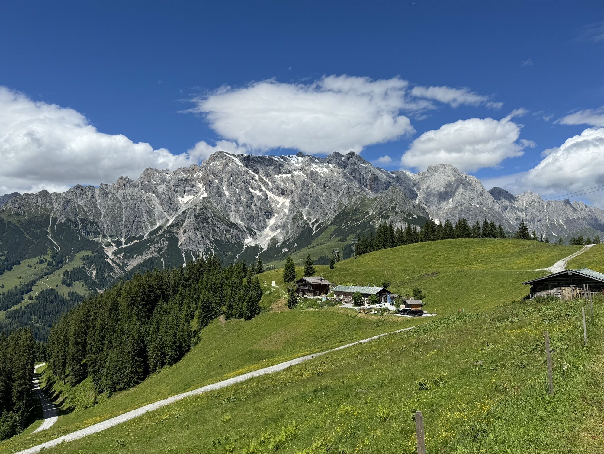
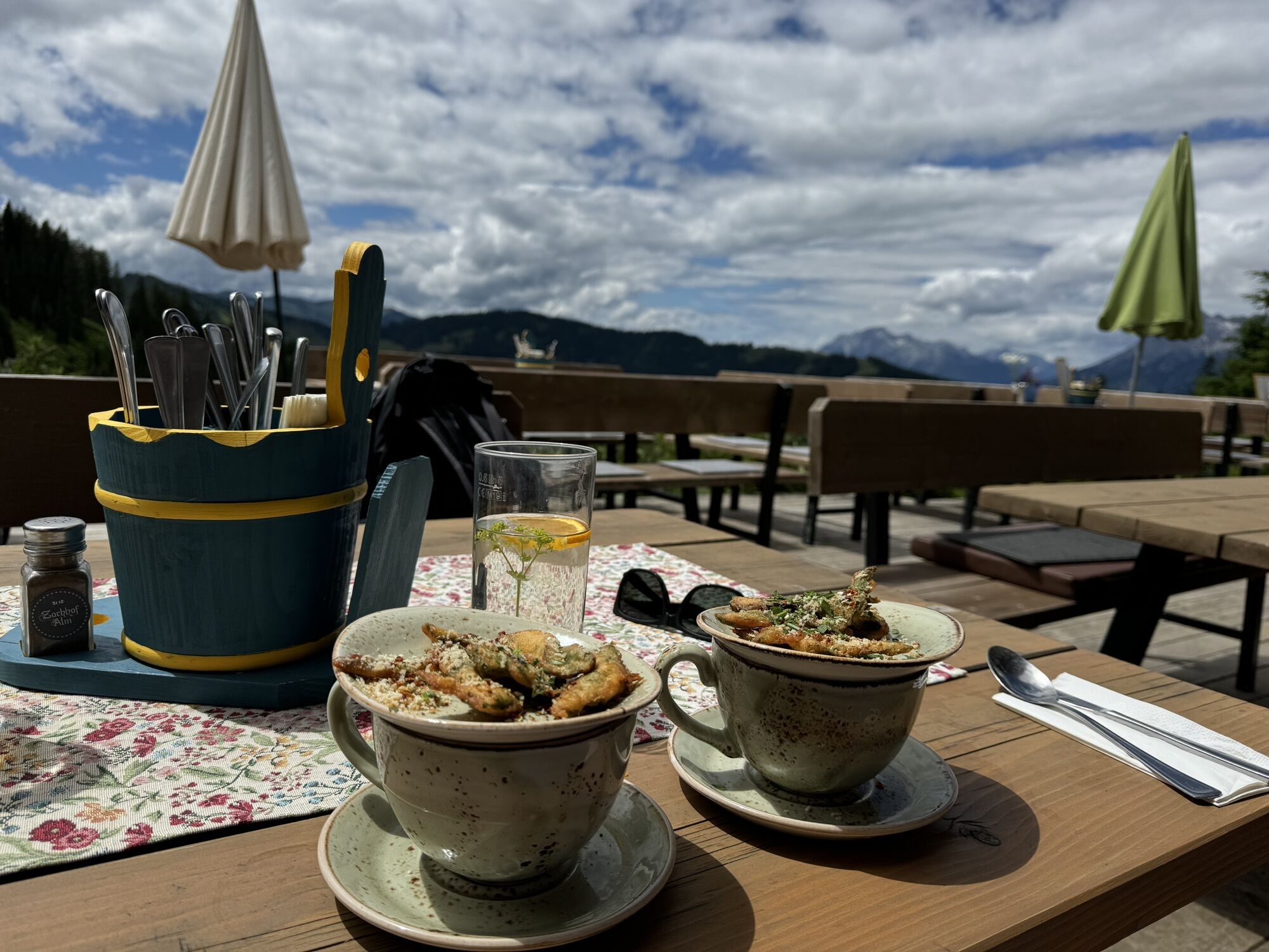
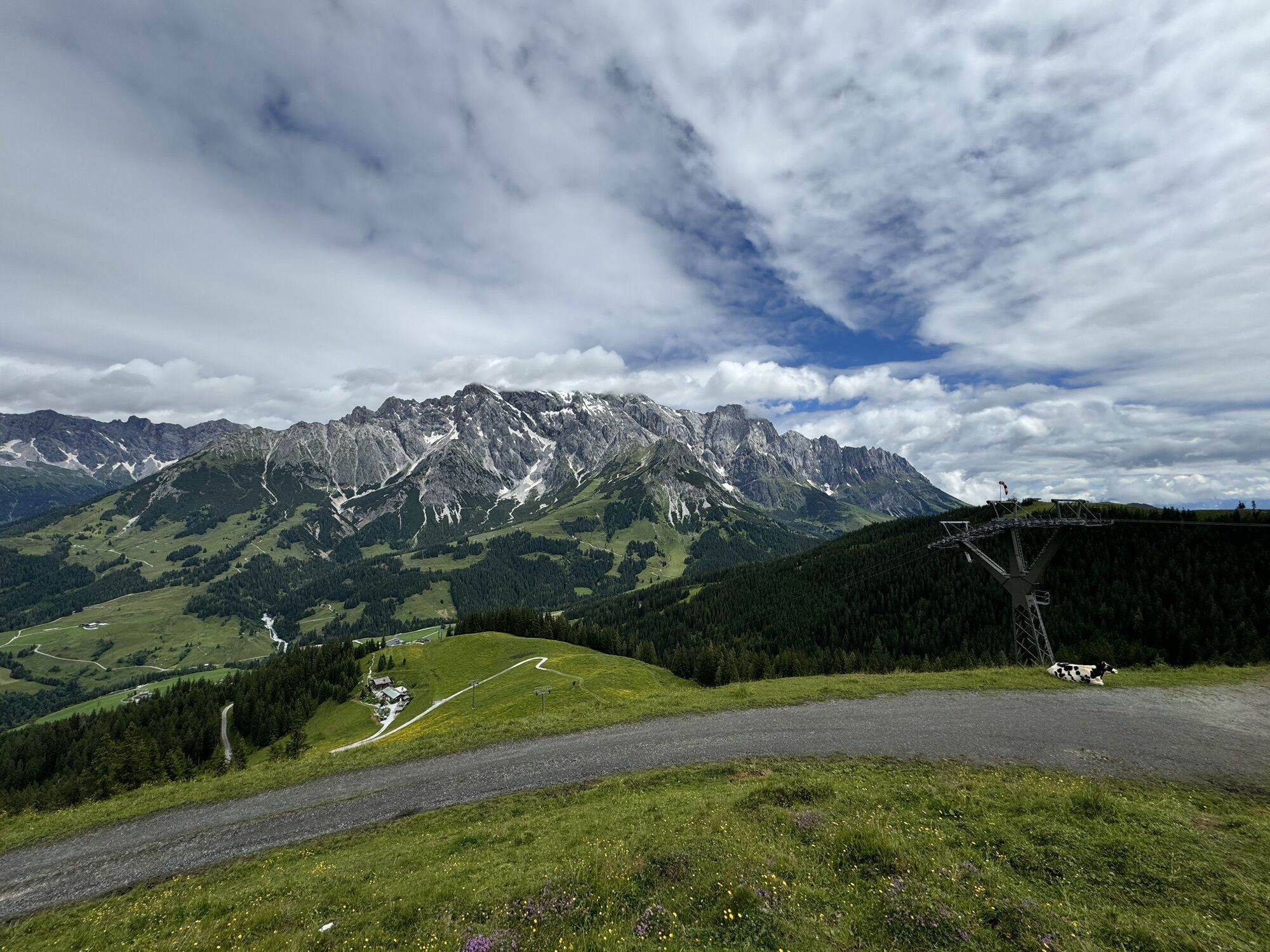
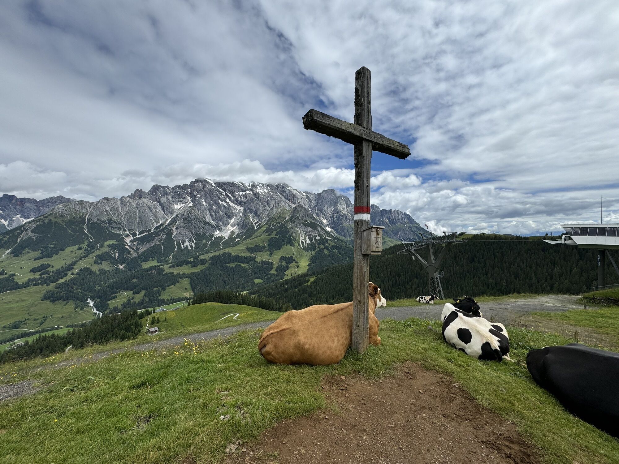
It is worth taking a short breather in the two rustic herbal alpine pastures of the Hochkönig region - Bürglalm and Zachhofalm. Both alpine pastures also have an eBike charging station. Mariedl & Nani were the good souls of the Zachhofalm. The two single trails have therefore been given the names of the two ladies.
Webové kamery z prehliadky
-
Mühlbach am Hochkönig
-
Maria Alm - Hochmaisbahn
-
Bergstation Kings Cab
-
Hinterthal - Urslauerhof
-
Hinterthal - Urslauerhof
-
Matrashaus am Hochkönig
-
Grünegg Alm & Edelbrennerei
-
Dienten - Übergossene Alm Resort
-
Dienten - Almsee
-
Dienten - Übergossene Alm Resort
-
Bergstation Kings Cab
-
Bergstation Kings Cab
-
Bergstation Kings Cab
-
Bergstation Kings Cab
-
Bergstation Kings Cab
-
Bergstation Kings Cab
-
Bergstation Kings Cab
Obľúbené výlety v okolí
-
4,8
Summit storming route Taghaube
ťažkéTuristika 6,25 km -
4,9
Hochkönig - Gipfel der Gefühle - Matrashaus
ťažkéTuristika 20,9 km -
3,8
Hochkönig summit route - main ascent
ťažkéTuristika 18,1 km -
4,7
Panorama hike to the Hochkeil
strednáTuristika 6,07 km -
4,8
Summit stormer route Lauskopf
ťažkéTuristika 8,16 km -
3,6
Wanderung zur Ostpreußenhütte in Werfen (1.630 m)
strednáTuristika 11,2 km -
4,7
About the "Four Huts circular route" to Windraucheggalm
strednáTuristika 10,1 km -
4,3
Riemannhaus
ťažkéTuristika 3,69 km -
3,9
Mühlbacher Höhenweg
strednáTuristika 11,2 km -
4,3
Peter-Wiechenthaler Hut
strednáTuristika 4,32 km
Turistika a stopovanie


Nenechajte si ujsť ponuky a inšpiráciu na ďalšiu dovolenku
Vaša e-mailová adresa bol pridaný do poštového zoznamu.