


Hüttschlag: Hundegg


The hike starts in the center of Hüttschlag. You cross the Ache and hike quite steeply up to the Hundegg. At the beginning you always have a view of the Hüttschlag Wall, where in 2009 the via ferrata "Kupfergeist"...
The hike starts in the center of Hüttschlag. You cross the Ache and hike quite steeply up to the Hundegg. At the beginning you always have a view of the Hüttschlag Wall, where in 2009 the via ferrata "Kupfergeist" was established. The via ferrata "Franzl" also leads through the Hüttschlag Wall. For all less experienced climbers, there is also the practice via ferrata "Gletschergoas". The path first leads through forest, then over beautiful alpine meadows to the Hundegg. Here the panoramic view is simply unique. In front of you is the Draugstein, which majestically watches over the Ellmautal. Behind it, the Dachstein mountains already appear. To the south, you can see the Hohe Tauern with the first three-thousand-meter peaks. In the other direction, you can see the Hochkönig as well as the Tennen and Hagen mountains. After the summit rest, you return on the same path back to Hüttschlag, where you can then really recharge in a guesthouse.
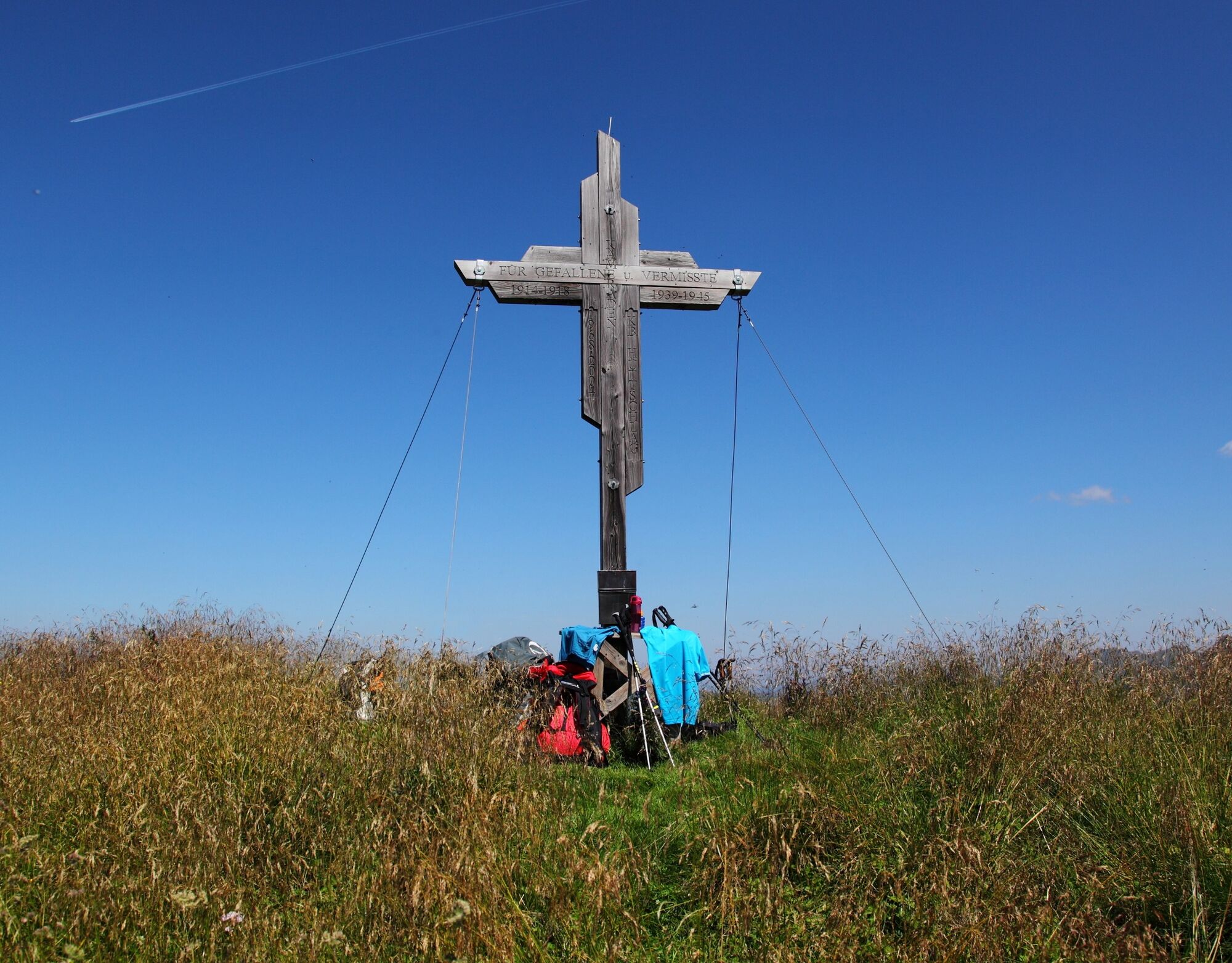
In the center of Hüttschlag you cross the Großarler Ache at the Asthütten farm. From here, a narrow path (no. 55) leads in several switchbacks up to Hüttschlag's local mountain, the Hundegg, 2,079 m (approx. 3 1/2 hours). Return on the same path (no. 55A) or via the Schleglalm, 1,566 m (not managed) to the Hallmoosalm, 1,350 m (not managed), and further to Hüttschlag/Karteis (approx. 2 3/4 hours).
Áno
Áno
Hiking boots with profile sole, hiking map
You will not pass any managed alpine huts on this route. So take enough food and drink with you!
Drive by car, hiking taxi or the Postbus to Hüttschlag town center.
Parking lot just after the tunnel on the right side, next to the Schappach chapel
Anyone who is not afraid of heights can make a short detour to the Hüttschlag Wall and experience a breathtaking view of Hüttschlag!
Webové kamery z prehliadky
Obľúbené výlety v okolí
-
4,7
Bahnhof Bad Hofgastein nach Bahnhof Bad Gastein
strednáTuristika 13,0 km -
4,5
Mosermandl Windischscharte, Salzburger Land/Österreich
ťažkéTuristika 14,6 km -
4,2
Ennskraxn (2410m)
ťažkéTuristika 14,7 km -
4,8
Hüttenkogel - Graukogel von der Bergstation
strednáHorská turistika 4,68 km -
4,8
Gasteiner Höhenweg von Bad Gastein nach Bad Hofgastein
svetloTuristika 8,58 km -
4,1
Großarl: Unterwandalm - Karseggalm - Breitenebenalm
strednáTuristika 5,93 km -
4,4
Wasserfall Bad Hofgastein
svetloTuristika 3,89 km -
4,7
Kölnbreinspeicher bis Osnabrücker Hütte
svetloTuristika 15,9 km -
4,6
Bergtour vom Kötschachtal zum Naturjuwel Reedsee
strednáTuristika 12,5 km -
4,4
Ski tour Liebeseck
ťažkéSkitour 14,1 km
Turistika a stopovanie


Nenechajte si ujsť ponuky a inšpiráciu na ďalšiu dovolenku
Vaša e-mailová adresa bol pridaný do poštového zoznamu.