


Path of Piottino itinerary


It is very important not to wander off the path.The upper section part of the route passes through an area covered with birch, whitebeams, spruce, larch, rhododendrons, juniper, bilberries, cranberries,...
It is very important not to wander off the path.The upper section part of the route passes through an area covered with birch, whitebeams, spruce, larch, rhododendrons, juniper, bilberries, cranberries, bog bilberries and heather. Mushrooms, toadstools and club mosses also grow here.
The point that skirts the Motto di Dalpe precipice, which enjoys all-round views, is home to lily of the valley, Turk’s cap lily and gentian, all of which flower in around mid-June, marking the effective start of spring in this area.
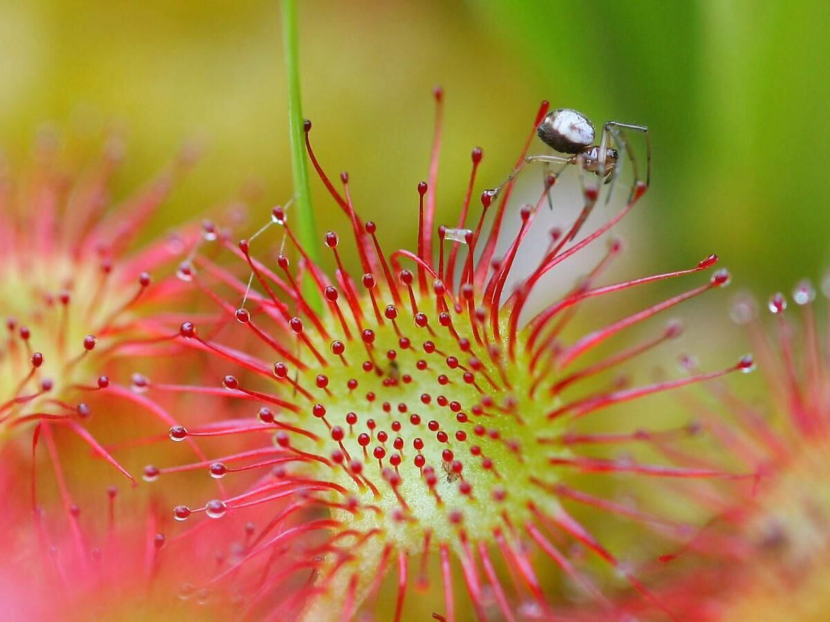
The central part of the boggy area provides a habitat for sphagnum, round-leaved sundew (a protected carnivorous plant), sedges, narrow-leaved cottongrass and tussock cottongrass.The numerous animals to be found in the area include: hares, squirrels, roe deer, badgers, European common frogs, golden eagles, great tits, green woodpeckers, jays and dragonflies.The itinerary visits a number of different environments, including arid pastures with silver thistles, and a stretch of river with common ash, white alder, maple and goat’s beard. Crickets can be heard singing in the background, while small mounds of earth indicate the presence of moles in the area.Next you come to the Prato Leventina, where you can enjoy a clear view of the church dating back to 1210, the old mule track and the kiln.The second part of the itinerary leads to Dazio Vecchio. A little farther ahead, on the right-hand slopes of the Piottino walkers can enjoy a beautiful view over the Media Leventina area. Turning back on your steps you pass through a quartz quarry before the excursion comes to an end in Dazio Grande.
www.percorsopiottino.ch


Áno
Hiking boots
Sun cap
Water-bottle
Sunglasses
Sun cream
Hiking map
Camera
Food
Montagnepulite: This project was born to promote an effective management and sustainable use of mountain huts in Ticino, and in particular the litter management. The responsible management of litter in the mountains is a matter of common sense. We can all contribute: www.montagnepulite.ch
Obľúbené výlety v okolí
-
Val Piora lakes route
strednáTuristika 15,8 km -
4,7
Fusio-Lago Mognola-Fusio
strednáTuristika 8,94 km -
Lai Blau
Turistika 8 km -
Mognola Rock Climbing
Lezenie 8,93 km -
5,0
Lukmanier Pass - Cadlimo Hut
strednáTuristika 9,80 km -
Lukmanier Alps
strednáTuristika 13,2 km -
5,0
lago retico
svetloTuristika 9,81 km -
3-Tagestour Greina-Lucomagno: Capanna Bovarina - Lukmanierpass (Etappe 3)
strednáTuristika 7,97 km -
Via Alta Vallemaggia - Stage 6W: Rifugio Alpe Fontana-Fusio
strednáTuristika 8,65 km -
«Highway» to Tremorgio
Turistika 14,7 km
Turistika a stopovanie


Nenechajte si ujsť ponuky a inšpiráciu na ďalšiu dovolenku
Vaša e-mailová adresa bol pridaný do poštového zoznamu.