


Variante Monte Generoso - Gianola Trail


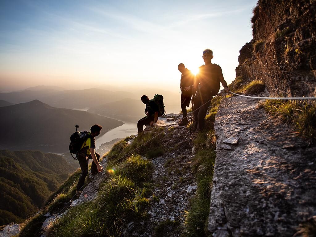
A trail for expert hikers that starts in Rovio and becomes steeper and steeper, climbing right up to the peak. A wonderful way to discover this mountain's most spectacular Alpine side. After crossing through...
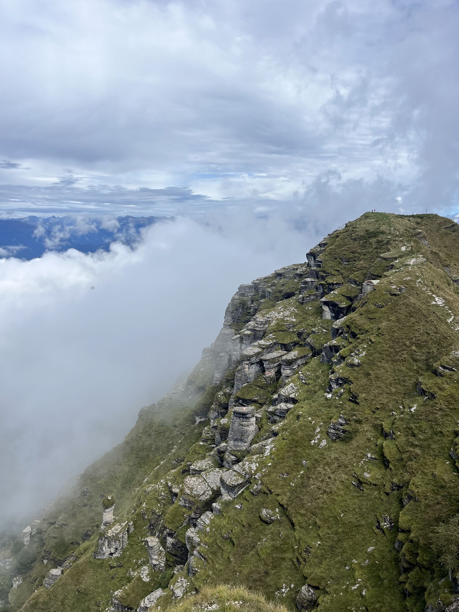
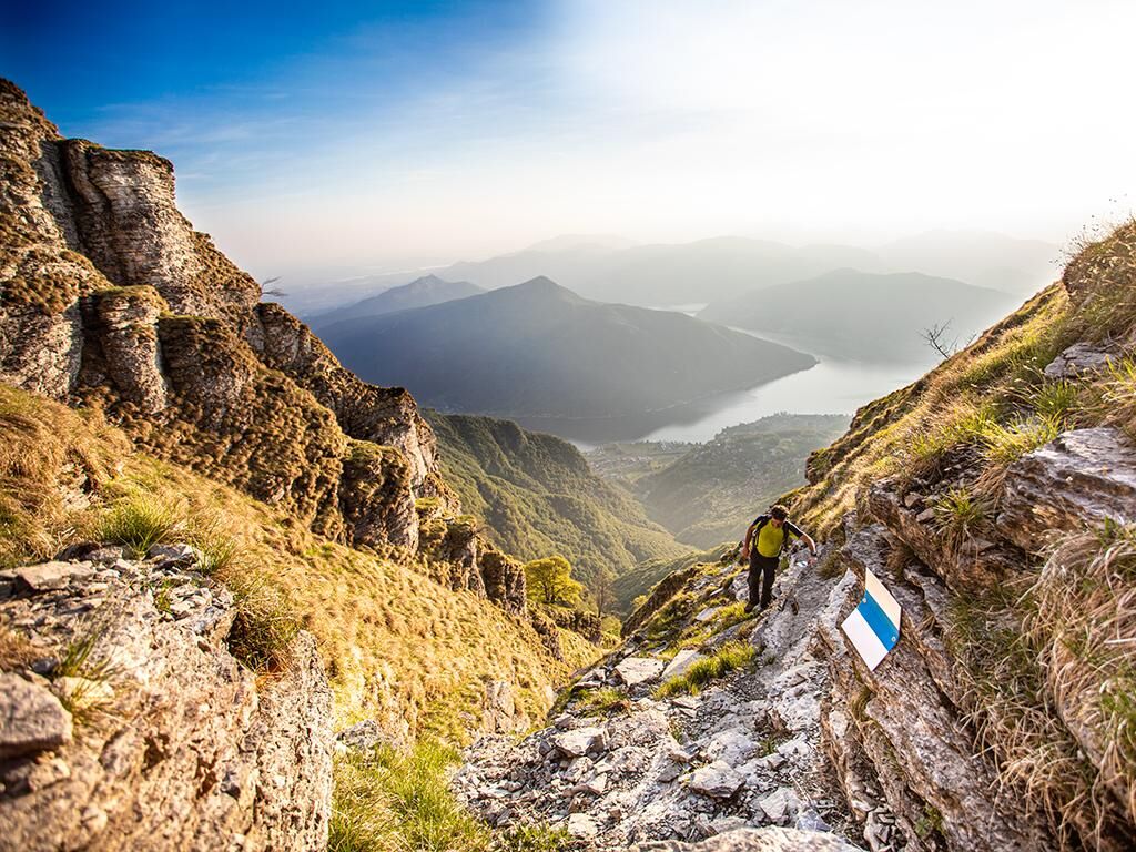
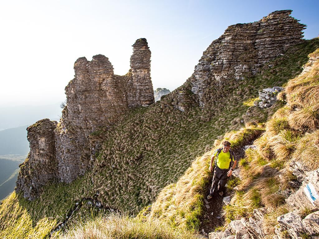
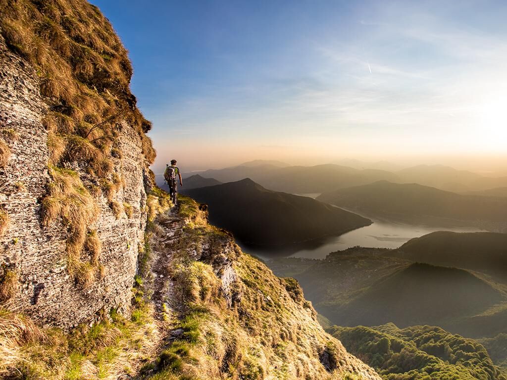
A trail for expert hikers that starts in Rovio and becomes steeper and steeper, climbing right up to the peak. A wonderful way to discover this mountain's most spectacular Alpine side. After crossing through the town of Rovio, it begins to ascend towards Pioda along a cobbled road that runs along the western slopes of Monte Generoso and was built during the war. A slight diversion here will take you to the famous Buco della Sovaglia, the source of the river of the same name. The trail with its blue and white markers, the official Alpine colours, travels around hairpin bends as it climbs up through the dense woodland to the Perostabbio Refuge. From this point onwards, the path becomes more challenging and hazardous, scaling the height of 1200 metres up to the peak. Descent and return to Rovio via the easier route through Bellavista and the Alpe di Melano (please note: it is not possible to follow the Alpine trail back down to Rovio from the peak). You must be sure-footed and equipped with suitable mountaineering equipment. Only for expert hikers (it includes dangerous sections, with some rock-climbing involved). Not recommended for those who suffer from vertigo. Please check the weather forecast before setting out.

Boots
Sun hat
Water bottle
Sunglasses
Protective cream
Hiking map
Camera
Food
White-blue trail (alpine track)
Obľúbené výlety v okolí
-
4,7
Sentiero del Monte Generoso (SwitzerlandMobility 635)
strednáTuristika 9,22 km -
4,6
Abendwanderung
strednáTuristika 8,01 km -
5,0
Denti della Vecchia
strednáTuristika 14,7 km -
4,5
Lenno - Val Perlana
strednáTuristika 11,7 km -
3,0
Bellavista - Monte Generoso
svetloTuristika 2,60 km -
S.Salvatore
svetloTuristika 15,0 km -
5,0
Valle di Muggio
strednáTuristika 14,2 km -
Val Mara - Muggio Valley
strednáTuristika 13,0 km -
Sentiero del Monte San Giorgio (SwitzerlandMobility 636)
strednáTuristika 12,7 km -
5,0
Mendrisiotto Parks Route
strednáTuristika 19,5 km
Turistika a stopovanie


Nenechajte si ujsť ponuky a inšpiráciu na ďalšiu dovolenku
Vaša e-mailová adresa bol pridaný do poštového zoznamu.