


4 summit route


It doesn't always have to be the 6,000ers – we have 600ers! (– what’s a zero anyway…!)
Circular hiking route over 4 peaks of the Vogtland
Stelzenbaum - Reuther Linde - Galgenpöhl - Rosenbühl
Set out...
It doesn't always have to be the 6,000ers – we have 600ers! (– what’s a zero anyway…!)
Circular hiking route over 4 peaks of the Vogtland
Stelzenbaum - Reuther Linde - Galgenpöhl - Rosenbühl
Set out on a summit route across the legendary Vogtland. Whether the legend of the Stelzenbaum, which sprouted from the enchanted staff of a herdsman and thus proved his innocence, or the learned farmer from Rothenacker who was in demand at princely courts for his language skills. On our route proposal, hikers will find a genuine summit register on Rosenbühl, beautiful views, and breathtaking long-distance sight – weather permitting.

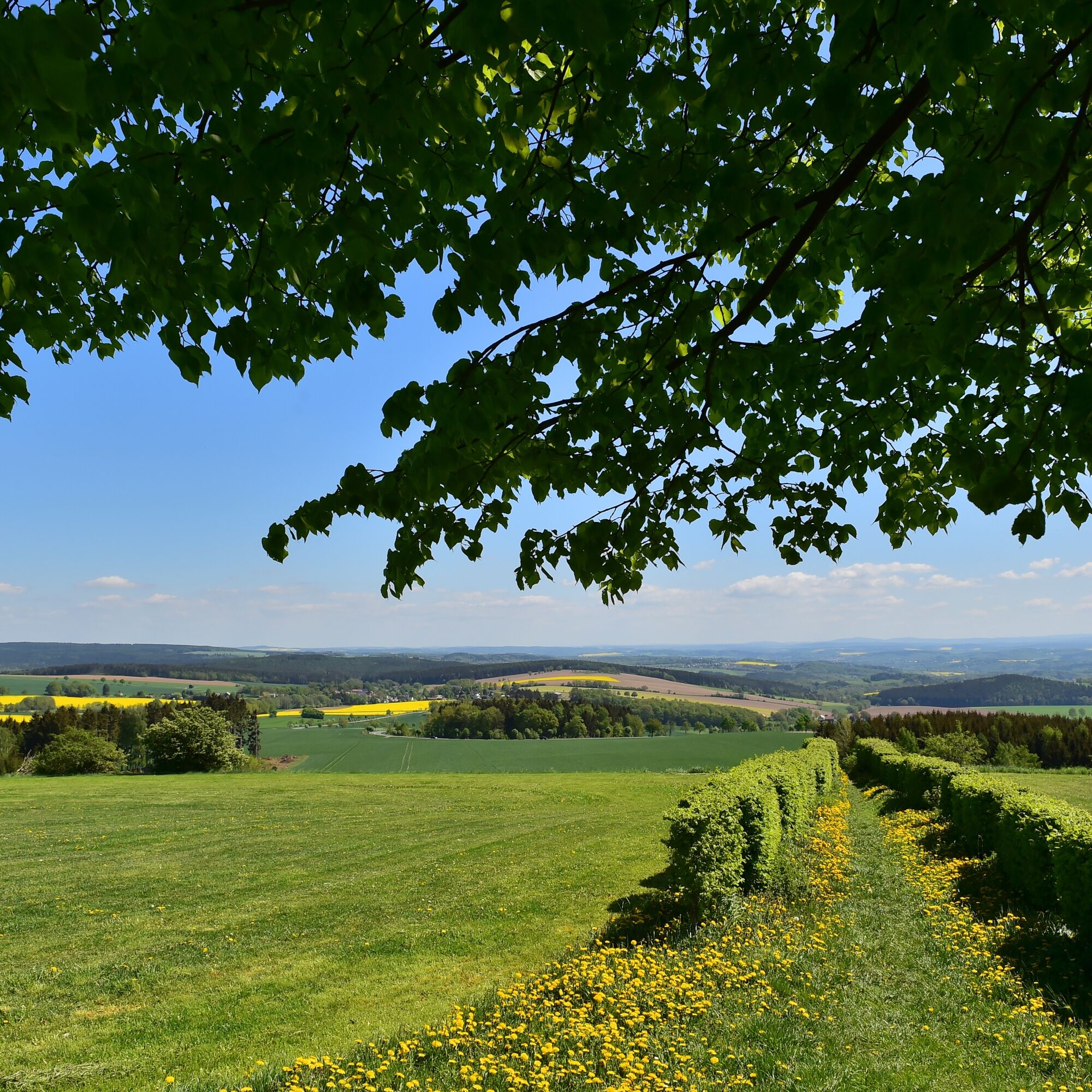
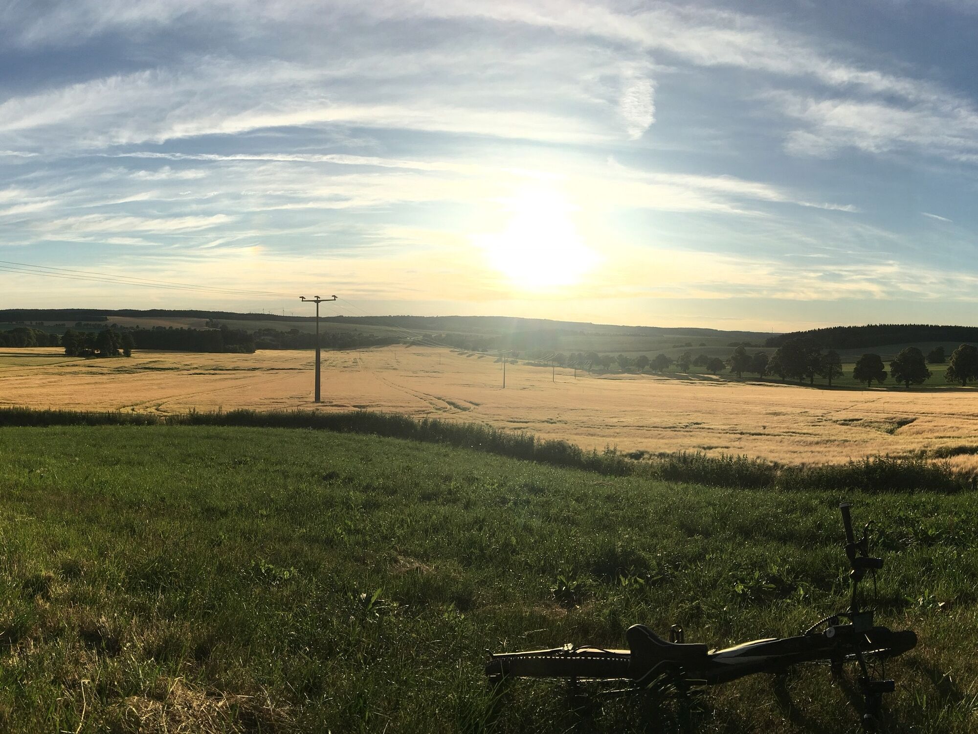


From Stelzenbaum, first descend into the village Stelzen and onto the stream meadow. Continue on the road to Reuth and to Reuther Linde. On the yellow-marked hiking trail, walk through forest and field, partly along the railway to Galgenpöhl near Mißlareuth. From Mißlareuth it goes on to Rothenacker, where a detour to the Museum of the Learned Farmer is recommended. Further on field and forest paths to Rosenbühl with shelter and summit register. From Rosenbühl back to Stelzenbaum. The entire route can of course also be walked in reverse.
A 9 exit Gefell towards Tanna, continue via Oberkoskau to Stelzen
Bus: Line 163 to Tanna; on-call bus lines 44 + 48 please check information at www.vogtlandauskunft.de
Parking in front of the festival barn and in the village Stelzen is free of charge.
Also in the other villages along the route, if another starting point is chosen.
The view from the Reuther Linde offers a fantastic long-distance view to the Ore and Fichtel Mountains
Obľúbené výlety v okolí
-
4,5
Hirschberg Primeval Forest Trail - Thuringian Primeval Forest Trails
svetloTuristika 2,80 km -
5,0
Burgsteinlehrpfad
strednáTuristika 9,51 km -
5,0
Saalepfad - Circular hike at the Green Belt
ťažkéTuristika 34,8 km -
Circular hiking trail - Mushroom experience trail Gräfenwarth - Thuringia
strednáTuristika 5,48 km -
3,0
Syrau Dragon Circuit
svetloTuristika 10,3 km -
Rund um die Erdachsenstadt
Turistika 16,4 km -
Kürbitz Lindworm Trail
strednáTuristika 4,80 km -
Von Saaldorf zum Marienstein
svetloTuristika 9,41 km -
Through the Kemnitzbach valley
ťažkéTuristika 20,7 km -
Wiedersberger Grenzweg - Geh.Zeiten
Turistika 12,3 km
Turistika a stopovanie


Nenechajte si ujsť ponuky a inšpiráciu na ďalšiu dovolenku
Vaša e-mailová adresa bol pridaný do poštového zoznamu.