


Sentier viticole / Wine trail


The wine educational trail offers a fascinating introduction to the world of Valais wines. The route leads from Salgesch - one of the most valuable Valais wine villages - to Siders, also called the capital...
The wine educational trail offers a fascinating introduction to the world of Valais wines. The route leads from Salgesch - one of the most valuable Valais wine villages - to Siders, also called the capital of Swiss wine and host of the annual wine fair VINEA.
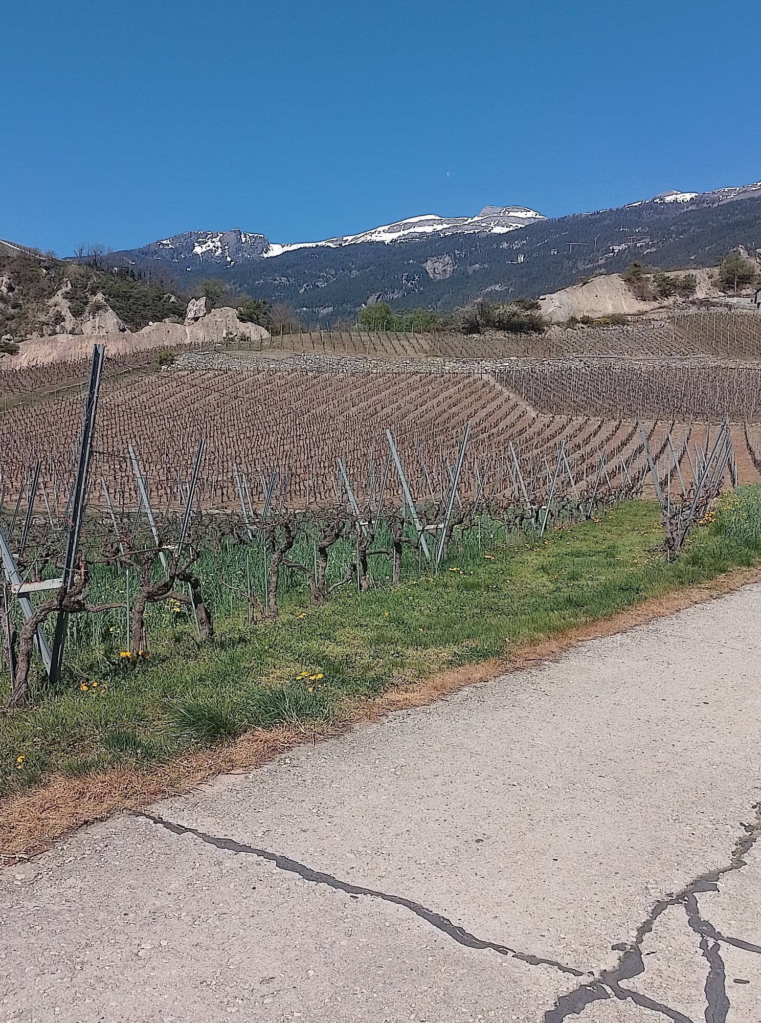
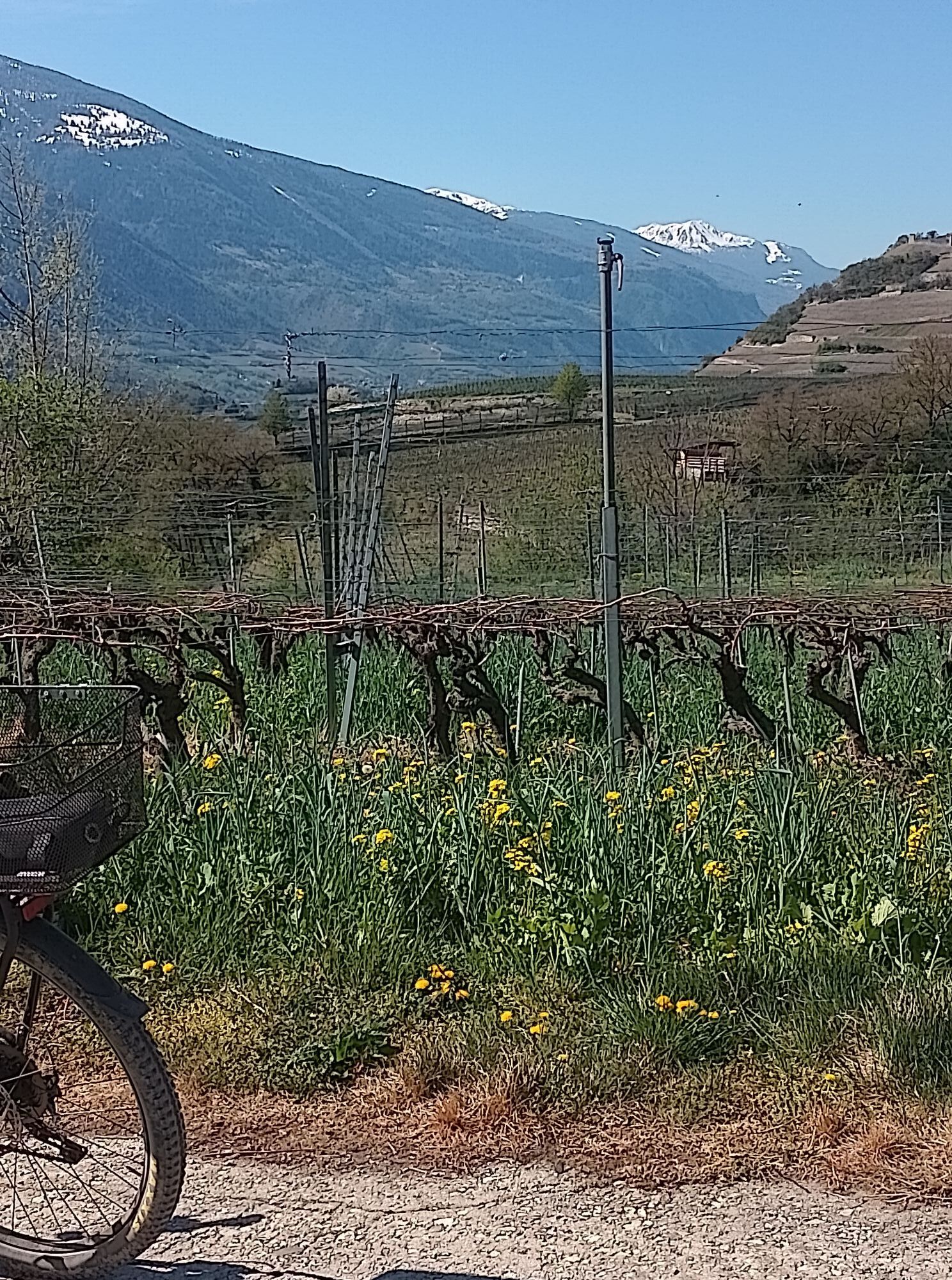
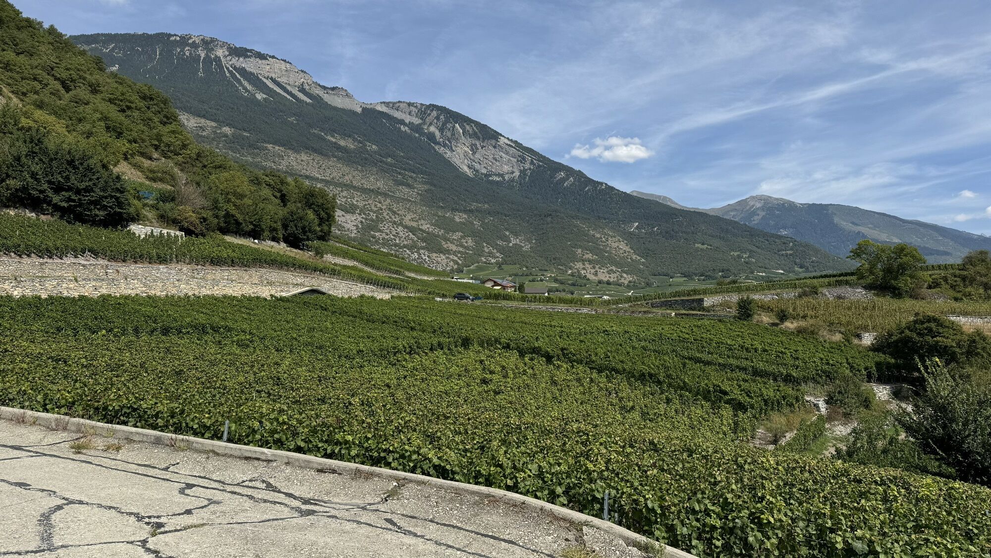
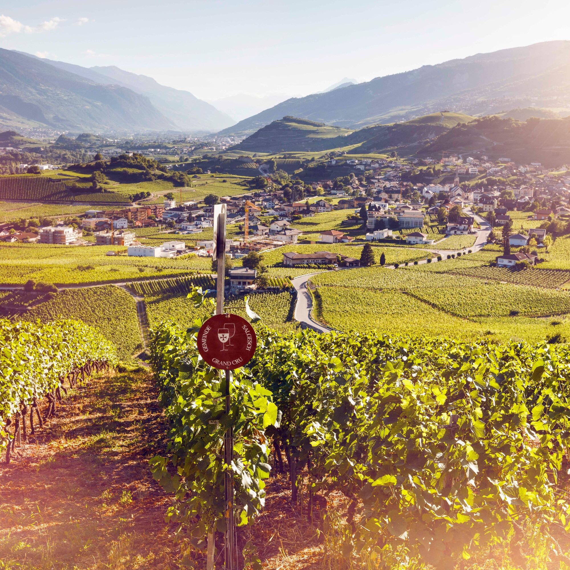
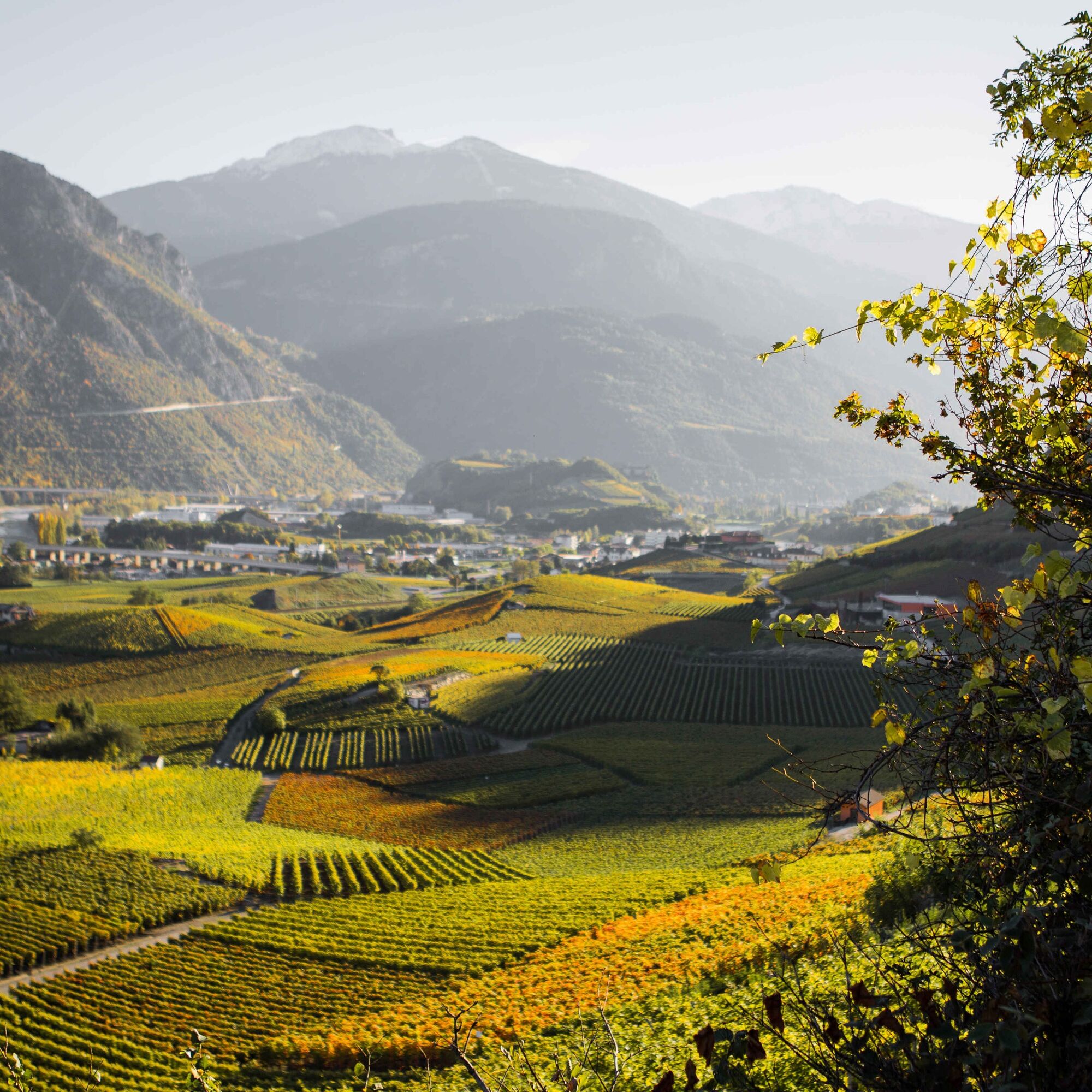
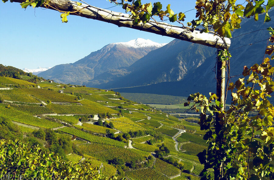
The path leads through the wine villages and vineyards and provides on 80 information boards a wealth of information about the different grape varieties, the history and techniques of viticulture as well as about the lives of the winemakers who have shaped the landscape for a long time. Many farmers came from the Val d'Anniviers and led a nomadic lifestyle by moving between the mountains in Val d'Anniviers and the Rhone Valley. The numerous historic wooden chalets are witnesses to these generations and a highlight of the hike.
The path represents, in a figurative sense, another transition between two different worlds. The vines have probably been part of the landscape for thousands of years, yet untouched nature can still be discovered on the hike: for example, in the wild Raspille gorge at the beginning of the hike. Here is also the language border between the French- and German-speaking part of Valais.
The trail connects the two sites of the Valais Wine Museum. The hike begins in Salgesch at the historic Zumofenhaus, where the permanent exhibition of the Wine Museum is located. Numerous historic wine-growing artifacts show the history of the Valais winemakers in an entertaining way.
At the arrival point at Château de Villa in Sierre are the museum's temporary exhibitions. The little castle also houses a restaurant known for its Valais specialties and especially raclette. In the cellar is also the "Oenothèque du Villa", the largest Valais wine shop where more than 650 Valais wines can be tasted and purchased at cellar prices.
Highlights of the hike:
Valais Wine Museum with two contrasting sites at the start and end of the hike. Panoramic variety: vineyard landscapes, wine villages, and the wild Raspille Gorge. Numerous opportunities to taste grapes and wines.

Allow enough time when planning the hike to visit the two sites of the Valais Wine Museum at the start and end of the hike.
The first section of the path leads through the Raspille Gorge, set in a unique landscape. The path then leads through the wine village of Veyras, which has attracted writers and artists like Rainer Maria Rilke for a long time.
A little before, be sure to make a small stop at the "Chivirau" plot. Here the diversity of Valais wines is grown in a single plot. You are welcome to taste and compare the grapes of the different wine varieties.
The last section of the path leads through the heights of Sierre and its surroundings, crossing the wine village of Muraz and showing the traditional gatehouses built by nomadic winemakers. At the end of the walk, Château de Villa offers the opportunity to discover the diversity and taste the exceptional quality of Valais wines.
Áno
We recommend:
Good footwear Weather-dependent clothing: always bring a waterproof vest Headwear Sunscreen Water bottle Picnic Camera Binoculars (optional) Walking sticks (optional) Printout of the hiking trail (click "Print" to download)
For certain hikes:
Swimsuit
The mountains, a place of joy for sharing and respect. The mountain world is a place to meet and experience unforgettable moments together – whether by bike or on foot. So that all users can benefit from it, it is essential to share this space with respect for nature and agriculture. Respectful behavior makes it possible for everyone to carry out their leisure activities under the best conditions. Inform yourself about recommendations and rules. Assess your own abilities and fitness well. Using the various routes is fundamentally at your own risk.
For all hikes:
Carry a map with you. Download the complete description of the hiking trail with a large-scale map by clicking "Print" at the top right of the page. Use only marked hiking trails and observe all signposts and instructions – for your own safety, to protect grazing animals, and out of respect for wildlife. Close gates after passing through. Be considerate of other trail users, plants, and animals.
For mountain hikes:
Carry additional sunscreen. UV rays can be very strong at high altitudes, even in cloudy weather. Plan your hike carefully: take into account the required fitness level of all participants, weather forecasts, and seasonal dependencies. Weather conditions can change very quickly and without warning in the mountains. Appropriate clothing and sufficient provisions (food and drink) are very important. In unstable weather, it is better to turn back early.
For high alpine hikes:
Inform your family about your hiking route. If possible, avoid being alone. Do not go onto glaciers without a mountain guide. Observe warning signals indicating dangers at riverbanks, along watercourses below dams and reservoirs: water levels can rise quickly and without warning.
A9 motorway, exit 28 (Sierre-West) coming from the west or exit 29 (Sierre-East) coming from the east.
Regular train connections to Sierre. The starting point of the hike is about one kilometer from the station. From the end of the hike at Zumofenhaus it is about 800 meters to Salgesch station.
Large car park on the south side of the station (access via Route de la Monderèche).
More information about the destination:Sierre, Salgesch & surroundings
Make a stop in the vineyard "Chivirau" to taste the 34 different Valais grape varieties.
Obľúbené výlety v okolí
-
5,0
Bella-Tola
strednáVysoké turné 6,72 km -
4,0
Belvédère via ferrata
strednáVia ferrata 1,81 km -
5,0
Klettersteig Daubenhorn
ťažkéVia ferrata 5,34 km -
5,0
Wildstrubel Umrundung 4-Tage
strednáTuristika 79,1 km -
5,0
Torrenthorn- Rigi der Walliser Alpen
Turistika 2,99 km -
4,0
Gemmipass - Lämmerenhütte - Rote Totz Lücke - Daubensee - Gemmipass
strednáTuristika 13,7 km -
4,0
Grand Bisse de Lens
svetloTuristika 8,73 km -
Valais Alpine Bike - Complete route
ťažkéMountainbike 367,0 km -
Colombire-Tieche-Petit Bonvin-retour
strednáTuristika 13,0 km -
Gratweg
Via ferrata 5,16 km
Turistika a stopovanie


Nenechajte si ujsť ponuky a inšpiráciu na ďalšiu dovolenku
Vaša e-mailová adresa bol pridaný do poštového zoznamu.