







Road cycling route : Tour du lac du Bourget

Úroveň náročnosti: 2
Departing from Culoz, between wild Bugey and the peaceful reflections of France's largest natural lake in Savoie, a cycling route as sumptuous as it is stimulating begins: the tour of Lake Bourget via...
From the first few kilometers, you follow the ViaRhôna and the peaceful banks of the Savières Canal, a true link between the Rhône and Lake Bourget. Then, after skirting the northern and eastern banks of the Bourget, passing through Aix-les-Bains, with the deep blue of the lake as a backdrop, you will reach the southern shore of Lake Bourget. But the highlight of this loop remains the ascent of the Col du Chat from Lake Bourget. The effort is felt as it winds between limestone cliffs, but each pedal stroke offers an increasingly spectacular view.
The descent takes you to the majestic Jongieux bends, where the road winds through the Savoyard vineyards. All that's left is to follow the ViaRhôna cycle route, passing through the small village of Chanaz.
This comprehensive tour, with its changing landscapes and varied rhythms, offers cyclists a true immersion in an alpine setting spanning lake, pass, and valley. An unforgettable outing, ideal for cycling enthusiasts seeking a balance between performance, pleasure, and contemplation.
It is recommended to cycle clockwise to better enjoy the view of the lake.
This beautiful ride around the lake is not, however, easy, as it climbs from Bourget-du-Lac to the Col du Chat, the only difficulty on the route, with its 7 km of ascent and 368 m of elevation gain.
(It is possible to avoid the pass by taking the Tunnel du Chat, reserved for pedestrians and cyclists).

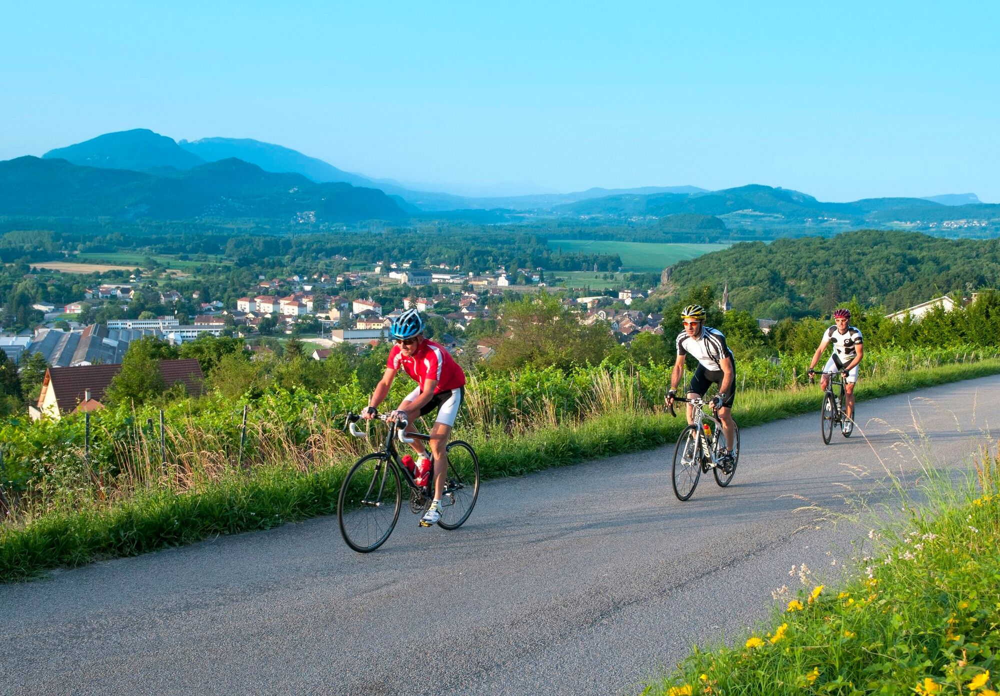
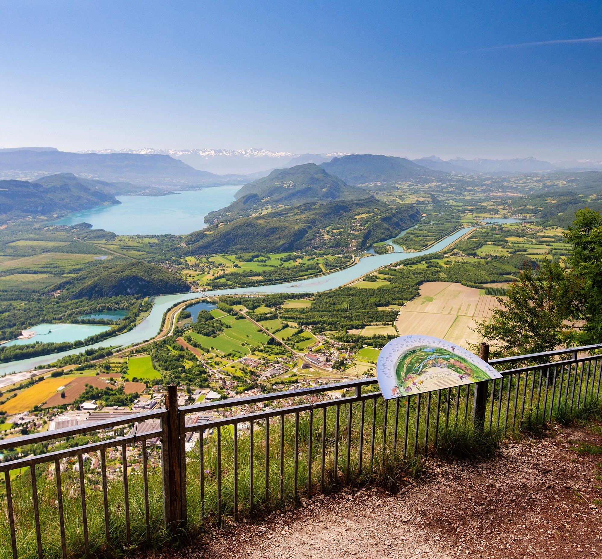

The departure at the foot of the Grand Colombier quickly meets the ViaRhôna greenway along the Rhône before reaching the charming village of Chanaz on the edge of the Savière canal.
It is recommended to have a suitable bike, in good condition, enough water, a helmet, and repair equipment.
Rental available in Belley.
– I respect nature and its environment
– I am properly insured and adapt my behavior to traffic conditions
– I keep a safety distance from the cyclist ahead, I see and am seen
– I ride without jeopardizing my own safety or that of other road users
– I know the procedure for calling emergency services in case of bodily injury
– I choose a route suitable for my physical abilities
– I follow the Highway Code to ride safely by bicycle
– I use a bicycle that is properly equipped and in perfect mechanical condition
By car:
Highways from Lyon:
A42, exit 8: Ambérieu-en-Bugey
A43, exit 10 Les Abrets
Departmental roads
D 1504 from Ambérieu-en-Bugey
D 992 from Chambéry
The Culoz station is located on the Lyon - Geneva section.
Many parking spaces are available at the Maison du Vélo or in front of the Culoz gymnasium.
2
An error on this sheet? Write to the owner referencing these details:
Sheet name: Cycling route: Tour of Lake Bourget | Sheet ID: 818592 | URL of this Outdooractive page.
Example of a loop around Lake Bourget starting from Culoz.
There are many possible variations (Col de la Chambotte, Chat cycling tunnel, or even Mont du Chat for the more daring).
The tour of Lake Bourget is not flat; you will need to climb a bit on its western side.


Obľúbené výlety v okolí
-
5,0
Hike : Tour de Nattages
svetloTuristika 4,83 km -
Cycling route: Balcony over Bourget lake.
ťažkéCestný bicykel 59,2 km -
3,0
Le Col du Pertuiset
strednáTuristika 9,26 km -
Les balcons du Revard
svetloTuristika 22,2 km -
3,0
Trévignin, La Cremaillere, France
strednáTuristika 8,79 km -
Cycling route: Mandrin's routes
ťažkéCestný bicykel 78,4 km -
Entre Isere et Savoie
svetloCyklistika 72,9 km -
5,0
Yenne - Notre-Dame de la Montagne - Mont Tournier - Saint-Genix-Sur-Guiers
ťažkéTuristika 24,9 km -
La Féclaz - Chalets du Sire - Mont Kamuniak - Croix du Nivolet
strednáTuristika 10,0 km -
Le Sire - Mont Kamuniak - Croix du Nivolet - boyau
strednáTuristika 10,0 km
Turistika a stopovanie


Nenechajte si ujsť ponuky a inšpiráciu na ďalšiu dovolenku
Vaša e-mailová adresa bol pridaný do poštového zoznamu.





