






Tour della Bessanese | Tappa 3 Refuge Avérole - Rifugio Gastaldi
Hiking route in the high mountains which, starting from the Avérole refuge, connects the upper Maurienne in France with the Val d'Ala through the Alpine pass of the Collerin Pass. The itinerary was promoted...
Hiking route in the high mountains which, starting from the Avérole refuge, connects the upper Maurienne in France with the Val d'Ala through the Alpine pass of the Collerin Pass. The itinerary was promoted within the platform as part of the PITEM M.I.T.O. project – Outdoor OFF - Cross-border Cooperation Program Interreg Italy-France ALCOTRA 2014-2020.

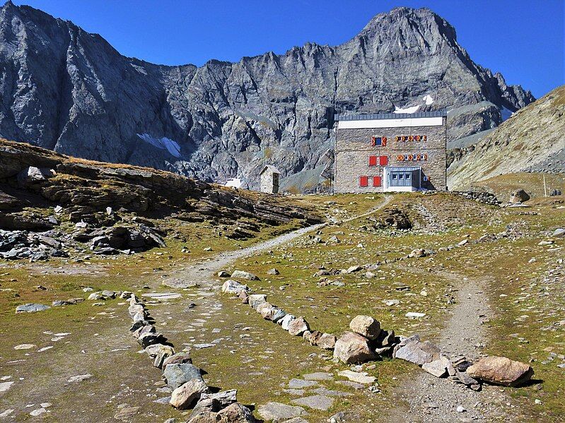
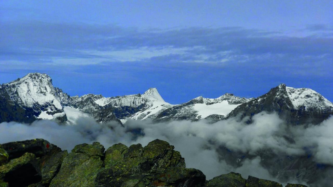
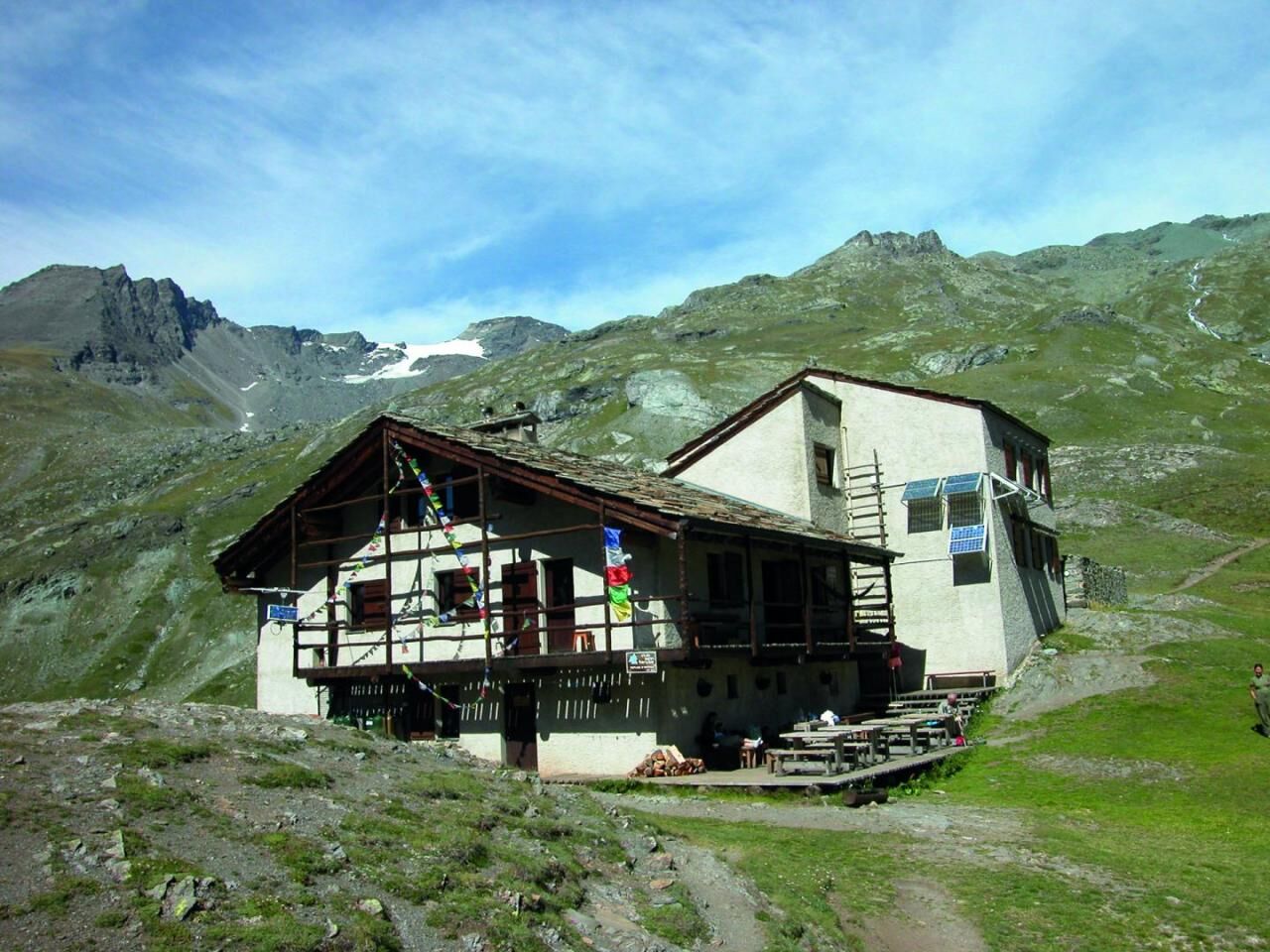

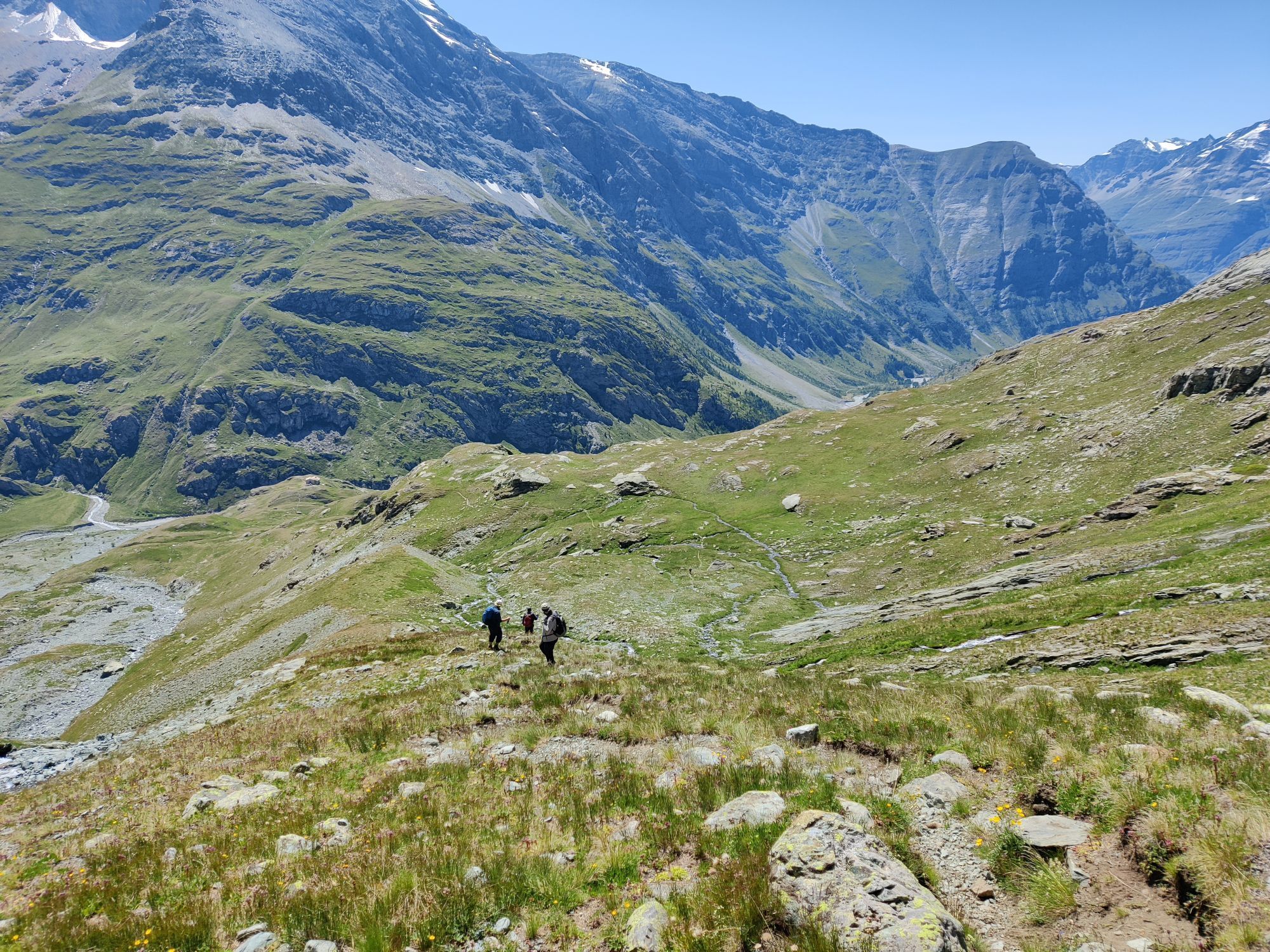
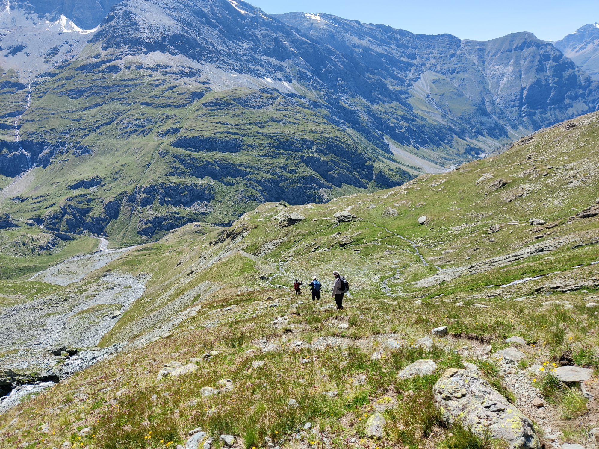
From the Avérole Refuge, go up the grassy slope, passing the crag until you approach the orographic right of the Rio Ruisseau du Veillet. Continue until you reach a clearly visible frontal moraine near which you cross the stream. The path goes up the moraine until it reaches a small crag of rocky steps (2850 m) where it passes back onto the right bank of the stream. The crossing may require some attention if the river swells. The track climbs the ridge on very steep morainic terrain until it reaches the basin dominated by the remains of the Des Grandes Pareis Glacier. Here the trail disappears into Clapier Blanc (3030 m). Looking north you notice a saddle behind which the summit part of Albaron appears. To reach it, the route initially continues slightly uphill to an altitude of 3100 m and then lowers slightly into a basin in the direction of some schist crags. The path then makes an arc that leads towards the saddle (the trail signs, to always be visible, are sometimes positioned very high on the boulders). Once you reach the crags, the track becomes visible again and goes up the slope to the left on a triangle. The trail signs lead to the ridge that runs alongside Punta Audras until reaching the Collerin Pass. Here begins the descent on the Italian side on a steep slope of unstable debris. The descent, in the case of frozen or mixed snow, can prove challenging, therefore adequate equipment is advisable (ice ax and crampons). The steep channel descends for about 200 meters and leads to the Pian Gias glacier (3000 m). With due care it is possible to advance without crampons on this glacier which is not too steep and mostly covered in debris, always paying maximum attention to the trail markers on the boulders, especially in case of fog. The descent trail continues in the center of the slope, keeping to the orographic right of the stream that emerges from the glacier until it meets the boulders under the crest of the Rocce delle Russe (2800 m). Here it crosses the stream and runs alongside it, following the moraine downhill until it meets the traces of the path to Ciamarella where it crosses the stream again, returning to the right bank. Having reached the indicator pole, the route leaves the path that descends to Pian della Mussa and follows the track on the right which, with an up and down route halfway up the hillside in 30 minutes, leads to Rifugio Gastaldi. From Rifugio d'Avérole go up the grassy slope, passing the leap until you approach the orographic right of the Rio Ruisseau du Veillet. Continue until you reach a clearly visible frontal moraine near which you cross the stream. The path goes up the moraine until it reaches a small crag of rocky steps (2850 m) where it passes back onto the right bank of the stream. The crossing may require some attention if the river swells. The track climbs the ridge on very steep morainic terrain until it reaches the basin dominated by the remains of the Des Grandes Pareis Glacier. Here the trail disappears into Clapier Blanc (3030 m). Looking north you notice a saddle behind which the summit part of Albaron appears. To reach it, the route initially continues slightly uphill to an altitude of 3100 m and then lowers slightly into a basin in the direction of some schist crags. The path then makes an arc that leads towards the saddle (the trail signs, to always be visible, are sometimes positioned very high on the boulders). Once you reach the crags, the track becomes visible again and goes up the slope to the left on a triangle. The trail signs lead to the ridge that runs alongside Punta Audras until reaching the Collerin Pass. Here begins the descent on the Italian side on a steep slope of unstable debris. The descent, in the case of frozen or mixed snow, can prove challenging, therefore adequate equipment is advisable (ice ax and crampons). The steep channel descends for about 200 meters and leads to the Pian Gias glacier (3000 m). With due care it is possible to advance without crampons on this glacier which is not too steep and mostly covered in debris, always paying maximum attention to the trail markers on the boulders, especially in case of fog. The descent trail continues in the center of the slope, keeping to the orographic right of the stream that emerges from the glacier until it meets the boulders under the crest of the Rocce delle Russe (2800 m). Here it crosses the stream and runs alongside it, following the moraine downhill until it meets the traces of the path to Ciamarella where it crosses the stream again, returning to the right bank. Having reached the indicator pole, the route leaves the path that descends to Pian della Mussa and follows the track on the right which, with an up and down route halfway up the hillside in 30 minutes, leads to Rifugio Gastaldi.
Percorso di alta montagna dove si richiede l'uso di attrezzatura tecnica adeguata: scarponi impermeabilie bastoncini da trekking.
Regarding the route that crosses the Passo del Collerin pass in the direction of Pian Gias and Rifugio Gastaldi, maximum attention is advisable when descending from the pass itself due to the presence of debris.
Route that winds through a dip of 6/7 hours starting from the French territory of Rifugio Averole to get to the top of the highest point of the route rapppresented by Passo del Collerin
Obľúbené výlety v okolí
-
4,5
Rocciamelone partedjo dalla Riposa. Mompantero, Piemont/Italien
strednáTuristika 10,6 km -
5,0
The Grand Méan lake via the Evettes circus
ťažkéTuristika 13,6 km -
5,0
BALME Green Lakes and Lago Paschiet
strednáTuristika 7,51 km -
5,0
BALME Arnas Ring - Pian della Mussa
ťažkéTuristika 13,6 km -
USSEGLIO Lake Nero from Lake Malciaussia
svetloTuristika 4,79 km -
5,0
LEMIE Ovarda Lakes loop
ťažkéTuristika 15,9 km -
4,7
High Way of the Lanzo Valleys | Stage 6 Tazzetti Refuge - Lake of Malciaussia
strednáTuristika 5,49 km -
5,0
Alta Via delle Valli di Lanzo | Stage 4 Rifugio Citt di Ciri - Rifugio Cibrario
ťažkéTuristika 12,0 km -
4,0
Hiking at Lake Clair
ťažkéTuristika 6,99 km -
Lake Dres - Ceresole Reale
strednáTuristika 7,24 km
Turistika a stopovanie


Nenechajte si ujsť ponuky a inšpiráciu na ďalšiu dovolenku
Vaša e-mailová adresa bol pridaný do poštového zoznamu.





