
From Oingt to Col du Châtoux - Beaujolais - Oingt - Val d'Oingt
ťažké
Získajte túto prehliadku v mobilnom telefóne
From Oingt to Col du Châtoux - Beaujolais - Oingt - Val d'Oingt
ťažké
Turistika
15,11
km
Naskenujte kód QR a spustite navigáciu v aplikácii bergfex


Turistika a stopovanie





From Oingt to Col du Châtoux - Beaujolais - Oingt - Val d'Oingt
ťažké
Vzdialenosť
15,1
km
Trvanie
05:00
h
Ascent
468
hm
Hladina mora
357 -
743
m
Stiahnutie skladby
From Oingt to Col du Châtoux - Beaujolais - Oingt - Val d'Oingt
ťažké
Turistika
15,11
km
You'll love:
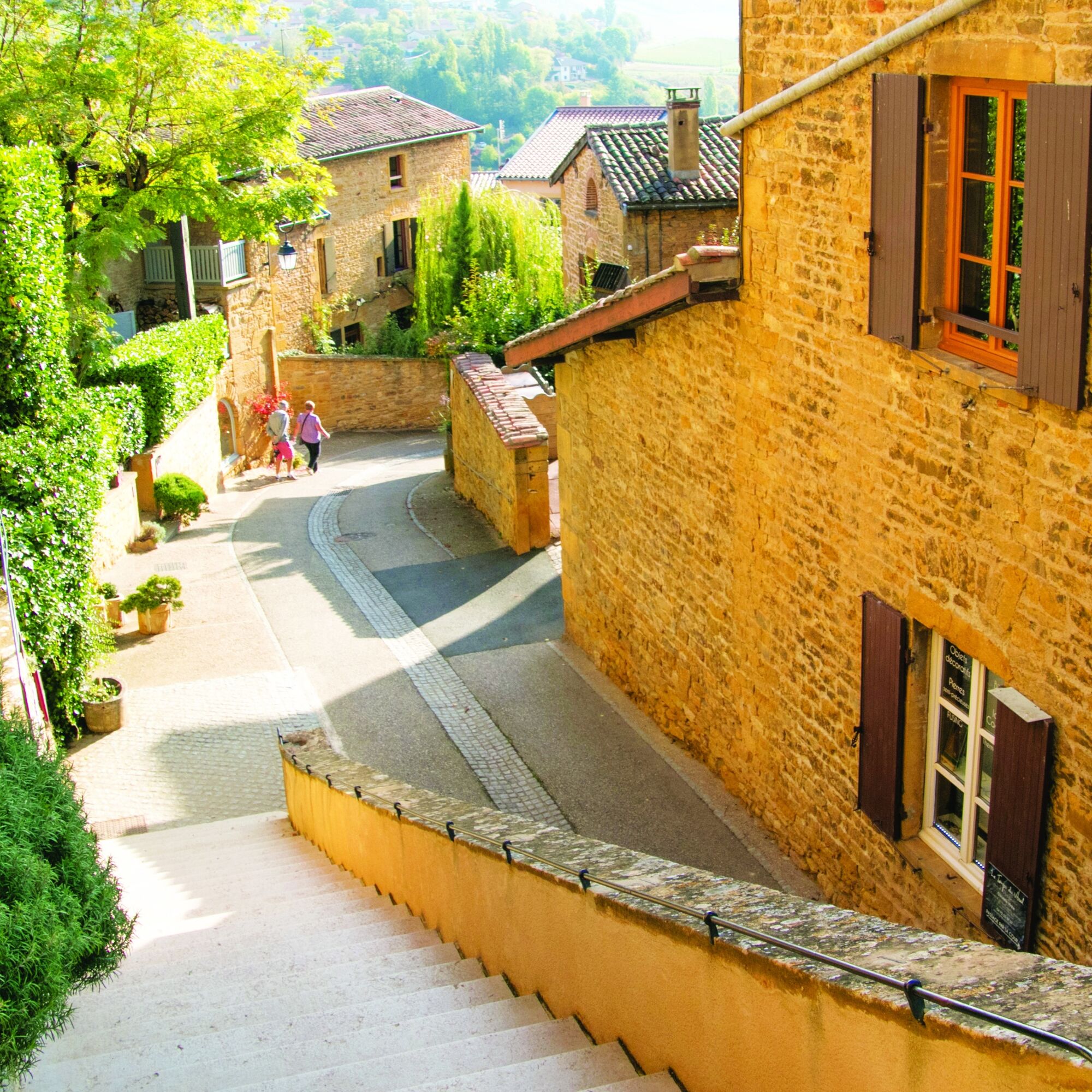
• Oingt, colored with ochre and gold.
• The perfect blend of vegetation and minerals.
• The panoramas: from Saule d'Oingt facing the Alps, from Château de Montmelas and Mont Brouilly. Between...
Opis
You'll love:
• Oingt, colored with ochre and gold.
• The perfect blend of vegetation and minerals.
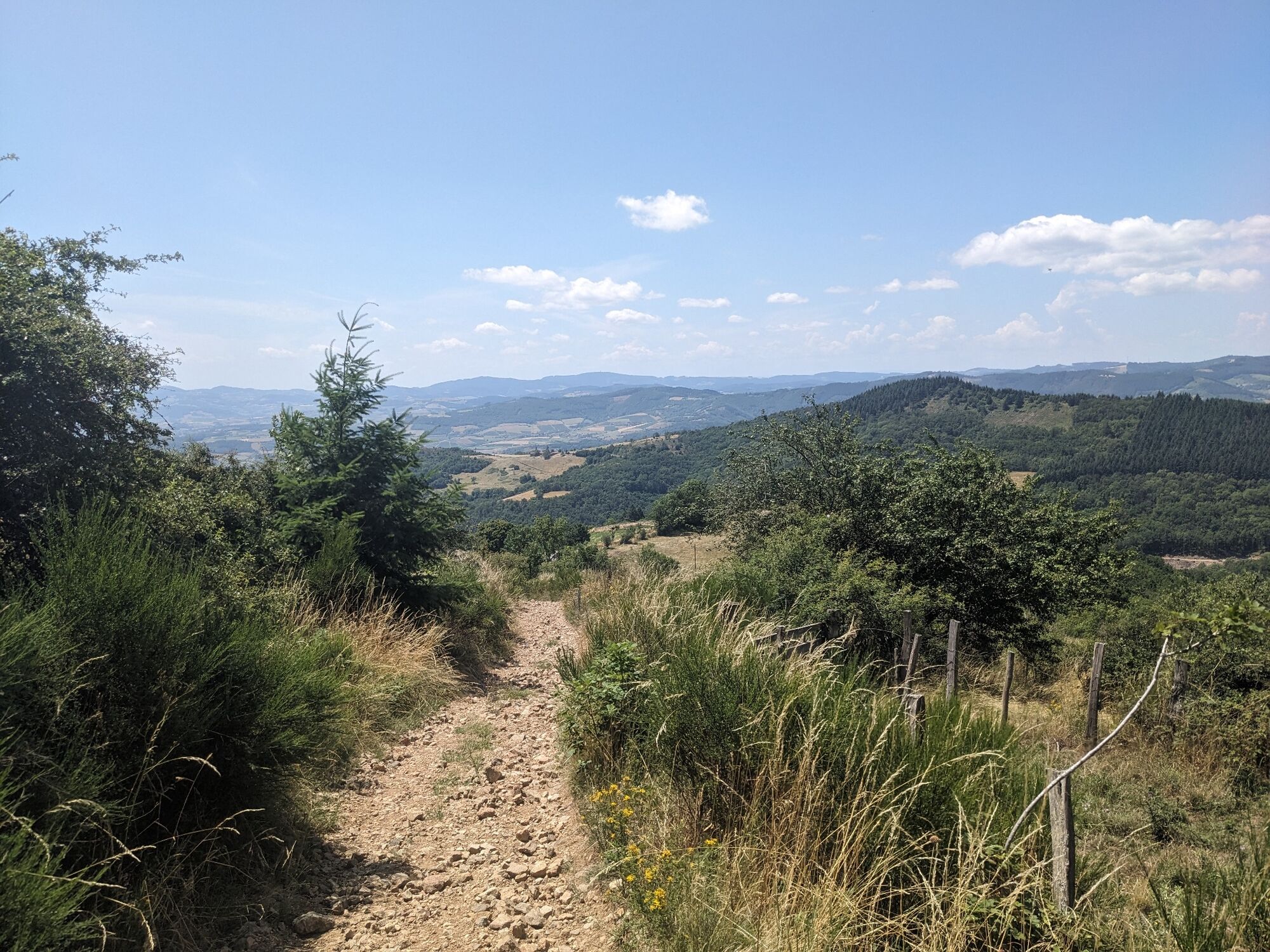
• The panoramas: from Saule d'Oingt facing the Alps, from Château de Montmelas and Mont Brouilly. Between Crêt de la Garde and Les Avenières: to the east of the chapel of Mont Joly in Saint-Laurent-d'Oingt, the villages of Oingt and Bois d'Oingt, to the west, the Lyonnais mountains.
From the top of the Oingt tower, a clear 360° horizon.
• The welcoming spirit of the winemakers to accompany tastings of Beaujolais des pierres dorées.
You'll enjoy it best:
• By admiring the landscape's nuances. In May, meadows are covered with orchids between La Guillardière and Crêt de Remont. • By coming to walk during Oingt's major festivities: the Barrel Organ Festival in early September and Oingt's nativity scenes throughout December at Epiphany.
• By lingering in the gentle countryside at the bottom of the Vervuis Valley.
• Beware of the steep descent after the Sainte-Paule Le Cimetière intersection.
* The orchids are protected; do not pick them.
A bit of history:
Oingt and its surroundings
Throughout the trail, the environment varies without interrupting the harmony between plant and mineral. The turbulent geology of Beaujolais, which has stirred the soil, partly explains the diversity of the environments.
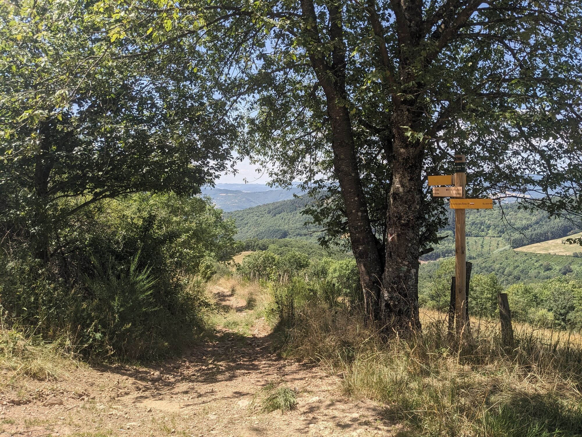
At Saule d'Oingt, the vines disappear, giving way to pastures and moors, with boxwood framing the path. Between late May and early June, orchids grow among the grasses. Then, towards Le Châtoux, the forests take over, and houses built from dark rocks with green highlights evoke the mountains.
After Les Sapins, the vineyards reappear, overlapping with pastoral activity. At Croix du Maury, pinkish walls raised by a row of vertical stones prevent goats from escaping. Old mine shafts also bear witness to the past mining of coal delivered as far away as Saint-Étienne in the Loire.
The hike ends in Oingt, which has retained its appearance of a medieval fortified village. The Nizy Gate, the old castle chapel, and a keep tower still stand as testaments.
• Oingt, colored with ochre and gold.
• The perfect blend of vegetation and minerals.
• The panoramas: from Saule d'Oingt facing the Alps, from Château de Montmelas and Mont Brouilly. Between Crêt de la Garde and Les Avenières: to the east of the chapel of Mont Joly in Saint-Laurent-d'Oingt, the villages of Oingt and Bois d'Oingt, to the west, the Lyonnais mountains.
From the top of the Oingt tower, a clear 360° horizon.
• The welcoming spirit of the winemakers to accompany tastings of Beaujolais des pierres dorées.
You'll enjoy it best:
• By admiring the landscape's nuances. In May, meadows are covered with orchids between La Guillardière and Crêt de Remont. • By coming to walk during Oingt's major festivities: the Barrel Organ Festival in early September and Oingt's nativity scenes throughout December at Epiphany.
• By lingering in the gentle countryside at the bottom of the Vervuis Valley.
• Beware of the steep descent after the Sainte-Paule Le Cimetière intersection.
* The orchids are protected; do not pick them.
A bit of history:
Oingt and its surroundings
Throughout the trail, the environment varies without interrupting the harmony between plant and mineral. The turbulent geology of Beaujolais, which has stirred the soil, partly explains the diversity of the environments.
At Saule d'Oingt, the vines disappear, giving way to pastures and moors, with boxwood framing the path. Between late May and early June, orchids grow among the grasses. Then, towards Le Châtoux, the forests take over, and houses built from dark rocks with green highlights evoke the mountains.
After Les Sapins, the vineyards reappear, overlapping with pastoral activity. At Croix du Maury, pinkish walls raised by a row of vertical stones prevent goats from escaping. Old mine shafts also bear witness to the past mining of coal delivered as far away as Saint-Étienne in the Loire.
The hike ends in Oingt, which has retained its appearance of a medieval fortified village. The Nizy Gate, the old castle chapel, and a keep tower still stand as testaments.
Trasa
Oingt
(527 m)
Dedina
0,1 km
Le Saule d'Oingt
(549 m)
Zúčtovanie
3,0 km
Le Châtoux
(672 m)
Zúčtovanie
6,2 km
Église Sainte-Paule
(507 m)
Miesto uctievania
11,2 km
Sainte-Paule
(508 m)
Dedina
11,3 km
La Picotière
(510 m)
Zúčtovanie
14,4 km
Oingt
(527 m)
Dedina
14,4 km
Trasa
From Oingt to Col du Châtoux - Beaujolais - Oingt - Val d'Oingt
ťažké
Turistika
15,11
km
Oingt
(527 m)
Dedina
0,1 km
La Guillardière
(545 m)
Zúčtovanie
0,1 km
Puits Novel
(563 m)
Koridor/terén
0,5 km
Les Avoreux
(591 m)
Koridor/terén
1,8 km
Le Saule d'Oingt
(549 m)
Zúčtovanie
3,0 km
Petite Terre
(638 m)
Koridor/terén
4,4 km
Chanrion
(690 m)
Koridor/terén
5,0 km
Le Châtoux
(672 m)
Zúčtovanie
6,2 km
Glaizé
(593 m)
Zúčtovanie
8,5 km
Lambert le Haut
(490 m)
Zúčtovanie
10,6 km
Le Favrot
(539 m)
Zúčtovanie
11,0 km
Église Sainte-Paule
(507 m)
Miesto uctievania
11,2 km
Sainte-Paule
(508 m)
Dedina
11,3 km
Polluis
(410 m)
Zúčtovanie
13,0 km
Le Bourg
(536 m)
Koridor/terén
14,3 km
La Picotière
(510 m)
Zúčtovanie
14,4 km
Chez Marguerite
(526 m)
Reštaurácia
14,4 km
Oingt
(527 m)
Dedina
14,4 km
La Guillardière
(545 m)
Zúčtovanie
14,8 km
Autor
Poskytuje Rhône Tourisme
Prehliadku From Oingt to Col du Châtoux - Beaujolais - Oingt - Val d'Oingt zabezpečuje outdooractive.com.



Zariadenie
Set off hiking with a light spirit
Check the weather Shoes and suitable clothing A light backpack A first aid kit Water and food supplies Go at your own pace Read maps, prepare your route
Bezpečnostné pokyny
Emergency phone numbers:
European emergency call number: 112
Medical emergency service (SAMU): 15
Police emergency: 17
Firefighters: 18
Emergency number for deaf and hard of hearing people: 114
Wild animal care center l’Hirondelle: 04 74 05 78 85
French office for biodiversity: 04 74 69 49 32
Informácie o príchode
Príchod
45 min from Lyon, take the A6 motorway.
Parkovanie
At the starting point
Ďalšie informácie a tipy
Ďalšie informácie
APIDAE Tourism data updated on 23/03/2023 by "Rhône Tourisme".
An error on this page? Write to the owner mentioning these references:
Sheet name: From Oingt to the Châtoux Pass - Beaujolais - Oingt - Val d'Oingt | Sheet identifier: 6029503 | URL (link) of this Outdooractive page.
An error on this page? Write to the owner mentioning these references:
Sheet name: From Oingt to the Châtoux Pass - Beaujolais - Oingt - Val d'Oingt | Sheet identifier: 6029503 | URL (link) of this Outdooractive page.
Zatiaľ žiadne recenzie
Obľúbené výlety v okolí
-
The forest of Flachère - Beaujolais - Légny
svetloTuristika 6,68 km -
Hiking on the Voie du Tacot
ťažkéTuristika 77,0 km -
La forêt de la Cantinière - Beaujolais - Saint-Cyr-le-Châtoux
svetloTuristika 11,3 km -
Porte des Pierres Dorées - Beaujolais - Jarnioux
svetloTuristika 14,8 km -
De l’Aze à l’Ergues - Beaujolais Vert - Claveisolles
svetloTuristika 13,0 km -
Circuit de découverte du patrimoine
svetloTuristika 2,19 km -
The forest of Brou - Beaujolais - Dième
svetloNordic Walking 10,5 km -
The golden stones - Between Pierres Dorées and Val d’Azergues - Loop 7.4
ťažkéCestný bicykel 57,6 km -
Buisante - Beaujolais - Pommiers
svetloTuristika 8,09 km -
The Cantinière forest
svetloTematická trasa 2,96 km
Turistika a stopovanie

Viac ako 550.000 návrhov výletov, podrobné mapy a intuitívny plánovač trás robia z aplikácie povinnú výbavu pre všetkých nadšencov prírody.

Nenechajte si ujsť ponuky a inšpiráciu na ďalšiu dovolenku
Prihlásiť sa k odberu noviniek
Chyba
Vyskytla sa chyba. Prosím, skúste to znova.
Ďakujeme za vašu registráciu
Vaša e-mailová adresa bol pridaný do poštového zoznamu.
Zájazdy po celej Európe
Rakúsko
Švajčiarsko
Nemecko
Taliansko
Slovinsko
Francúzsko
Holandsko
Belgicko
Poľsko
Lichtenštajnsko
Česko
Slovensko
španielsko
Hrvaška
Bosna a Hercegovina
Luxembursko
Andorra
Portugalsko
Island
Spojené kráľovstvo
Írsko
Grécko
Albánsko
Severné Macedónsko
Malta
Nórsko
Čierna Hora
Moldavsko
Kosovo
Maďarsko
San Maríno
Rumunsko
Estónsko
Lotyšsko
Bielorusko
Cyprus
Litva
Srbsko
Bulharsko
Monako
Dánsko
Švédsko
Fínsko





