


To Enz and Eyach
From Dobel, go down along the "Reischacher Berg" to the "Eyachmühle". After a steep climb, we pass the "Spitzhütte", before the "Dobler Sträßle" leads steeply down to Bad Wildbad.
On the "Enz Valley Cycle...
From Dobel, go down along the "Reischacher Berg" to the "Eyachmühle". After a steep climb, we pass the "Spitzhütte", before the "Dobler Sträßle" leads steeply down to Bad Wildbad.
On the "Enz Valley Cycle Path", we pass Calmbach and Höfen to the "Eyachbrücke" with rest area. The path continues to the Neuenbürg district "Rotenbach", where we leave the "Enz Valley Cycle Path" to reach the "Schwanner Warte" on a steeply ascending path.
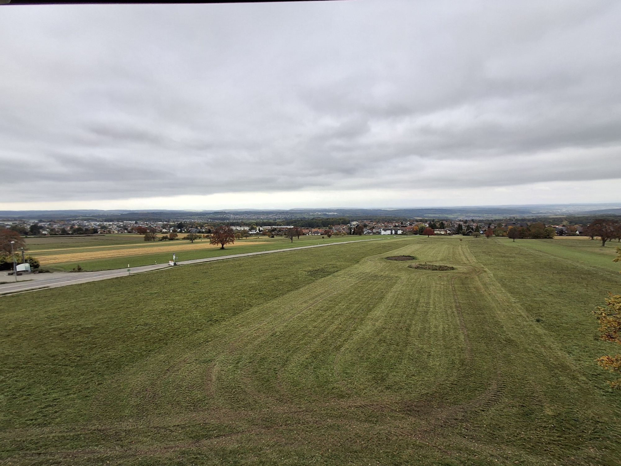
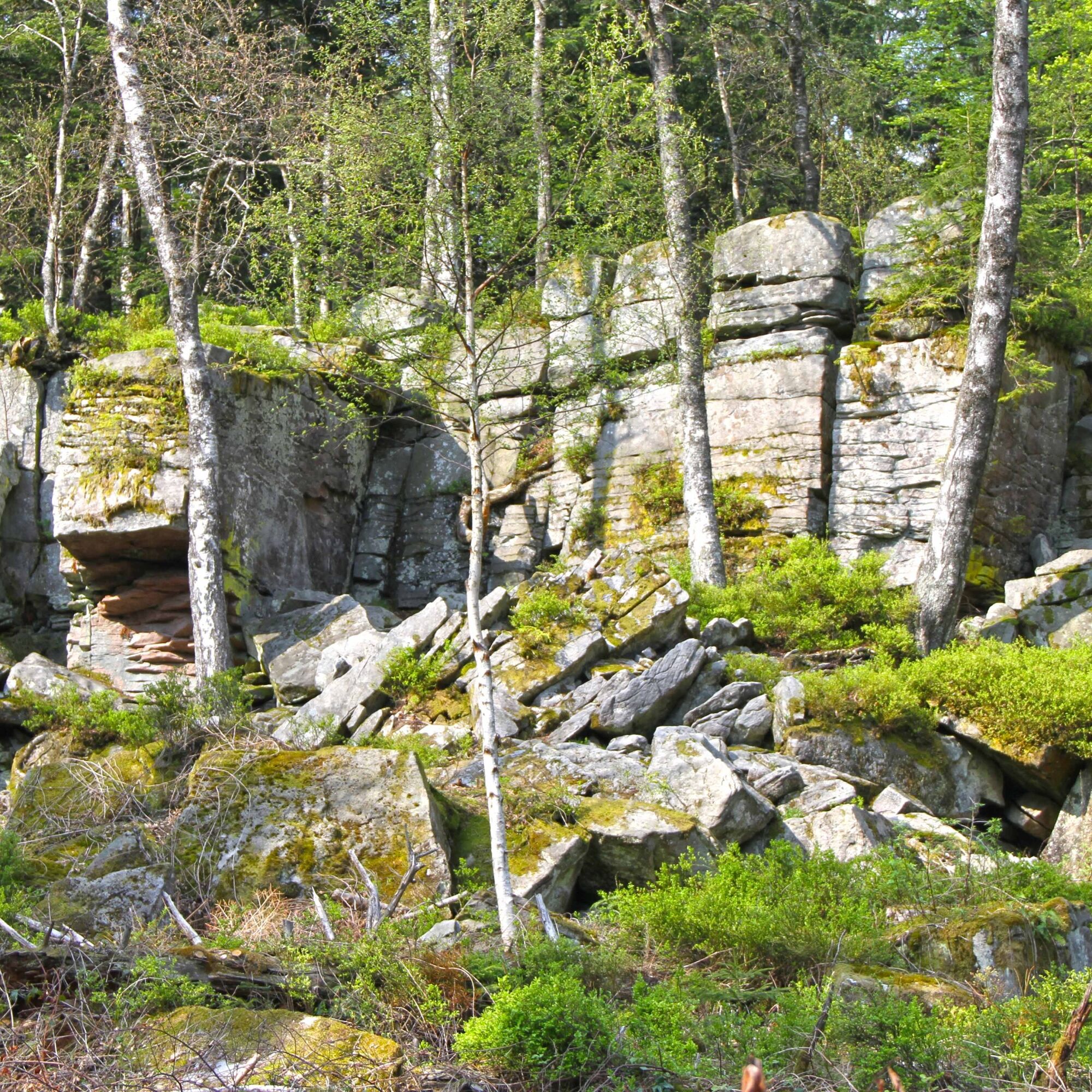
Here we are rewarded with a magnificent view of the Albgau and the Pfinzgau. Via a section of the "old Westweg", past the rock formation "Volzemer Steine", we return to Dobel.
From Dobel, we reach wide forest paths above the Mannenbach valley and along the ridge of the "Reischacher Berg" down to the "Eyachmühle".
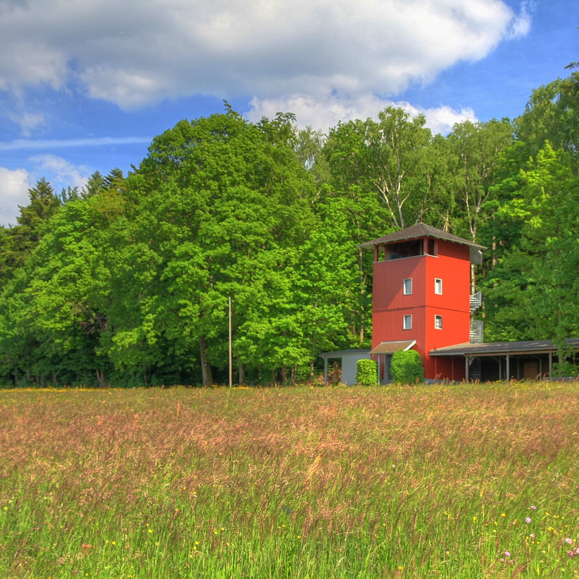
The path leads over the bridge always uphill towards Wildbad to the "Spitzhütte" and the densely forested plateau of the "Oberer Eiberg". At the fork at "Hohe Dohle", a detour to the "Wetterfahnen-Hütte" (0.6 km), from which there is a magnificent view, is possible.
Past the "Paulinenhöhe", we descend steeply into the urban area of Bad Wildbad. Still above the station, we turn left from "Rennbachstraße" into "Paulinenstraße" to reach the railway crossing in Calmbach along the continuing "Alte Calmbacher Str." on the left side of the Enz.
Within Calmbach, we have to cover a few meters on the heavily trafficked "Wildbader Straße" (state road L 350) to reach the memorial and join the "Enz Valley Cycle Path".
From Calmbach, we follow the "Enz Valley Cycle Path" to Höfen, to the "Eyachbrücke" (be careful crossing the state road L 340) to the Neuenbürg district "Rotenbach". Shortly after the confluence of the "Rotenbächle" into the "Enz", we leave the "Enz Valley Cycle Path".
On the "Schwabstichweg" and the "Rotenbachweg", we reach the car park on state road L 339. On the "Sautriebweg" leading right into the forest, we reach the water reservoir "Wolfsgrube". There we turn left into "Eichwaldweg" towards "Schwanner Warte".
When crossing the L339, we are extremely careful. Under the "Friedenslinde", we can refresh ourselves for the climb towards Dobel. On the "old Westweg", we come almost to the southwestern outskirts of Dennach and follow this on the "Neusatzer Sträßle". About 300 m before a forest junction, the "old Westweg" continuing as a path branches off, but we stay on the forest lane until the junction and only then turn towards "Dreimarkstein".
We cross the L 340 with the utmost caution and are back on the "Westweg", which leads us past the "Volzemer Steine" back to Dobel. Past the horse stud, we return to the Kurhaus via "Wildbader Straße".
Beware when crossing the L 350 in Calmbach and the L 340 in the "Eyachbrücke" area.
This also applies when crossing the L 339 at Schwanner Warte and especially when crossing the unrestricted-speed L 340 in the "Dreimarkstein" area.
On downhill sections, there can be danger from rough gravel surfaces or fallen branches.
From the Karlsruhe area via Bad Herrenalb and the L340.
From the Pforzheim area and the Calw area via the Enz Valley (B294), at the Eyach bridge onto the L340
Südwestbus line 719 (Bad Wildbad - Bad Herrenalb)
Südwestbus line 716 (Pforzheim - Bad Herrenalb)
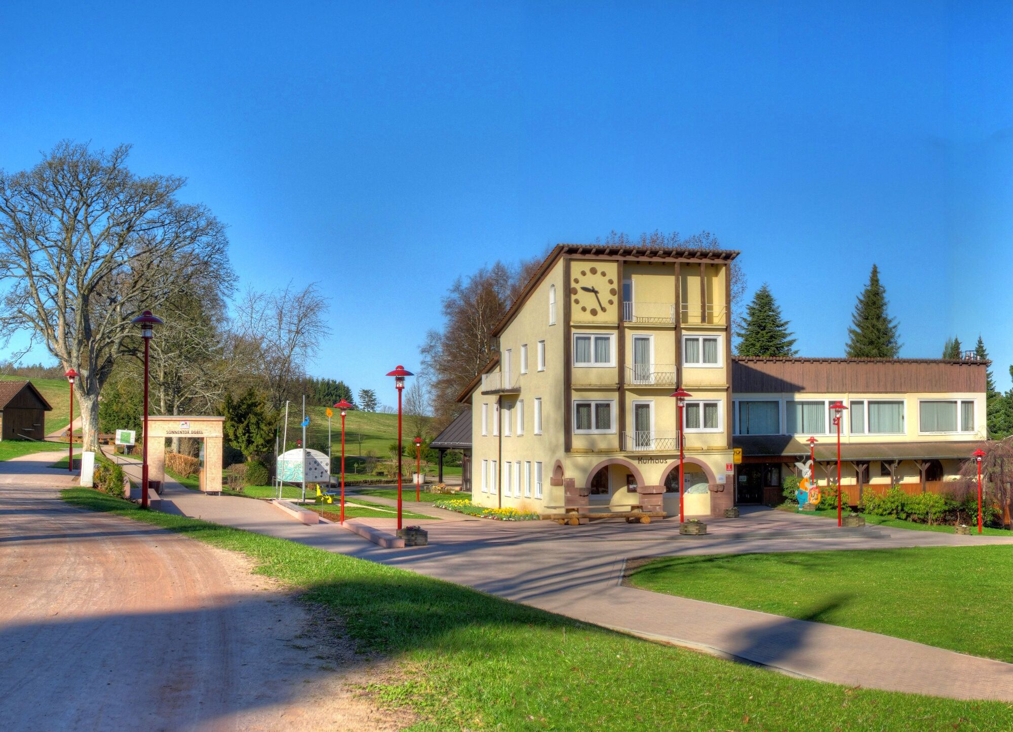
Start and finish is the car park at Dobel Kurhaus with e-bike rental and e-bike charging station
Before the uphill climb from Schwanner Warte to Dobel, you should refresh yourself on a terrace of the 3 cafes/restaurants on the forest edge above Schwann or at least enjoy the view with a cappuccino.
Obľúbené výlety v okolí
-
4,7
Hiking through the Monbach Gorge in search of the kingfisher
strednáTuristika 10,5 km -
5,0
Wild romantic Monbach Valley
svetloTuristika 6,25 km -
5,0
Circular route via spring nature trail and Wurstberg
svetloTuristika 8,08 km -
4,7
Eyach round
strednáTuristika 7,84 km -
4,7
Through the wild romantic Schweinbachtal to the Bruderhöhle cave
strednáTuristika 13,8 km -
3,0
Dobel High-Altitude Route
strednáTuristika 11,8 km -
4,0
Kaltenbronn Circular Route No. 1 - Wildsee Moor Loop
svetloTuristika 8,30 km -
4,3
Nature experience tour Kaltenbronn
strednáTuristika 14,2 km -
4,0
Spaziergang zum Bernsteinfelsen
strednáTuristika 14,5 km -
4,8
Weisenbacher Steig (Rechts der Murg)
strednáTuristika 17,6 km
Turistika a stopovanie


Nenechajte si ujsť ponuky a inšpiráciu na ďalšiu dovolenku
Vaša e-mailová adresa bol pridaný do poštového zoznamu.