


Helfenstein round
Úroveň náročnosti: T2
Geislingen is nestled in a beautiful landscape, surrounded by the heights of the Swabian Alb. The Helfenstein castle ruins and the Ödenturm are attractive hiking destinations and wonderful viewpoints....
Geislingen is nestled in a beautiful landscape, surrounded by the heights of the Swabian Alb. The Helfenstein castle ruins and the Ödenturm are attractive hiking destinations and wonderful viewpoints. The historic old town with its half-timbered houses and idyllic corners invites discovery and lingering.
Anyone who wants to appreciate the value of the landscape and the charms of the "five valleys" should take time for one or more hikes around the town: wonderful viewpoints like the Ostlandkreuz, the Tegelberg or the Himmelsfelsen invite you to rest, maybe also to contemplate what creation has bestowed on us.
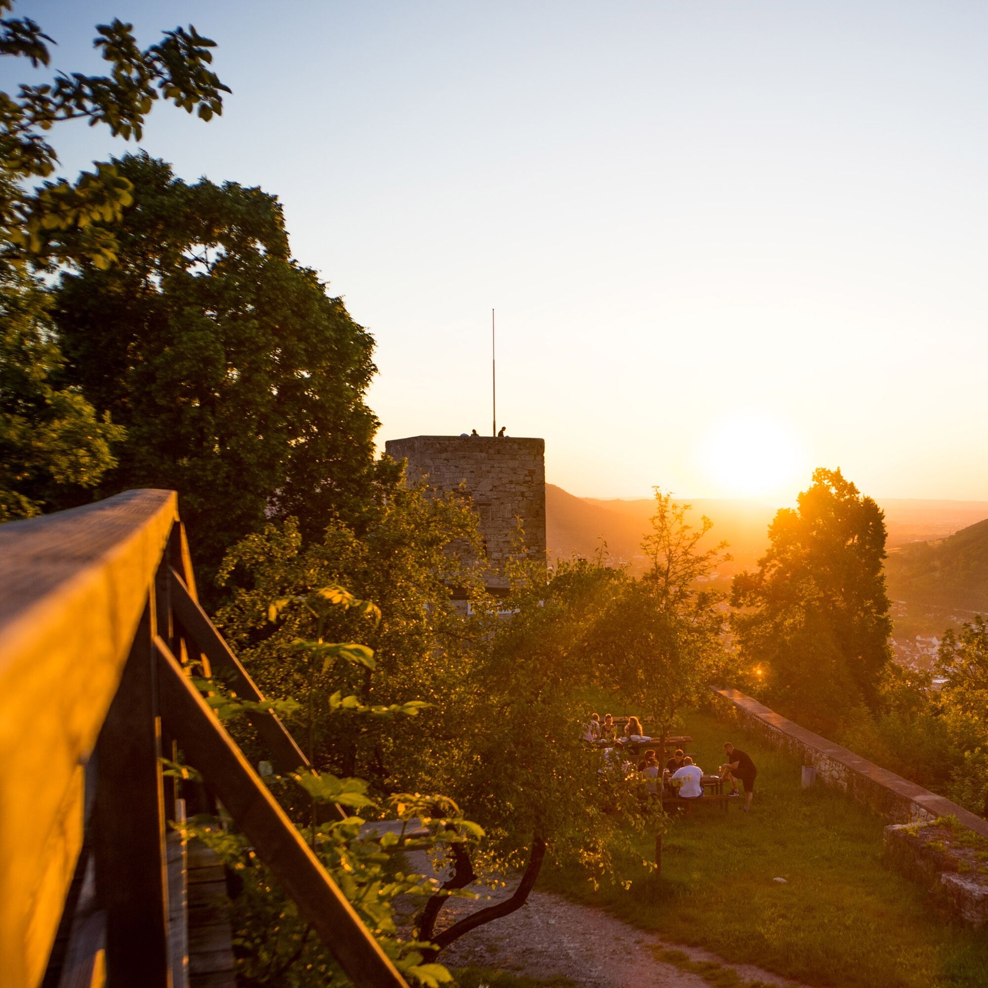
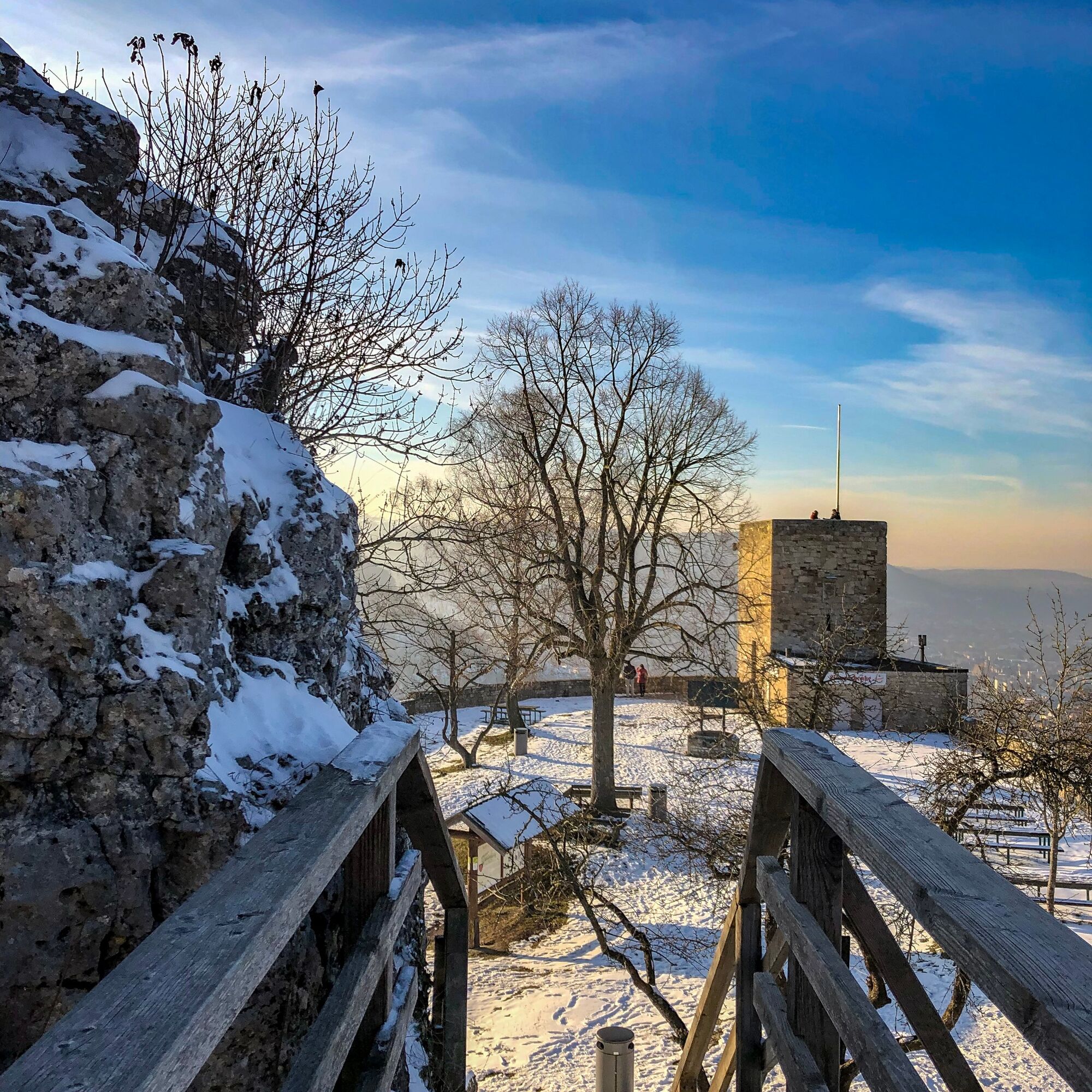
The Helfenstein castle dates back to the 11th century and served to monitor and control traffic from the Filstal to the Alb plateau. The castle was used by the Counts of Helfenstein, who at their peak owned a large area between Geislingen, Heidenheim, Blaubeuren and Wiesensteig. In the immediate vicinity of the castle, the Ödenturm was built on an artificially created plateau. The exact date of construction is not recorded. It also served as a watchtower for Geislingen after the castle was abandoned and demolished. The solitary tower was burned down several times after lightning strikes. Today visits are possible.
City of Geislingen an der Steige – Information Point in the Old Customs House
Hauptstrasse 24 | 73312 Geislingen an der Steige
07331 24 279 | infopunkt@geislingen.de | www.geislingen.de


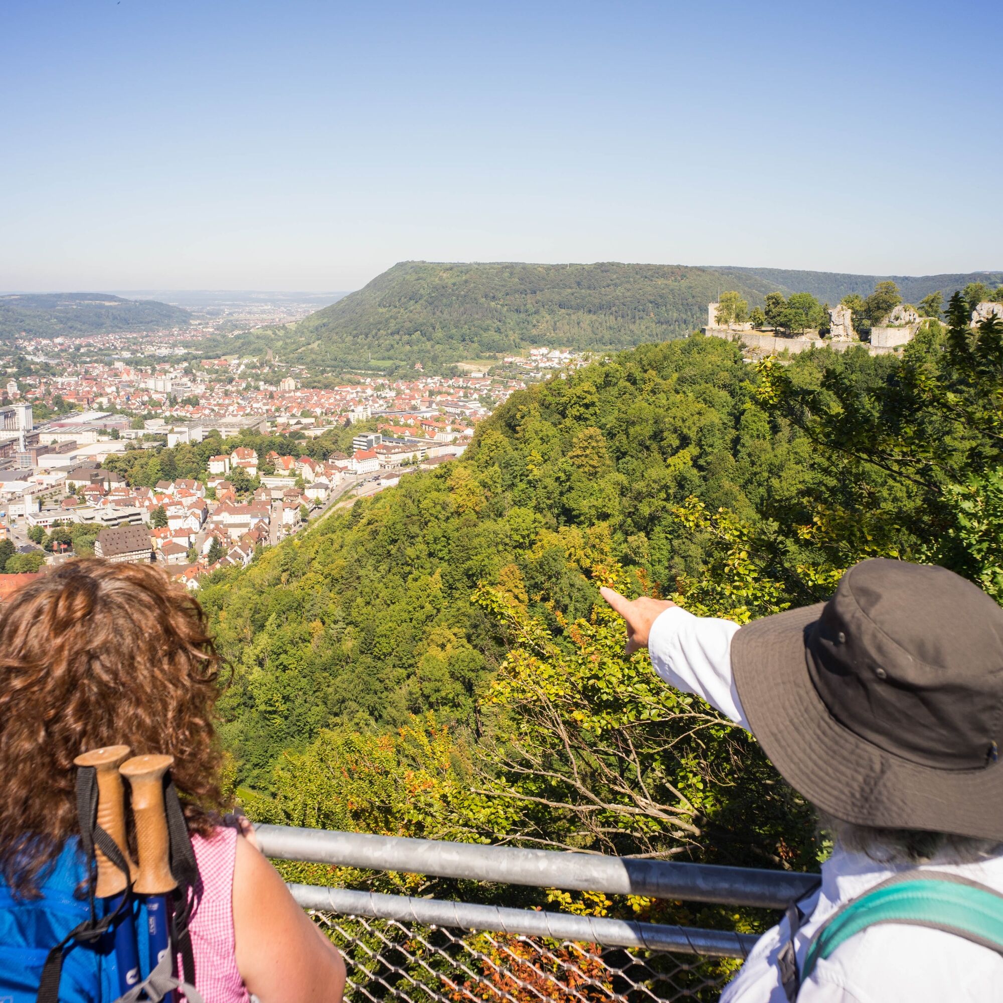

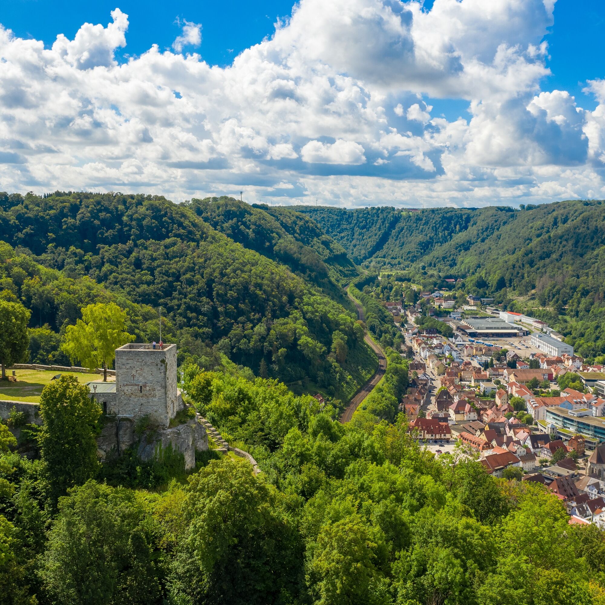
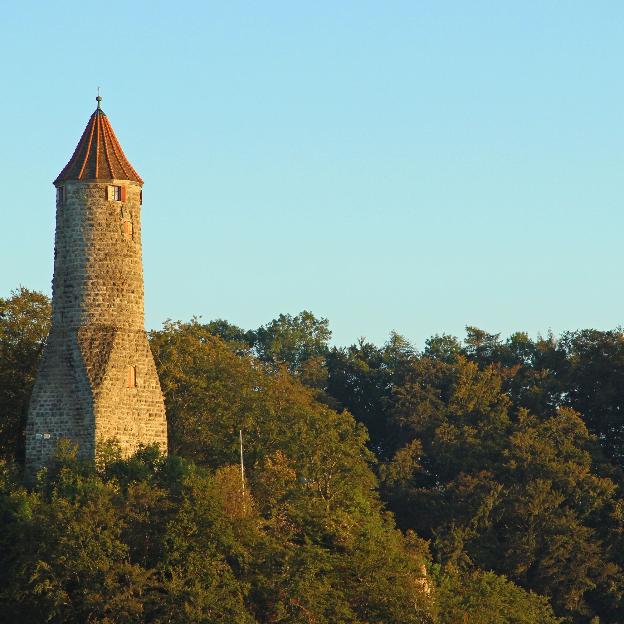
On the 4.4 km long route, you pass the popular landmarks of Geislingen an der Steige, the Helfenstein castle ruins and the Ödenturm.
The starting point of the route is at Geislingen station. After crossing the tracks, we turn right and walk along the old Weilersteige through the forest uphill to the Helfenstein castle ruins. From here you enjoy a stunning view over the five-valley town. On Sundays and public holidays from April to October, as well as on Saturdays with good weather, the castle tavern in the ruins is open. It continues along the Alb edge past the Geislingen district of Weiler to the Ödenturm, from where new perspectives of the wide valley open up again. From there, we return to the old town via natural forest paths and striking rock formations, which invites you to linger with its historic half-timbered houses, the cozy pedestrian zone and a wide range of gastronomy.
Áno
Wear sturdy, non-slip footwear and weather-appropriate clothing. A backpack with water, snacks and a first aid kit is recommended.
When wet, some paths can be slippery and dangerous. Watch your step and use walking sticks for stability if necessary.
Car
You can reach Geislingen an der Steige via the B10 Stuttgart - Ulm and via the A8 Stuttgart - Munich exits Mühlhausen i. Täle or Merklingen
Take the RE 5 or MEX 16 from Stuttgart or Ulm to the Geislingen/Steige station. After a few meters on foot, the route starts directly beside the station.
The circular timetable can be found at: www.vvs.de/fahrplan
Parking facilities at the start/end point Geislingen (Steige) station
additional parking facilities
Helfenstein car park
T2
Respectful coexistence in the Göppingen district.
Code of conduct:
Respect path closures and the quiet zones developed in the recreational path concept. Leave no traces such as litter or animal droppings and treat your path carefully. Act thoughtfully and considerately. Adapt your behavior to the situation. Safety comes first. Respect other users of forest and fields. Consider animals and plants. Plan ahead and use daylight. Try to avoid dawn and dusk. Observe the prohibition on entering agricultural areas during the growing season. Stay on marked paths and avoid forest edges so that wild animals can better get used to humans.More information at ruecksicht-macht-wege-breiter.de
Obľúbené výlety v okolí
-
4,5
Löwenpfad "Orchideenpfad" - Herbs, Pasqueflower and Juniper Heathlands
strednáTuristika 9,33 km -
5,0
Löwenpfad "Heldentour" - The king stage of the Löwenpfade
ťažkéTuristika 23,6 km -
4,4
Löwenpfad "Geislinger Felsen-Tour" - up and down through the Eybach valley
strednáTuristika 10,8 km -
4,5
Löwenpfad "Weitblick-Tour" - High up and far-reaching view
ťažkéTuristika 12,0 km -
4,7
Löwenpfad "Filstalgucker" - views from the heart of the Filstal valley
strednáTuristika 13,0 km -
3,7
Löwenpfad "Wasserberg-Runde" - pure panorama and typical Swabian Jura landscapes
ťažkéTuristika 12,0 km -
3,5
Lion trail "Messelberg tour" - hiking with impressive views
strednáTuristika 7,72 km -
4,3
Lion Trail "Steigen Tour" - Along the Swabian construction of the century
ťažkéTuristika 16,1 km -
3,8
Lion trail "Ave-Weg" - A touch of pilgrimage on the Albtrauf
strednáTuristika 8,65 km -
1,0
Nordalbrunde
strednáTuristika 4,76 km
Turistika a stopovanie


Nenechajte si ujsť ponuky a inšpiráciu na ďalšiu dovolenku
Vaša e-mailová adresa bol pridaný do poštového zoznamu.