


Raichberg route in Hechingen
The hike suitable only for experienced connects the gentle Alb foreland with numerous orchards with the rough, barren high plateaus of the Alb. From gentle to rough, several altitude meters are overcome...
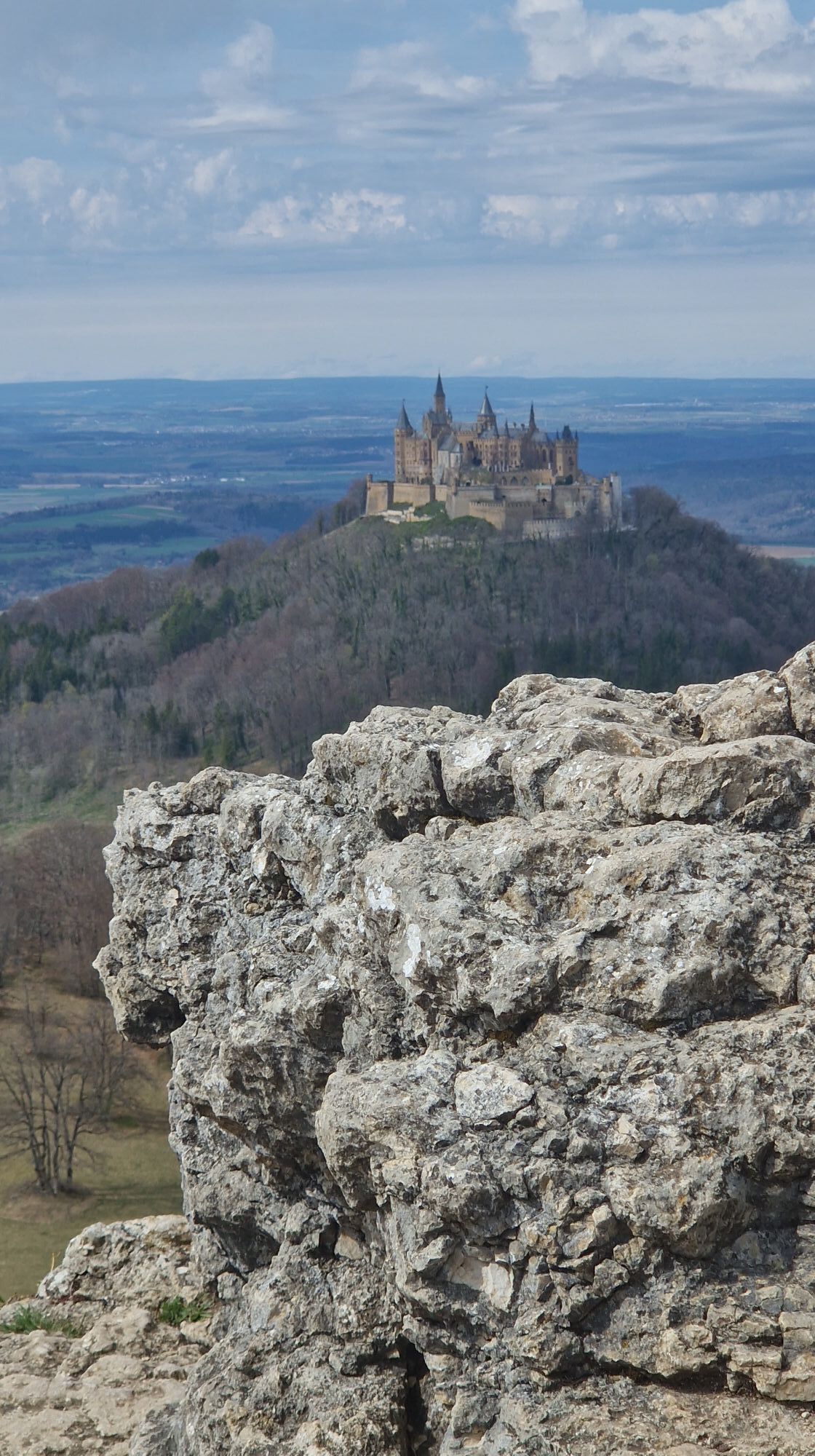
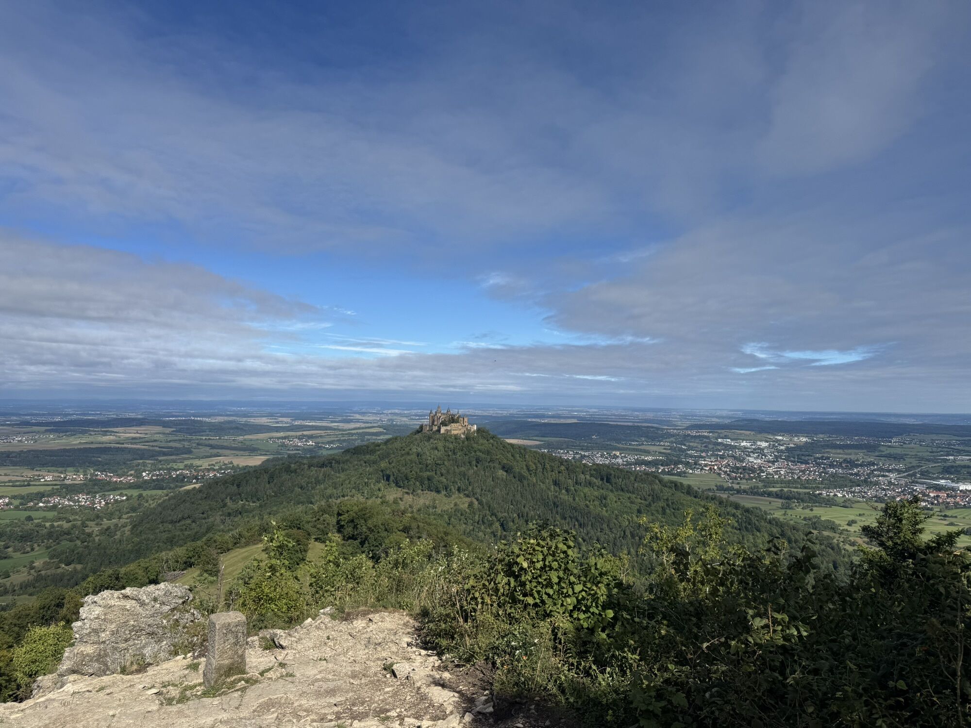
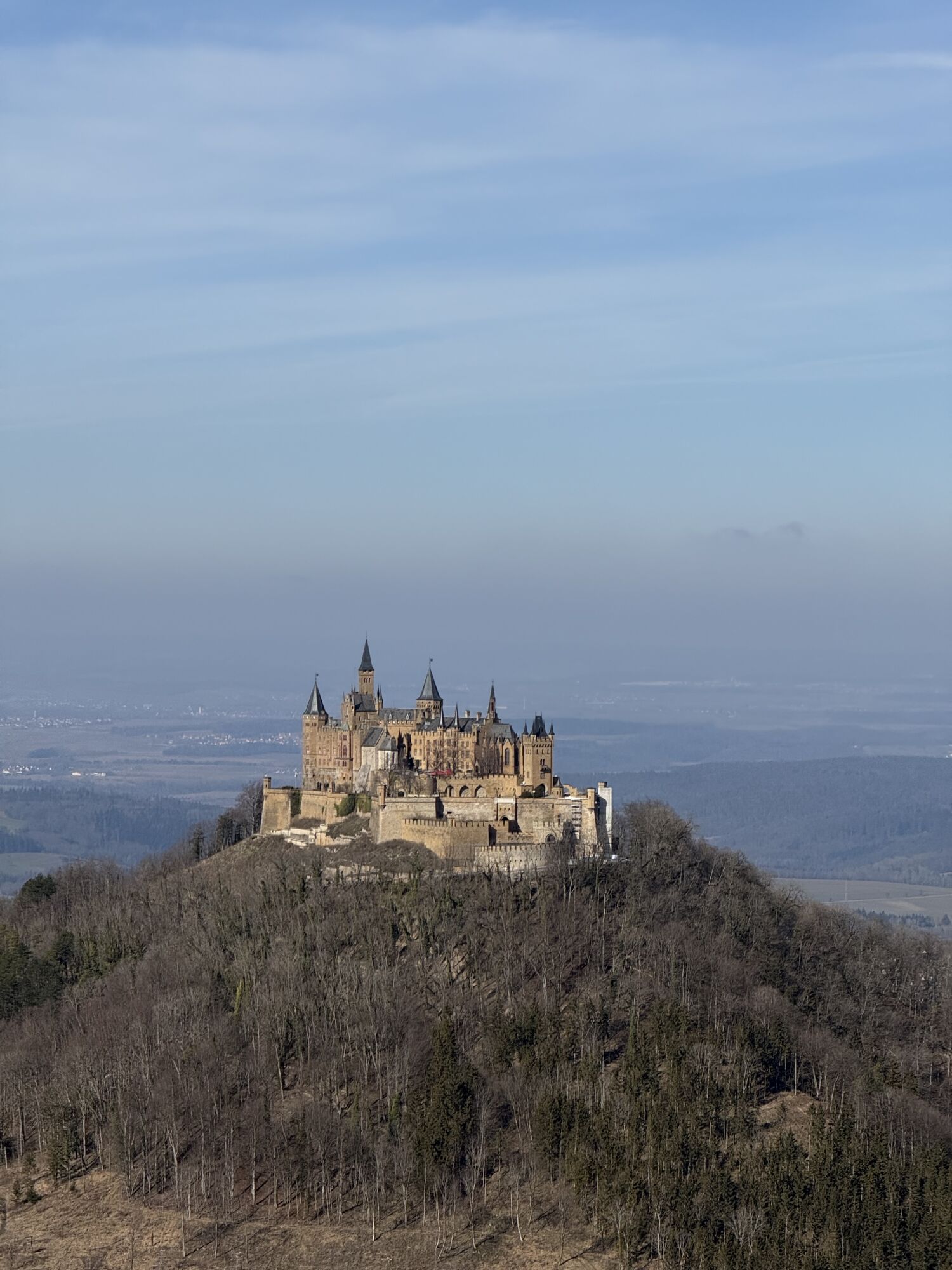
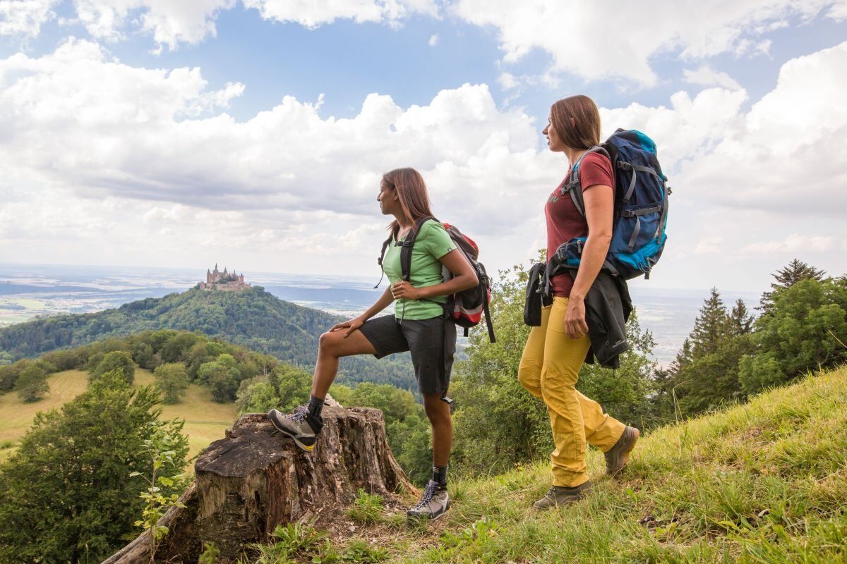
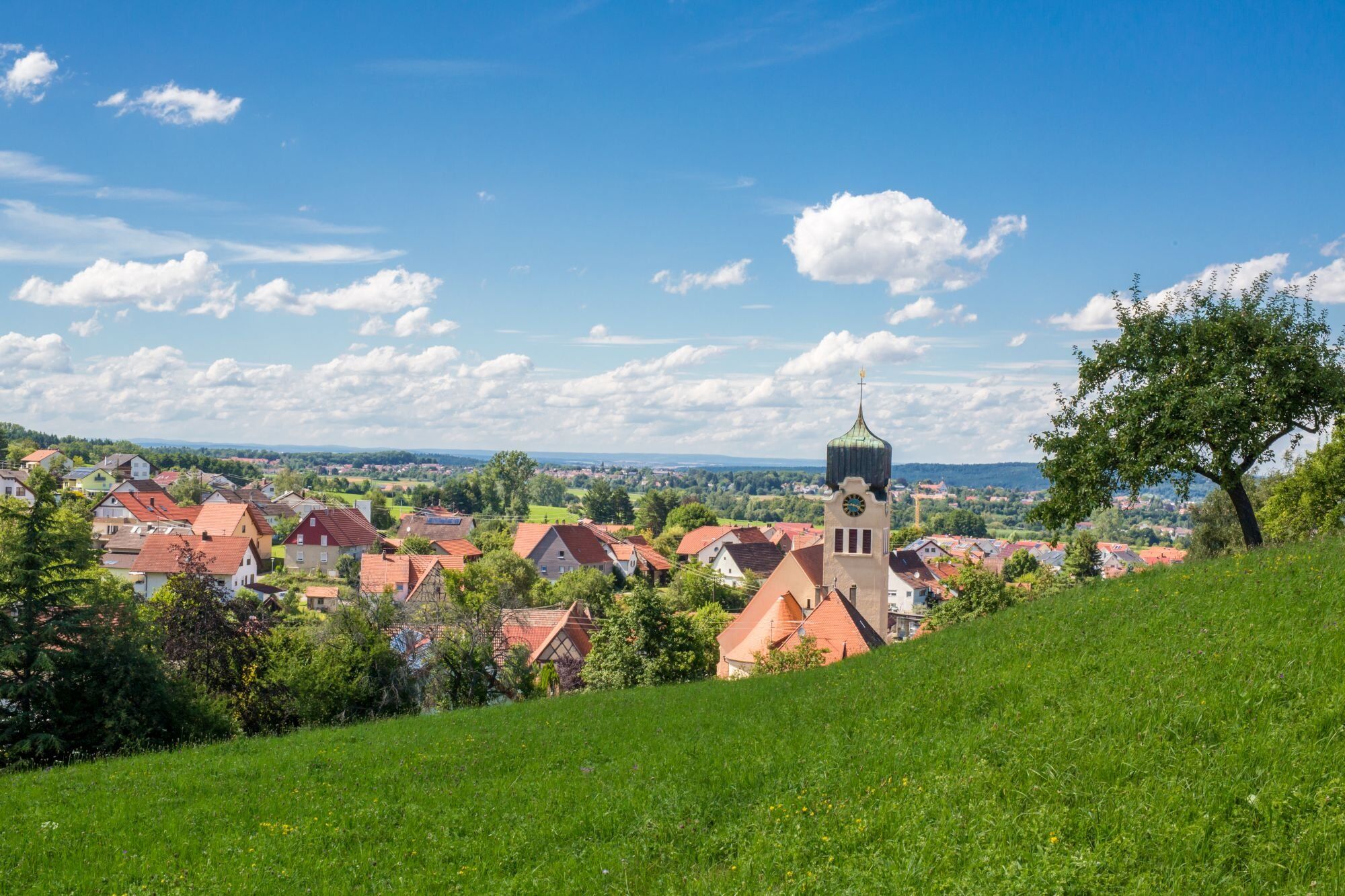
The hike suitable only for experienced connects the gentle Alb foreland with numerous orchards with the rough, barren high plateaus of the Alb. From gentle to rough, several altitude meters are overcome on narrow paths through wooded Alb escarpments. The magnificent views from the escarpment to Hohenzollern Castle and Hechingen including districts, to the Neckar valley and the Black Forest make up for the effort.
The pilgrimage church "Maria Zell" is another highlight of the route. On wildly romantic paths, through almost untouched slopes, past massive stone giants back into the valley floors, a barbecue area invites you to relax comfortably. There you can review the day's work. Accompanied by the element water, return to the starting point.
Alternative parking options:
Car park Bollemer WasenBarbecue areas:
Bollemer Wasen Nägelehaus Schumacher Hut
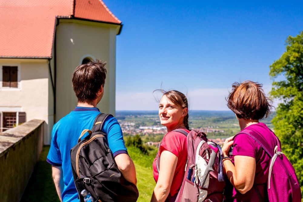
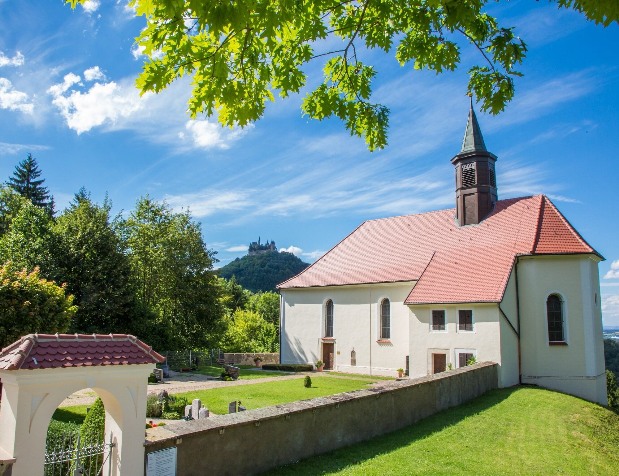
From the Hüttenwiesen hiking car park, first follow the paved road to the left towards the Boll district to the intersection where the pilgrimage church "Maria Zell" is signposted. Follow this little road slightly uphill. At the Dorfblick viewpoint, with views of Boll or optionally the Hohenzollern Castle towering above us, turn left onto a meadow path. Arriving at the Bollemer Wasen barbecue area, march past the lower car park of the Pilgrimage Church Maria Zell and steeply climb the Stations of the Cross path up to the pilgrimage church.
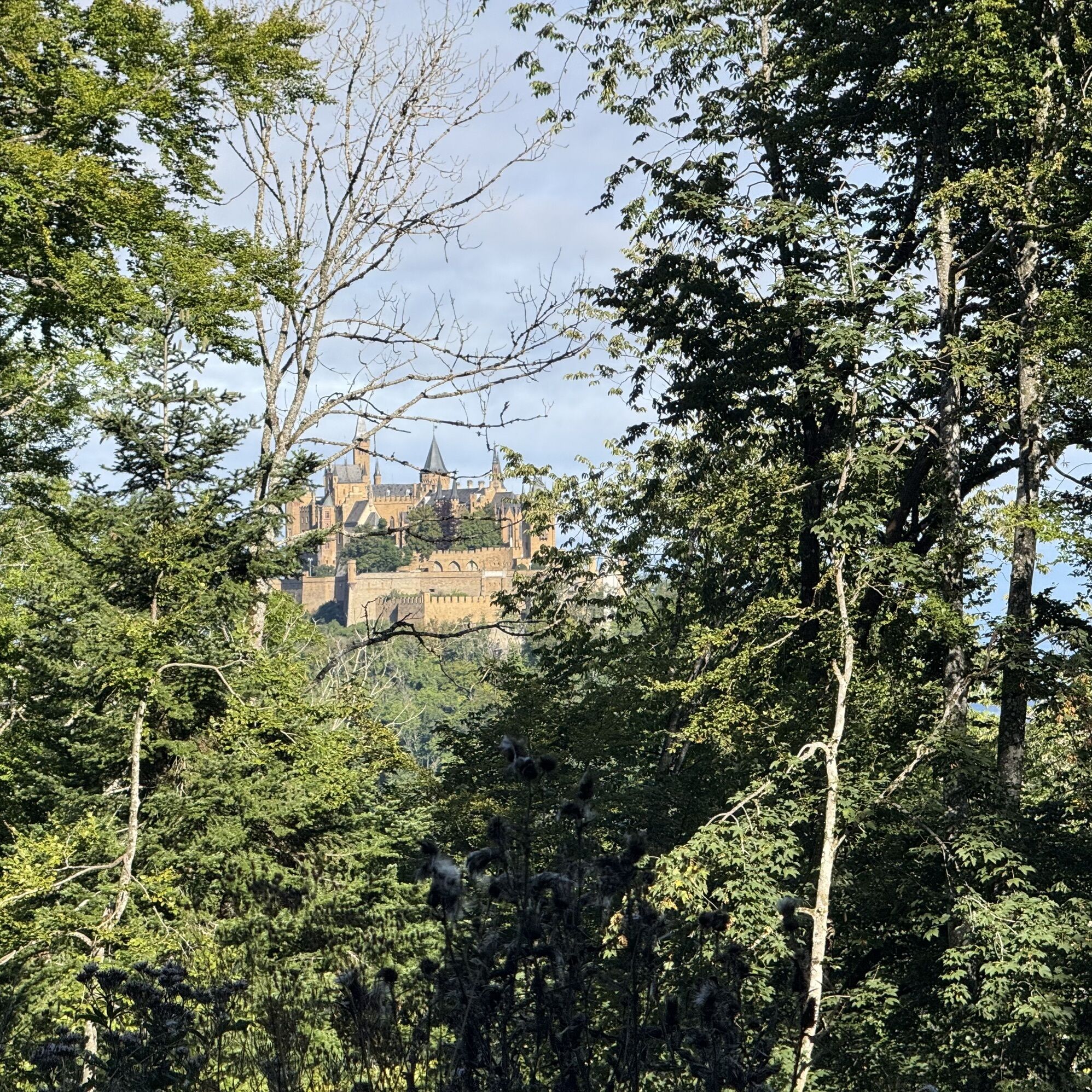
If you think the climb is over, you're mistaken! You will have to catch your breath again before heading over a narrow, continuously ascending zigzag path past the ski hut towards the Zeller Horn. The climb is a small challenge, but you can already guess what awaits you at the top: There it is, already flashing between the trees – Hohenzollern Castle. You made it, you arrived at the escarpment, where you are rewarded with the probably best-known view of the castle.
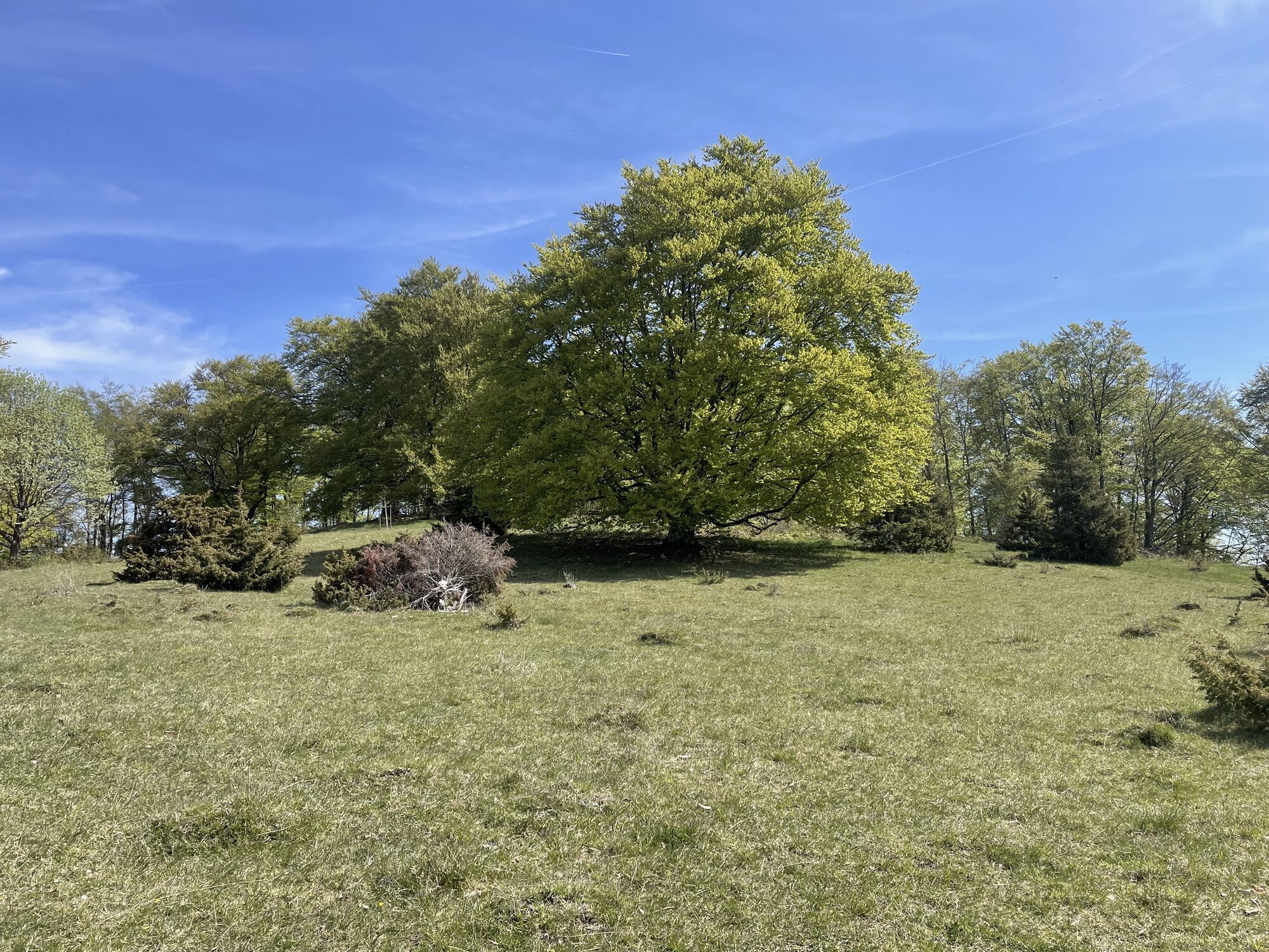
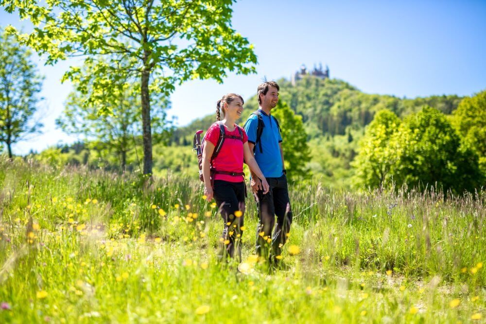
Overwhelmed by the impressions, continue easily along the escarpment to the Trauf Rock and towards the red glowing Raichberg Tower including Nägelehaus. The heathland accompanies us for a short stretch before the depths of the Alb escarpments captivate us.
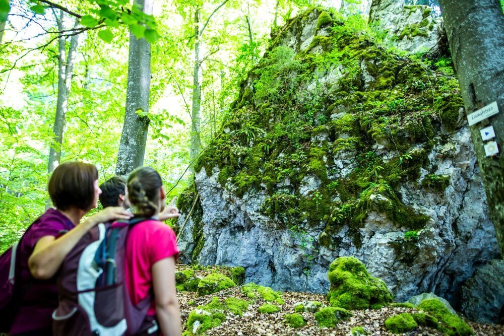
Optionally, a detour can be made to the Kohlwinkelfelsen or the "Black Hand" (distance approx. 600 m one way). A wildly romantic sea of rocks now lies before you, where the boulders are scattered crosswise as if a giant once bowled with them. The Emma Rock, wrapped in a velvet-soft coat of moss, marks the end of the mystical sea of rocks.
On well-developed forest paths, continue downhill to the Schumacher Hut with fireplace. The path leads out of the forest towards Friedrichstal. From here, the path winds almost flat through the valley along the Reichenbach stream. Past an Alb pasture and the obelisk, you reach the starting point again.
Gastronomy and dining options:
Barbecue area "Bollemer Wasen", directly on the path Ski hut, directly on the path. Note: only open on serving days Hiking home Nägelehaus, directly on the path Barbecue area at the Schumacher Hut, directly on the path Gasthaus Löwen in Boll, not directly on the path approx. 850 m awayÁno
Áno
Please keep in mind that you are moving on natural paths that are partly strewn with stones and roots and are steep. Hiking-appropriate sturdy footwear and hiking poles are therefore recommended. Don't forget snacks and sufficient liquids.
DISCLAIMER:
Despite repeated checks and careful preparation of the directions, the publisher assumes no liability for the accuracy and completeness of the information in this description.
NOTICE OF USE:
Dear hiking friends, the hiking trails lead through nature reserves and forests. Preserving and protecting nature is an important concern for us. Please stay on the marked paths.
Furthermore, we point out the presence of natural forest hazards. Due to weather conditions, some sections of the path may also be softened and slippery and should therefore be approached with special caution. Sturdy footwear is therefore recommended for all routes.
Use of the hiking trails is at your own risk.
MARKING AND SIGNPOSTING:
The hike can basically be done in both directions. Therefore, the signage is made in both directions. At intersections, there is a direction indicator and in between these areas a marking with the yellow circle shows the way.
From B27: Leave the federal road at the South exit towards Hechingen center. Immediately before the city entrance turn right towards Boll/Pilgrimage Church Maria Zell. Follow the road, pass through the Boll district and follow the signs "Maria Zell". At the intersection at the edge of the village, follow the signs to the Hüttenwiesen car park.
Alternative parking option: Car park "Footpath to Maria Zell"
For travel by public transport, the following bus stop is recommended:
Hechingen-Boll: "Kirche", bus line 302
From the bus stop, pass the Bollemer village square and town hall, continue along Eichgasse, always keep right until Eichgasse leads into Zellerweg. Walk along Zellerweg to the Hüttenwiesen hiking car park (signposted). The Raichberg route starts here and there is also an orientation hiking map at the car park.
Free parking available
The Pilgrimage Church Maria Zell is locked? Aim the QR code on the "Discover Hechingen" sign and you will have comprehensive information about the attraction available.
Obľúbené výlety v okolí
-
4,8
Onstmettingen - Heiligenkopf - Zeller Horn - Raichberg
strednáTuristika 15,7 km -
5,0
Rund um Hohenzollern
svetloTuristika 12,9 km -
5,0
Mildersbach-Rundweg in Balingen-Ostdorf
strednáTuristika 9,85 km -
5,0
Heideweg route in Hechingen
svetloTuristika 5,57 km -
5,0
Dreifürstenstein-Hirschkopf-Runde in Burladingen
svetloTuristika 10,1 km -
4,0
HochAlbPfad Tieringer Hörnle in Meßstetten
strednáTuristika 10,6 km -
4,0
Kirchenköpfle route in Hechingen
strednáTuristika 9,78 km -
5,0
Kreuzfelsenweg in Burladingen
strednáTuristika 8,98 km -
4,0
Rundweg Starzeltal in Rangendingen
svetloTuristika 11,0 km -
5,0
Rundweg Weiler Berg in Rangendingen
strednáTuristika 12,3 km

Turistika a stopovanie


Nenechajte si ujsť ponuky a inšpiráciu na ďalšiu dovolenku
Vaša e-mailová adresa bol pridaný do poštového zoznamu.