


Von der Feldbergbahn zur Blackforestline


For an easy hike, we recommend starting the hike in Todtnau. From here, take the bus (L7300) in the direction of Titisee to Feldberg and get off at the Feldberger Hof stop.
From here, we orientate ourselves...
For an easy hike, we recommend starting the hike in Todtnau. From here, take the bus (L7300) in the direction of Titisee to Feldberg and get off at the Feldberger Hof stop.
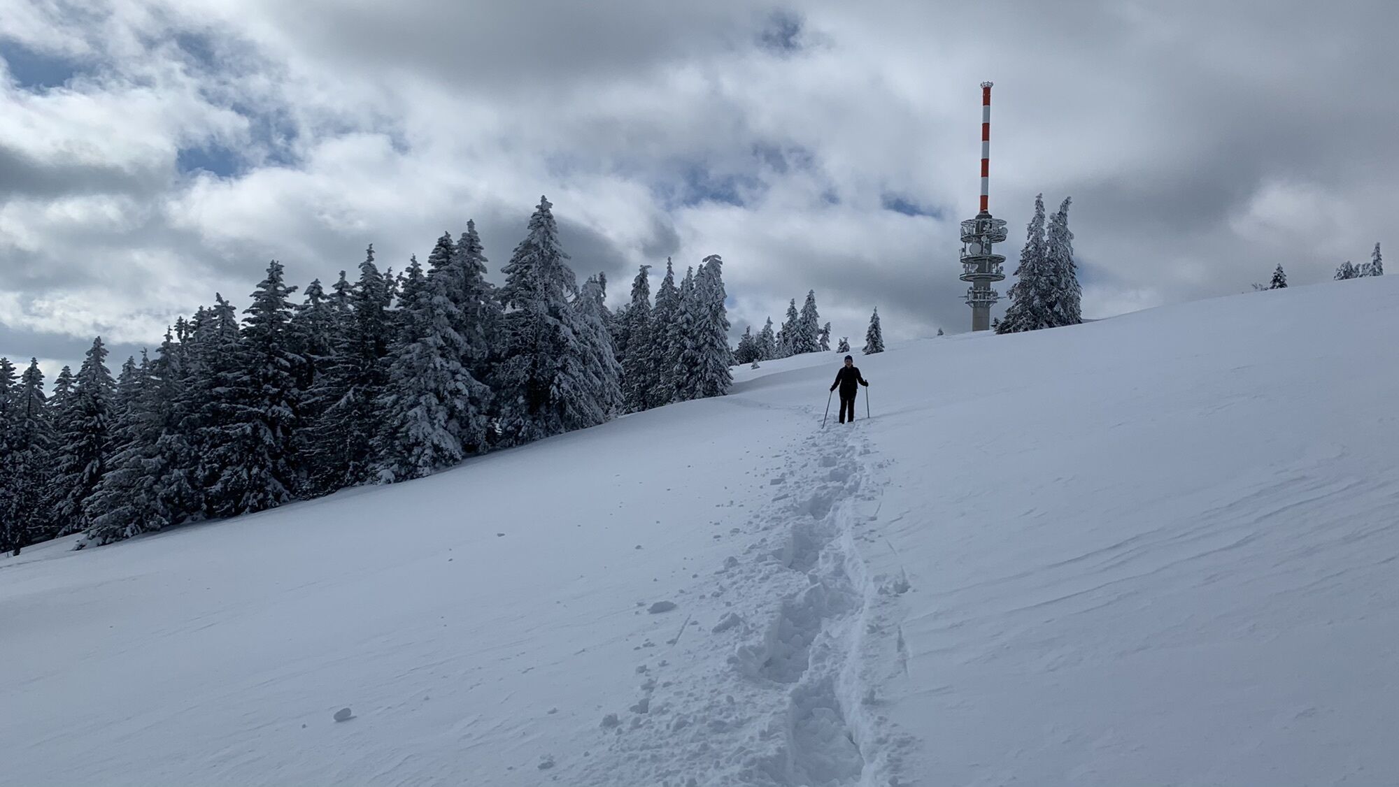
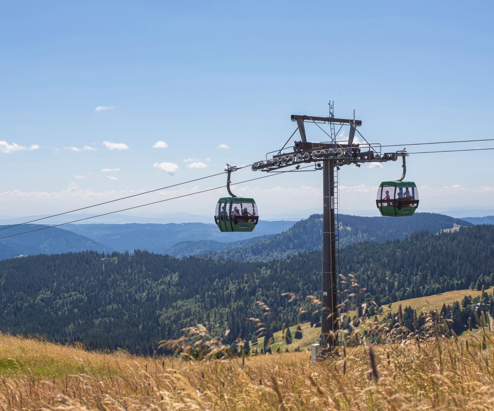
From here, we orientate ourselves by the Feldberg Cable Car and walk to the valley station. Once there, we have two options: Either we take the Feldberg Cable Car up to the Seebuck summit in comfort or we hike up along the edge of the forest (approx. 30 min).
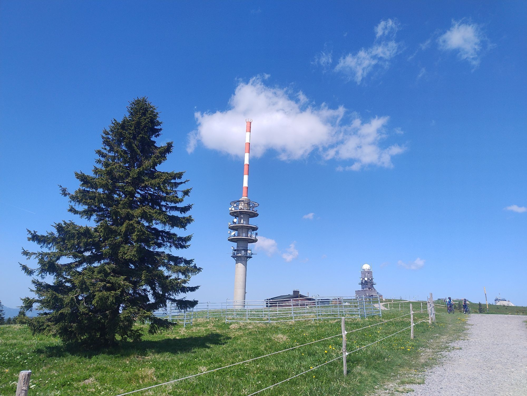
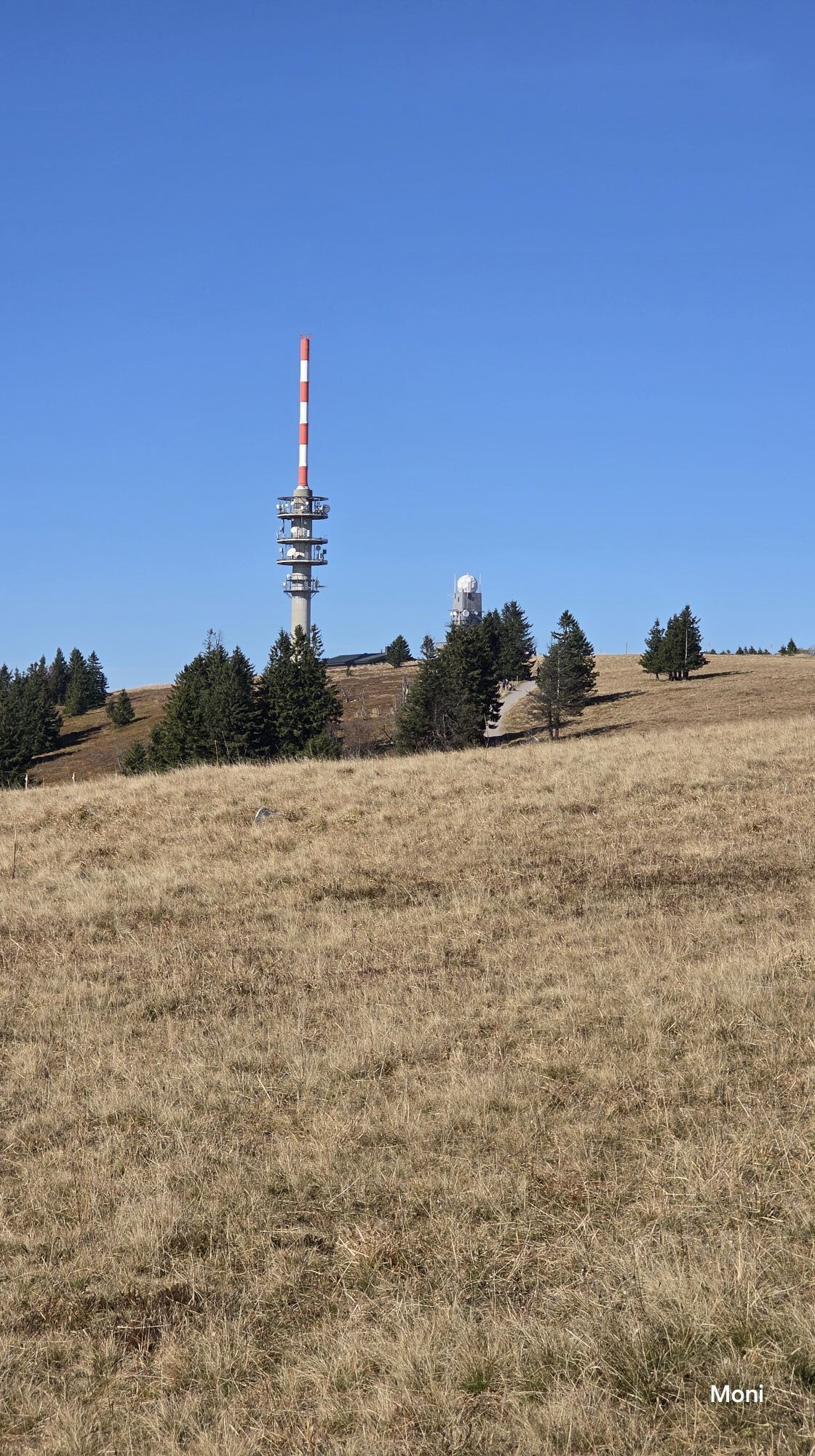
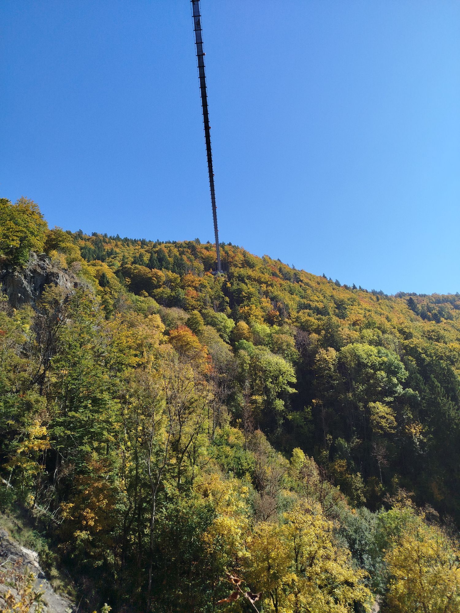
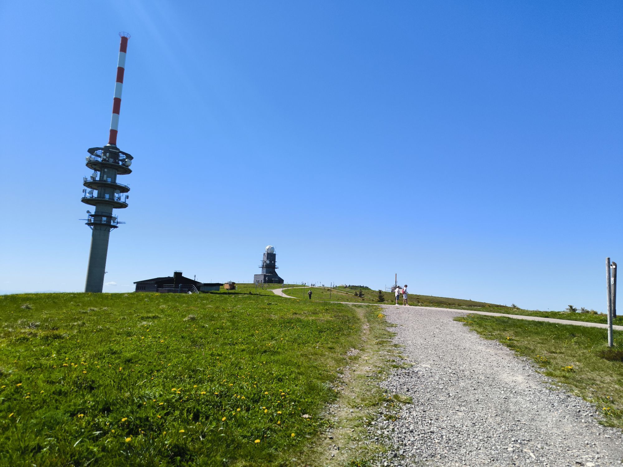
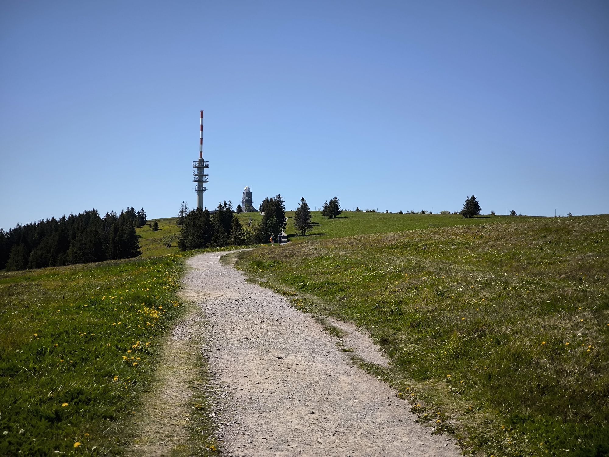
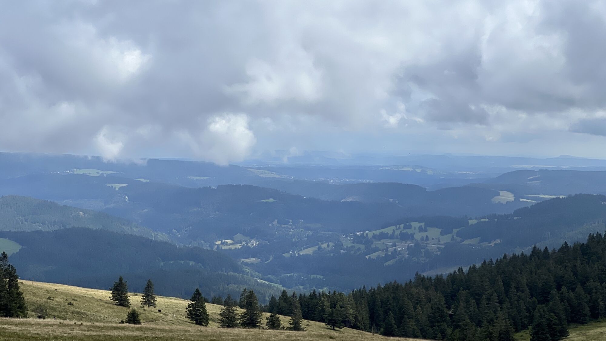
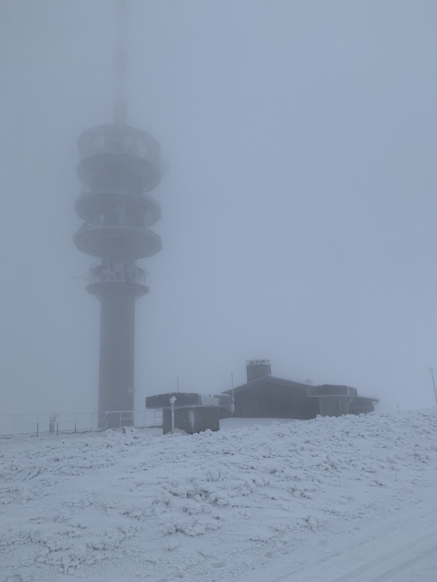
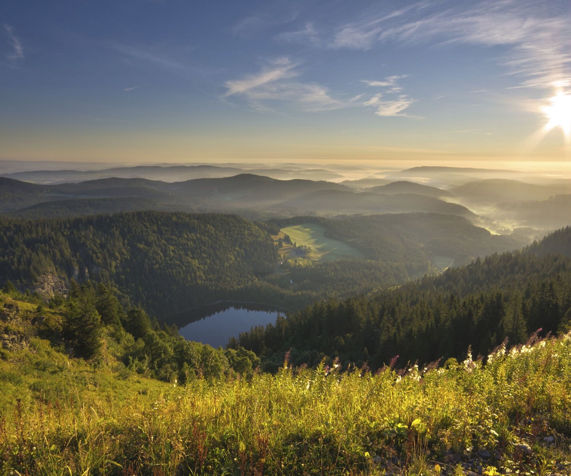
At the Seebuck summit, a fantastic view down to the Feldsee awaits us. Not only can we see the surrounding Black Forest peaks here, but on a clear day we also have the chance to see the Alps - on very clear days, the Alpine chain from Mont Blanc to the Zugspitze opens up here. If you want to enjoy the view from even higher up, you can take a detour up to the Feldberg tower, which also houses the Black Forest Ham Museum.
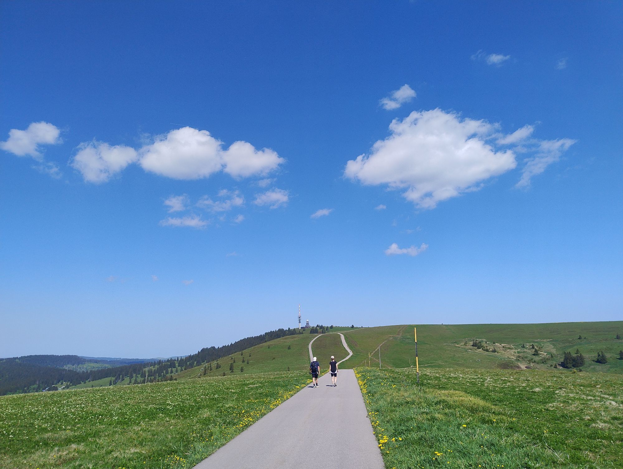
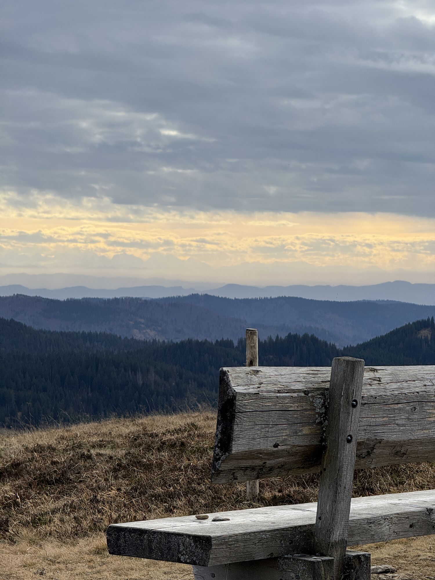
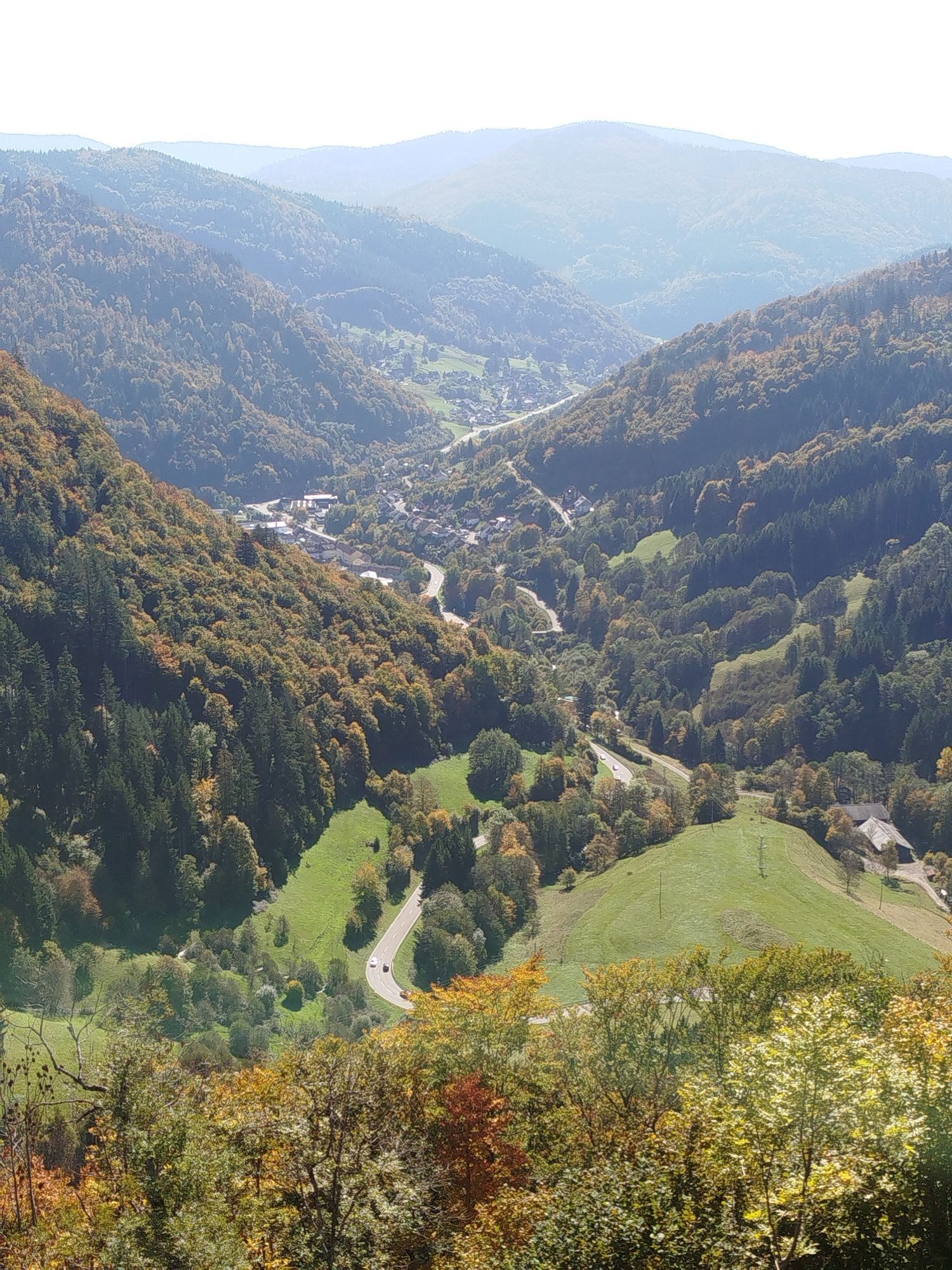
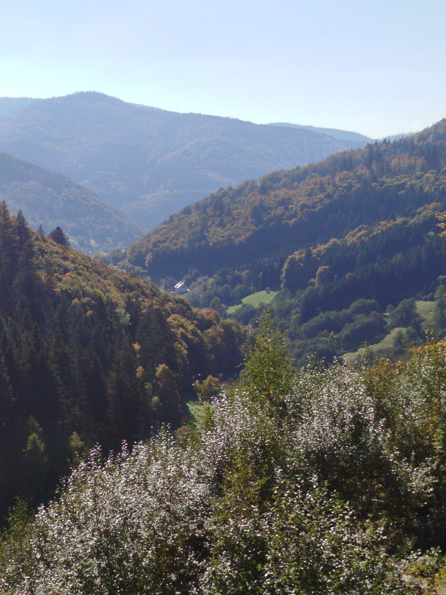
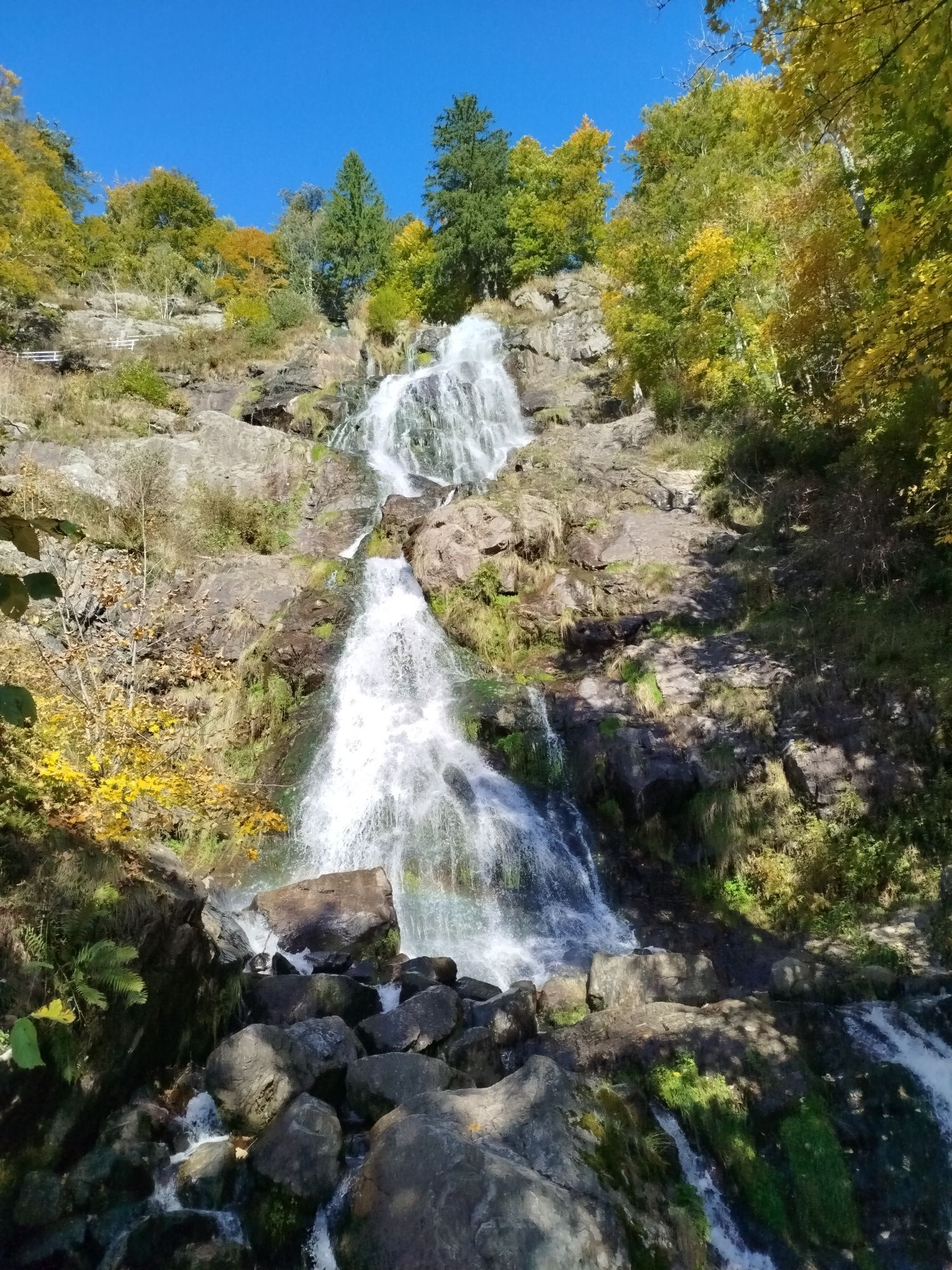
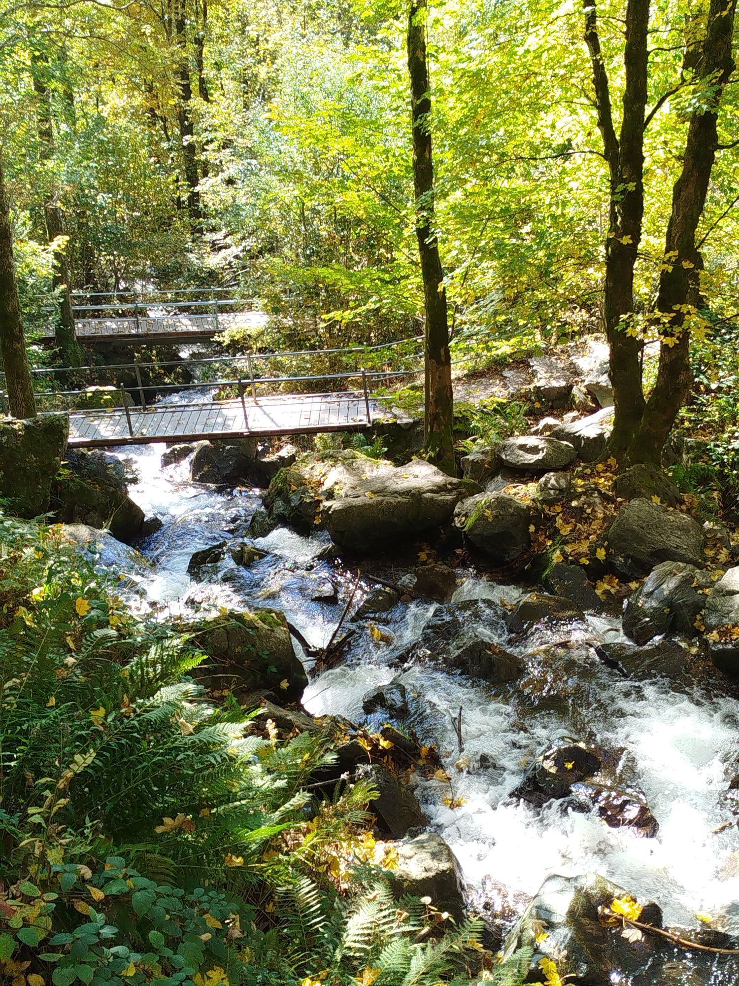
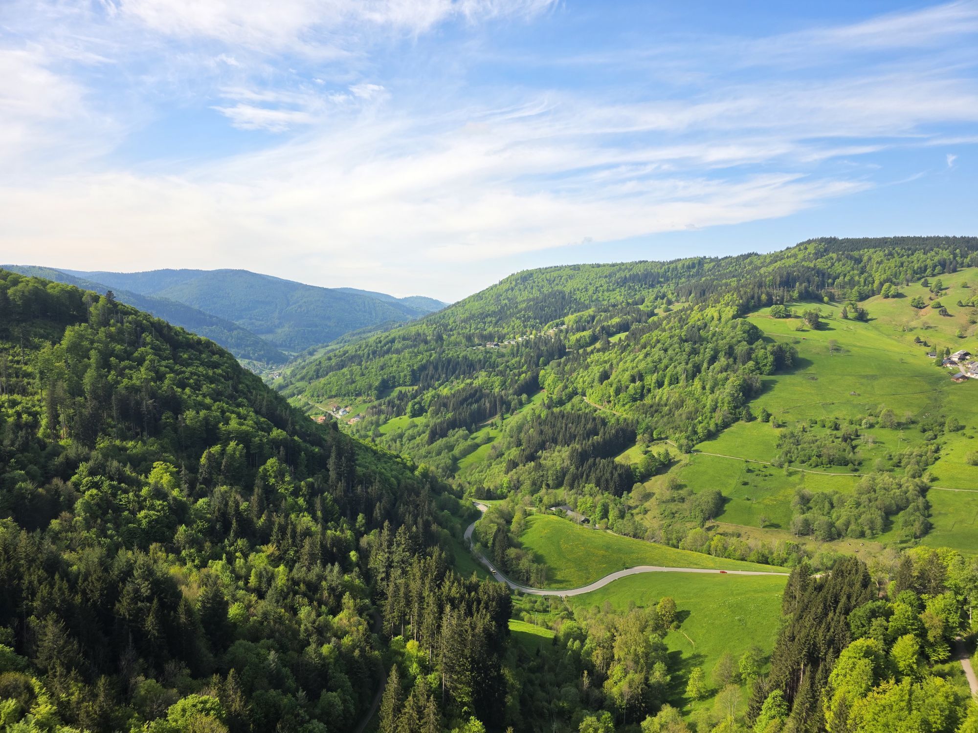
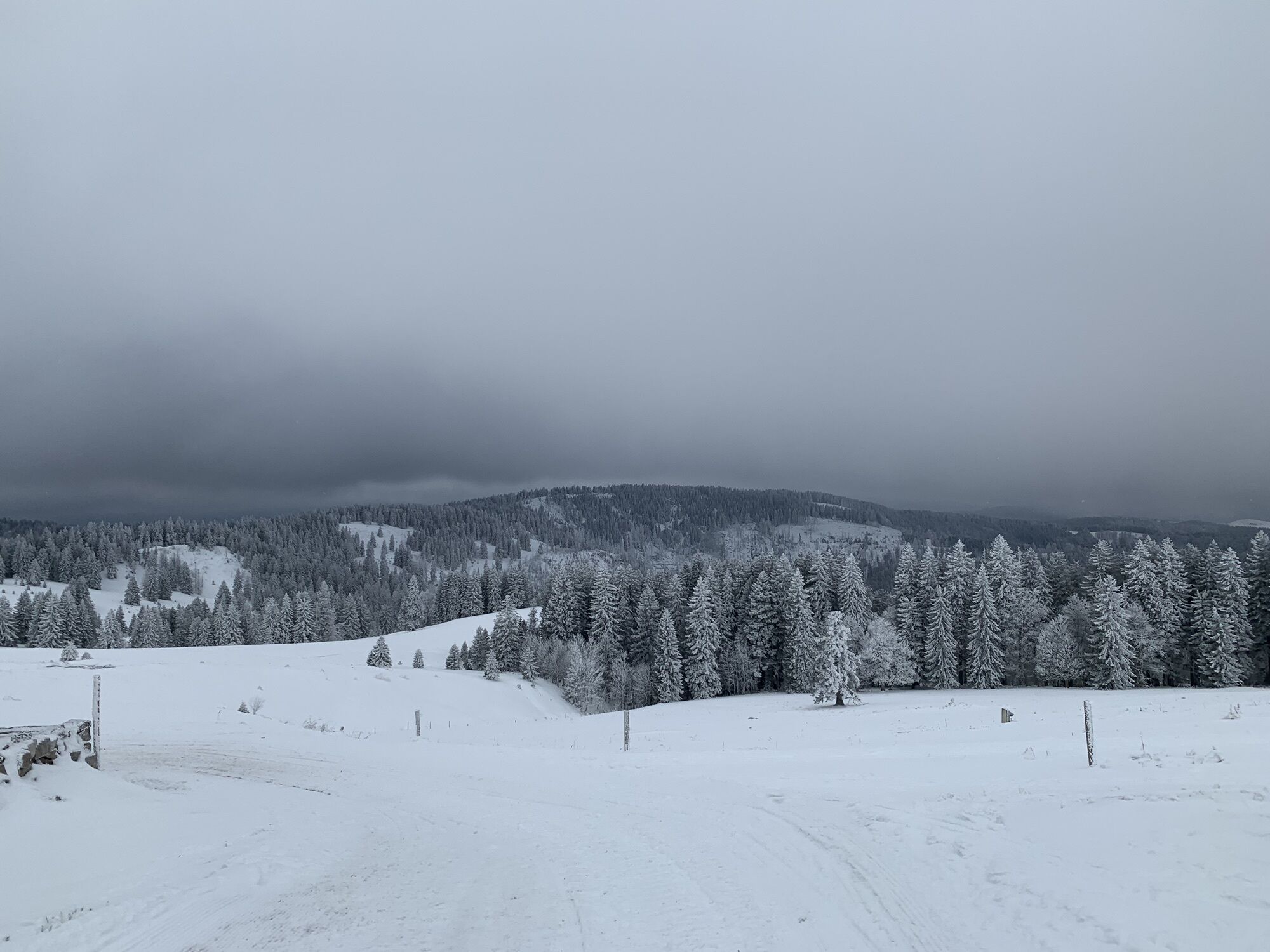
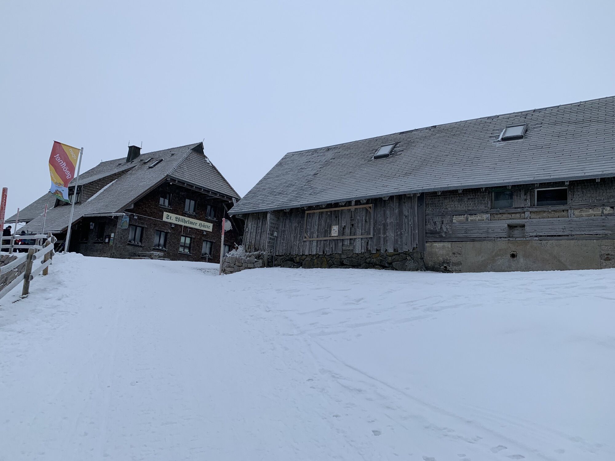
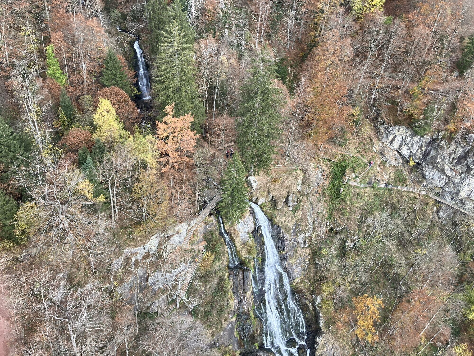
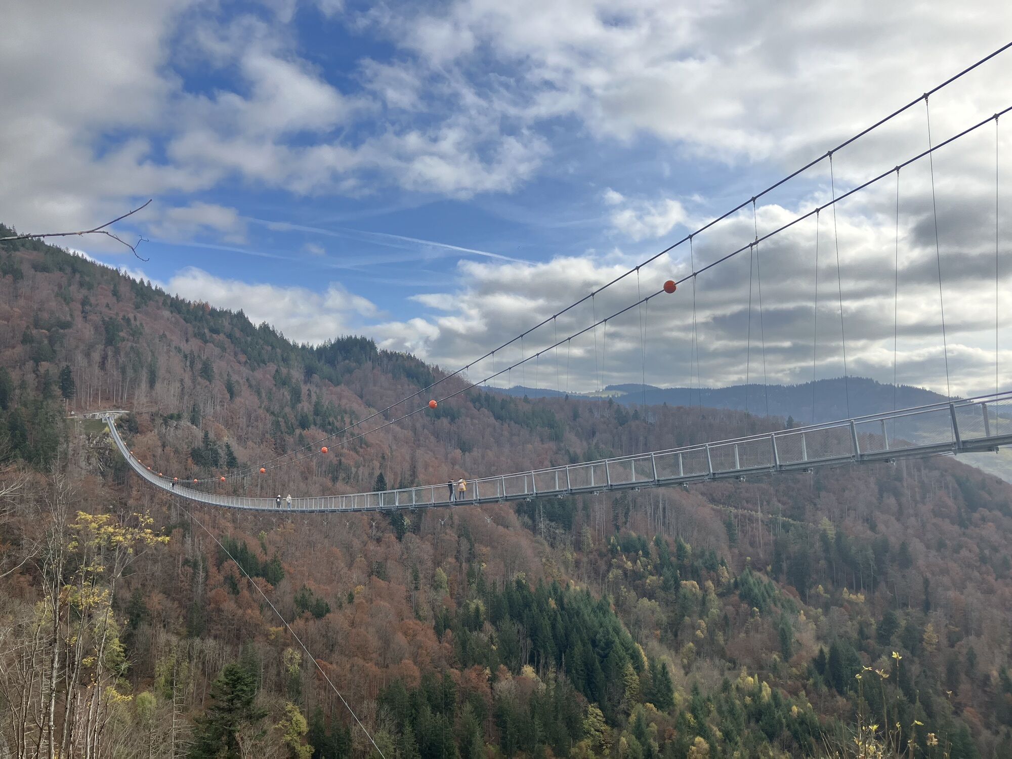
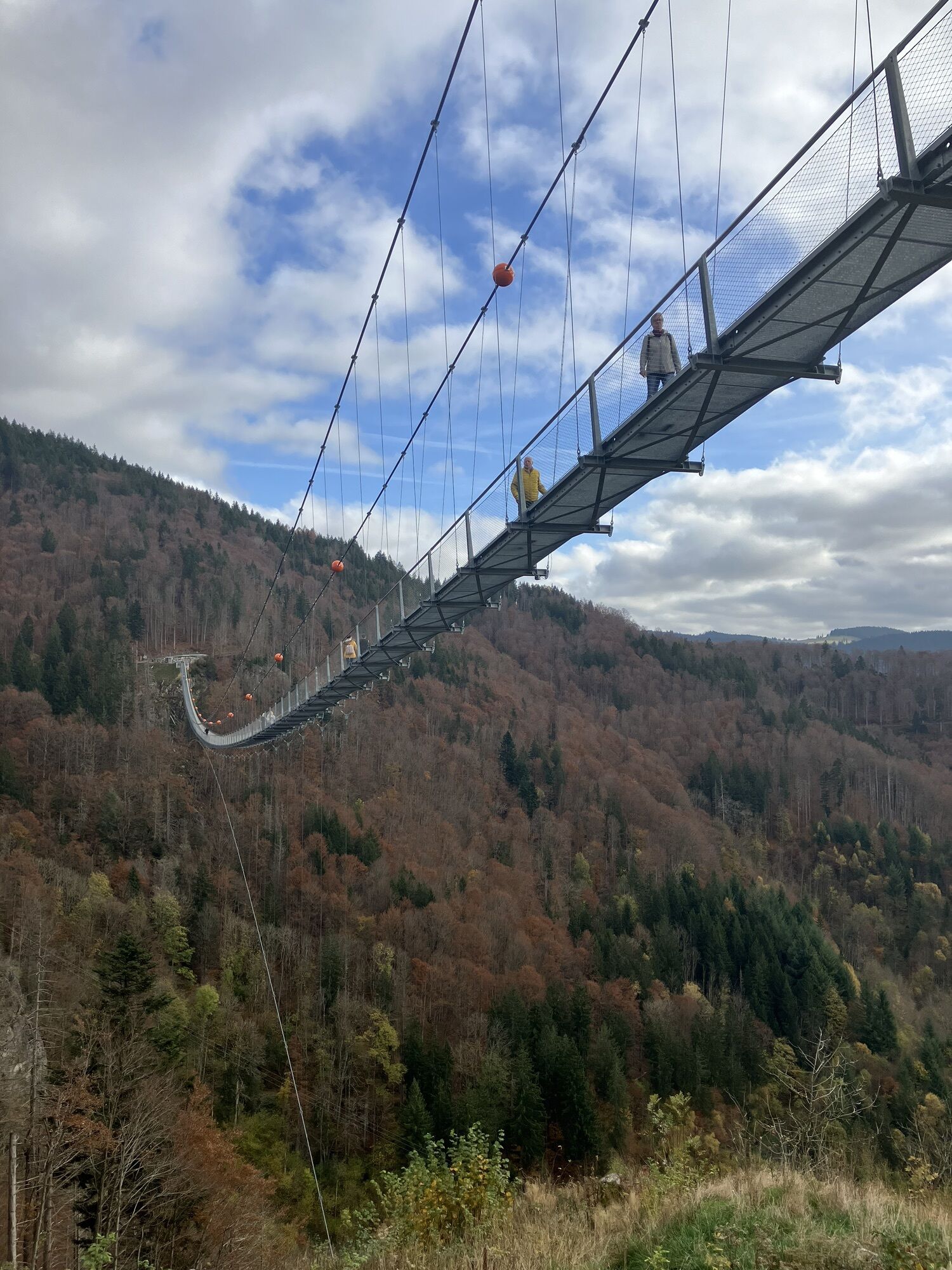
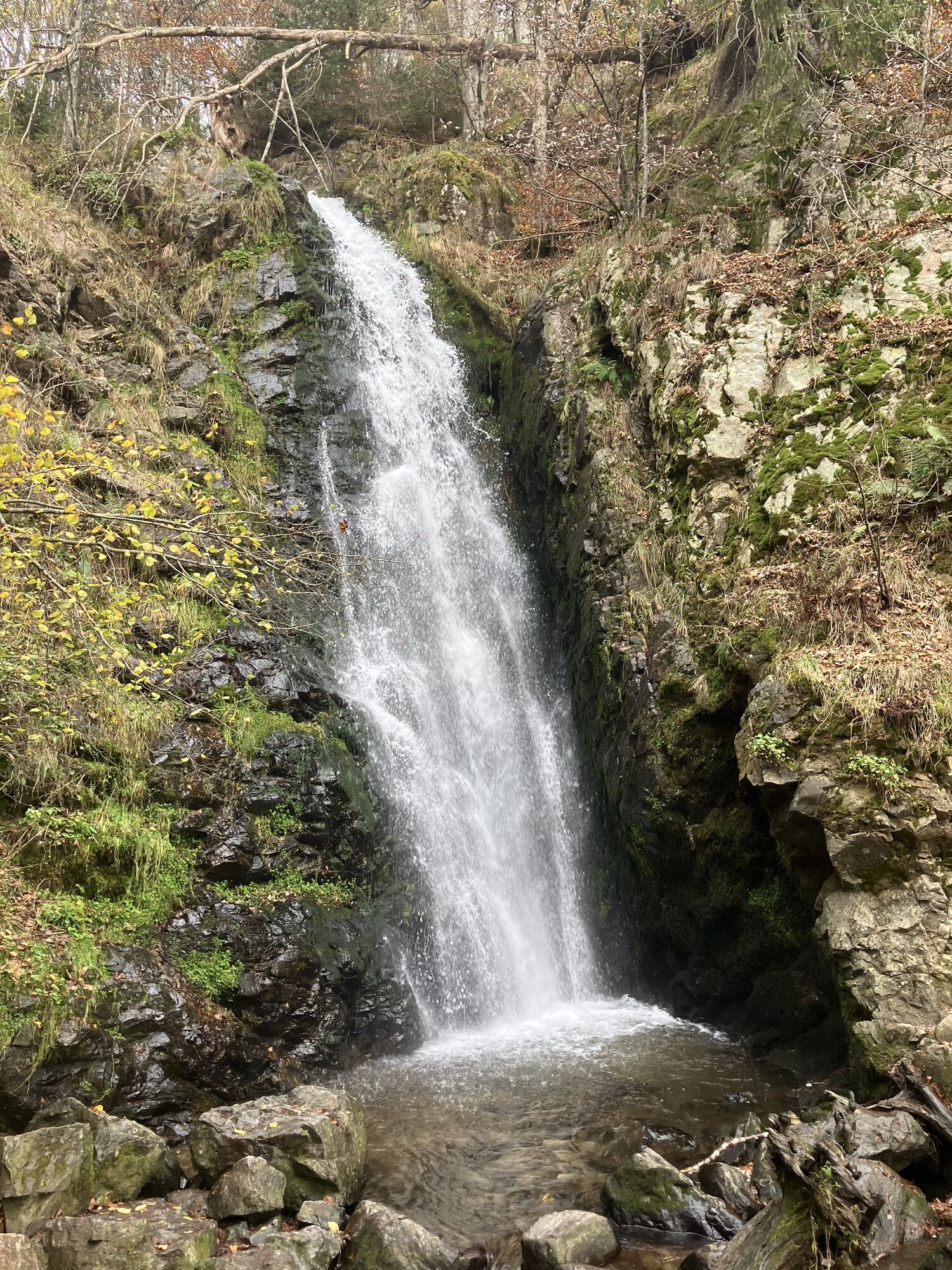
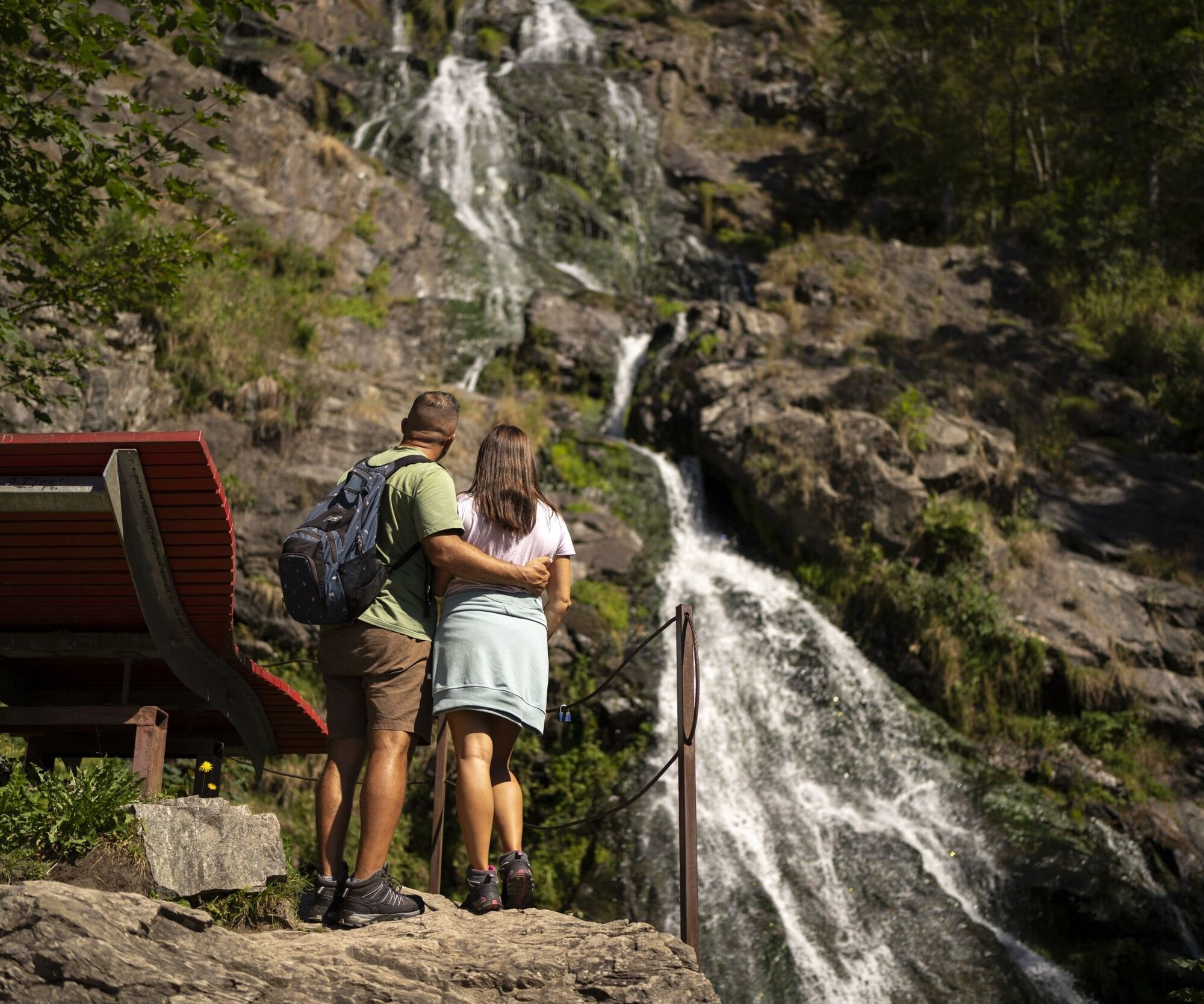
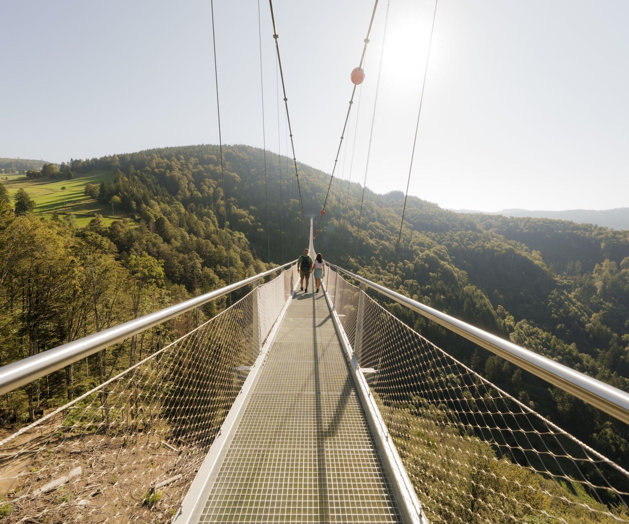
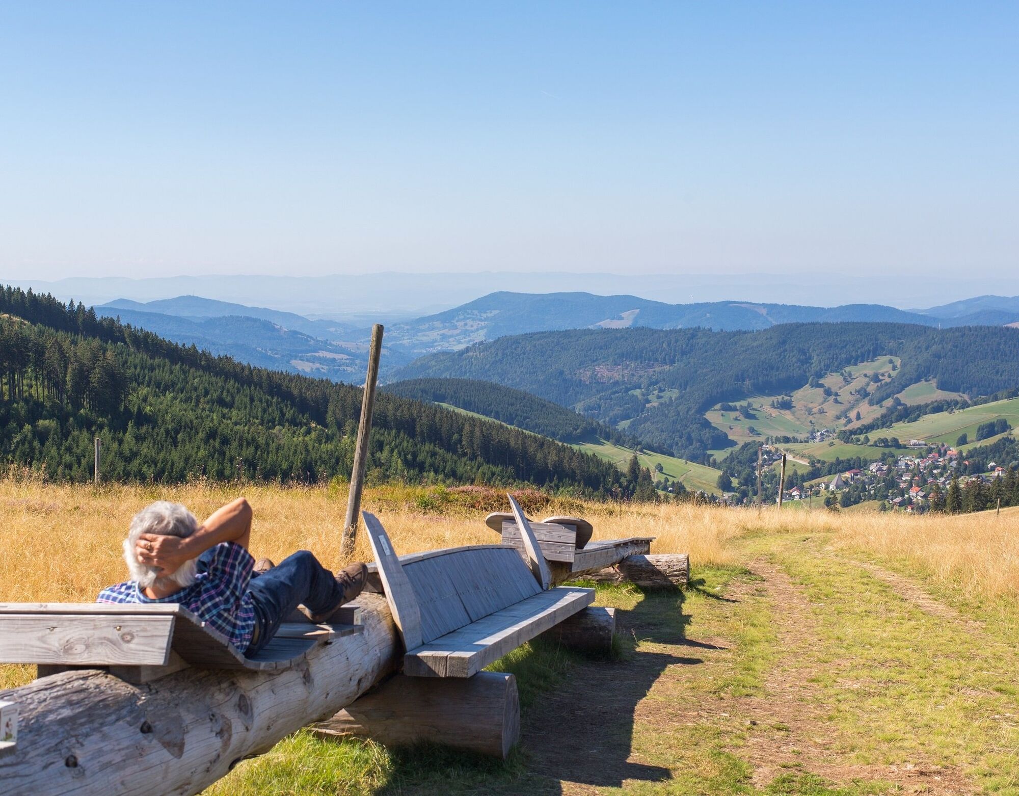
The hike now leads up to the Feldberg summit before descending via the St. Wilhelmer Hütte (refreshments available). The hike continues via the Westweg up to the Stübenwasengipfel, where the longest bench in the world is located and invites you to take a break. Here, too, we are rewarded with a view of Todtnauberg and the Wiesental valley, and on a clear day the view from here extends as far as the Swiss and French Alps. Via the Radschert hiking car park and through the village of Todtnauberg, we now reach the "BLACKFORESTLINE" suspension bridge. Here we take a breathtakingly high route over the Todtnau waterfall, which we can see from a bird's eye view from a height of 120 metres.
After crossing the bridge, we now walk along the Todtnau waterfall down to Todtnau, where we reach the market square behind the church. Here we have the opportunity to stop for a bite to eat before returning to the starting point via Meinrad-Thoma-Straße to the car park at the Haus des Gastes.

Vom Parkplatz am Haus des Gastes in Todtnau führt ein kleiner Fußweg zum Supermarkt "Netto" über den wir auf kurzem Weg zum Busbahnhof in Todtnau gelangen. Hier nehmen wir den Bus L7300 (Richtung Titisee) zur Bushaltestelle Feldberger Hof. Dort angekommen sehen wir auch schon die Feldbergbahn und gehen zur Talstation. Entweder wir fahren gemütlich mit der Feldbergbahn zum Seebuckgipfel hinauf oder wir wandern am Waldrand entlang hinauf (ca. 30min). Hierzu laufen wir ein kurzes Stück unter der Seilbahn hindurch zum Waldrand, wo ein schmaler Pfad links abzweigt, dem wir geradeaus der Beschilderung zum Bismarckdenkmal folgen. Weiter geht es am Feldbergturm vorbei, wo wir der Beschilderung zum Feldberggipfel folgen. Vom Gipfelweg folgen wir anschließend dann der Westwegbeschilderung (rote Raute) über die St. Wilhelmer Hütte zum Gipfel des Stübenwasen. Hier verlassen wir die rote Raute und biegen links auf einen Wiesenweg ab, der nach einer kurzen Strecke wieder auf einen breiten Forstweg mündet, dem wir weiter bergab zum Radschert folgen. Weiter geht es am Waldrand über Todtnauberg zum Horn. Hier biegen wir links ab in den Hornweg, der am Hotel Sternen endet. Hier passieren wir die Straße und laufen den Pfad gegenüber zum Todtnauberger Schwimmbad hinunter. Hier treffen wir auf die Straße "Schwimmbadweg". Dieser folgen wir zunächst hinab bis zur Mühlenbrücke.
Nun stellt sich die Frage, ob wir die Hängebrücke passieren wollen oder nicht. Wenn ja, dann biegen wir rechts ab und laufen die schmale Straße hinauf. Oben angekommen können wir auch schon das Besucherzentrum der BLACKFORESTLINE sehen und schließlich die Brücke überqueren. Auf der anderen Brückenseite biegen wir links auf den breiten Weg bergab und folgen diesem, bis wir wieder an der Mühlenbrücke stehen.
Von hier geht es nun zum Todtnauer Wasserfall hinab. Ab hier können wir bequem der blauen Raute folgen, die uns bis nach Todtnau auf den Marktplatz führt. Hier biegen wir rechts in die Meinrad-Thoma-Straße ab, die uns zurück zum Haus des Gastes führt.
Áno
Wir empfehlen festes Schuhwerk.
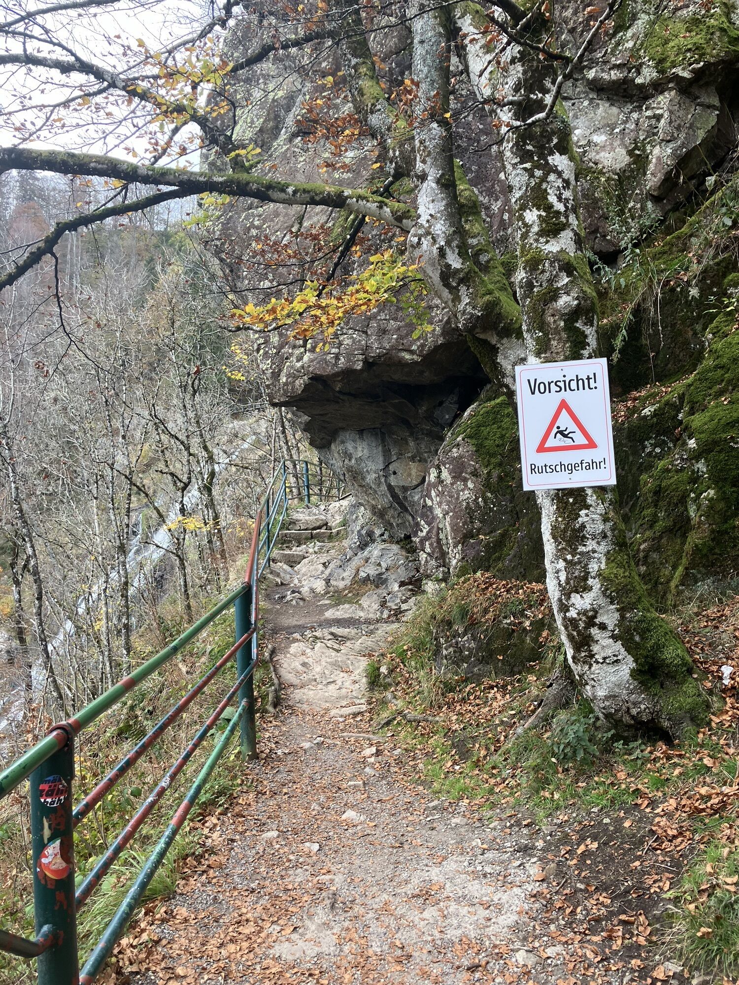
Bitte beachte auf dem Wanderweg die Hinweisschilder. Genaue und detaillierte Informationen über die Hinweisschilder und das Wanderleitsystem findest du auf unserer Webseite. In Notfällen die 112 anrufen.
Wir empfehlen das Auto beim Haus des Gastes in Todtnau zu parken und von dort mit dem Bus (L7300) zum Feldberger Hof hinauf zu fahren.
Webové kamery z prehliadky
-
Feldbergturm Seebuck Gipfel
-
Todtnauberg - Pension Glöcklehof
-
Todtnauberg - Haus Keller
-
Feldberg - Grafenmatt I
-
Todtnau - Aftersteg
-
Todtnau - Aftersteg
-
Seebuck Bergstation
-
Todtnauberg - Bucklift
-
Seebuck Talstation
-
Hofeck Talstation
-
Talstation Winkellift
-
Feldberg - Opelhaus
-
Menzenschwander Hütte - Feldberg
-
Menzenschwand Hinterdorf
-
Bergstation Mösle - Menzenschwand
-
Skilift Schwinbach - Menzenschwand
-
Radon Revital Bad - Menzenschwand
-
Menzenschwander Hütte - Feldberg
-
Skilifte Stollenbach
-
Scheuermatthof
-
Stollenbach
-
Haldenköpfle - Talstation Lift 2
-
Todtnauer Hütte
-
Haldenköpfle - Talstation Lift 1
-
Haldenköpfle - Talstation Lift 1
-
Feldberg - Fahl
-
Todtnauberg
-
Todtnauer Hasenhornturm
-
Todtnauer Hasenhornturm
-
Todtnauberg Stübenwasenlift
-
Todtnauberg
Obľúbené výlety v okolí
-
4,7
Black Forest Highlands heritage trail - mills and saws in the gorge
strednáTuristika 7,42 km -
3,7
Seerundweg Titisee
svetloTuristika 5,84 km -
4,2
Belchensteig
strednáTuristika 14,8 km -
4,1
Höhenklimaweg Titisee-Rundweg
strednáTuristika 7,44 km -
3,8
Premium Hiking Trail- Säbelthomaweg
ťažkéTematická trasa 11,3 km -
4,0
Altitude on the Herzogenhorn
strednáTuristika 11,1 km -
5,0
Premium Hiking Trail - Menzenschwander Geißenpfad
ťažkéTematická trasa 9,78 km -
4,8
Sonnenaufgang und Feldbergsteig
strednáTuristika 11,6 km -
3,7
Rundweg zum Todtnauer Wasserfall
svetloTuristika 6,06 km -
4,3
Mystical path to the Mathisleweiher pond
strednáTuristika 8,94 km

Turistika a stopovanie


Nenechajte si ujsť ponuky a inšpiráciu na ďalšiu dovolenku
Vaša e-mailová adresa bol pridaný do poštového zoznamu.