


Donaufelsenläufe - Donaufelsengarten
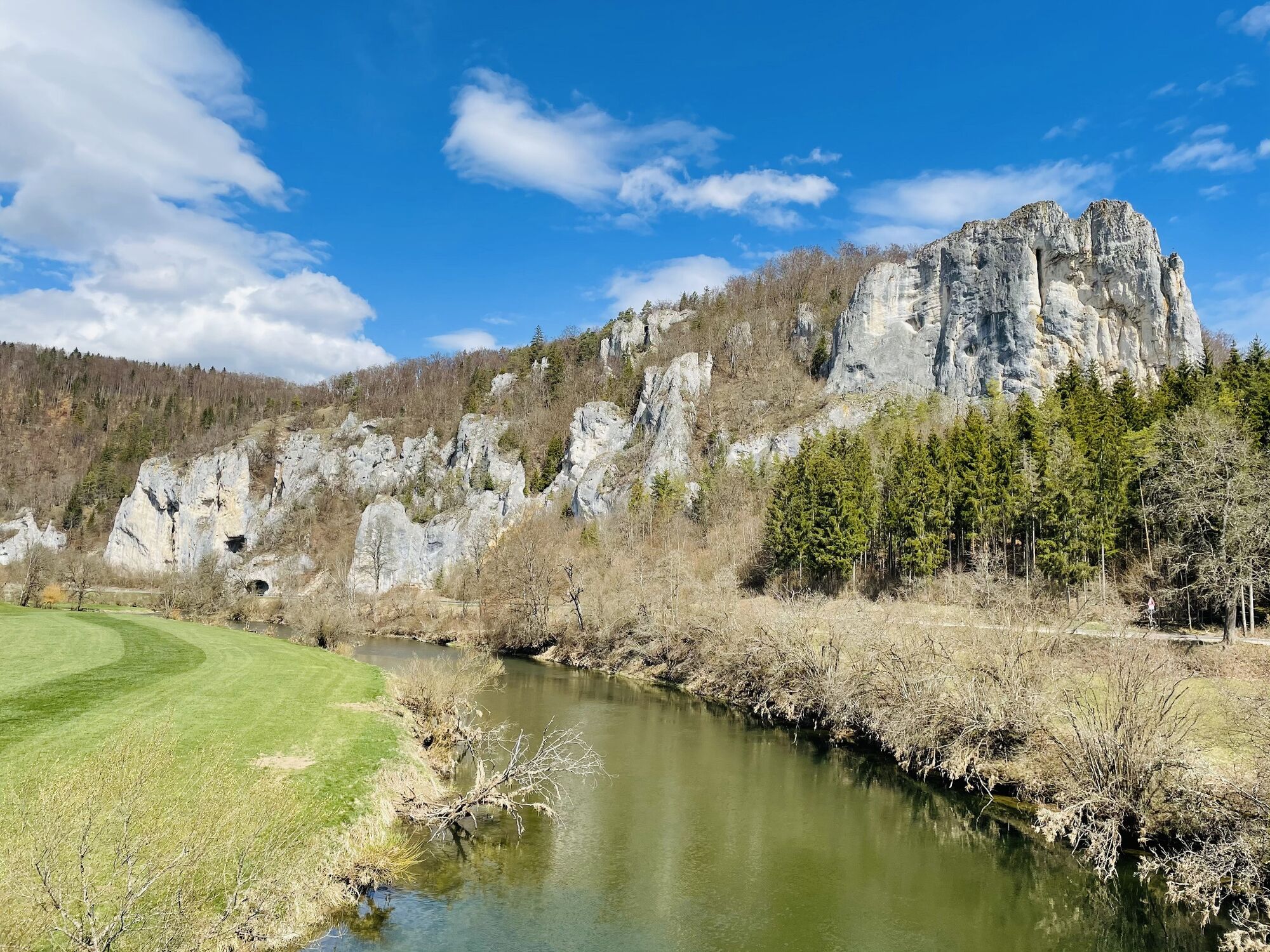
The name says it all! Everywhere on the loop trail Donaufelsengarten one encounters bizarre rock formations and discovers high rock walls. At the Burghalde, the Rabenfelsen and the Teufelslochfelsen you...
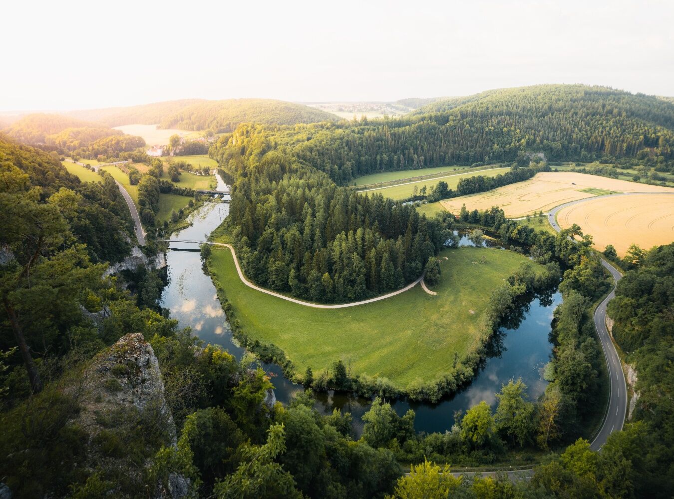
The name says it all! Everywhere on the loop trail Donaufelsengarten one encounters bizarre rock formations and discovers high rock walls. At the Burghalde, the Rabenfelsen and the Teufelslochfelsen you can let your gaze wander over the Danube, and the St. Antonius beech tree serves as a perfect resting place. For a grand finale at the large barbecue area directly at the starting point, we advise you to pack a few sausages for this tour!
We start our tour at the Hofstättle parking lot and follow the path in an easterly direction through a sparse mixed beech forest to the first view point, the "Teufelsloch". After enjoying the beautiful view into the Danube valley, we continue our hike on the narrow nature trail towards the east. After about 900 m we step out of the forest into a field landscape, which we cross on a grassy path until we meet a paved path. There we turn left, but immediately after about 100 m we leave the gravel path and turn right onto a narrow nature trail. Here we cross a small forest, then we turn left again until we reach a paved gravel path into the Kohltal. Here we now go straight on in a slight ascent. After a little more than a kilometer we leave this paved path by turning right uphill into a nature path.
After a short while we step out of the forest again and turn sharply right to cross the farmland there after about 100 m on a gravel road. At the end of the road we meet a short piece of asphalt road, which we leave however immediately after 50 meters again and turn right into the forest. There we follow the forest path until after a short time we reach the St. Antonius beech tree. A resting place under shady trees invites you to have a snack.
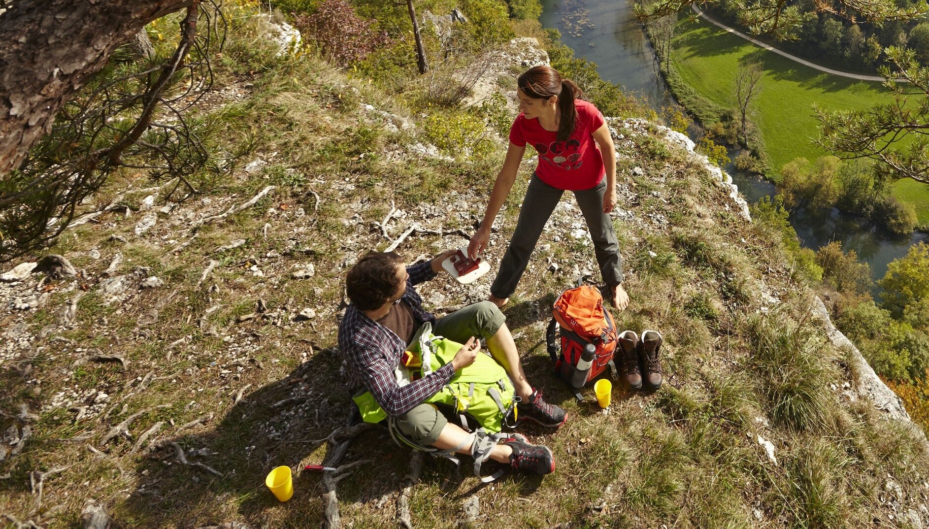
From here we hike in a southwestern direction until we reach the turnoff to the Rabenfelsen. This vantage point can be climbed via a short path with a slight climbing character, but it is only recommended for sure-footed hikers. It is also necessary to be absolutely free from vertigo and to be careful, because at the top of the lookout point the Rabenfelsen drops down in a vertical wall. However, wonderful views of the Danube valley await the brave.
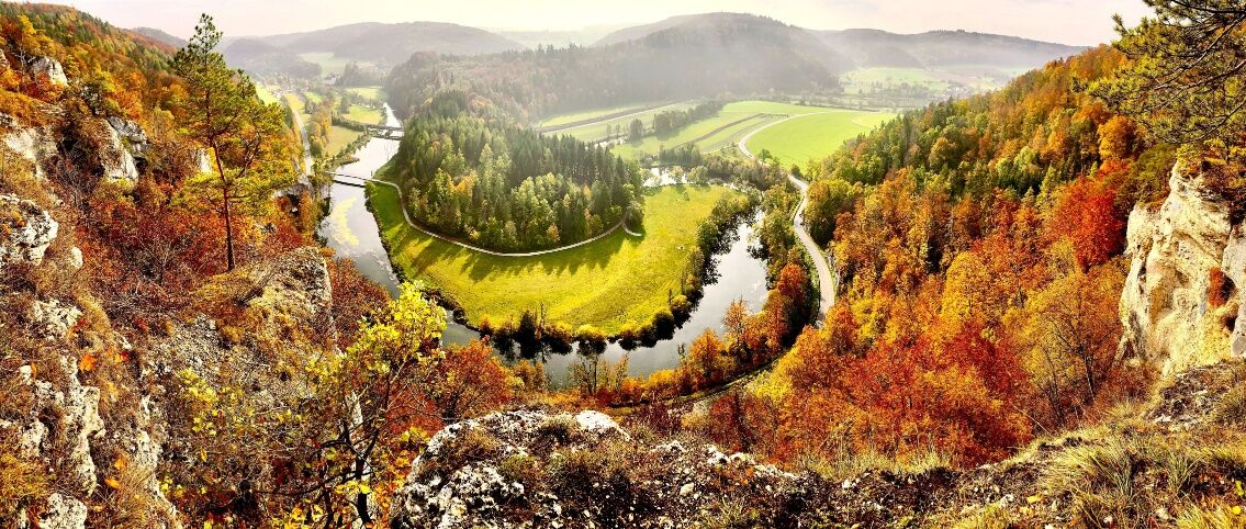
From the crossing point Rabenfelsen we now follow a section of the "Donau-Zollernalb-Weg" further south on a narrow nature trail and can once again have a full view of the Rabenfelsen from the opposite side of the valley. Over a small serpentine we pass the lookout point Eichbühl, where we can catch a small view into the Danube valley. The narrow path leads us gradually downhill to an asphalt path, which we cross and continue walking on a grassy path. We then walk only about 50 m uphill on a gravel path, continue straight ahead on a forest path up to the Burghalde turnoff. The detour to the Burghalde lookout point rewards us with a beautiful view of Gutenstein Castle and the meandering Danube.
From the Burghalde branch, our last few meters of the trail take us further over a hilltop until we begin the descent over several hairpin bends. At about the halfway point of the descent, we find the last opportunity for a complete view of Gutenstein, in which we branch off to the right over a short path to the Kreuzfelsen. We hike the last piece downhill and after a short time we reach our starting point again; there is also a large barbecue area, which invites you to a nice finale of this impressive loop trail.
Sturdy shoes, weather appropriate clothing and hiking poles are recommended.
Walking on the Rabenfelsen is not easy and only recommended for sure-footed hikers who are free from vertigo. Please note that these are natural trails, which can be slippery, possibly icy, in some weather conditions. Due to this, a complete walk on the trail in winter is not recommended for safety reasons.
Navigation: Parkplatz Hofstättle, Bei der Brücke 3, 72488 Sigmaringen-Gutenstein
You can find more information about public transport here.
Parking lot Hofstättle or Wanderparkplatz Gutenstein
The St. Antonius beech tree is a good place for a rest. At the starting point there is also a large barbecue area, so don't forget to bring a picnic!
Obľúbené výlety v okolí
-
4,8
Kloster Beuron
strednáTuristika 15,0 km -
5,0
Amalienfels Tour
svetloTuristika 14,6 km -
4,8
Fridingen- Beuron - Donautal
strednáTuristika 16,1 km -
4,7
Donauradweg Etappe 2
strednáCyklistika 62 km -
5,0
Vom Finstertal zum Korbfelsen und Schloss Werenwag
strednáTuristika 9,85 km -
1,0
Thiergarten
svetloTuristika 6,13 km -
Donautal
svetloTuristika 3 km -
Zum Mammutbaum
svetloTuristika 7,12 km -
Donaufelsenläufe - Klosterfelsenweg
strednáTuristika 12,7 km -
Donau-Zollernalb-Weg - Gesamtroute von Beuron über Albstadt zum Lemberg
strednádiaľková pešia trasa 167,4 km
Turistika a stopovanie


Nenechajte si ujsť ponuky a inšpiráciu na ďalšiu dovolenku
Vaša e-mailová adresa bol pridaný do poštového zoznamu.