


Circular hike around Monhardt
A circular hike with rustic nature and wonderful views. The hike initially leads through the yard of the old power plant, along the Nagold, which here shows itself in its beautifully rustic form. Downstream,...
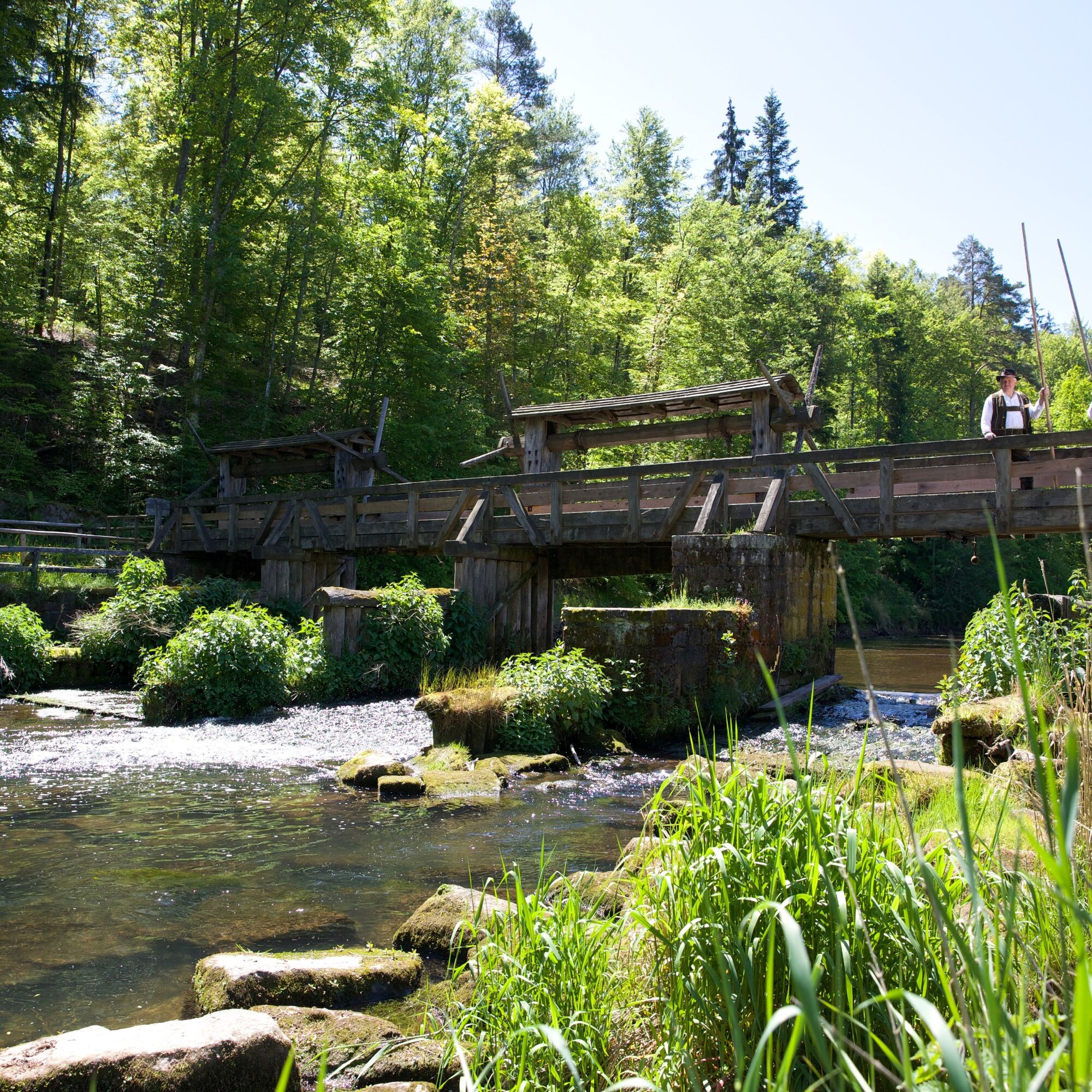
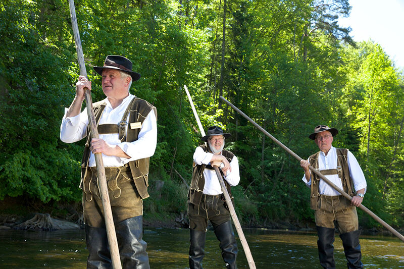
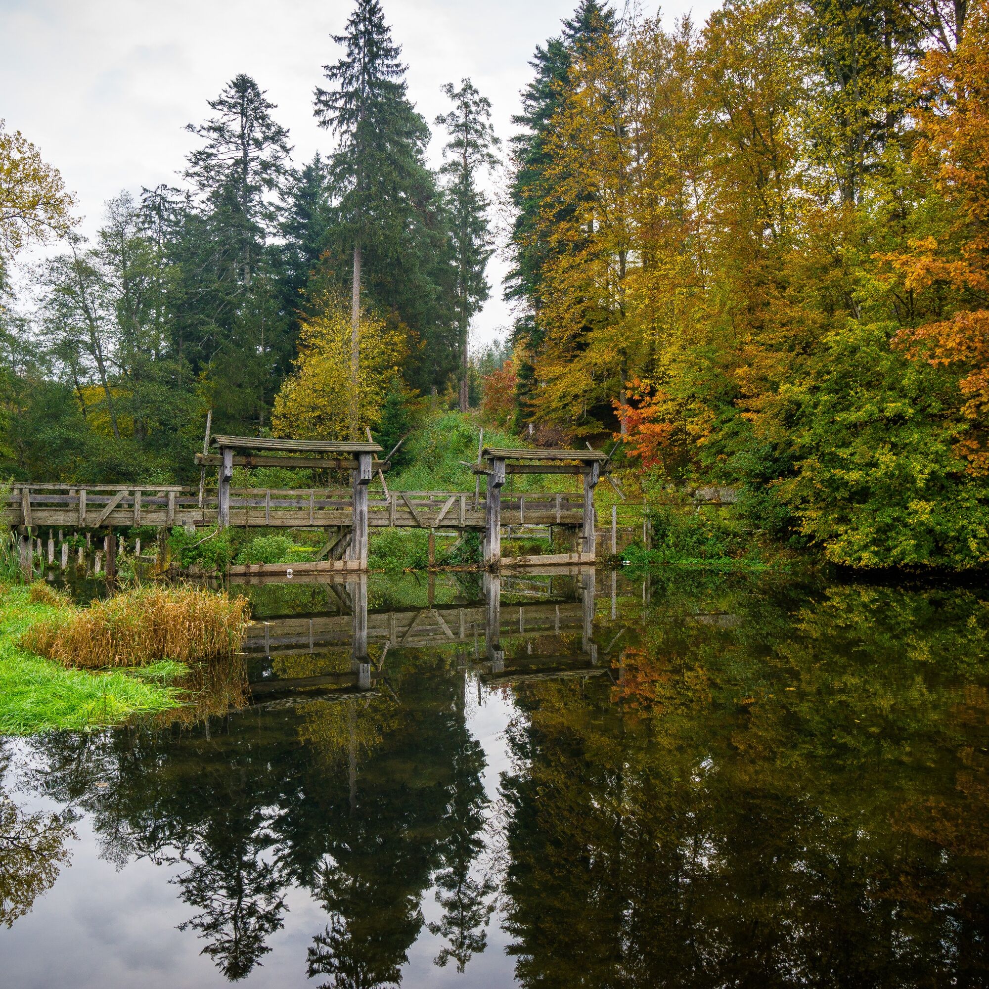
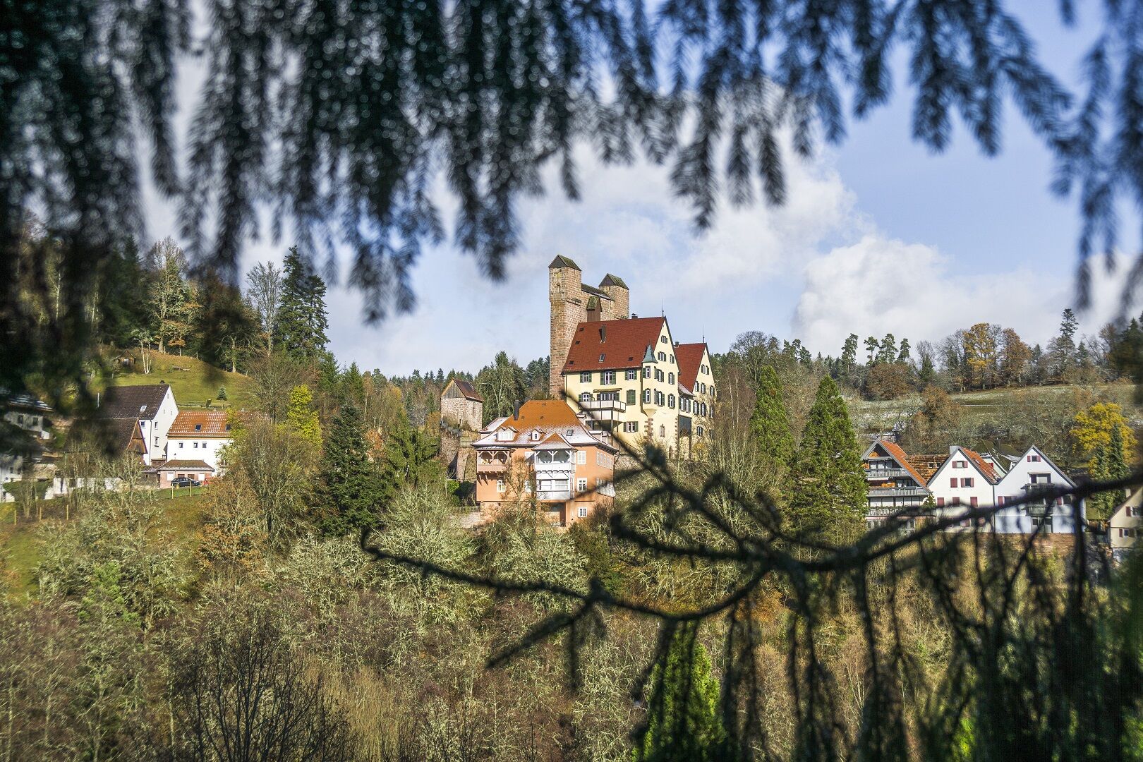
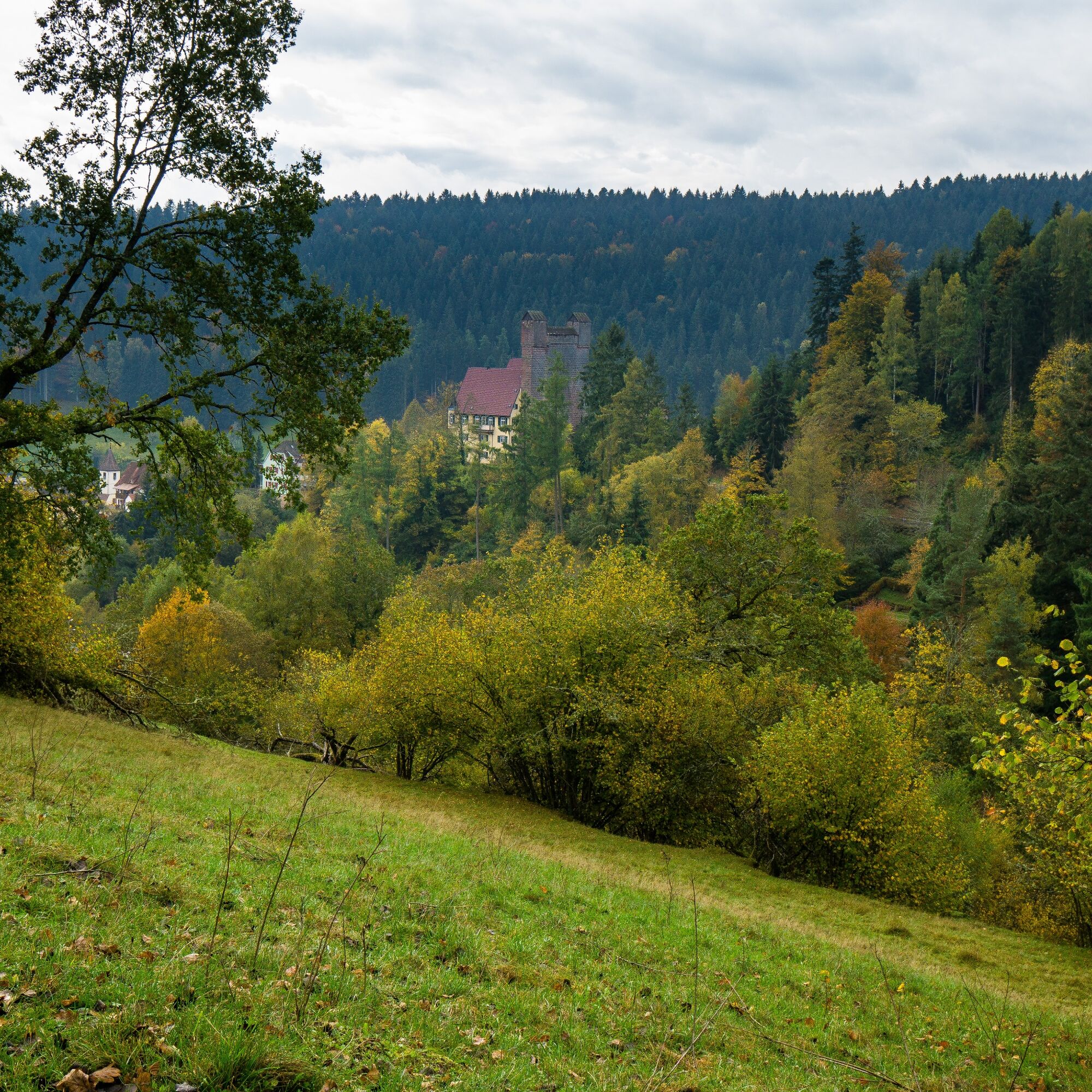
A circular hike with rustic nature and wonderful views. The hike initially leads through the yard of the old power plant, along the Nagold, which here shows itself in its beautifully rustic form. Downstream, the Monhardter Wasserstube, a historic facility still operated today for demonstrations by the rafting guild Upper Nagold Valley, invites you to take a short break. Worth seeing is the "Bähofen," where tree trunks are "boiled" to twist them into “wieden,” a rope-like binding material. The tour continues to the historic Nonnenwald Bridge, or cement bridge, into the Nonnenwald forest. Uphill leads to the idyllic village of Monhardt. Upon reaching the forest edge, there is an impressive view of Bernecker Castle. Following the romantic path through the forest, you meet the Gäurandweg. Shortly thereafter, the hiker is rewarded with a magnificent view from above of Altensteig and the region. A forest road leads back down to Altensteig.
The tour starts at the parking lot of the Altensteig sewage treatment plant. We follow the rhombus markings of the Black Forest Association past the sewage treatment plant, over the Nagold, into the forest. At the signpost Sewage treatment plant we keep left and quickly reach the marked path. We follow this straight ahead, later also the forest path, to the Monhardter Wasserstube. Shortly afterward, we reach the signpost Monhardter Wasserstube, from where we hike uphill towards Monhardt. We follow the rhombus markings through the small village and continue hiking, up to the height just before Walddorf. At the signpost Monhardter Berg we turn right and follow the Gäurandweg for a stretch. Then we cross the street and reach the Grillplatz Hagen, where we now leave the rhombus and the Gäurandweg. We hike right through a short forest section and then always keep left on the same path until we reach the first houses in the valley. On the street there, we again meet the rhombus, which leads us to the right. Following the rhombus, we walk past the Lohmühle again to the signpost Sewage treatment plant. There we turn left and reach the starting point of the hike.
Áno
Sturdy footwear and provisions
Directly via the B28 at the Berneck junction, between Nagold and Altensteig.
Hourly bus line X77 between Herrenberg, Nagold, Altensteig
Bus stop Berneck B28 / Berneck station
Schedule information at www.efa-bw.de
Parking options at the Altensteig sewage treatment plant
Citizens’ Office and City Information Altensteig
Rathausplatz 1
72213 Altensteig
0 74 53 94 61 - 211
At the height, you can visit the Walddorf Orchard Trail. During a guided tour through the orchards, you experience exciting and delicious things!
Obľúbené výlety v okolí
-
4,7
premium hiking trail Enzquellenpfad
strednáTuristika 19,9 km -
5,0
Der Teinacher (Premiumweg & Genießerpfad)
strednáTuristika 12,0 km -
5,0
Water, Woods and Meadowtrail / Zavelstein > Calw (Premium trail & Genussweg)
ťažkéTuristika 14,4 km -
5,0
AugenBlick route Bad Teinach-Zavelstein Zettelberg
ťažkéTuristika 15,5 km -
5,0
Hike through the idyllic Kälbertal
strednáTuristika 8,01 km -
5,0
GeoTour Wildberg through the picturesque Lützenschlucht
ťažkéTuristika 2,80 km -
4,5
Waldeck ruins and the largest water wheel in Europe
strednáTuristika 15,4 km -
5,0
From Altburg over scenic heights to Zavelstein
strednáTuristika 10,6 km -
Exciting circular hike with beautiful views and culture
strednáTuristika 9,98 km -
4,0
Naturpark-AugenBlick-Runde Calw-Holzbronn
strednáTuristika 13,3 km
Turistika a stopovanie


Nenechajte si ujsť ponuky a inšpiráciu na ďalšiu dovolenku
Vaša e-mailová adresa bol pridaný do poštového zoznamu.