


Panorama trail around Saig
Úroveň náročnosti: 2

This panoramic trail is also beautiful to walk in summer.

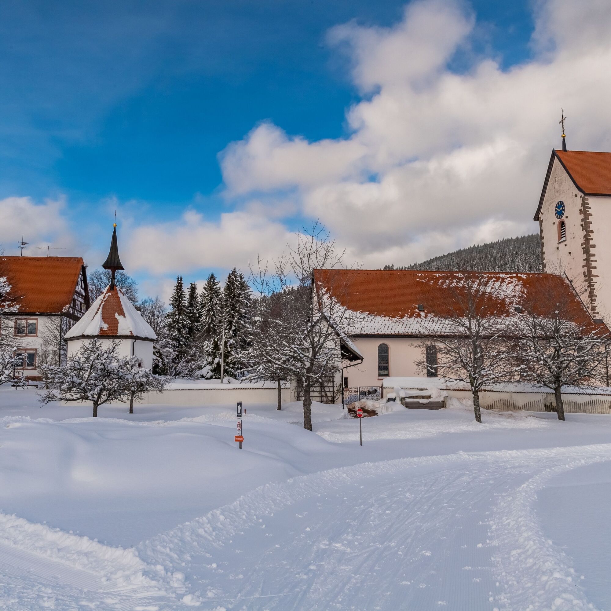
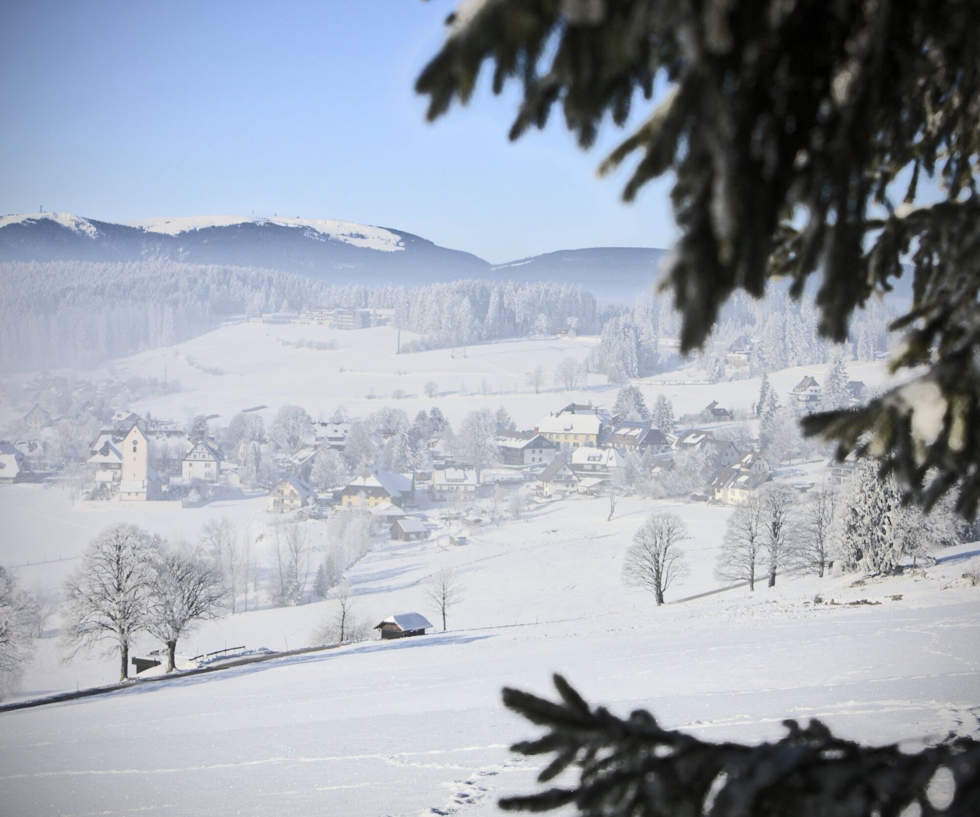
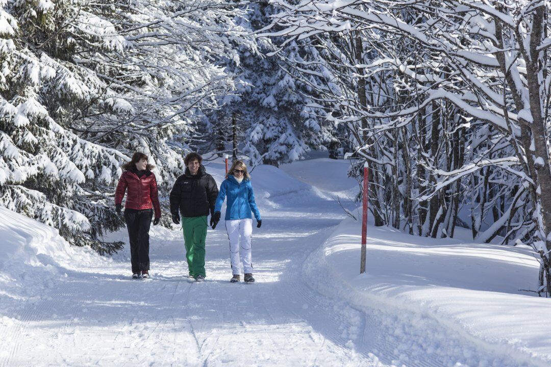
You start the tour at the Haus des Gastes in Saig and follow Titiseestraße uphill towards the sports field and Saiger Höhe. Alternatively, you have the option of turning right into Hochfirstweg and taking a detour to the Hochfirstturm. There are several ways to ‘climb’ the Hochfirst. We recommend the route via Turmweg. You have to past the Luchsenfelsen rock. Once you reach the Hochfirstturm, you will have a fantastic view over the Black Forest (the tower is currently closed due to structural problems). The path up to an altitude of over 1200 metres is cleared in winter. Back to the actual route. As soon as you reach the Titiseestraße/Saiger Höhe crossroads, turn left onto the ‘Saiger Höhe’ path. Right at the crossroads, you will discover the Saig - Titisee toboggan run, where fast-paced tobogganing fun is guaranteed. But please be aware that, you also have to run up the 1.2 km toboggan run again. Follow the ‘Saiger Höhe’ trail to the real Saiger Höhe at an altitude of 1055 metres. This is the highest point of the hike (apart from the Hochfirst). The tour then descends slightly through the snow-covered forest to the Rotkreuz hiking car park. Alternatively, you could have started the tour here. From here, you walk comfortably on an almost flat, sunny little road via "Schlauch" to "Hof".From Hof, the hiking trail leads you directly to the centre of Saig. Here, as well as in the Saiger Höhe area, there are numerous places to stop for refreshments.
Áno
We recommend winterproof equipment!
Please pay attention to the signs on the hiking trail. You can find precise and detailed information about the signposts and the hiking guidance system on our website. Call 112 in an emergency.
-
Bus stop Saig Ochsen Dorfplatz, 79853 Lenzkirch
Haus des Gastes in Saig, Dorfpl. 4, 79853 Lenzkirch
2
Premium winter hiking trails are specially maintained and signposted winter hiking trails. The routes are selected so that they are mostly very scenic and as easy to walk as possible. The winter hiking trails are checked and cleared or rolled daily and are mostly circular hiking trails.
We recommend to bring a sledge for every toboggan fan.
Webové kamery z prehliadky
-
Feldberg - Falkau
-
Altglashütten - Schwarzenbachlift
-
Skilift Fischbach
-
Titisee - Hotel Brugger
-
Hinterzarten - Ferienhaus Carola
-
Hinterzarten - Adlerschanze
-
Hinterzarten - Adler-Skistadion
-
Kappel / Lenzkirch
-
Titisee - Fewo Titiseeblick
-
Lenzkirch Kappel Talweg
-
Feldberg - Altglashütten
-
Dorf / Lenzkirch Saig Hochfirstweg
-
Alpen / Lenzkirch Saig Hochfirstweg
Obľúbené výlety v okolí
-
4,8
Black Forest Highlands heritage trail - mills and saws in the gorge
strednáTuristika 7,42 km -
3,7
Seerundweg Titisee
svetloTuristika 5,84 km -
4,1
Höhenklimaweg Titisee-Rundweg
strednáTuristika 7,44 km -
3,7
From Titisee to the Hochfirst with its stunning views
strednáTuristika 10,6 km -
3,8
Premium Hiking Trail- Säbelthomaweg
strednáTematická trasa 10,9 km -
4,3
Mystical path to the Mathisleweiher pond
strednáTuristika 8,94 km -
5,0
Premium Hiking Trail - Menzenschwander Geißenpfad
strednáTematická trasa 10,3 km -
4,8
Sonnenaufgang und Feldbergsteig
strednáTuristika 11,6 km -
4,0
Altitude on the Herzogenhorn
strednáTuristika 11,1 km -
4,0
Bernauer Hochtal Steig
strednáTuristika 15,9 km

Turistika a stopovanie


Nenechajte si ujsť ponuky a inšpiráciu na ďalšiu dovolenku
Vaša e-mailová adresa bol pridaný do poštového zoznamu.