


From Grimsel Pass to the Sidelhorn
The Rhone Valley stretches to the heart of the Alps, where historic Alpine passes long connected Northern and Southern Europe. Today, transit traffic goes through tunnels, but the historic villages remain...
The Rhone Valley stretches to the heart of the Alps, where historic Alpine passes long connected Northern and Southern Europe. Today, transit traffic goes through tunnels, but the historic villages remain witnesses to the past trade routes.
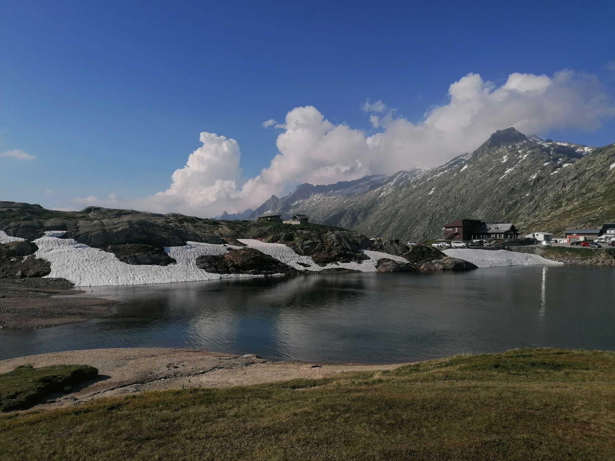
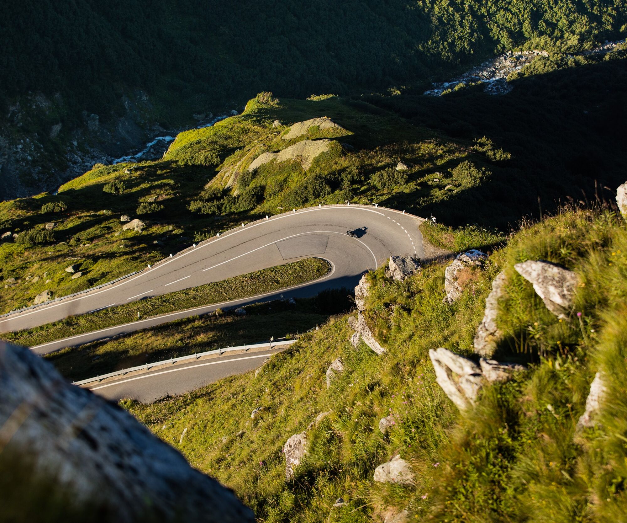
The ascent to the Grimsel Pass at 2164 m above sea level is already an adventure on the winding road from Oberwald via Gletsch. The road with its hairpin turns was a key route between Central Switzerland and Lombardy. Swiss cheese and livestock traveled southward, while mules transported wine, grain, rice, and olive oil northward.
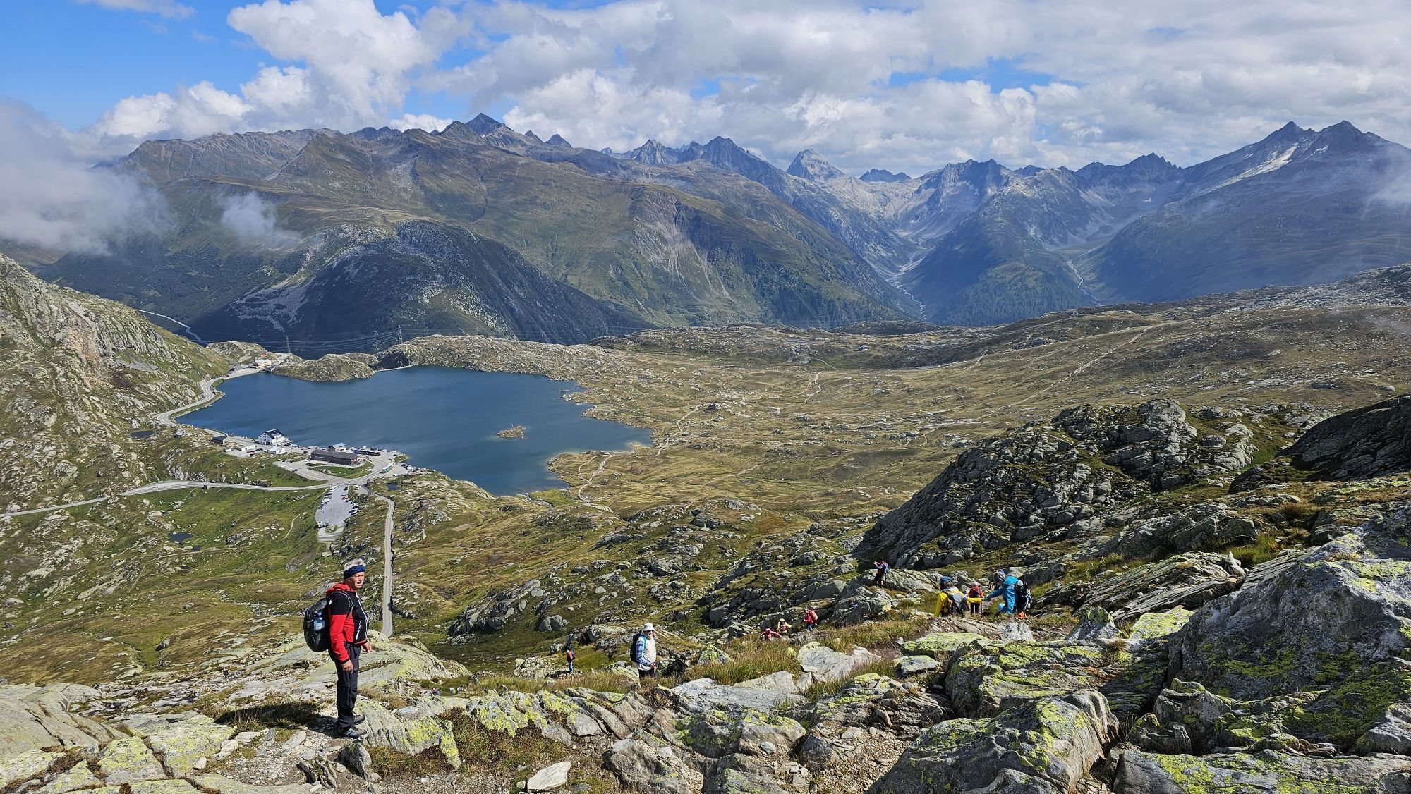
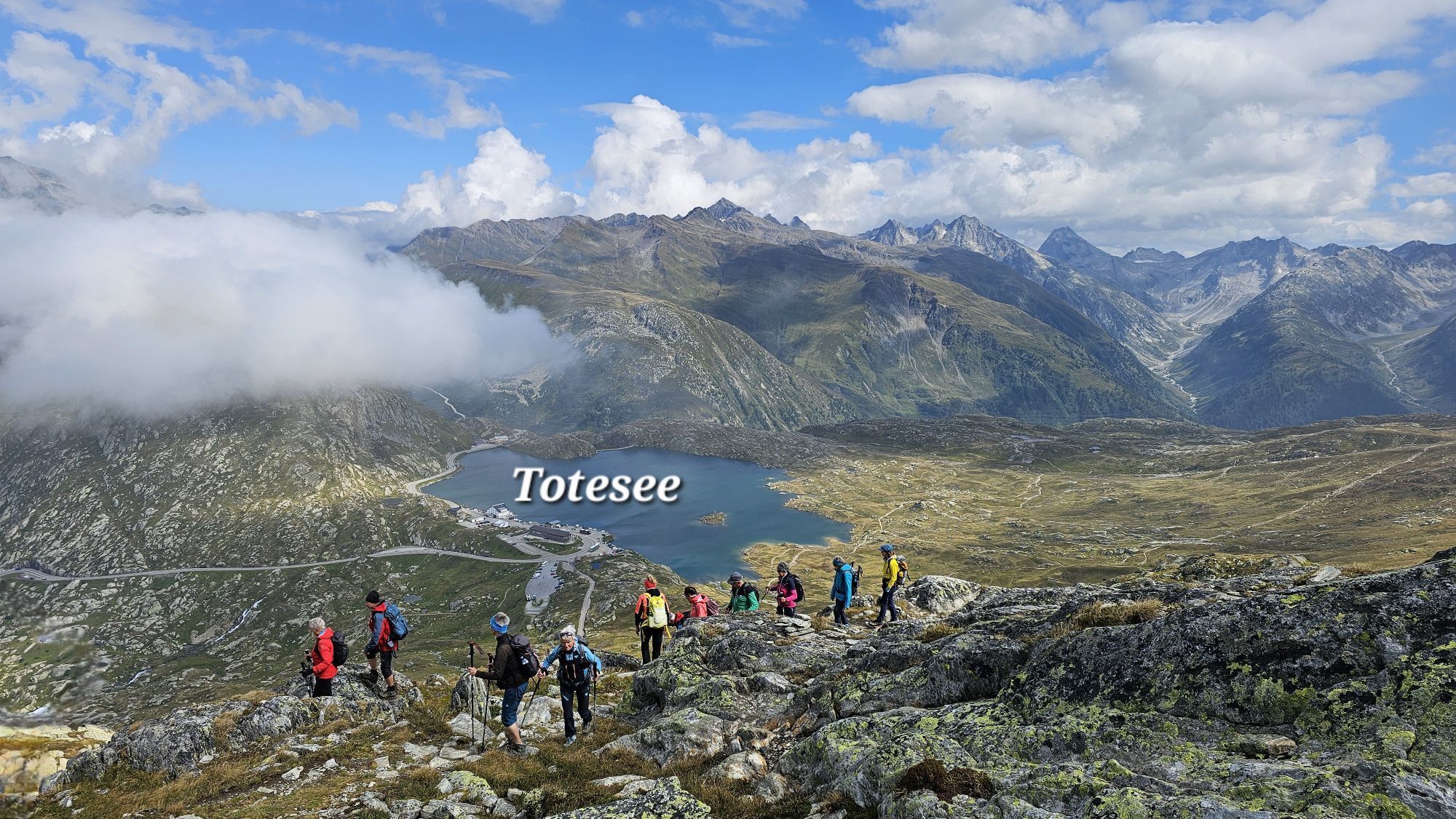
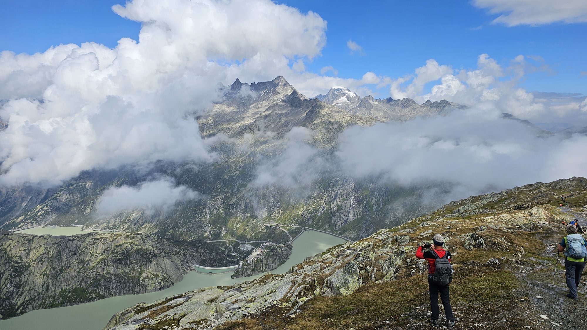
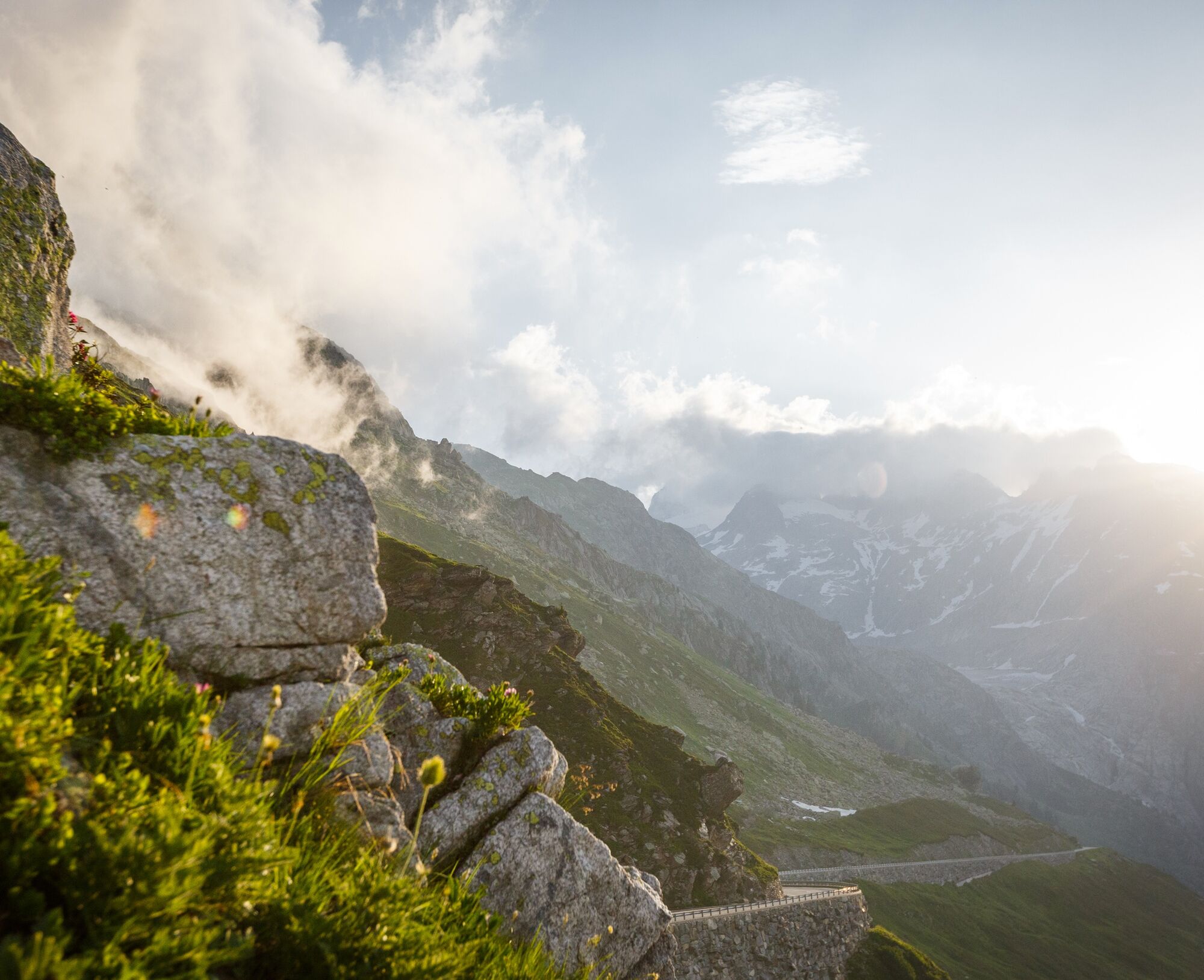
From the pass, the path leads westwards along the ridge. The view is fantastic: to the north lie the reservoirs of the Grimsel power plants and the glaciers of the Bernese Oberland. If it rains on this side of the path, the water is transported via the Aare to the North Sea. On the left side of the ridge, the water flows with the Rhone into the Mediterranean. It passes the Rhone Valley surrounded by the Valais 4000-meter peaks, flows along the vineyards of the Valais to Lake Geneva, where it leaves Switzerland.
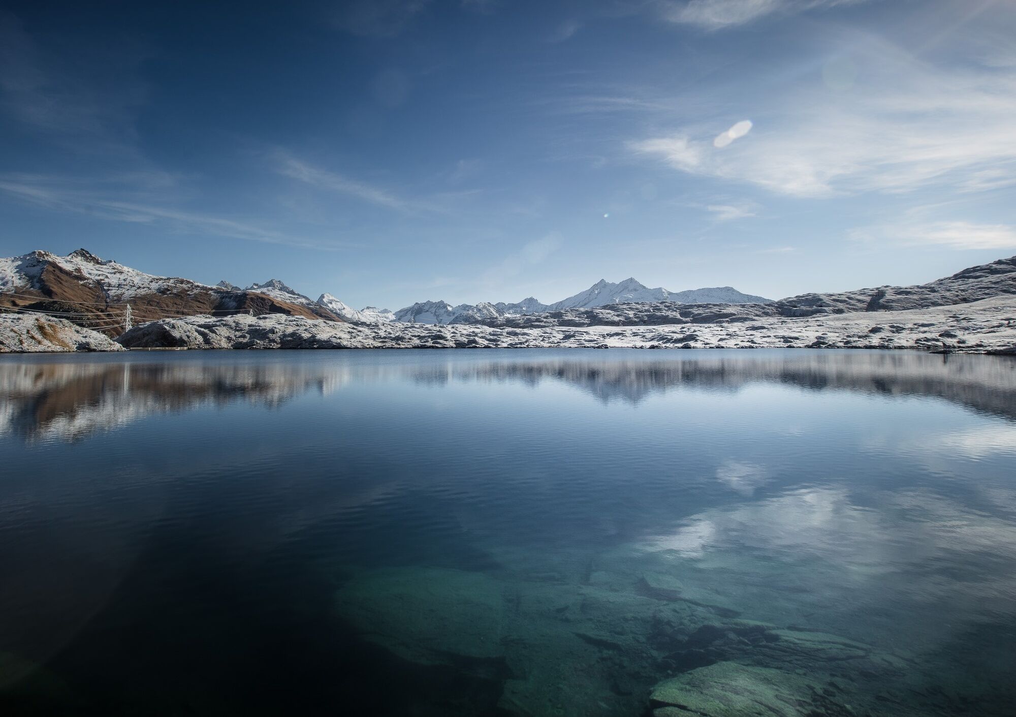
The ridge ends at the highest point of the route, the Sidelhorn (2764 m above sea level). Shortly after, the route leaves the ridge and descends towards the Rhone Valley, past Lake Jost, before returning northeast to the Grimsel Pass.
Tour highlights
Adventurous path along the ridge on the European watershed. Experience in the heart of the Alps: historic passes, Grimsel energy park with its reservoirs and power plants. Breathtaking views of glaciers, mountain lakes, snow-covered peaks, and the villages of the Rhone Valley.
The first section of the hike leads from the Grimsel Pass through the Bernese Oberland near the Valais border. Further up, you reach the border between the two cantons, which follows the European watershed up to the summit of the Sidelhorn.
Below, the path leads to the Triebtenseelücke with a great view of the lakes and glaciers. Then follows the descent to the shore of Lake Jost, before the return route leads back to the Grimsel Pass. The route crosses the mountain slope to the westernmost shore of Lake Totesee and then back to the pass height.
Áno
Áno
We recommend:
Good footwear Weather-dependent clothing: always carry a waterproof vest Headwear Sunscreen Water bottle Picnic Camera Binoculars (optional) Hiking poles (optional) Printout of the hiking trail (click "Print" to download)For certain hikes:
SwimsuitThe mountains, a place of joy to share and respect. The mountain world is a place to meet and experience unforgettable moments together – whether by bike or on foot. So that all users can benefit, it is essential to share this space with respect for nature and agriculture. Respectful behavior enables everyone to enjoy their recreational activities under the best conditions. Inform yourself about recommendations and rules. Assess your own abilities and fitness well. Using the various routes is fundamentally at your own risk.
For all hikes:
Carry a map with you. Download the complete description of the hiking trail with a large-scale map by clicking "Print" at the top right of the page. Use only marked hiking trails and observe all signs and instructions – for your own safety, to protect grazing animals, and out of respect for wild animals. Close gates after passing through. Behave considerately towards other trail users, plants, and animals.For mountain hikes:
Carry additional sunscreen. UV rays at high altitudes can be very strong, even in cloudy weather. Plan your hike carefully: take into account the required fitness level for all participants, weather forecasts, and seasonal factors. Weather conditions in the mountains can change very quickly and without warning. Appropriate clothing and sufficient provisions (food and drink) are very important. In unstable weather, it is better to turn back early.For high alpine hikes:
Inform your family about your hiking route. If possible, avoid traveling alone. Do not venture onto glaciers without a mountain guide. Observe warning signs indicating dangers at riverbanks, along watercourses below dams and reservoirs: water levels can rise quickly and without warning.Motorway A9 to Brig. From Brig, follow cantonal road 19 (Furka road) for 40 km to Oberwald, then follow the signs to the Grimsel Pass. The Grimsel Pass is also accessible via Central Switzerland or the Bernese Oberland.
Regional trains of the Matterhorn Gotthard Bahn to Oberwald, then by PostBus to the Grimsel Pass. The Grimsel Pass is also accessible via Central Switzerland or the Bernese Oberland. You can find the timetables for trains and PostBuses at sbb.ch.
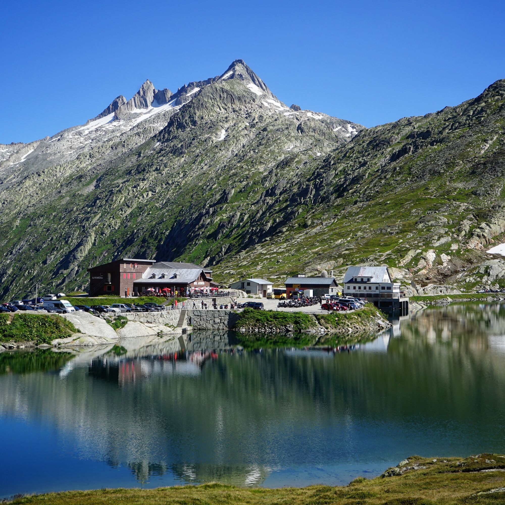
Grimsel Pass height
More information about the destination:
ObergomsKeep an eye out for the steam trains of the Furka Mountain Railway. The historic train passes the Furka Pass on the historic route between Oberwald and Realp.

Obľúbené výlety v okolí
-
5,0
Circular hike from Grimsel Pass - Sidelhorn via Jostsee
strednáTuristika 8,47 km -
5,0
9 lake-trail
ťažkéTuristika 17,3 km -
Furka Pass – Rhone Glacier
svetloTuristika 3,59 km -
5,0
Gelmersee-Tour
svetloTuristika 9,03 km -
4,0
Capanna Piansecco
svetloSnežnice 7,26 km -
5,0
Um den Gelmersee zur Gelmerhütte
strednáTuristika 9,30 km -
von Albert-Heim-Hütte via Nepali Highway und Sidelenhütte nach Furkapass
ťažkédiaľková pešia trasa 8,40 km -
5,0
Sidelenhütte
svetloTuristika 3,39 km -
5,0
Cycling pleasure on the Rottenweg
svetloCyklistika 25,0 km -
4,0
Realp - Witenwasseren - Rotondohütte - Leckihorn - Rottällihorn - Stelliboden - Realp
svetloSkitour 19,7 km

Turistika a stopovanie


Nenechajte si ujsť ponuky a inšpiráciu na ďalšiu dovolenku
Vaša e-mailová adresa bol pridaný do poštového zoznamu.