Les crêtes boisées du Mâconnais
stredná
Navigácia na stránke
Navigácia na stránke
Získajte túto prehliadku v mobilnom telefóne
Les crêtes boisées du Mâconnais
stredná
Mountainbike
170,75
km
Naskenujte kód QR a spustite navigáciu v aplikácii bergfex

Turistika a stopovanie


Les crêtes boisées du Mâconnais
stredná
Vzdialenosť
170,75
km
Trvanie
19:30
h
Ascent
4 641
hm
Hladina mora
177 -
696
m
Úroveň náročnosti: S1
Stiahnutie skladby
Les crêtes boisées du Mâconnais
stredná
Mountainbike
170,75
km
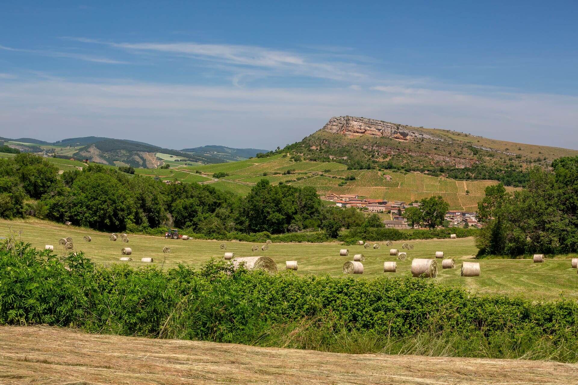
From Mâcon, the Voie Verte takes you to the vineyards of the Mâconnais. Here, the scenery reveals the famous Solutré and Vergisson rocks and all the beauty of this Grand Site de France.We then follow in...
Opis
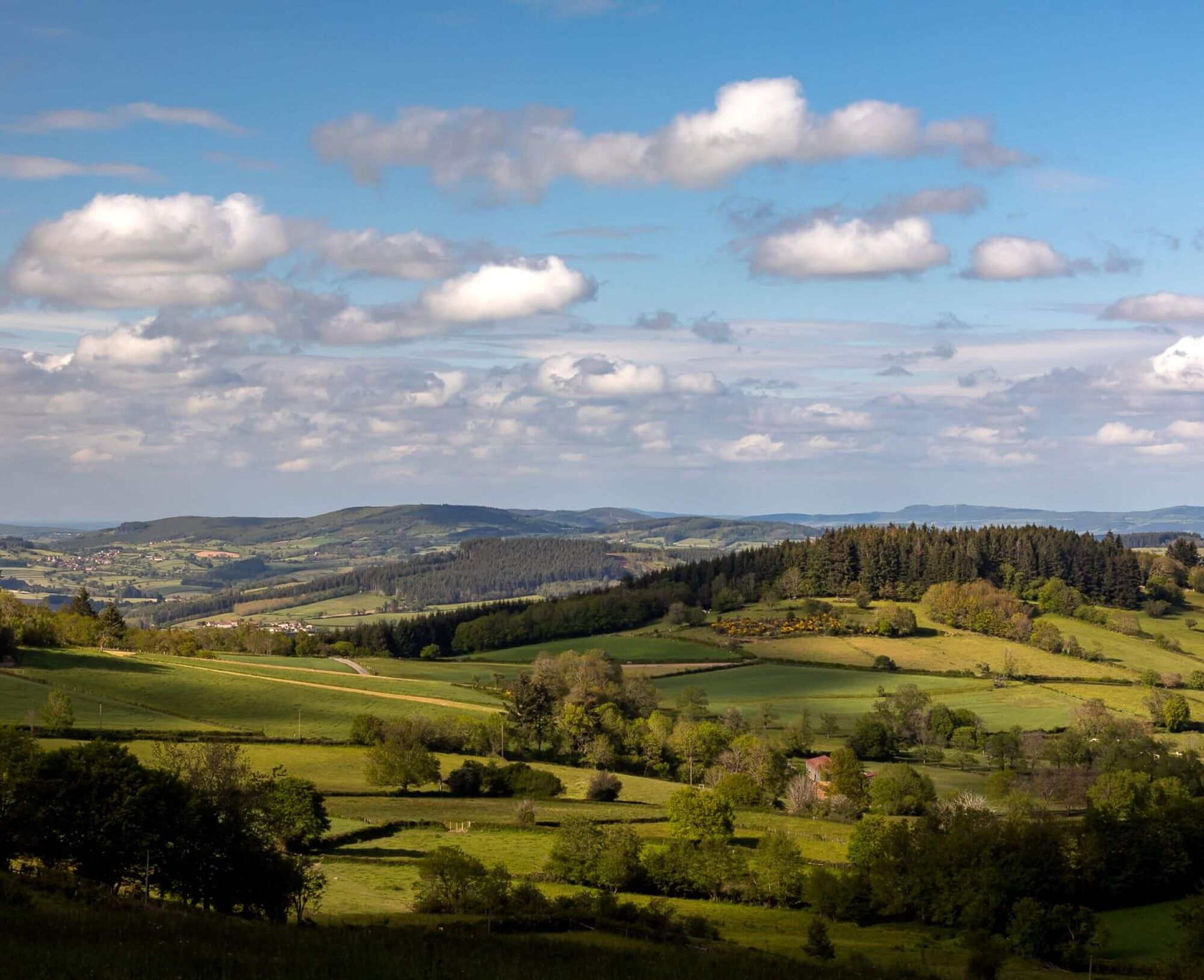
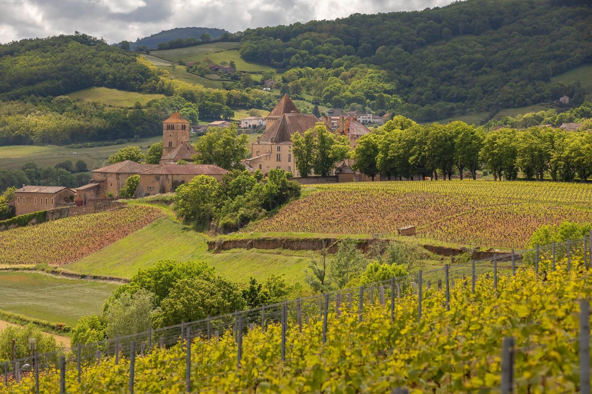
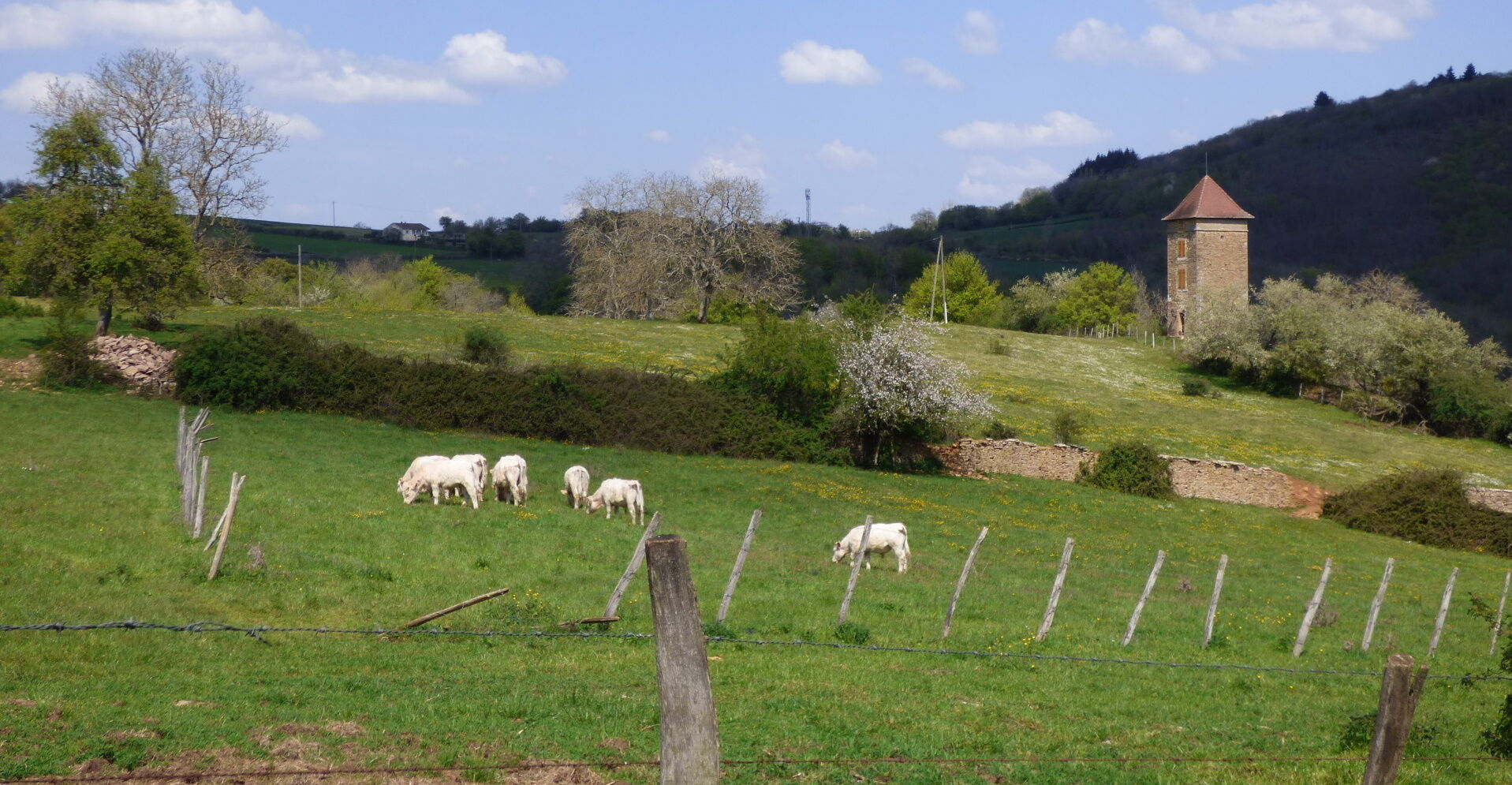
From Mâcon, the Voie Verte takes you to the vineyards of the Mâconnais. Here, the scenery reveals the famous Solutré and Vergisson rocks and all the beauty of this Grand Site de France. We then follow in the footsteps of Alphonse de Lamartine: his childhood village - Milly-Lamartine - where his house remains, the château de Pierreclos where he often stayed, and a passage near the château de Saint-Point where he lived until the end of his life. Gradually, the vineyards give way to a landscape alternating between meadows and woods. Stage 1 ends at Bourgvilain, a village nestling in the heart of gentle valleys, part of which is classified as a Natura 2000 area.
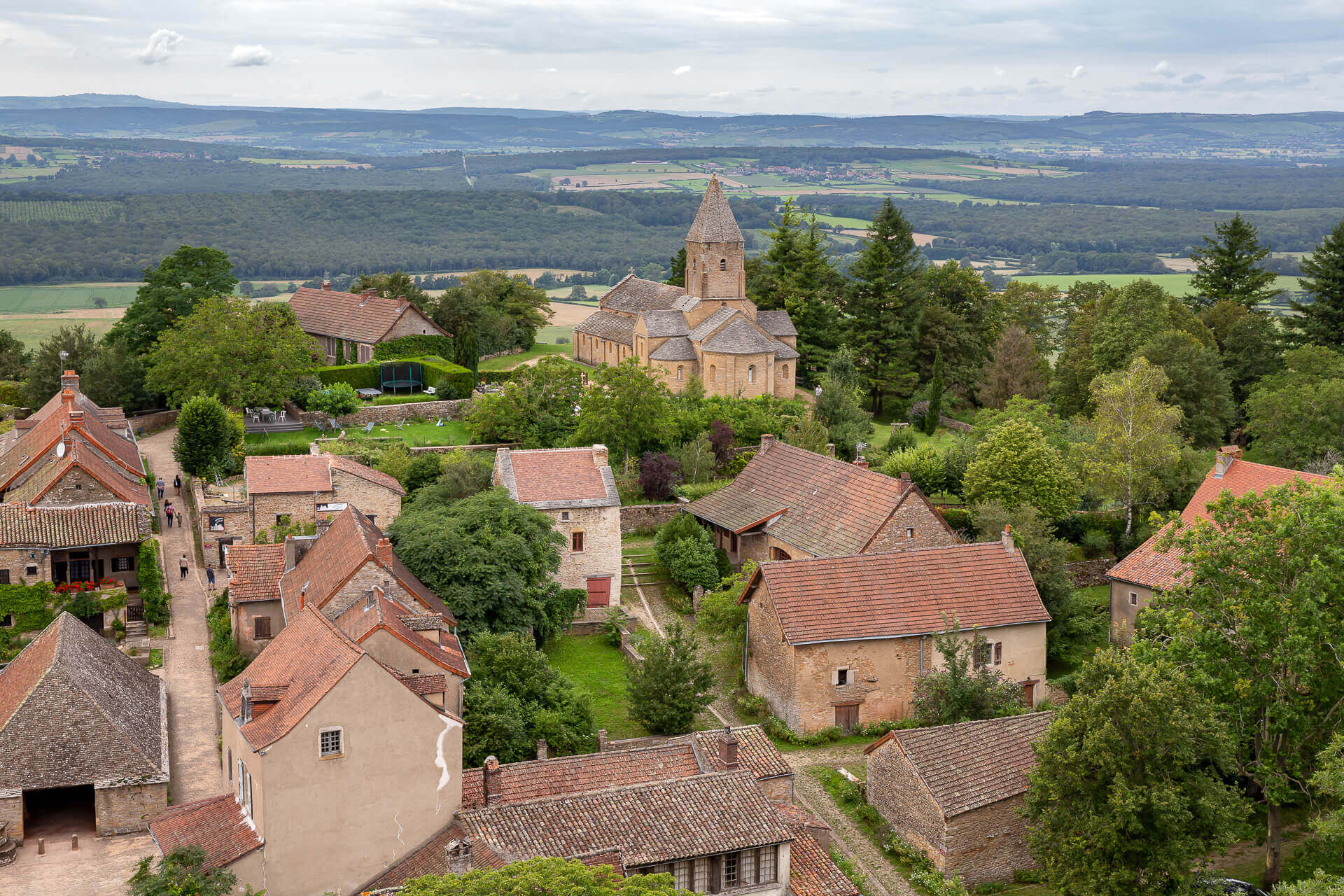
The romantic scenery of the Val Lamartinien then returns in the first few kilometres of stage 2, leaving Bourgvilain for La Roche-Vineuse, Berzé-la-Ville and Berzé-le-Châtel and its splendid medieval fortress. The route then runs through the woods of the Clunisois on the edge of the Haut-Mâconnais. Donzy-le-Pertuis offers lovely views of the countryside, which is shaped by hedged farmland in a mid-mountain microclimate. The route continues on to Azé, a village classified as a "Station Verte" (green resort) and famous for its rich underground network.
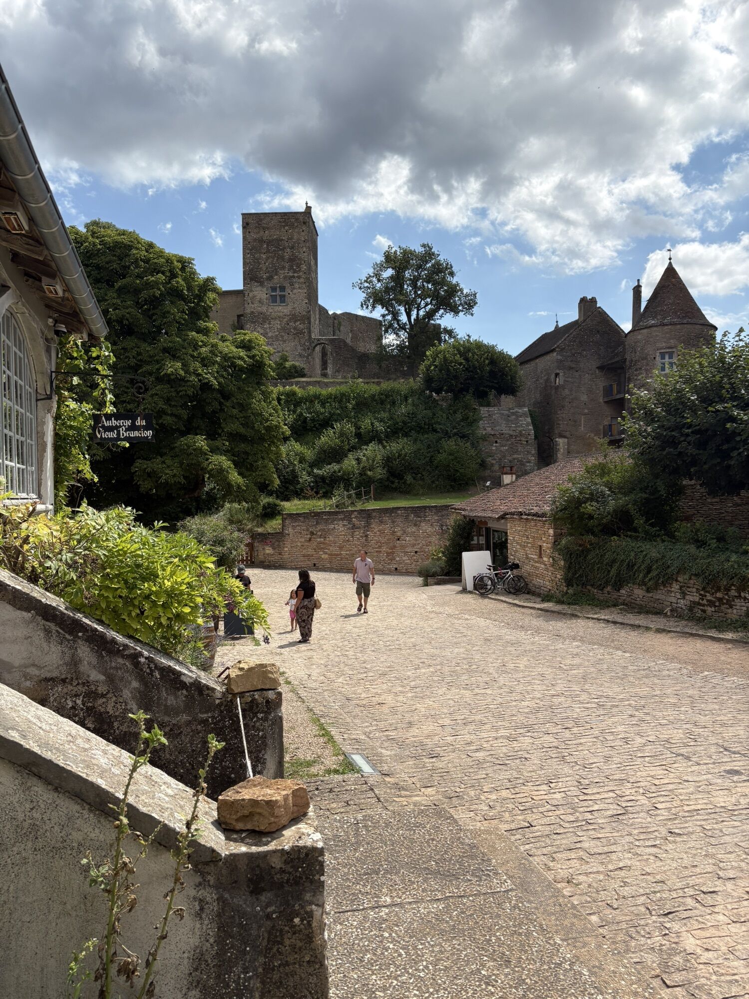
Stage 3 begins on the Rochebin massif, the "roof of the caves", a natural zone of ecological, faunistic and floristic interest, and then into the Clunisois countryside. Chissey-lès-Mâcon is an interesting stop-off for lovers of arts and crafts. Further on, passing near La Chapelle-sous-Brancion, at the foot of the fortified spur of Brancion, allows you to admire the village, its hamlets and its Romanesque church. After passing through the authentic village of Montceaux-Ragny, the route soon reaches Laives, where two orientation tables offer superb views over the Grosne valley, the Chalonnais region, Bresse, the Jura and the Alps. Finally, we head back south to Mancey and then Tournus. All around, the vineyards are regaining ground. Once in Tournus, a visit to the medieval town and abbey is a must.
The return journey to Mâcon can be made along the Voie Bleue. 32 km of cycle path along the banks of the Saône. You can also return by TER.
The romantic scenery of the Val Lamartinien then returns in the first few kilometres of stage 2, leaving Bourgvilain for La Roche-Vineuse, Berzé-la-Ville and Berzé-le-Châtel and its splendid medieval fortress. The route then runs through the woods of the Clunisois on the edge of the Haut-Mâconnais. Donzy-le-Pertuis offers lovely views of the countryside, which is shaped by hedged farmland in a mid-mountain microclimate. The route continues on to Azé, a village classified as a "Station Verte" (green resort) and famous for its rich underground network.
Stage 3 begins on the Rochebin massif, the "roof of the caves", a natural zone of ecological, faunistic and floristic interest, and then into the Clunisois countryside. Chissey-lès-Mâcon is an interesting stop-off for lovers of arts and crafts. Further on, passing near La Chapelle-sous-Brancion, at the foot of the fortified spur of Brancion, allows you to admire the village, its hamlets and its Romanesque church. After passing through the authentic village of Montceaux-Ragny, the route soon reaches Laives, where two orientation tables offer superb views over the Grosne valley, the Chalonnais region, Bresse, the Jura and the Alps. Finally, we head back south to Mancey and then Tournus. All around, the vineyards are regaining ground. Once in Tournus, a visit to the medieval town and abbey is a must.
The return journey to Mâcon can be made along the Voie Bleue. 32 km of cycle path along the banks of the Saône. You can also return by TER.
Trasa
Mont de Pouilly
(481 m)
Summit
13,7 km
Église Saint-Jacques-le-Majeur
(303 m)
Miesto uctievania
26,8 km
Église Saint-Denis
(285 m)
Miesto uctievania
55,3 km
Mont Chevreuil
(464 m)
Summit
78,3 km
Mont de la Fâ
(506 m)
Summit
79,1 km
La Roche Coche
(546 m)
Summit
80,5 km
Église Saint-Félix
(250 m)
Miesto uctievania
159,5 km
Trasa
Les crêtes boisées du Mâconnais
stredná
Mountainbike
170,75
km
Mâcon-Ville
(188 m)
Železničná stanica
0,0 km
Mâcon
(175 m)
Mesto
0,1 km
Église Saint-Clément
(179 m)
Miesto uctievania
0,2 km
Saint-Clément
(184 m)
Dedina
0,6 km
Les Blanchettes
(175 m)
Susedstvo
0,8 km
Le Charmillon
(205 m)
Zúčtovanie
3,8 km
La Lye
(204 m)
Zúčtovanie
4,8 km
Vignes Guérin
(209 m)
Zúčtovanie
4,9 km
Balme
(189 m)
Zúčtovanie
5,9 km
Loché
(219 m)
Dedina
7,7 km
Sur les Molards
(321 m)
Zúčtovanie
8,8 km
Fuissé
(244 m)
Dedina
9,7 km
Le Chapal
(237 m)
Zúčtovanie
9,8 km
En Collonge
(235 m)
Zúčtovanie
9,9 km
Pouilly
(274 m)
Zúčtovanie
10,9 km
Église Saint-Pierre
(281 m)
Miesto uctievania
11,4 km
Barvay
(307 m)
Zúčtovanie
11,8 km
Mont de Pouilly
(481 m)
Summit
13,7 km
Le Gros Bois
(448 m)
Zúčtovanie
15,2 km
La Grange du Bois
(527 m)
Zúčtovanie
17,1 km
Moulin Gabot
(235 m)
Zúčtovanie
23,9 km
Les Fuchats
(254 m)
Zúčtovanie
24,3 km
Bussières
(276 m)
Dedina
24,9 km
La Chize
(330 m)
Zúčtovanie
25,8 km
Église Saint-Jacques-le-Majeur
(303 m)
Miesto uctievania
26,8 km
L'auberge de Jack
(304 m)
Reštaurácia
26,8 km
Milly-Lamartine
(311 m)
Dedina
26,9 km
Le Chalument
(337 m)
Zúčtovanie
29,9 km
Le Carruge
(299 m)
Susedstvo
30,5 km
Pierreclos
(268 m)
Dedina
30,6 km
Le Fou
(345 m)
Zúčtovanie
31,2 km
La Varenne
(376 m)
Zúčtovanie
31,2 km
Les Margots
(310 m)
Zúčtovanie
31,9 km
La Roche
(328 m)
Zúčtovanie
32,7 km
Serrières
(316 m)
Dedina
33,6 km
La Croix
(304 m)
Zúčtovanie
34,1 km
La Farge
(313 m)
Zúčtovanie
34,5 km
Les Monterrains
(396 m)
Zúčtovanie
35,0 km
Bois-Saint
(471 m)
Zúčtovanie
36,0 km
Les Provenchères
(430 m)
Zúčtovanie
37,4 km
Les Fougères
(565 m)
Zúčtovanie
38,8 km
Le Grand Chemin
(523 m)
Zúčtovanie
42,1 km
Champvent
(470 m)
Zúčtovanie
42,7 km
Les Trèves
(460 m)
Zúčtovanie
43,0 km
Les Morats
(457 m)
Zúčtovanie
44,3 km
La Garenne
(463 m)
Susedstvo
44,4 km
La Chevrotte
(459 m)
Zúčtovanie
44,7 km
Tramayes
(467 m)
Dedina
45,0 km
Église Saint-Jean-Baptiste
(480 m)
Miesto uctievania
45,3 km
Fontaine Verdine
(573 m)
Zúčtovanie
50,3 km
Les Grands Gouillats
(454 m)
Zúčtovanie
52,2 km
Les Sardyz
(350 m)
Zúčtovanie
53,4 km
Bourgvilain
(283 m)
Dedina
55,2 km
Larochette Aubergiste
(285 m)
Reštaurácia
55,3 km
Église Saint-Denis
(285 m)
Miesto uctievania
55,3 km
Lotissement des Vignes
(322 m)
Susedstvo
55,6 km
Les Meuriers
(308 m)
Zúčtovanie
55,7 km
La Pierre Sauvage
(527 m)
Reštaurácia
58,9 km
Sologny
(322 m)
Dedina
66,0 km
La Croix-Blanche
(272 m)
Zúčtovanie
66,9 km
Les Furtins
(284 m)
Zúčtovanie
67,3 km
Chapelle des Moines
(323 m)
Miesto uctievania
67,8 km
Berzé-la-Ville
(334 m)
Dedina
68,4 km
Église de la Purification de la Vierge
(323 m)
Miesto uctievania
68,7 km
Lapalue
(262 m)
Zúčtovanie
73,0 km
Escolles
(272 m)
Zúčtovanie
73,2 km
La Mure
(282 m)
Zúčtovanie
74,9 km
Vanzé
(281 m)
Zúčtovanie
75,1 km
Verzé
(281 m)
Dedina
76,2 km
Les Terres Derrières
(293 m)
Zúčtovanie
76,5 km
Mont Chevreuil
(464 m)
Summit
78,3 km
Mont de la Fâ
(506 m)
Summit
79,1 km
Berzé-la-Ville
(334 m)
Dedina
80,4 km
La Roche Coche
(546 m)
Summit
80,5 km
Mont Perret
(480 m)
Koridor/terén
81,9 km
Le Perret
(447 m)
Zúčtovanie
82,6 km
Berzé-le-Châtel
(379 m)
Dedina
83,9 km
Les Raveaux
(409 m)
Zúčtovanie
83,9 km
Église Saint-Sébastien
(389 m)
Miesto uctievania
84,0 km
Les Baudys
(394 m)
Zúčtovanie
84,1 km
Les Thinons
(420 m)
Zúčtovanie
84,7 km
En Pain Chaud
(244 m)
Susedstvo
93,0 km
Les Brouillards
(244 m)
Susedstvo
93,2 km
Bellecroix
(237 m)
Susedstvo
93,5 km
Cluny
(241 m)
Dedina
93,9 km
Narancy
(340 m)
Zúčtovanie
99,5 km
Les Quatre Vents
(488 m)
Zúčtovanie
101,4 km
Donzy-le-Pertuis
(429 m)
Dedina
102,3 km
La Filatière
(435 m)
Zúčtovanie
102,8 km
En Fourgeau
(275 m)
Susedstvo
111,2 km
Azé
(247 m)
Dedina
112,2 km
Rizerolles
(247 m)
Zúčtovanie
112,5 km
Montchanin
(260 m)
Zúčtovanie
112,5 km
La Verzée
(344 m)
Zúčtovanie
117,2 km
Col de la Croix
(486 m)
Horské sedlo
119,7 km
Moulin aux Grues
(242 m)
Zúčtovanie
124,5 km
Chissey-lès-Mâcon
(251 m)
Dedina
126,0 km
Église Saint-Pierre
(252 m)
Miesto uctievania
126,0 km
Prayes
(243 m)
Zúčtovanie
126,4 km
L'Auberge du Grison
(237 m)
Reštaurácia
126,7 km
L'Échelette
(344 m)
Zúčtovanie
130,2 km
La Fait
(411 m)
Koridor/terén
131,6 km
Brancion
(371 m)
Zúčtovanie
132,7 km
En Néguerre
(279 m)
Koridor/terén
133,9 km
La Chapelle-sous-Brancion
(271 m)
Dedina
134,1 km
Sous le Devant
(286 m)
Koridor/terén
134,7 km
Le Bout de Balleure
(265 m)
Koridor/terén
139,0 km
Balleure
(259 m)
Zúčtovanie
139,1 km
Étrigny
(262 m)
Dedina
140,5 km
Veneuse
(296 m)
Zúčtovanie
140,7 km
Corlay-le-Haut
(350 m)
Susedstvo
143,0 km
Corlay
(345 m)
Zúčtovanie
143,0 km
Lenoux
(217 m)
Zúčtovanie
148,9 km
Bas de Sermaisey
(200 m)
Susedstvo
149,1 km
Laives
(200 m)
Dedina
149,1 km
Montagne de Saint-Martin
(293 m)
Koridor/terén
150,2 km
Vers
(263 m)
Dedina
159,4 km
Église Saint-Félix
(250 m)
Miesto uctievania
159,5 km
A La Cure
(248 m)
Koridor/terén
159,5 km
En Marchefeu
(251 m)
Zúčtovanie
160,9 km
Dulphey
(242 m)
Dedina
161,1 km
Moulin Mutin
(210 m)
Zúčtovanie
162,7 km
A Robalot
(226 m)
Zúčtovanie
162,8 km
Le Roi Guillaume
(300 m)
Zúčtovanie
164,4 km
Beaufer
(251 m)
Zúčtovanie
167,4 km
L'Ambre
(223 m)
Zúčtovanie
168,2 km
Tournus
(177 m)
Mesto
170,1 km
Tournus
(192 m)
Železničná stanica
170,5 km
Autor
Prehliadku Les crêtes boisées du Mâconnais zabezpečuje outdooractive.com.
Bezpečnostné pokyny
Im Notfall wählen Sie 112
Informácie o príchode
Príchod
Denk an Fahrgemeinschaften
Verejná doprava
Parkovanie
Parkplatz in der Nähe des Startpunkts
Ďalšie informácie a tipy
Úroveň náročnosti
S1
Ďalšie informácie
Mâcon Sud Bourgogne, Tourisme et Congrès http://www.macon-tourism.com
Zatiaľ žiadne recenzie
Obľúbené výlety v okolí
-
5,0
The secrets of the Roche de Solutré
strednáTuristika 3,97 km -
La Boucle de Bourgogne du Sud
svetloCyklistika 145,0 km -
Le chemin des Moines
strednáTuristika 35,0 km -
CycloRoute71 - Etape 1 de Mâcon à Cormatin
strednáCyklistika 51,1 km -
Les confidences de la Roche de Vergisson
svetloTuristika 3,02 km -
Le Marais de Massilly
svetloTuristika 0,20 km -
Les Chemins de Saint-Jacques de Compostelle de Cluny au Puy-en-Velay
svetloTuristika 23,5 km -
Dans les pas du Poète - Milly-Lamartine
strednáTuristika 11,9 km -
Du toit des grottes à la Mouge
svetloTuristika 1,25 km -
Les quatre vents
strednáJazda na koni 17,4 km

Turistika a stopovanie

Viac ako 550.000 návrhov výletov, podrobné mapy a intuitívny plánovač trás robia z aplikácie povinnú výbavu pre všetkých nadšencov prírody.

Nenechajte si ujsť ponuky a inšpiráciu na ďalšiu dovolenku
Prihlásiť sa k odberu noviniek
Chyba
Vyskytla sa chyba. Prosím, skúste to znova.
Ďakujeme za vašu registráciu
Vaša e-mailová adresa bol pridaný do poštového zoznamu.
Zájazdy po celej Európe
Rakúsko
Švajčiarsko
Nemecko
Taliansko
Slovinsko
Francúzsko
Holandsko
Belgicko
Poľsko
Lichtenštajnsko
Česko
Slovensko
španielsko
Hrvaška
Bosna a Hercegovina
Luxembursko
Andorra
Portugalsko
Island
Spojené kráľovstvo
Írsko
Grécko
Albánsko
Severné Macedónsko
Malta
Nórsko
Čierna Hora
Moldavsko
Kosovo
Maďarsko
San Maríno
Rumunsko
Estónsko
Lotyšsko
Bielorusko
Cyprus
Litva
Srbsko
Bulharsko
Monako
Dánsko
Švédsko
Fínsko