Babino Polje - Odysseus Cave - Veliki Grad
stredná
Získajte túto prehliadku v mobilnom telefóne
Babino Polje - Odysseus Cave - Veliki Grad
stredná
Turistika
6,82
km
Naskenujte kód QR a spustite navigáciu v aplikácii bergfex

Turistika a stopovanie


Babino Polje - Odysseus Cave - Veliki Grad
stredná
Vzdialenosť
6,82
km
Trvanie
02:45
h
Ascent
514
hm
Hladina mora
-
m
Stiahnutie skladby
Babino Polje - Odysseus Cave - Veliki Grad
stredná
Turistika
6,82
km
If you really want to start the ascent at 0m above the Adriatic Sea, you shouldn't forget your swimming trunks (cliff diving!). The path leads through olive groves, through Babino Polje, through the forest,...
Opis
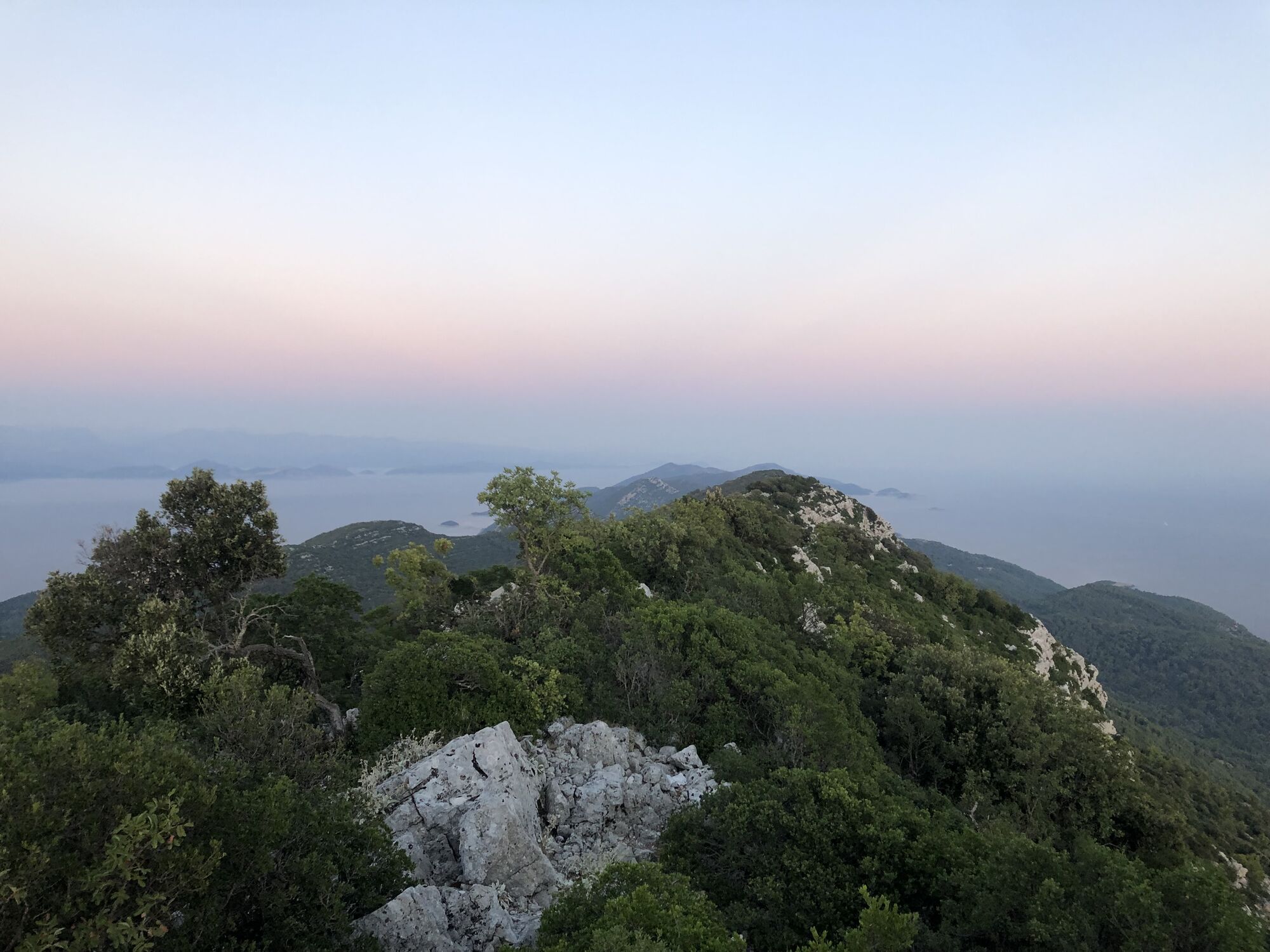
If you really want to start the ascent at 0m above the Adriatic Sea, you shouldn't forget your swimming trunks (cliff diving!). The path leads through olive groves, through Babino Polje, through the forest, finally over scree and becomes very steep (partly exposed) towards the end. There is an antenna system at the summit, but the view is definitely rewarding!
Trasa
Crkva svetog Pavla
(170 m)
Miesto uctievania
0,0 km
Odysseus cave
(15 m)
Vchod do jaskyne
1,5 km
Konoba Triton
(158 m)
Reštaurácia
3,0 km
Veliki Grad
(514 m)
Summit
4,7 km
Trasa
Babino Polje - Odysseus Cave - Veliki Grad
stredná
Turistika
6,82
km
Babino Polje
(150 m)
Dedina
0,0 km
Crkva svetog Pavla
(170 m)
Miesto uctievania
0,0 km
Odysseus cave
(15 m)
Vchod do jaskyne
1,5 km
Konoba Triton
(158 m)
Reštaurácia
3,0 km
Veliki Grad
(514 m)
Summit
4,7 km


Naposledy sledované
Pred 2 týždňami
Informácie o trase
Zastávka na odpočinok a občerstvenie
Pizzeria next to the partisan memorial
Strmý priechod
Áno
Prehliadka vrcholu
Áno
Lesná oblasť
Áno
Zariadenie
Sturdy shoes
Zatiaľ žiadne recenzie
Obľúbené výlety v okolí
-
MLJET
ťažkéMountainbike 71,7 km -
Sobra - Mali Grad - Veliki Planjak - Pomena
strednáTuristika 33,5 km -
Blato - Grabova glava - Pristanište - Pomena
svetlodiaľková pešia trasa 16,9 km -
Sobra - Babino Polje - Ostaševica - Blato
svetlodiaľková pešia trasa 15,4 km -
Crkva svetog Pavla - Konoba Triton - Crkva Gospe od Brijega - Babino Polje
ťažkéŠtrkový bicykel 42,4 km -
Polače - V. Gradac - Soline - Konoba Pikala
strednáTuristika 9,73 km -
Babino Polje - Odisejeva špilja - Dubrovačko-neretvanska županija
svetloTuristika 4,33 km -
Agroturizam Franka - Korita - Crkva Gospe od Brijega - Saplunara
strednáCestný bicykel 26,7 km -
Polače - Tatinica - Kozarica - Blato
strednáŠtrkový bicykel 26,4 km -
Konoba Triton - Crkva svetog Pavla - Babino Polje - Veliki Grad
strednáTuristika 6,91 km
Turistika a stopovanie

Viac ako 550.000 návrhov výletov, podrobné mapy a intuitívny plánovač trás robia z aplikácie povinnú výbavu pre všetkých nadšencov prírody.

Nenechajte si ujsť ponuky a inšpiráciu na ďalšiu dovolenku
Prihlásiť sa k odberu noviniek
Chyba
Vyskytla sa chyba. Prosím, skúste to znova.
Ďakujeme za vašu registráciu
Vaša e-mailová adresa bol pridaný do poštového zoznamu.
Zájazdy po celej Európe
Rakúsko
Švajčiarsko
Nemecko
Taliansko
Slovinsko
Francúzsko
Holandsko
Belgicko
Poľsko
Lichtenštajnsko
Česko
Slovensko
španielsko
Hrvaška
Bosna a Hercegovina
Luxembursko
Andorra
Portugalsko
Island
Spojené kráľovstvo
Írsko
Grécko
Albánsko
Severné Macedónsko
Malta
Nórsko
Čierna Hora
Moldavsko
Kosovo
Maďarsko
San Maríno
Rumunsko
Estónsko
Lotyšsko
Bielorusko
Cyprus
Litva
Srbsko
Bulharsko
Monako
Dánsko
Švédsko
Fínsko
Prehliadky v Hrvaška
Istria
Kvarner
Lika - Karlovacká
Dalmácia - Zadar
Dalmácia - Šibenik
Dalmácia - Split
Dalmácia - Dubrovník
Záhreb
Stredné Chorvátsko
Slavónsko
Mesto Záhreb
Krapinsko-zagorská
Varaždínska župa
Medzimurská župa
Koprivnica-Križevci County
Virovitica-Podravina County
Osijek-Baranja County
Vukovar-Srijem County
Brod-Posavina County
Sisak-Moslavina County
Karlovecká župa
Záhrebská župa