


Cammino di San Cristoforo | Val Meduna Route | Stage 2 - Campone-Tramonti-Palcoda
Challenging but unique stage, offering a journey through Valtramontina to discover its nature and history.
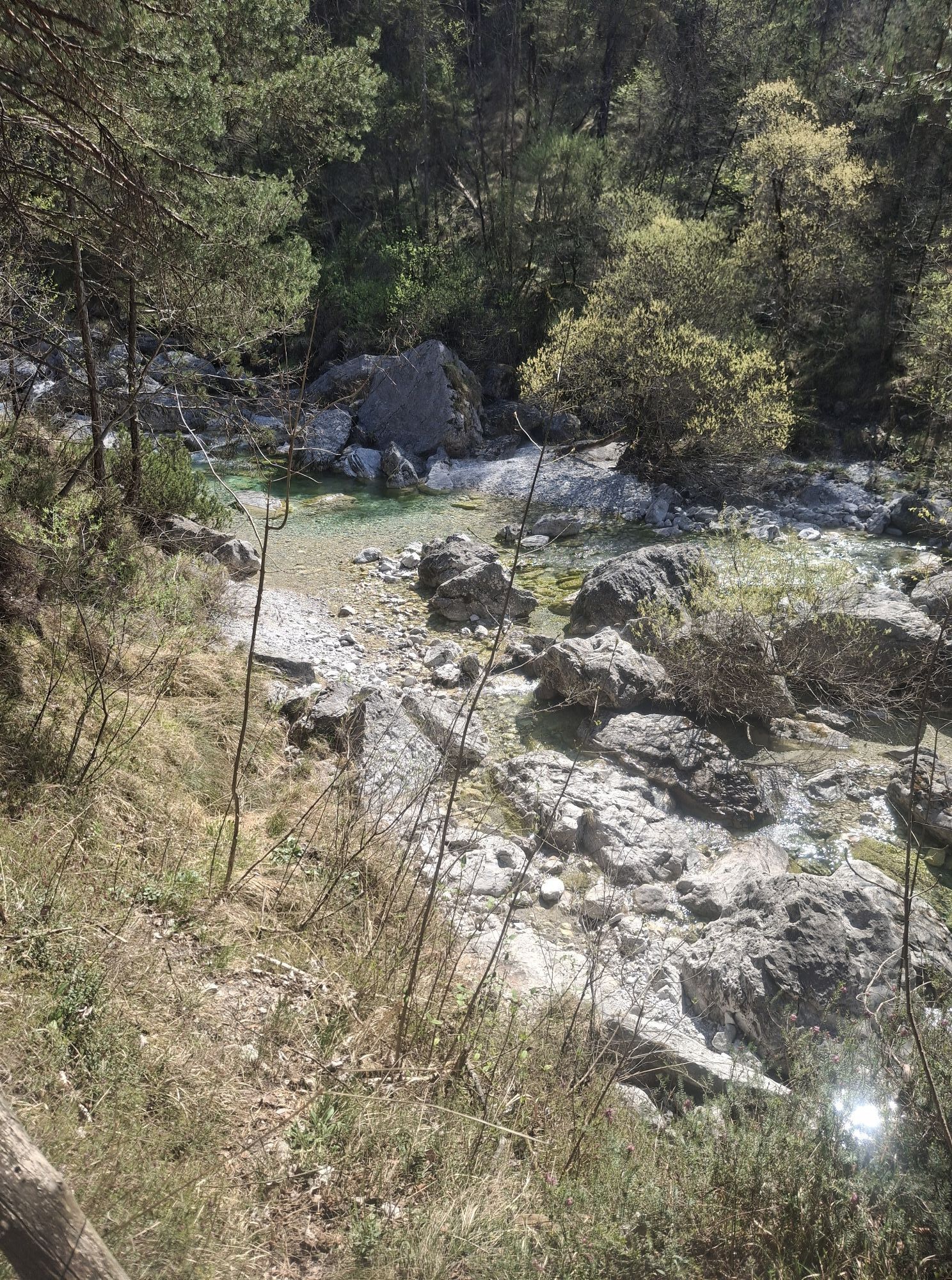
The route offers panoramic views of Lake Redona, trails through little-frequented woods, and a...
Challenging but unique stage, offering a journey through Valtramontina to discover its nature and history.
The route offers panoramic views of Lake Redona, trails through little-frequented woods, and a tranquility that characterizes the area. However, Tramonti di Sotto, a small mountain village, resists depopulation thanks to quality activities and events that attract visitors from all over Italy and beyond. These activities combine art, craftsmanship, farming, traditions, and innovations.
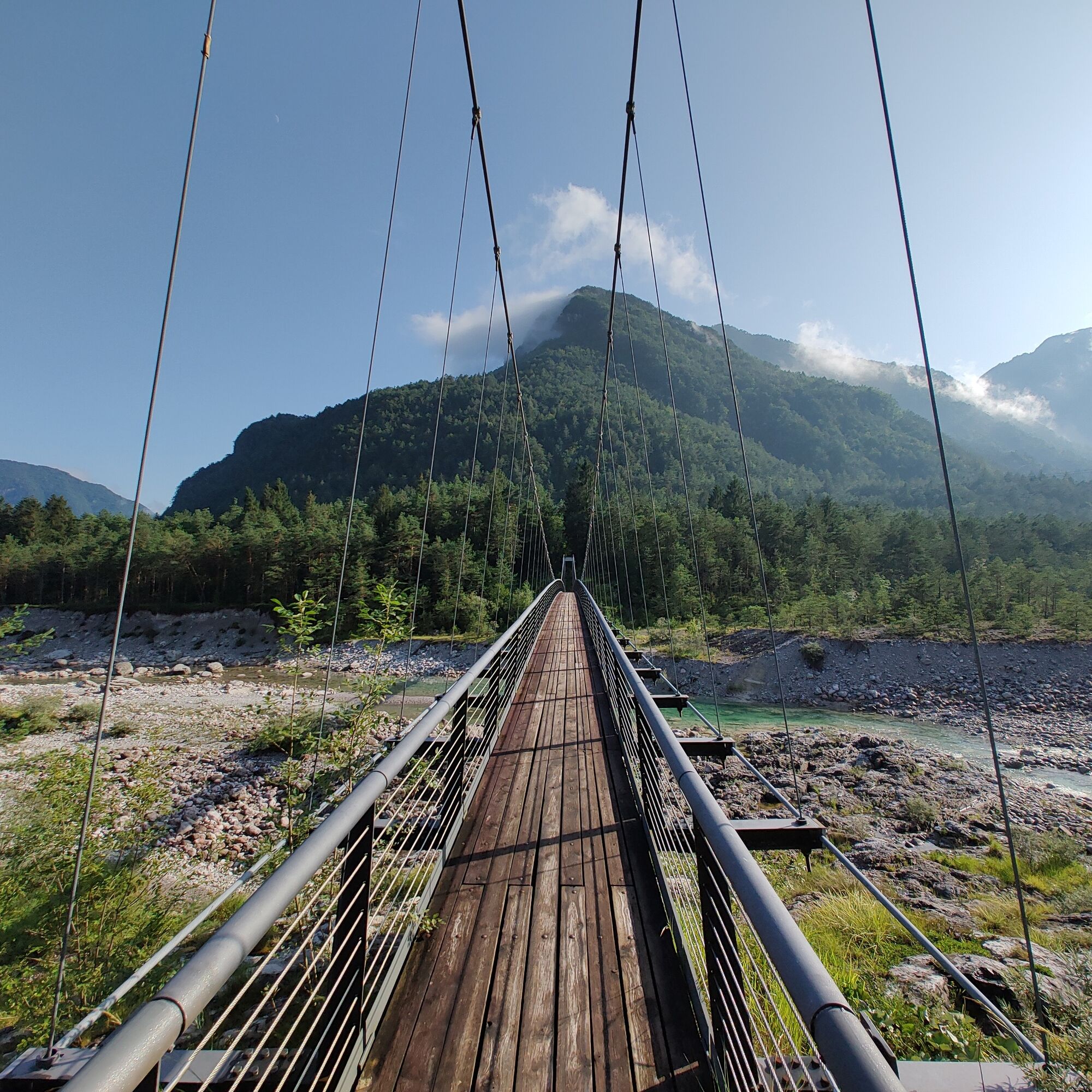
Along the route, you encounter the ancient village of Palcoda, once an important commercial center connecting Italy with Northern European and Dutch countries. Now abandoned for decades, this village has recently been renovated thanks to mountain tourism and its precious church. Trekking and nature walks are now an opportunity to explore the valley's richness.

The Valtramontina offers a panoramic route through woods with a view of Lake Redona and includes the ancient village of Palcoda and Tramonti di Sotto, a small mountain village. A challenging but unique stage, offering a journey through Valtramontina to discover its nature and history.
The route offers panoramic views of Lake Redona, trails through little-frequented woods, and a tranquility that characterizes the area. However, Tramonti di Sotto, a small mountain village, resists depopulation thanks to quality activities and events that attract visitors from all over Italy and beyond. These activities combine art, craftsmanship, farming, traditions, and innovations.
Along the route, you encounter the ancient village of Palcoda, once an important commercial center connecting Italy with Northern European and Dutch countries. Now abandoned for decades, this village has recently been renovated thanks to mountain tourism and its precious church. Trekking and nature walks are now an opportunity to explore the valley's richness.
Standard hiking equipment; trekking poles are strongly recommended.
Challenging but unique stage, offering a journey through Valtramontina to discover its nature and history.
Campone is located on the SP57, coming from either Tramonti or Clauzetto.
It is possible to reach Tramonti di Sopra and Tramonti di Sotto by public transport.
Parking is available in the village of Campone.
Hiking route - E
Don't miss the view of Lake Redona.
Obľúbené výlety v okolí
-
4,8
Monte Cuar loop
strednáTuristika 7,26 km -
PATH OF THE POZZE SMERALDINE
svetloTuristika 6,77 km -
Palcoda a Tamar, opustené dediny
strednáTuristika 8,38 km -
From Sella Chianzutan to Colle dei Larici, the route of red marble
strednáTuristika 10,5 km -
5,0
Raut da Palabarzana
strednáTuristika 9,72 km -
Panoramatická trasa z priesmyku Rest do hory Rest
strednáTuristika 7,72 km -
Monte Valinis loop from Sottomonte
strednáTuristika 8,41 km -
5,0
STRADA DA LIS FORNAS TRAIL
svetloTuristika 5,77 km -
FRASSANEIT AND LAGO DEL CIUL
strednáTuristika 11,4 km -
Sentiero dei Forestali in Val Silisia, Lake Cà Selva
strednáTuristika 10,8 km
Turistika a stopovanie


Nenechajte si ujsť ponuky a inšpiráciu na ďalšiu dovolenku
Vaša e-mailová adresa bol pridaný do poštového zoznamu.