


Circular Route of Open-air Museum of Mt. Kolovrat
Úroveň náročnosti: T1
Fotografie našich používateľov
-
 © Astrid TomadaVytvorené dňa 08.02.2025
 -
 © Astrid TomadaVytvorené dňa 08.02.2025
 -
 © Astrid TomadaVytvorené dňa 08.02.2025
 -
 © Astrid TomadaVytvorené dňa 08.02.2025
 -
 © Henrik SingelmannVytvorené dňa 17.09.2024
 -

 © NicoVytvorené dňa 09.08.2025
 -
 © NicoVytvorené dňa 09.08.2025
 -
 © Cornelia EggerVytvorené dňa 08.08.2025


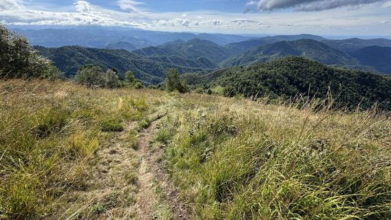
This short circular route allows visitors to explore the heart of the Kolovrat Open-Air Museum. This was once the Italian third line of defence, and today it offers insight into the events of the Twelfth...
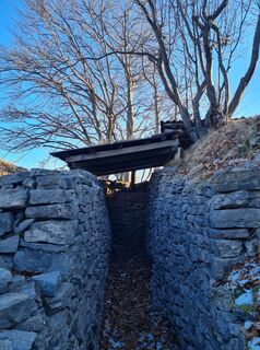
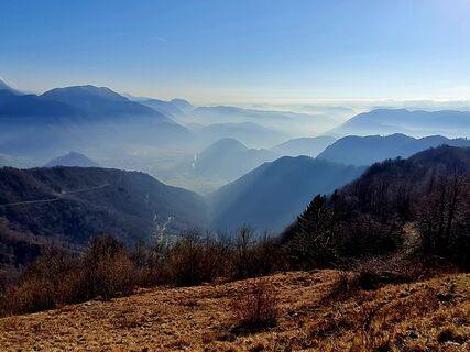
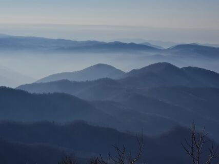
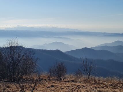
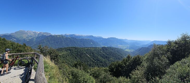
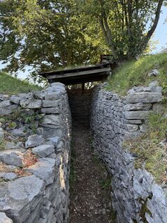
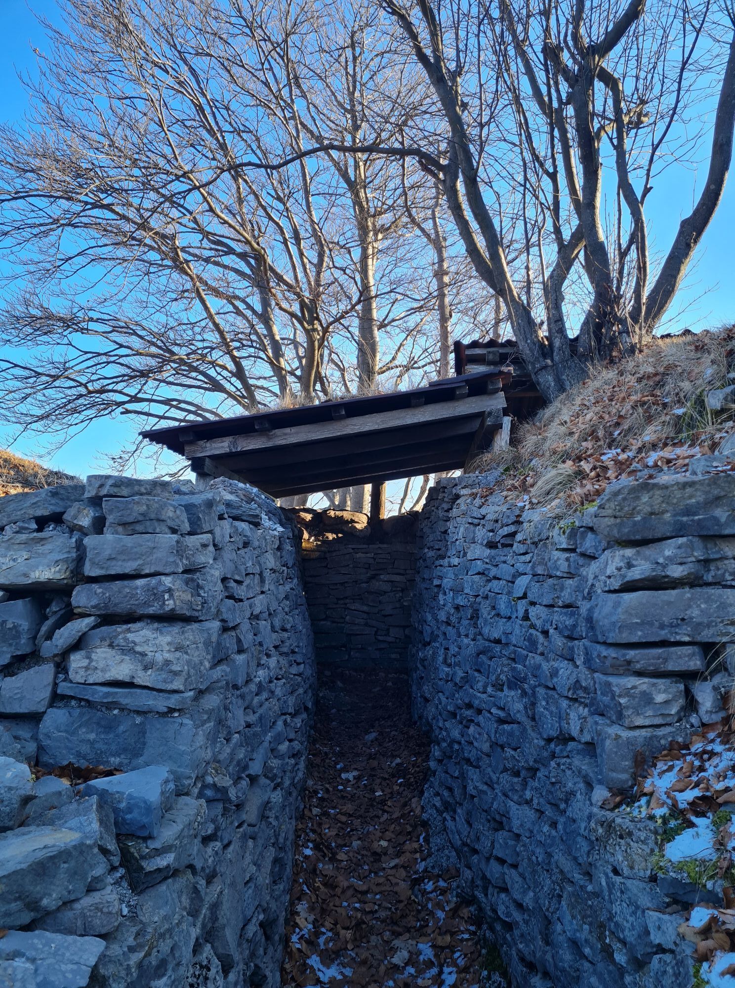
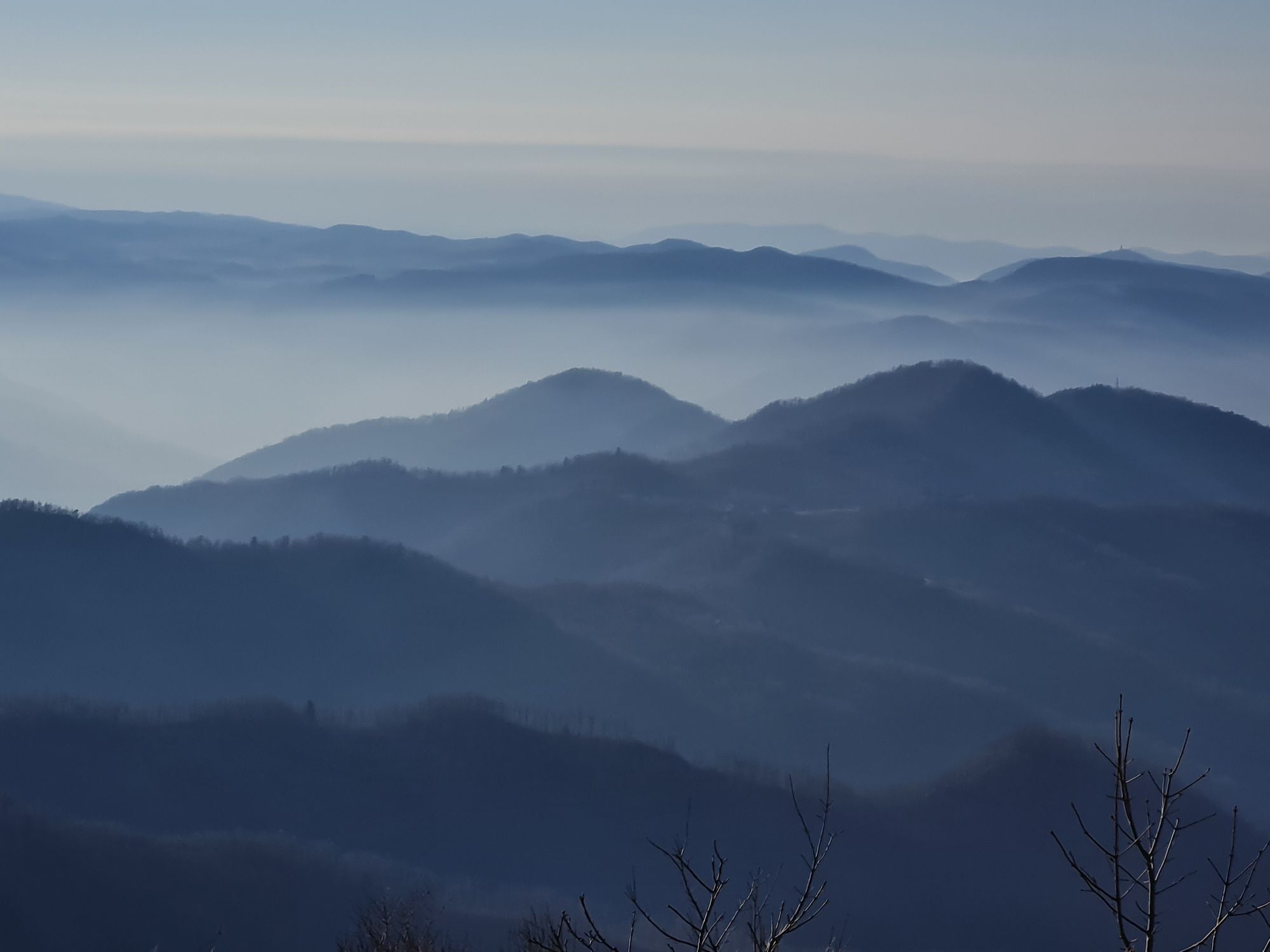
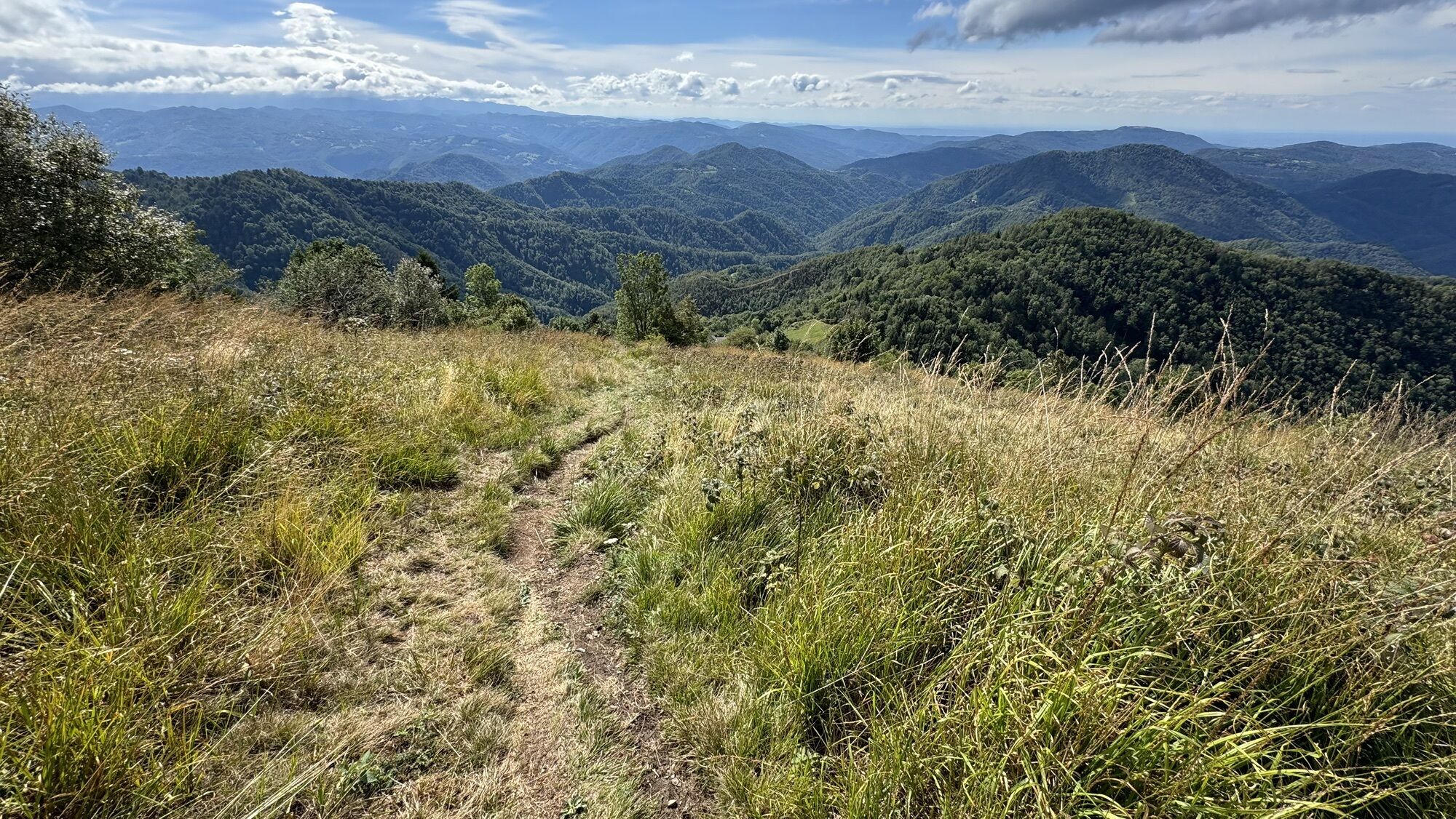
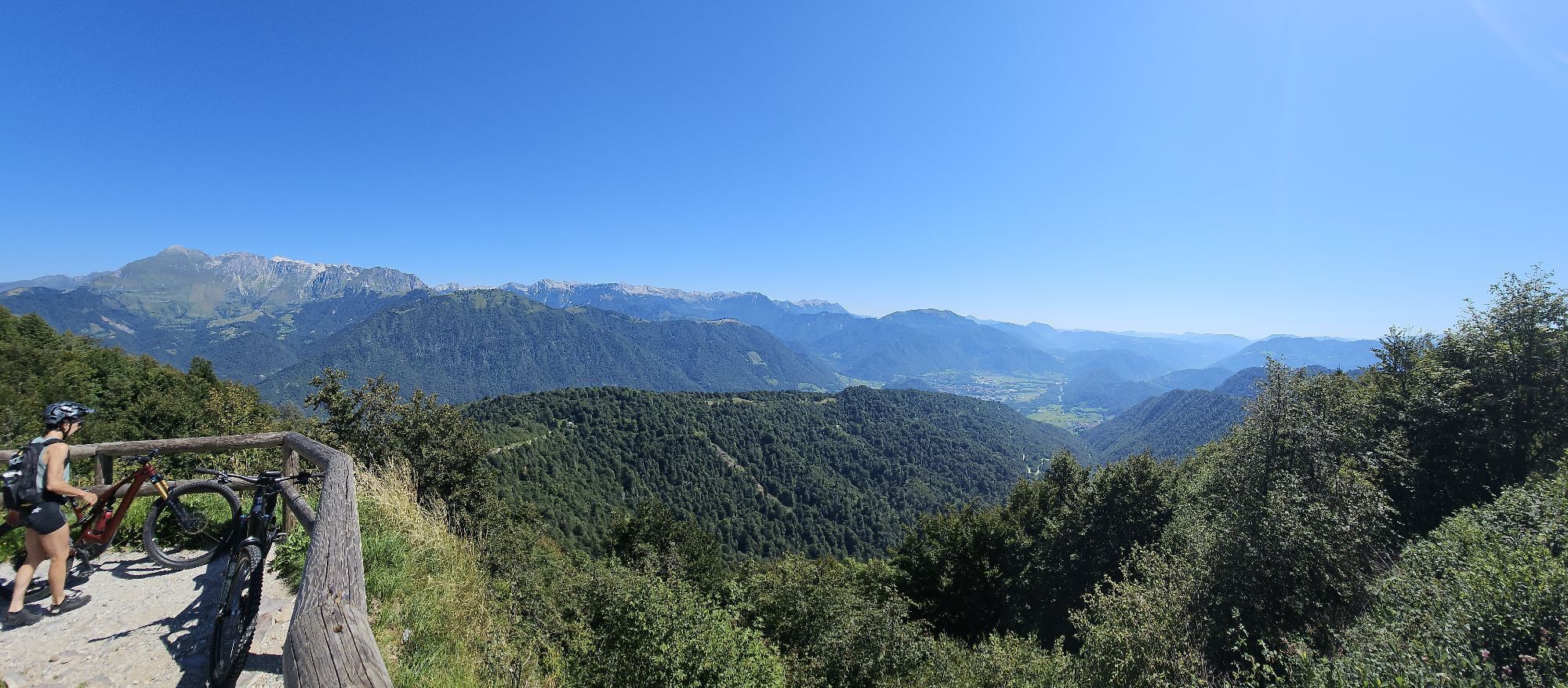
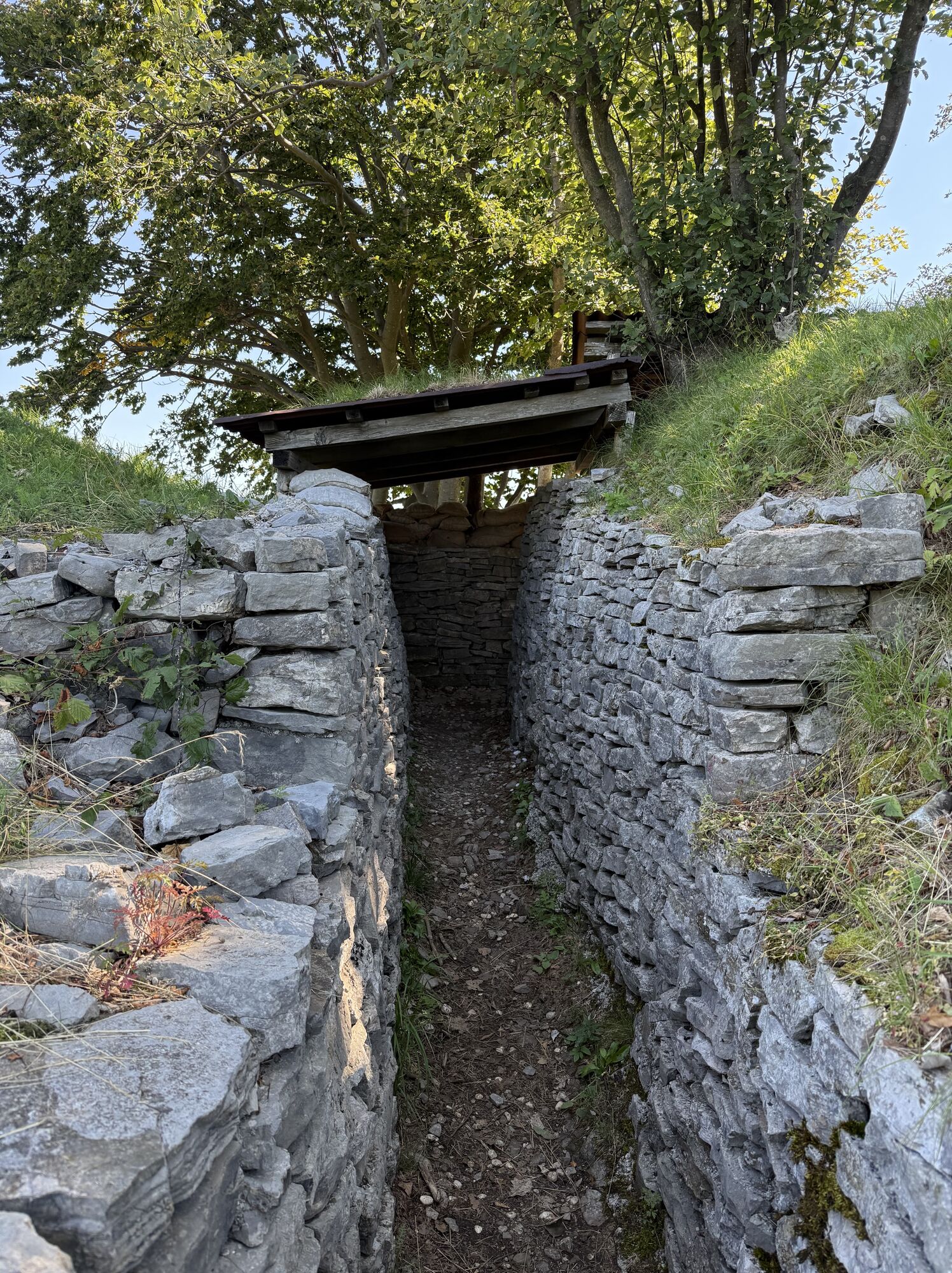
This short circular route allows visitors to explore the heart of the Kolovrat Open-Air Museum. This was once the Italian third line of defence, and today it offers insight into the events of the Twelfth Battle of the Isonzo and the retreat from Caporetto. At the starting point stands the monument dedicated to the first Italian soldier to fall in the First World War, Riccardo Giusto. Following CAI trail 746, a gently uphill paved road, you reach a small open area with an information panel introducing the museum. From here, a path leads to Mount Podklabuc/Na Gradu (1,114 m) and Passo Zagradan. In this area, visitors can also see several Cold War positions and walk through restored trenches and cave positions in the heart of the open-air museum. Continuing beyond the pass towards the north, in just a few minutes you reach an outstanding panoramic point overlooking the Isonzo Valley: this is the place where, on the evening of 24 October 1917, the German companies commanded by the famous Lieutenant Erwin Rommel took action.
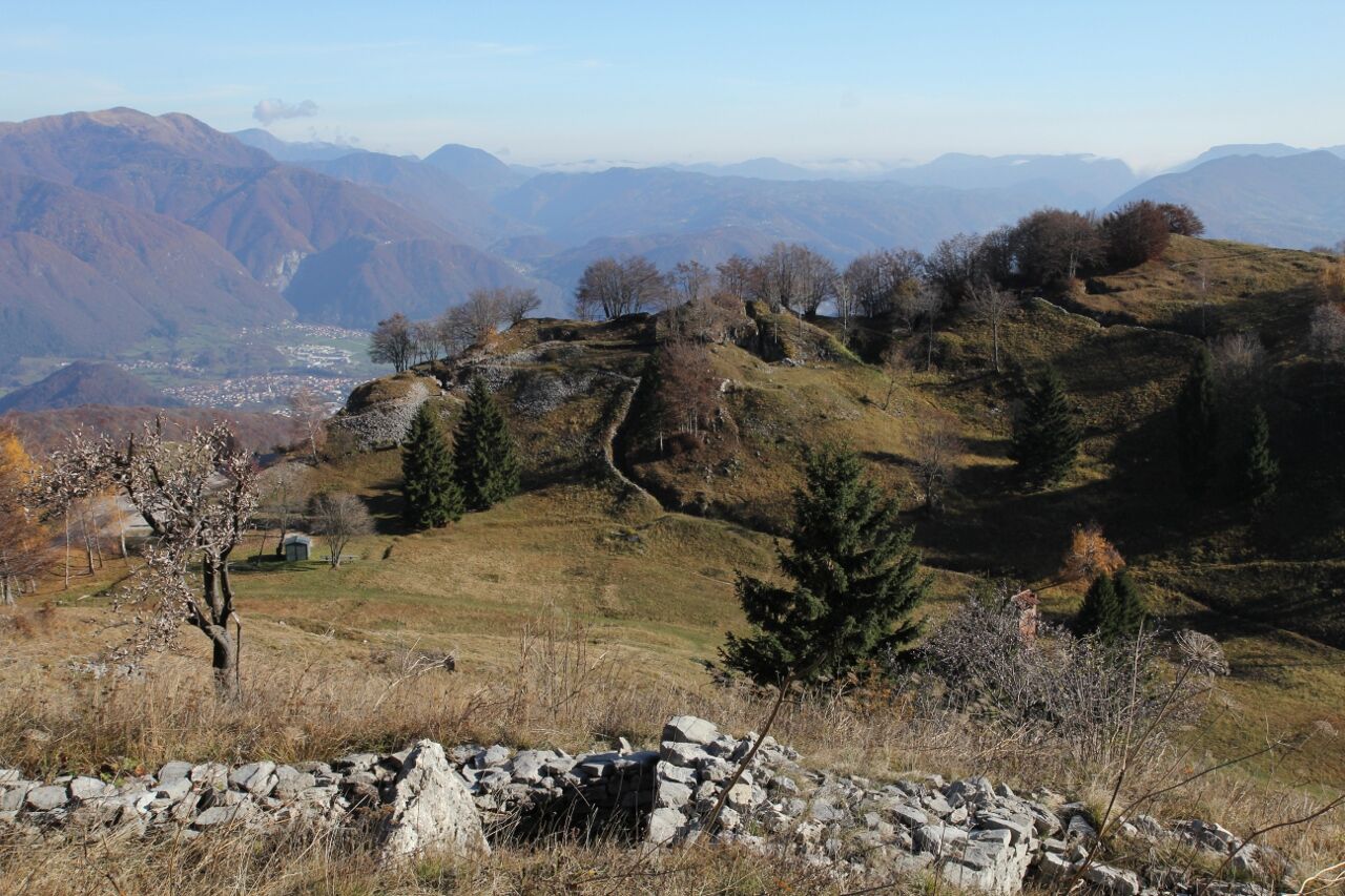
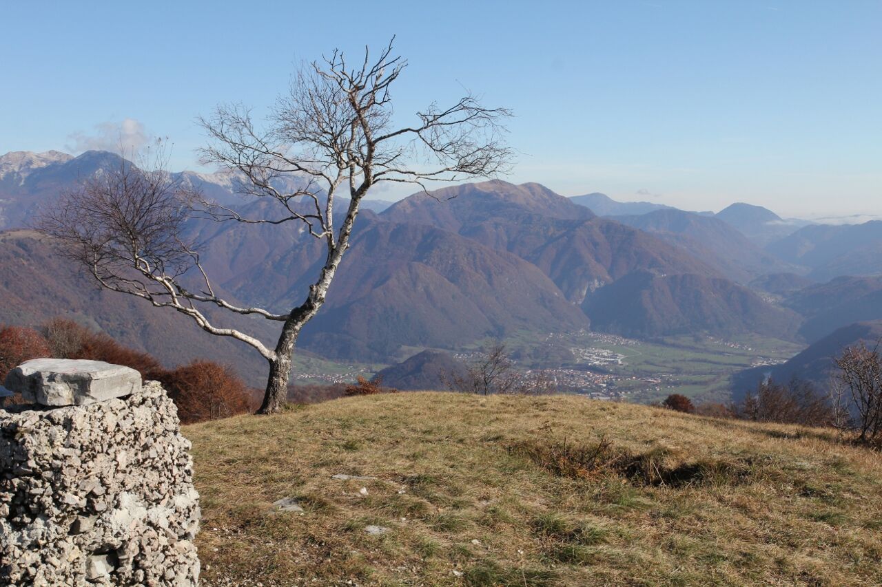
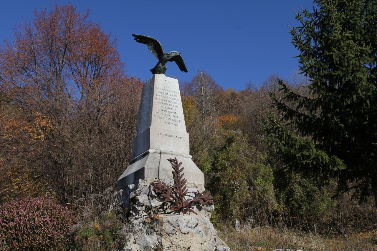
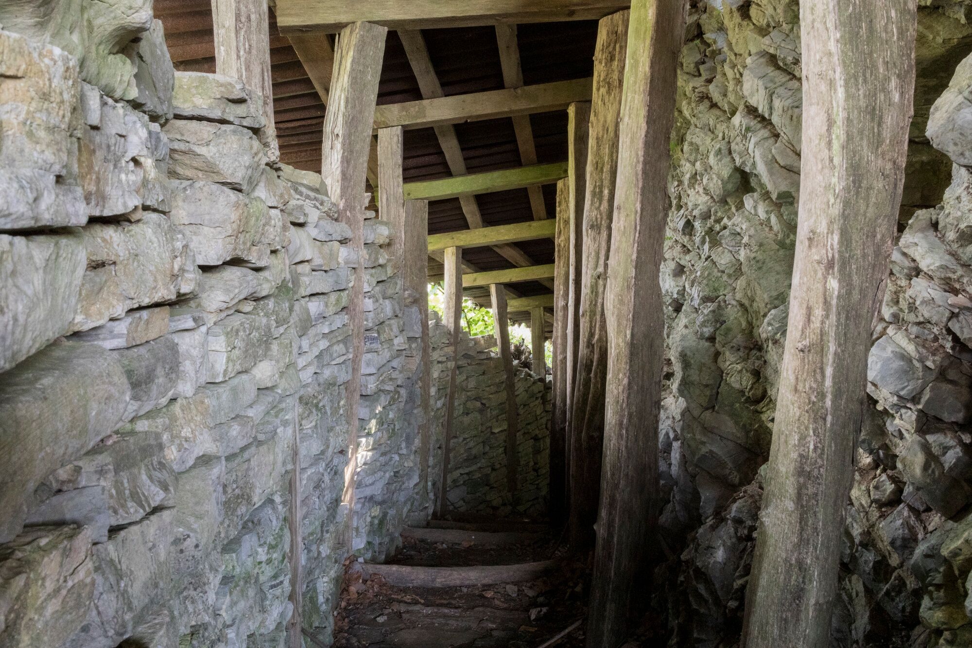
The starting point is Solarie pass, just before the former border crossing between Italy and Slovenia. Near the mountain hut, it is possible to park your car and immediately see the monument dedicated to the first Italian soldier to fall in the First World War, Riccardo Giusto. After about 50 metres, a gently uphill paved road branches off to the left. Marked as CAI trail 746, it leads to a small clearing where an information panel introducing the museum has been installed. At this point, leave the paved road and continue along the path on the right.7When you reach a fork, continue straight on and after about 10 minutes you will arrive at Passo Zagradan, at an altitude of 1,042 metres. On the left, the slope of Monte Piatto is clearly visible, while on the right stands Monte Klabuk, the summit where the Poti miru v Posočju Foundation from Kobarid has restored part of the Italian defensive positions. By following the tracks on the ground, it is possible to reach the summit and admire these interesting remains, which have been carefully preserved and restored. The route then reaches the top of Mount Podklabuc/Na Gradu (1,114 m), and from here a descending path leads back to the paved road followed at the beginning.
Áno
An adequate supply of water and food, suitable sportswear, proper mountain footwear, trekking poles, and a light source for visiting the caves are recommended.
In winter, snow may be present.
Take the A23 motorway and exit at Udine Nord, then follow the signs for Remanzacco/Cividale del Friuli. Continue along the SS54 state road for about 27 kilometres until you reach Ponte San Quirino. Turn right onto the SP45 provincial road towards Grimacco-Drenchia and continue for about 20 kilometres to the former border crossing with Slovenia at Passo Solarie.
Parking area near the mountain hut
T1
Obľúbené výlety v okolí
-
4,4
Kozjak Wasserfall und Soča
svetloTuristika 5,18 km -
3,6
Tolminka Klamm
svetloTuristika 1,90 km -
3,2
Slap Kozjak (Wasserfall)
svetloTuristika 3,40 km -
4,0
Matajur
strednáMountainbike 24,8 km -
4,0
Kolovrat
strednáMountainbike 33,0 km -
Juliana SkiTour 3 – Over Lanževica (2003 m) to Bohinj, ski journey over the shapes of Komna
ťažkéSkitour 21,7 km -
5,0
JULIANA TRAIL - stage 12: Tolmin – Kobarid
strednáTuristika 17,3 km -
5,0
Krnska jezera
strednáPrechádzka 12,4 km -
Planina Razor
ťažkéMountainbike 33,1 km -
4,0
Matajur (1642 m) from Marsin
strednáTuristika 10,2 km
Turistika a stopovanie


Nenechajte si ujsť ponuky a inšpiráciu na ďalšiu dovolenku
Vaša e-mailová adresa bol pridaný do poštového zoznamu.