


FORNI DI SOPRA LOOP FULL CIRCLE
Úroveň náročnosti: T1
The Forni Loop is a fascinating route that develops on the outskirts of the settlements, divided into several sections to be “linked” at will. Departures and returns are therefore adaptable based on the...
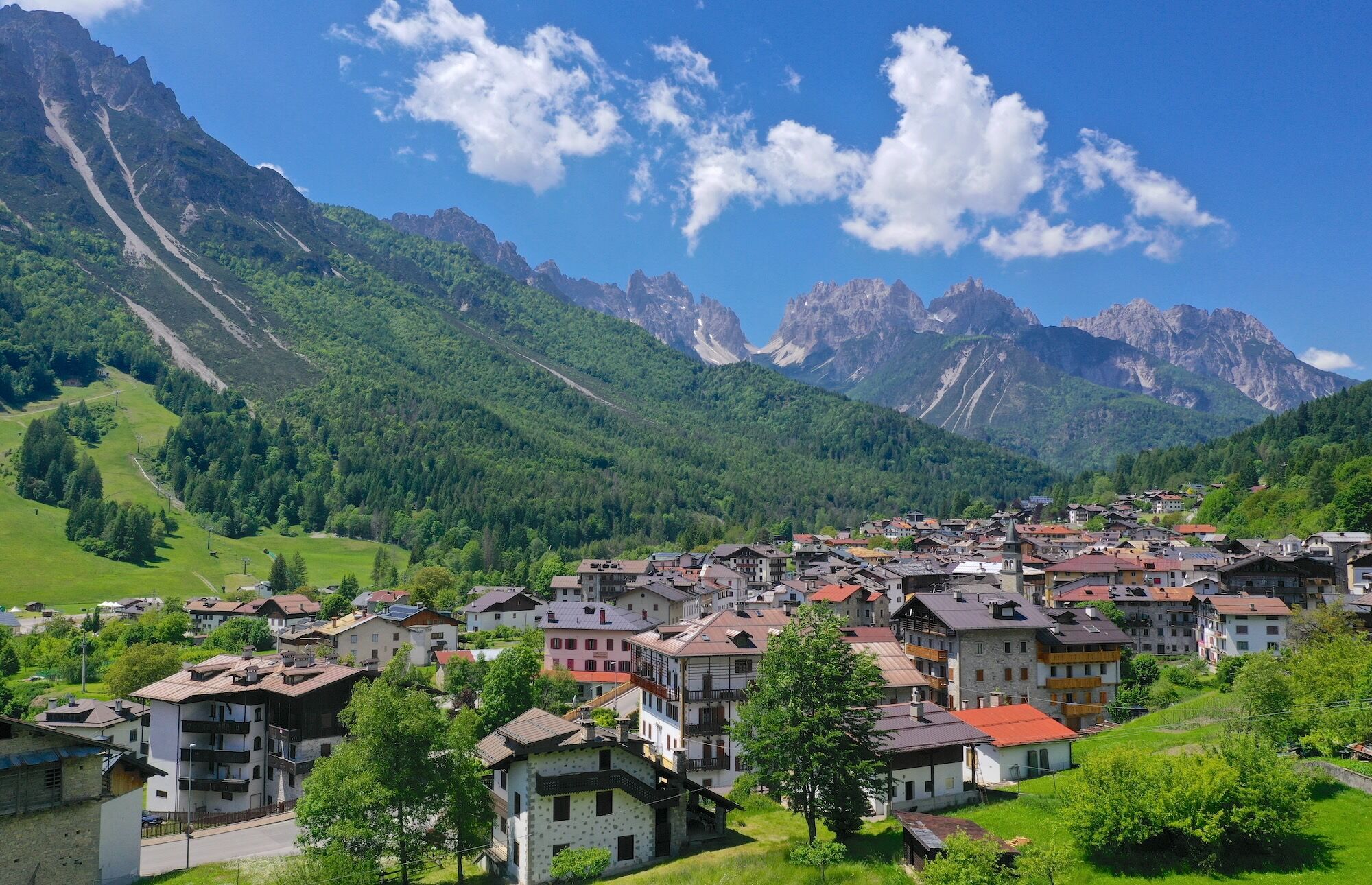
The Forni Loop is a fascinating route that develops on the outskirts of the settlements, divided into several sections to be “linked” at will. Departures and returns are therefore adaptable based on the available time and the preparation level of each person. Along the route, you cross woods, clearings, rivers, and streams, with extraordinary panoramic views of the valley and the Friulian Dolomites dominating the landscape. Sightings of wild animals are not missing, particularly deer, roe deer, squirrels, foxes, woodpeckers, and many other species. The circular track is suitable for everyone and can be traveled in both directions, although it is recommended to face it counterclockwise.
Numerous possibilities to return to the village, distributed along the route, allow dividing the loop into several stages. The total length is nearly 20 km and requires good physical preparation to be tackled in a single day.

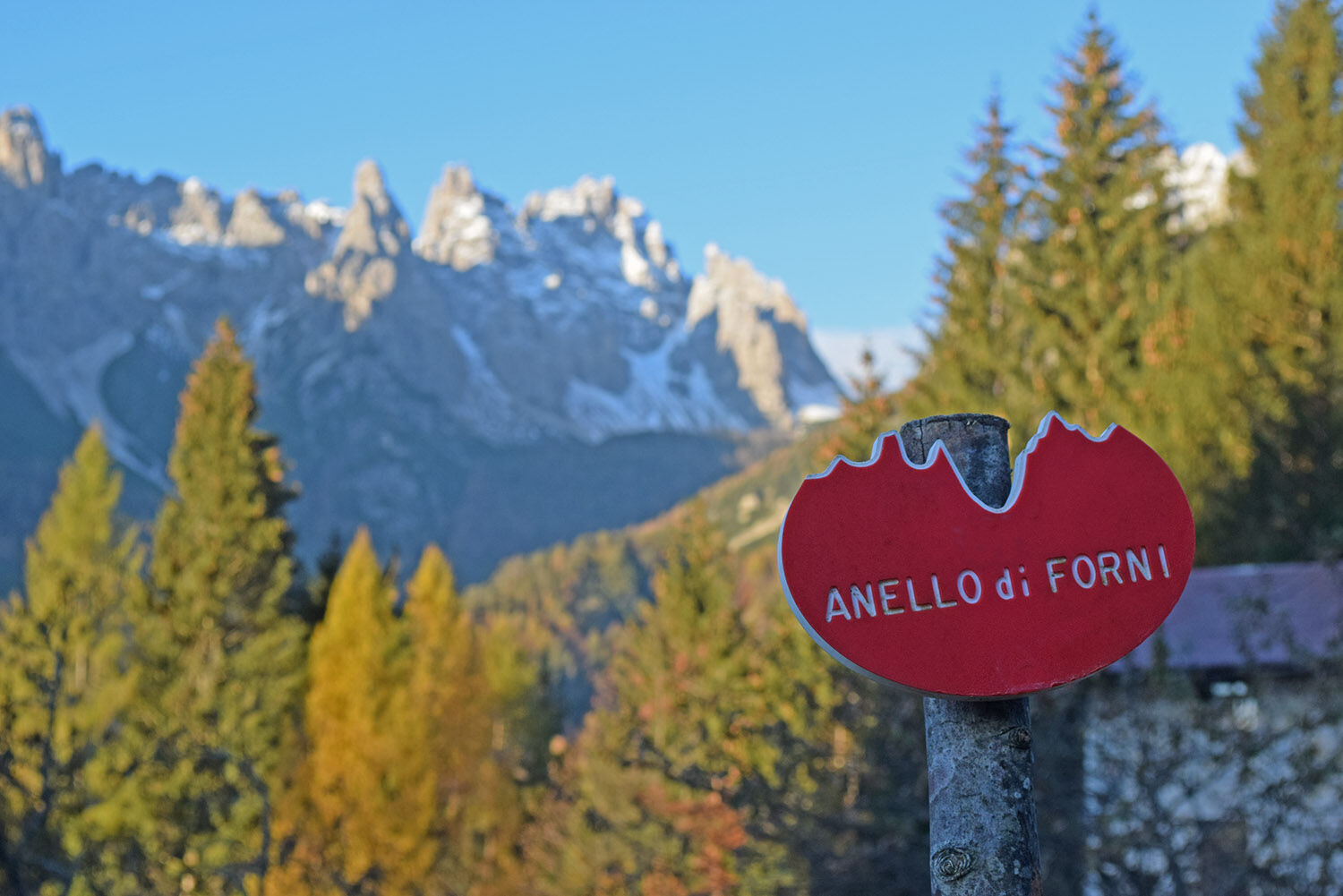
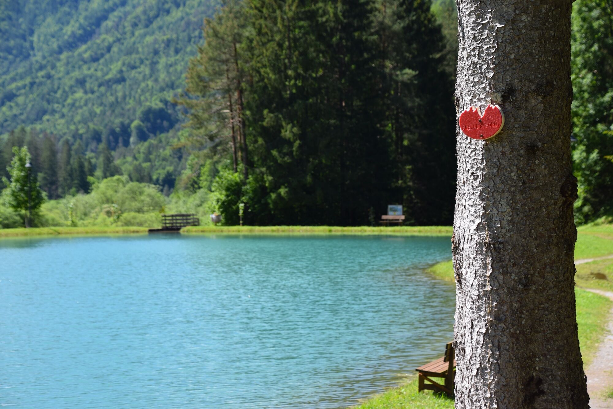
The recommended start is from the center of Forni di Sopra (Vico hamlet); carefully follow the waymarks (red signs with 'Amello di Forni' writing)
Take the internal small roads towards Passo della Mauria, then go up along via Chianeit. Having reached the village of Stalàs, turn left behind the aqueduct tank. Attention: the entrance to the path is narrow, located between a house and a woodpile. Follow the red signs as indicated.
After crossing the stream, you cross the chairlift and the ski slopes of Varmost (pay attention to the intersection with the Bike Park slopes), until reaching the locality "Pradas". From here, with a moderate slope, you reach the Misiei meadows. After leaving two mountain huts, you cross the stream and, behind a renovated rustic building, start to climb toward the ruins of "Glorion," up to the highest point of the loop, on the wide plateau of Poàs.
After crossing the plateau, you descend along a new forest track that, passing in front of some mountain huts, leads to the locality "Calda," where the former Colony building is located. From here, follow the municipal road to the state road, which is crossed to take the mule track leading to the houses of Roppa. After the stream, you arrive at the Tagliamento River, which you cross under the dam (waters here are diverted towards the Sauris dam). You continue on the road that from Nuoitas descends to the right, after the bridge, towards the houses of Tarmau.
Crossing the Davâràs bridge over the Tagliamento River, after about 100 meters you cross the Giaf stream to move to the right bank of the Tagliamento. Follow a small road between gravel, waters, and small groves up to the sports facilities, where you take the road towards Palas. After a couple of kilometres, near a parking lot, turn left to descend to the bridge over the Tagliamento, which is crossed near the hydroelectric plant.
Immediately after the bridge, leave the asphalt and take, on the right opposite the riding center, the forest track that enters the Saliet wood (also crossed by the MTB loop). Continue on flat and then uphill to the site of Sacuidic Castle. Continuing, you go along the Parulana Wildlife Area, finally reaching the state road, right in front of the campsite. A little further on, take the central lane of the village of Stinsans. Climb to the last houses, where the path to the Masaroul locality starts. After crossing the Agozza stream, turn right before the descent to climb up the wide plateau where the characteristic houses of Tiviei are located.
From the Tiviei plain, after enjoying a spectacular view of the valley, take the dirt road to Casera Montemaggiore, which you leave after a few hundred meters by turning left, until reaching, in a wooded area, the Pidîla locality with the homonymous mountain huts. From here, descend southwards, returning to Forni di Sopra near the bridge over the Tolina stream, a few steps from the village center.
Áno
Áno
Áno
Trekking shoes
The Forni Loop is a hike without technical difficulties; in summer conditions and with dry ground, light hiking boots or trail running shoes with good grip are generally sufficient, especially if you are used to walking in the mountains. In winter, there may be icy sections, so crampons are recommended.
T1
If you feel tired, it is recommended to return towards the village along the roads/trails/paths distributed along the route. The total length is almost 20 km and requires good physical preparation to be tackled in a single day.
Excellent from spring to autumn to enjoy beautiful views of the Tagliamento River and the Friulian Dolomites overlooking the loop.
Obľúbené výlety v okolí
-
4,5
Tiziana Weiss nature trail
strednáTuristika 9,23 km -
The multicolored campanili of Mount Zauf
strednáTuristika 14,2 km -
Mounts Bivera and Clap Savon from Casera Razzo, alpine ride
ťažkéTuristika 20,5 km -
Colmajer ridge loop
strednáTuristika 7,51 km -
Urtisiel and Canpuros, Dolomitic wonders
strednáTuristika 13,5 km -
Gnome village - green route
svetloTuristika 4,46 km -
5,0
Campanile di Val Montanaia a Bivacco Perugini
strednáTuristika 2,76 km -
MONTE DOSAIP
ťažkéTuristika 8,37 km -
Gnomes' village - blue route
svetloTuristika 5,71 km -
Enchanted Forest
svetloTuristika 5,16 km
Turistika a stopovanie


Nenechajte si ujsť ponuky a inšpiráciu na ďalšiu dovolenku
Vaša e-mailová adresa bol pridaný do poštového zoznamu.