


Cross-border bike tour "On the trail of history: bunkers, ramparts, casemates" (PAMINA)
Úroveň náročnosti: 3
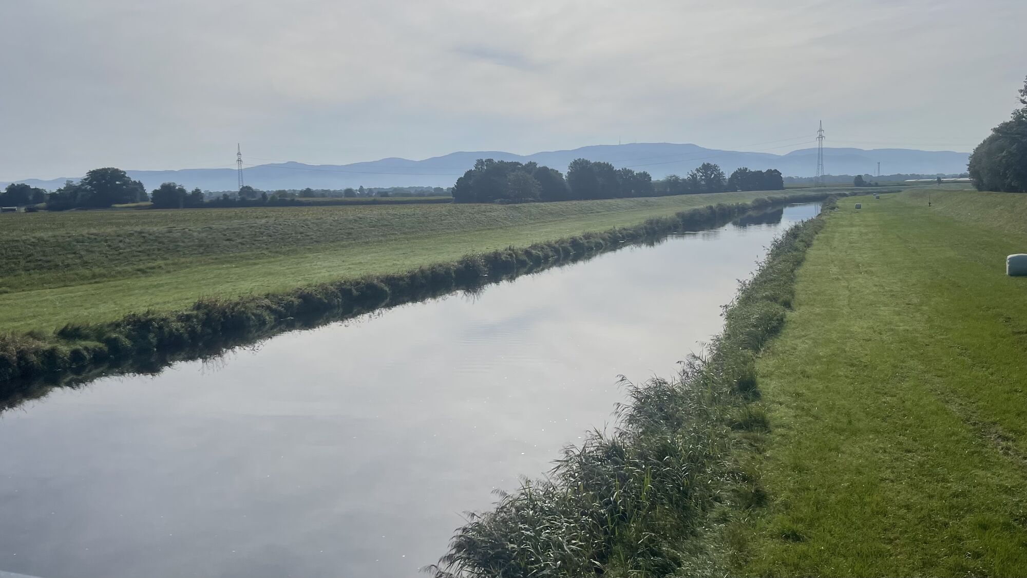
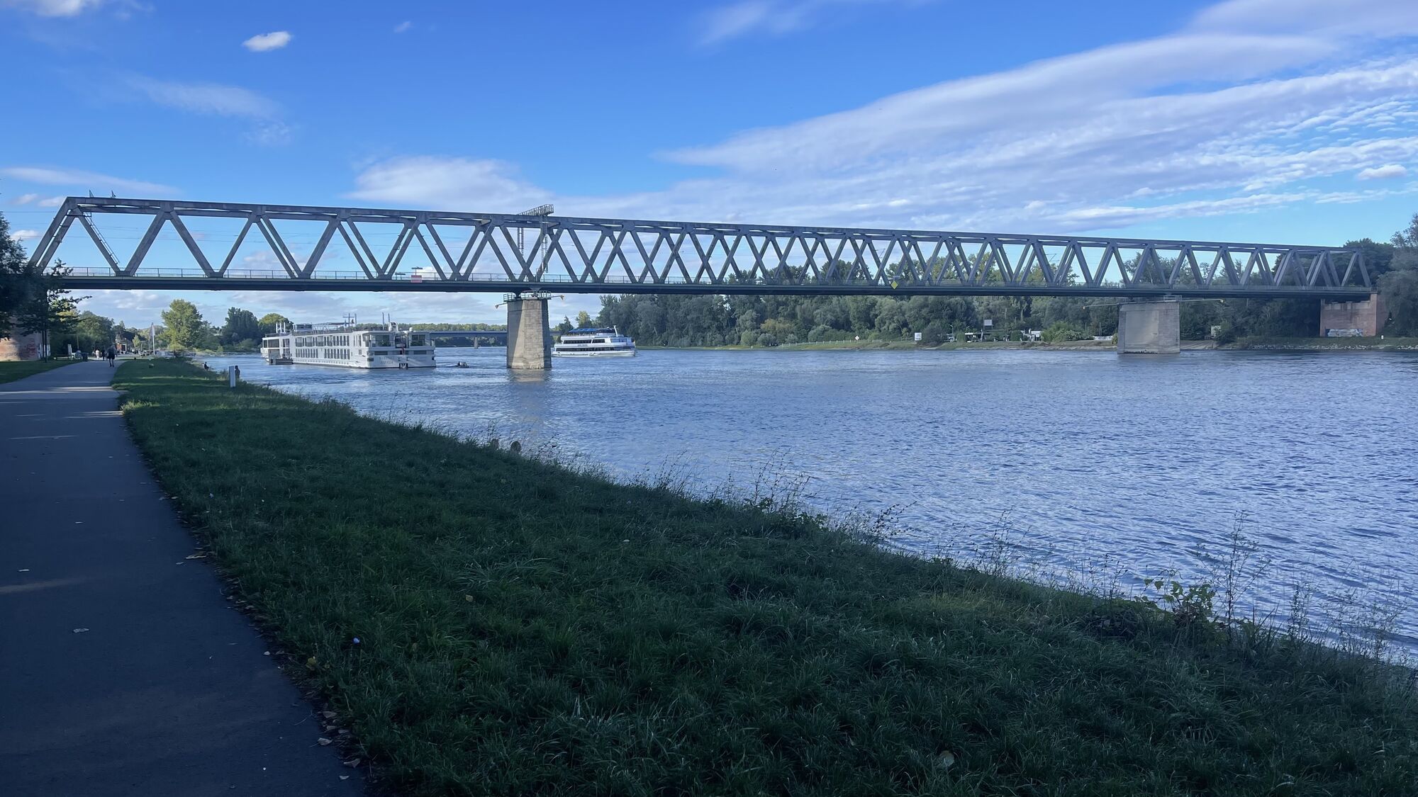
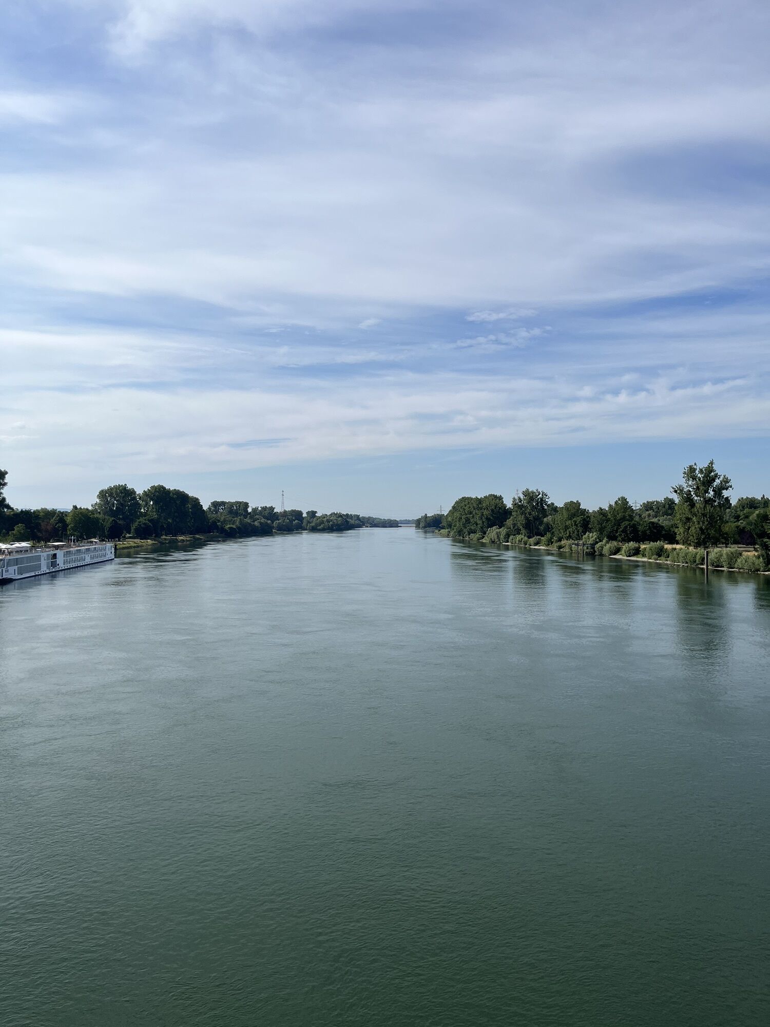
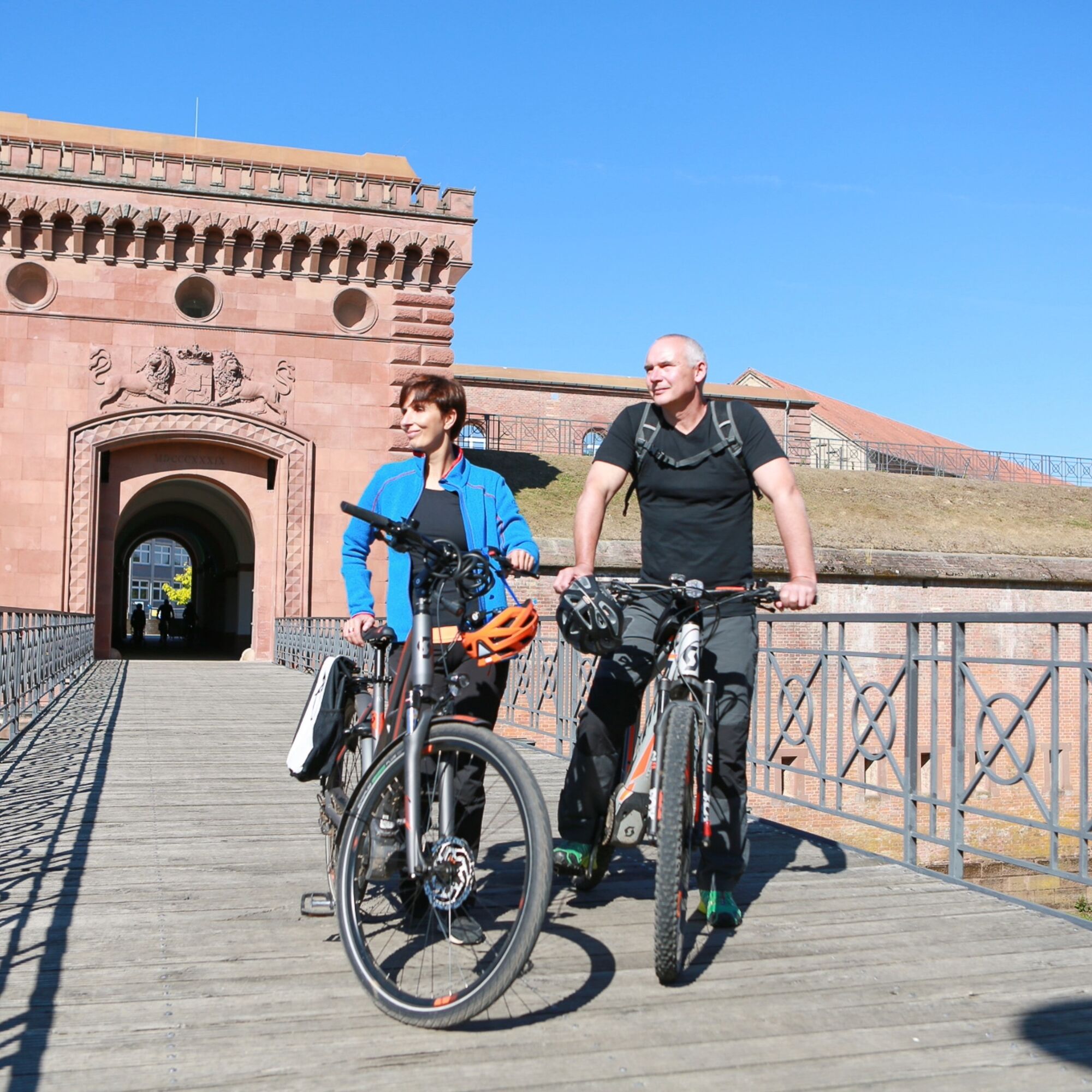
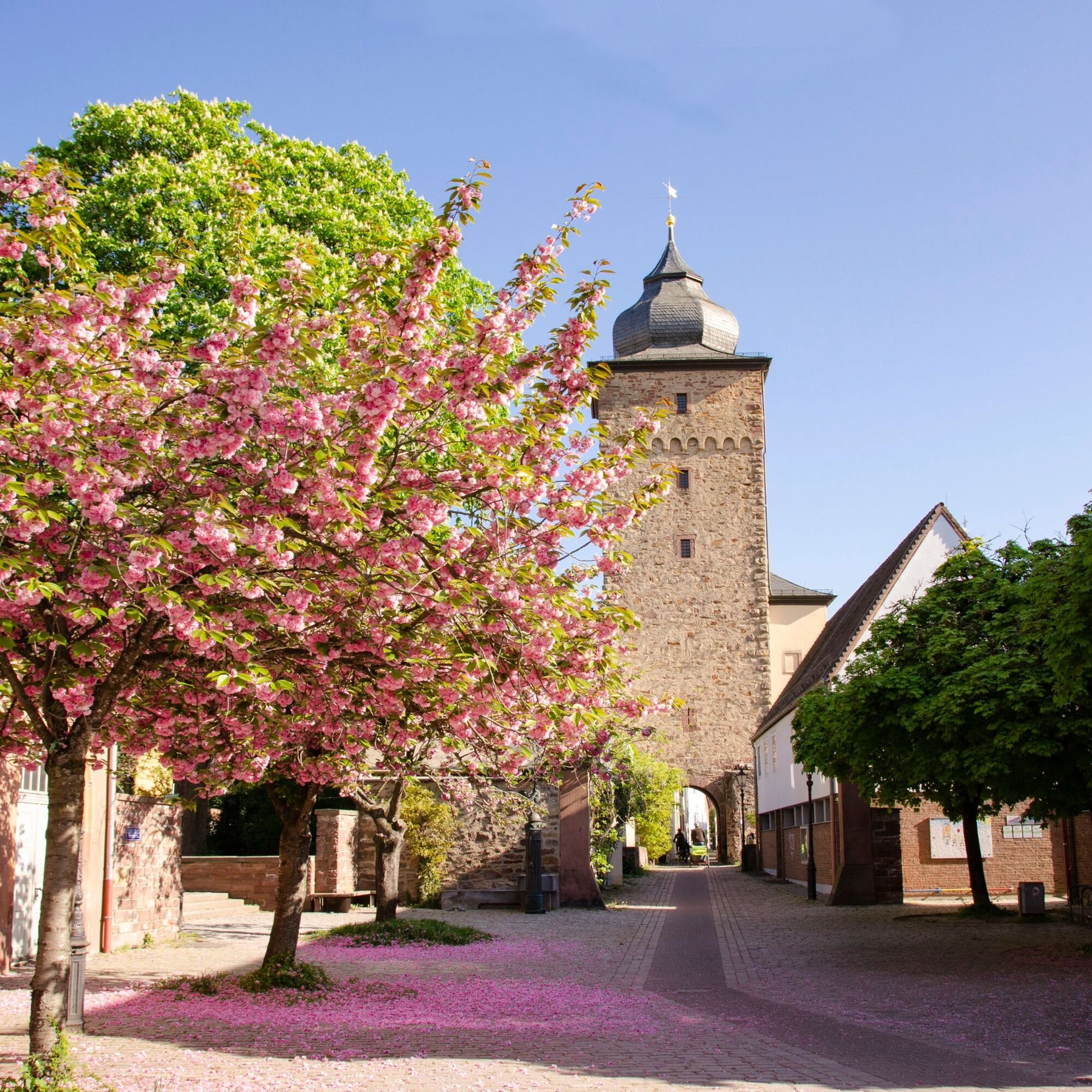
Fotografie našich používateľov
This cross-border cycle tour invites you to experience European history up close. It leads through former Franco-German border regions on the Upper Rhine and combines nature, culture and historic buildings...
This cross-border cycle tour invites you to experience European history up close. It leads through former Franco-German border regions on the Upper Rhine and combines nature, culture and historic buildings in a fascinating way. It makes the once turbulent history between France and Germany visible and impressively shows how former dividing lines have become connecting paths.
We follow in the footsteps of great master builders such as Vauban, discover relics of the wars of the 19th and 20th centuries and cross romantic villages, towns steeped in history and idyllic river landscapes. The route includes the Piste des Forts, the Rhine Cycle Route (EuroVelo 15) and the Baden Wine Cycle Route. It connects towns such as Strasbourg, Wissembourg, Bad Bergzabern, Landau, Germersheim, Karlsruhe, Ettlingen and Rastatt.
Whether impressive fortifications such as the Fort de Schoenenbourg, important memorials such as the European Monument at St. Germanshof or picturesque wine-growing villages - this tour brings “Europe in miniature” to life.
Route description of the entire route :
In Strasbourg, your tour begins at the intersection of Quai du Général Koenig / Route de Vienne. Here, the EuroVelo5 Via Romea and the EuroVelo15 Véloroute Rhin / Rhine Cycle Route intersect. You follow the EuroVelo5 along the Rhône-Rhine Canal in the direction of Strasbourg’s train station and then continue along the river “Ill” and the canal “Canal de la Bruche”.
The route passes by Eckbolsheim, crosses the Canal de la Bruche in Wolfisheim, and now follows the cycle path Piste des Forts into the center of Wolfisheim. The Piste des Forts / Path to the Forts is a German-French signposted cycle circuit just outside the gates of Strasbourg, which combines cultural heritage and nature and leads over a length of 85 km to a total of 19 defense structures on both sides of the Rhine and around Strasbourg.
In Wolfisheim, you cycle past the former military fort “Fort Kléber,” which lies directly next to the Piste des Forts / Path to the Forts and is surrounded by a beautiful park. You continue to Oberhausbergen and Niederhausbergen, where there are also two military forts – “Fort Frère” and “Fort Foch” – located near the cycle path. These are only open for visits on a few days each year. The further course of the route leads to the hill of Mundolsheim, where the impressive defensive structure “Fort Ducrot-Podbielski” stands. Twice a week, always on Thursdays and Saturdays, guided tours of the historical site are offered.
From here, you follow the Piste des Forts / Path to the Forts past Souffelweyersheim, Reichstett, and Hoenheim to La Wantzenau. In La Wantzenau, you switch to the EuroVelo15 Véloroute Rhin / Rhine Cycle Route heading north. The next stage of your round tour is Kilstett, with its casemate of the Maginot Line (“Casematte de Kilstett”). This third-line defensive structure was intended to block the connecting routes between Kilstett and the forest along the Rhine, thus preventing an invasion.
The path continues along the EuroVelo15 to Drusenheim, where the “Abri de l’ancienne redoute” is located. This former shelter is about 500 meters from the Rhine and was intended to protect the rear positions situated by the river.
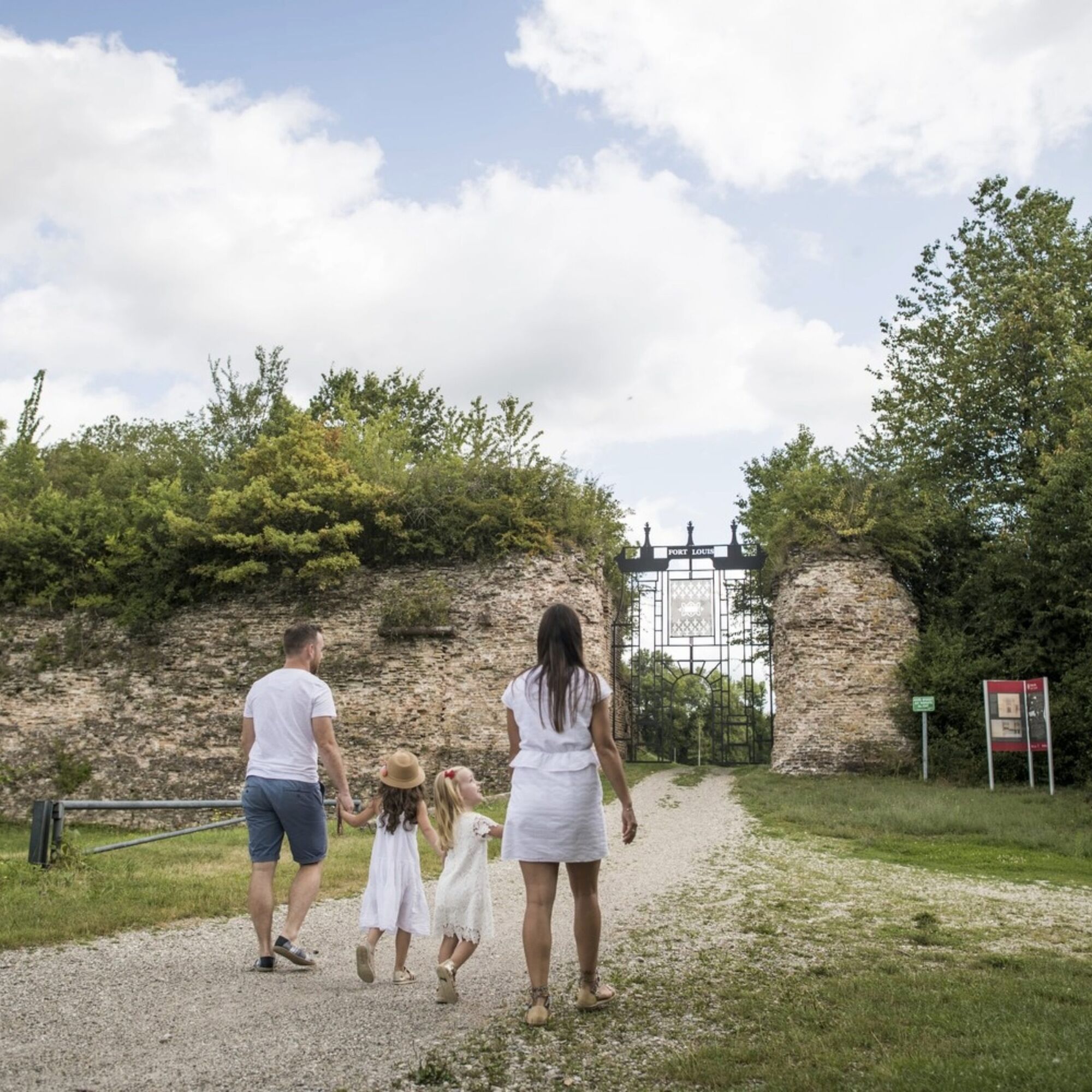
Now you head toward the Rhine and the ferry. Shortly before the Drusenheim ferry terminal, you turn onto the cycle path on the dike and ride to Fort Louis. The historic fortress town was built by the famous master builder Vauban and houses remnants of a former rectangular citadel.
You continue along the RD319 to Roeschwoog and Leutenheim. In the forest of Leutenheim stands the imposing “Abri du Heidenbuckel,” a concrete surface bunker. From there, you follow the RD163 to Koenigsbruck, where you turn onto the RD37. You follow the RD197 and then the RD297 heading north. At the intersection with the RD87, you follow the Véloroute de la Vallée de la Sauer (IC24-52), which leads on the left side to Hatten and through its small industrial area. In Hatten, a visit to the “Musée de l’Abri de Hatten” is worthwhile. The shelter bunker, located one kilometer behind the Maginot Line, served during the war as accommodation for 240 soldiers from the surrounding fortifications and now serves as a place of remembrance. 28 authentically restored rooms show the everyday life of the soldiers at that time.
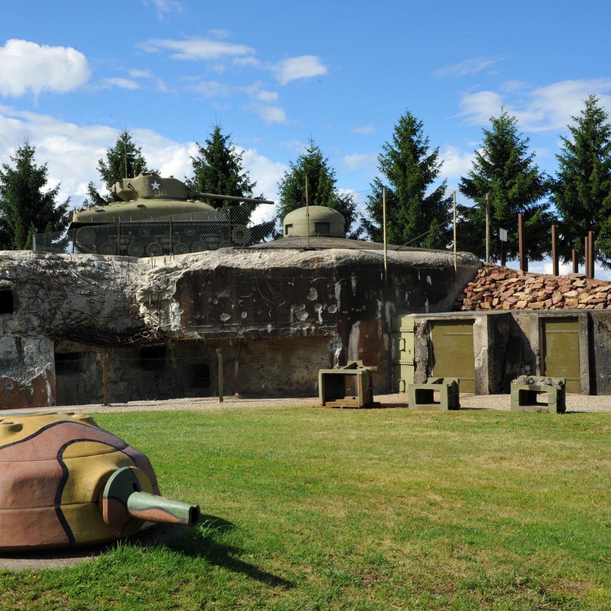
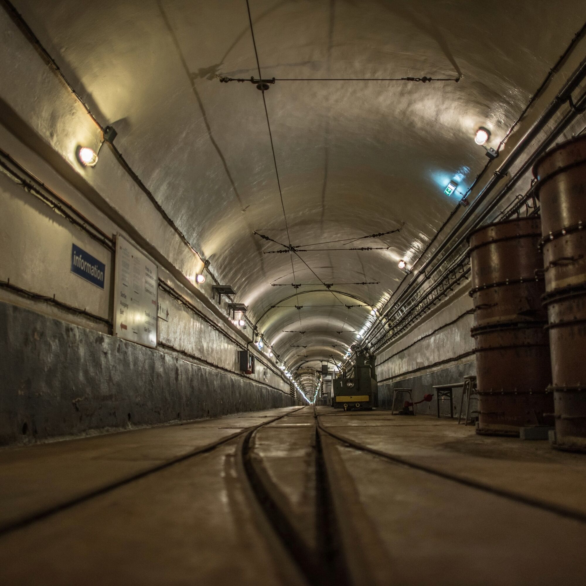
The route now leads via “Rue des Vignes” and “Rue du Ruisseau” to the RD245 to Oberroedern and to another bunker of the Maginot Line, the “Casematte Rieffel.” You follow the RD752. Shortly before Leiterswiller, you continue straight onto the street “Rue du Camp Cité des Cadres” and then onto the street “Rue de la Forêt” towards Hoffen, where another bunker is visible on the right-hand side. There you turn right onto the RD76 towards Hunspach, with its beautiful white half-timbered houses with arched windows. In 2020, the village was voted the favorite village of the French. After Hunspach, you turn left onto the RD249 and then go straight at the roundabout to reach one of the main attractions of your German-French cycling tour: the “Fort de Schoenenbourg.” The Fort de Schoenenbourg is a former large artillery fort of the Maginot Line that was equipped to be self-sufficient. The underground blocks were designed for 650 men. 30 meters below ground, there is a 3,000-meter-long circuit that can still be walked today and vividly shows the living conditions of the soldiers at that time: barracks, kitchens, the command post, the power plant, retractable gun turrets, and the ammunition depot can still be visited today.
Your tour continues along “Rue du Commandant Reynier” to Schoenenbourg. After a little less than a kilometer, at the RD65, you turn right. At the bend, turn left onto the forest path. Now continue straight ahead until you reach the RD170 near Retschwiller. You cross it in the direction of the cemetery of Retschwiller. You arrive in Soultz-sous-Forêt and ride on the RD51 to Lobsann. From there, you continue on the RD314 to Merkwiller-Pechelbronn. Just before the former tourist office, turn right over the parking lot of the Pôle santé (Health Center) onto the cycle path to Preuschdorf. In Preuschdorf, or at the exit of Preuschdorf, your tour briefly leads you back onto the RD28 and then immediately left onto the road leading to Biblisheim. From there, continue along the Véloroute de la Vallée de la Sauer (IC52) towards Walbourg.
In Walbourg, you’ll find the Benedictine Abbey Church Ste-Walburge and the “Musée Mémorial 1870–1945.” Here you can take a journey through time from 1870 to 1945. The interactive exhibition offers a multimedia sound trail, 20 recreated scenes from that time, and more than 7,000 original exhibits.
From the museum, the route continues along the Véloroute de la Vallée de la Sauer (IC20-52) through Durrenbach and Morsbronn-les-Bains to Woerth. In Woerth Castle is the “Musée de la Bataille du 6 août 1870.” The museum is dedicated to the history of the Battle of August 6, 1870. This went down in history as the “Battle of Reichshoffen,” although the French army referred to it as the Battle of Froeschwiller and the German army as the Battle of Woerth. Most of the exhibits were found on the former battlefield and bear witness to this event. A diorama with 4,000 tin soldiers illustrates a snapshot of this historic battle.
Your tour now continues along “Rue Hanau Lichtenberg” and “Rue Elsasshausen,” steeply uphill to the battlefield of 1870. The monument of the 1st Hessian Field Artillery Regiment No. 11 offers a very good view of the former battlefield from its observation platform. After Elsasshausen, you turn right to Froeschwiller with its impressive Peace Church. Along the way, you’ll find many more graves and memorials commemorating the battle of 1870. On the Route de Froeschwiller, you head north to Langensoultzbach. At the entrance to the village, turn right into the main road and first follow the cycle path next to the RD255 and then the Véloroute de la Vallée de la Sauer (IC20) to Lembach.
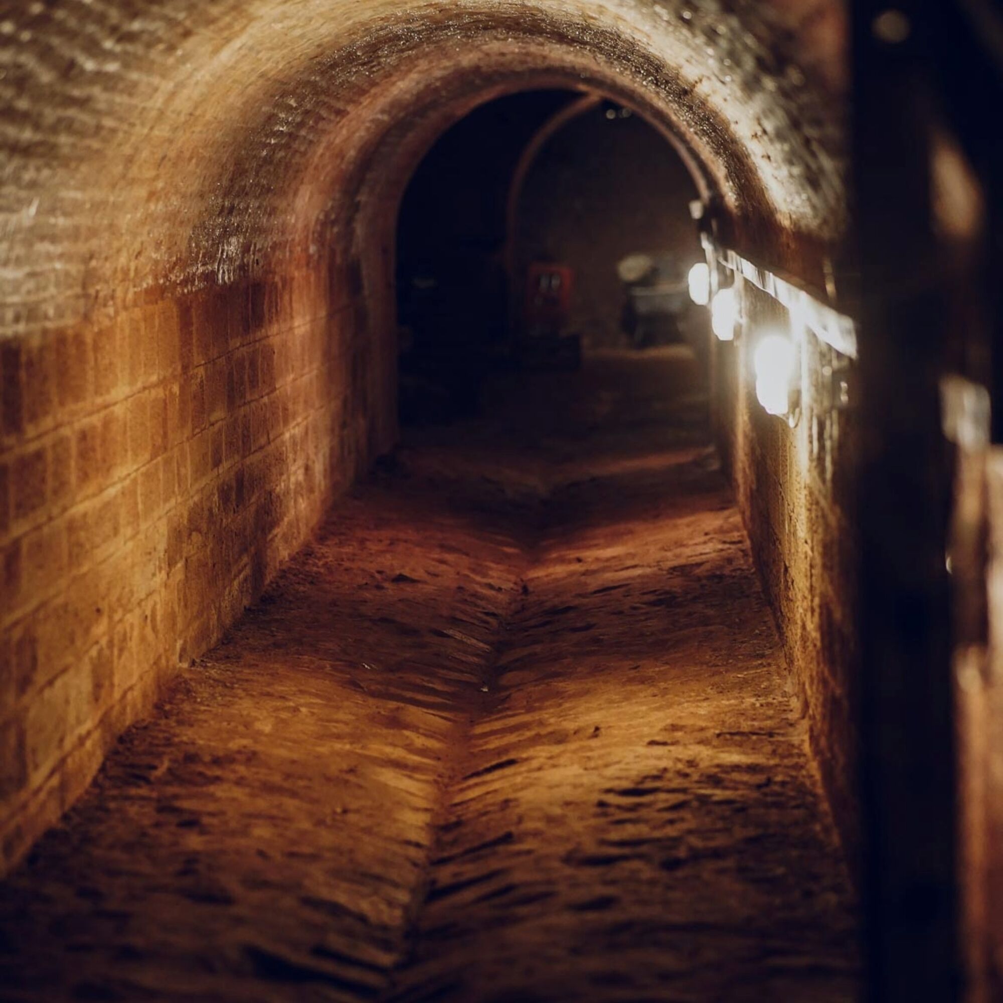
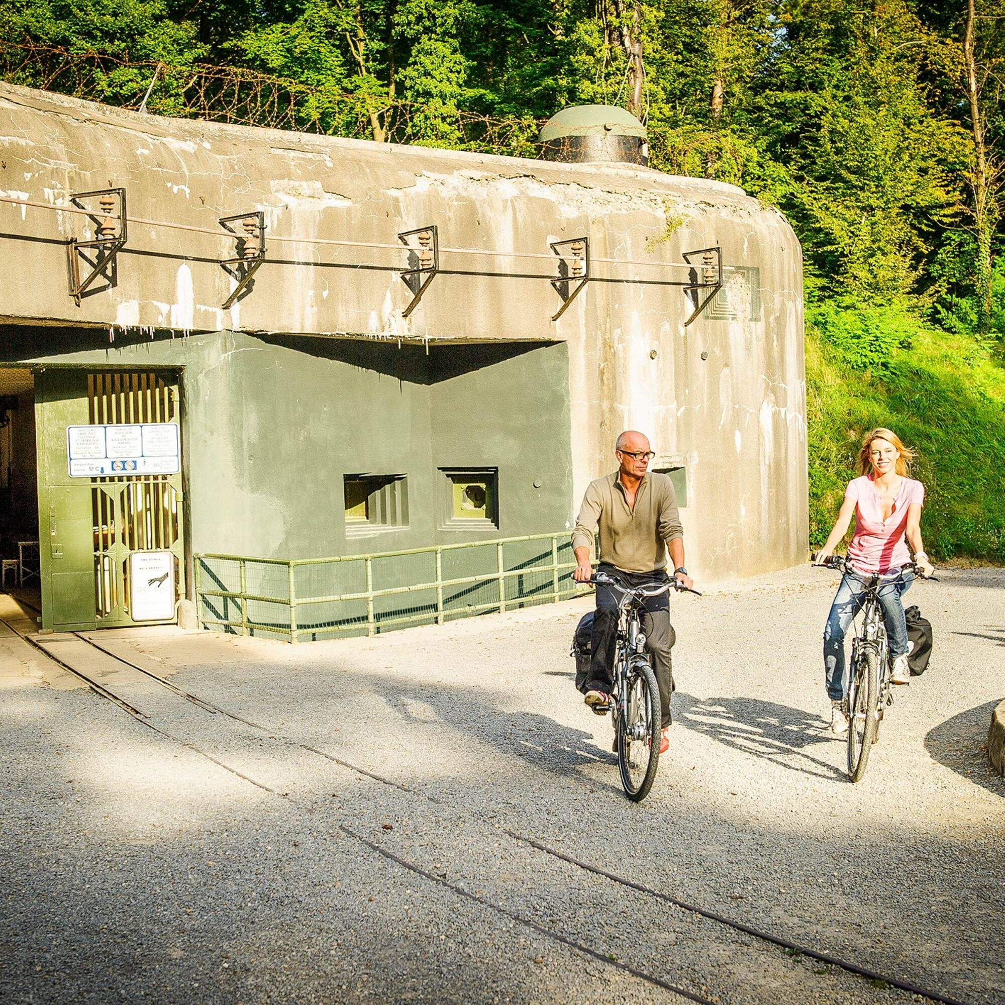
At the entrance to Lembach, turn right onto the RD65 to the “Four à Chaux.” The artillery fort “Four à Chaux,” also called the guardian of the Sauer Valley, is a former fortification of the Maginot Line, consisting of more than 5 km of tunnels, 30 m deep. 24 officers and 600 soldiers were stationed here. The guided tour shows the living conditions of the soldiers at that time, including sleeping quarters, sanitary facilities, kitchen, and infirmary of the former military base.
Through the village center of Lembach, you now pass the “Etang du Fleckenstein” (Fleckenstein Pond) and, after the pond, turn right onto the RD525 in the direction of the castle ruins “Château du Fleckenstein,” which is one of the most spectacular castle ruins in Alsace. In addition to the exciting visit to the castle itself, changing exhibitions are offered in the P’tit Fleck. The bistro invites you to take a break, and there is a service station for bicycles. From the parking lot below the castle, you reach, via the charcoal burner’s trail (Sentier des Charbonniers), a forest path (here, the bicycle may have to be pushed for about 200–300 meters), the Gimbelhof, then the “Col du Litschhof,” and the “Col du Schaufelshald,” where you turn left toward Nothweiler and the French-German border.
Through the Dahner Felsenland to the Westwall and the fortress city of Landau
In the idyllic little village of Nothweiler, a detour to the visitor mine Eisenerzgrube is worthwhile, which takes you underground. The detour begins at the Zeppelin Fountain in the village center, leads up Schützenstraße to the visitor mine, and is signposted.
From Nothweiler, the bike tour leads to Rumbach, an award-winning half-timbered village (Gold Medal at the German national level in the competition “Our village has a future”). Here, you can make a detour to the Christuskirche with its medieval frescoes. You ride through the Generations Park in Rumbach and follow the cycle path signs for the Biosphere Tour to Bundenthal. Before the gas station in Bundenthal, turn right onto the German-French Pamina Cycle Path Lautertal (Euroradler) and follow it to Wissembourg. Shortly before the German-French border at St. Germanshof, you can visit the historical Europe Monument.
After crossing the border, you follow the Véloroute de la Vallée de la Lauter (IC51 – PAM1) to Wissembourg. Along the Lauter and via the street Quai du 24 Novembre, you pass the Saints-Pierre-et-Paul Abbey Church and the historic salt house Maison du Sel. You continue on the Route Nationale and Rue Bannacker, then turn left at the intersection onto Rue de la Paix, and cross the border back into Germany to Schweigen.
In Schweigen-Rechtenbach, you reach the German Wine Gate, the southern starting point of the German Wine Route. From here, you continue on the German Wine Route Cycle Path through Oberotterbach to the spa town of Bad Bergzabern, where cafés and a historic old town invite you to linger. The Westwall Museum brings the history of the Westwall in southern Palatinate to life. It is open from Good Friday to the end of October every 2nd and 4th Sunday of the month as well as on public holidays in Rhineland-Palatinate (except Easter Sunday) from 11 am to 5 pm. More information about the museum can be found at: https://www.otterbachabschnitt.de/
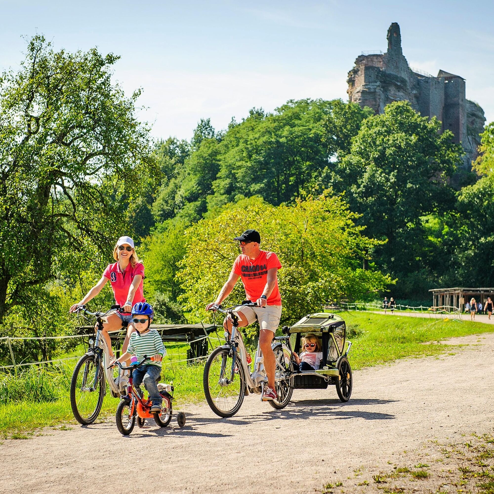
From Bad Bergzabern, you continue on the German Wine Route Cycle Path via Pleisweiler-Oberhofen to Gleiszellen-Gleishorbach, which, with its picturesque Winzergasse lined with pretty half-timbered houses, looks like something from a picture book. Here, rustic wine taverns invite you into their cellars. From here, it’s only a stone’s throw to Klingenmünster, above which towers the medieval Landeck Castle. A detour up to the castle is rewarded with a wonderful view over the Rhine plain all the way to the Black Forest.
After you’ve conquered the climb to Klingenmünster, you leave the German Wine Route Cycle Path and reach Göcklingen, where you encounter the Fassboden Tour, which leads you toward Mörzheim through wide fields and blooming vineyards. Along the way, you’re offered magnificent views of the sun-drenched landscape. West of Mörzheim, you switch to the Winzer Circular Cycle Path toward Wollmesheim. After Wollmesheim, the tour follows along the L509 to Landau. The bike path runs parallel to the road but still offers a pleasant and safe riding experience.
In Landau, you first reach the Savoyenpark, where the exhibition site of the fortress construction association, Lunette 41, is located. Until the 1870s, a massive fortress stood on the area of today’s city center, whose 198 lunettes, ravelins, and redoubts were connected by underground tunnels. One of the entrances into these "mines" is Lunette 41. The fortress was built during the reign of Louis XIV around the medieval town and was promoted with the title "the largest and strongest fortress of Christendom." Today, hardly anything of the former walls can be seen in the city itself. But during every construction project, gigantic walls are uncovered again. Fascinating insights into Landau’s underground world can be experienced on a walk through the subterranean fortress passages. The fortress construction association and the Landau tourism office offer guided tours.
From the Lunette 41 exhibition site, you continue to the former Landau Fort. On the way to the fort, a detour into Landau’s cozy city center is worthwhile. At the end of the historical monument zone “An 44,” with its typical townhouses from the late 19th and early 20th centuries, lies the entrance to Landau Fort, of which remnants can still be visited today. Between 1700 and 1702, a citadel was built on a northwestern hill. It was separated from the fortress by a flooding basin and was intended to protect and reinforce it. The main rampart is completely preserved, as well as the dry moat and the outer trench shears and half-moons. Inside the former fort, where military buildings once stood, you now find the university. On the other side, you now find the zoo.
The Museum of City History, near the main train station, presents Landau’s history from the Middle Ages to the modern era. The thematic focus is on Landau as a “German-French border case.” After the Thirty Years’ War, France claimed the medieval town on the Queich to secure its eastern border: this was the beginning of massive fortress construction, numerous sieges, changing rulers, and large garrisons, which had a decisive impact on the city’s development as well as the social and economic life of the people in the centuries that followed. After visiting the city of Landau, the Queich Valley Cycle Path leads you further to Offenbach an der Queich.
From the Queich Line to the Fortress City Germersheim and via Karlsruhe to the Ettlingen Line
In Offenbach, you switch to the Kraut- und Rüben Cycle Path (sign with a carrot), which leads via Ottersheim to Knittelsheim. Here, you join the Tobacco Cycle Path (sign with a tobacco plant), which you follow to Bellheim. In Bellheim, however, you stay on the main street and turn left at the church into Große Kirchstraße. Right after the church, turn right into Hintere Straße and then left into Mittelmühlstraße. You pass the museum Altes Sägewerk / Mittelmühle and come to the former Queich defense line, dating from the time of the War of the Austrian Succession in the 18th and 19th centuries. Here, turn right onto Schulstraße. At the end of Schulstraße, turn left onto the cycle path, go straight through the roundabout, and about 200 meters after the roundabout turn right onto the cycle path toward Germersheim. The path shortly turns left into the Bellheim Forest. In the forest, you reach the Queichtal Cycle Path (white letters on green background). You follow the Queichtal Cycle Path all the way into the fortress city of Germersheim. In the city, many well-preserved fortress buildings can still be seen, which were built from 1834 to 1861 according to the plans of Bavarian Engineer Major Friedrich Schmauß as border protection on the Rhine against France.
At the large roundabout with the stone statue “Knotenpunkt”, you turn onto the cycle path along Bellheimer Straße. Then turn left onto Zeppelinstraße toward the city center up to Paradeplatz. You ride past the impressive Weißenburger Tor, which houses the city’s tourism office as well as an exhibition about the city and its fortress. Behind the Weißenburger Tor is the fortress park with further fortress buildings, such as Fronte Lamotte. Continuing on the cycle path along the street, you turn left onto August-Keiler-Straße. You cross the roundabout at the Germersheim Süd train stop and cycle to the Rheinuferpark, from where you can enjoy watching passing ships. Along the Rhine, you follow the Rhine Cycle Path (Eurovelo 15, blue sign with euro stars and a cyclist), passing the Sondernheim Brick Museum, where you can take a break with coffee and cake or a small snack. You stay on the Rhine Cycle Path. After the Sondernheim Lock House, you cycle through the magnificent landscape of the Hördter Rhine Meadows to Leimersheim. At the pumping station there, you cross the road and continue to Wörth. Along the way, you pass old arms of the Rhine and can enjoy the silence in this wonderful nature. After riding a stretch through Wörth on the Rhine Cycle Path, you finally turn onto the path that leads over the Maxau Rhine Bridge to Karlsruhe.
After crossing the Rhine, you reach the signposted NaturRADtour below the bridge, which you follow to Karlsruhe-Durlach. On the way, you pass Hofgut Maxau and the Knielinger See and finally reach the Alb river. Along the Alb, you pass the outdoor pool Sonnenbad, the fish ladder, and the Maria-Hilf Chapel. You follow the NaturRADtour into the district Karlsruhe-Durlach. From the intersection Pfinztalstraße/Kelterstraße, you follow the signposted Badischer Weinradweg and where a sign might be missing, follow the waymarks toward Wolfahrtsweier/Ettlingen.
From Karlsruhe-Wolfahrtsweier, the Badischer Weinradweg leads along Durlacher Straße (B3) toward Ettlingen. Upon arrival, you pass the Herz-Jesu Church on your left and then the Lauerturm, one of Ettlingen’s landmarks. This houses a museum and a restaurant – the Lauerturmstüble. In the old town, it’s worth making a detour to one of Ettlingen’s traditional bakeries – the Maische Bäck. You cross the Alb over the beautiful Alb Bridge with the monument of Saint Nepomuk, cycle through the arch at the town hall to the marketplace, and reach the intersection Badener-Tor-Straße / Leopoldstraße. In front of you is now the Ettlingen Baroque Palace with the Asam Hall and museum. The ride continues left along Leopoldstraße. Here, many owner-managed boutiques invite you to shop. Passing the city garden, where the ice cream parlor invites you to linger in summer, and continuing straight along Schöllbronnerstraße, you pass the Albgaubad, an indoor pool with sauna and outdoor pool. Now follows the more challenging uphill section onto the Spessart on a newly built cycle path.
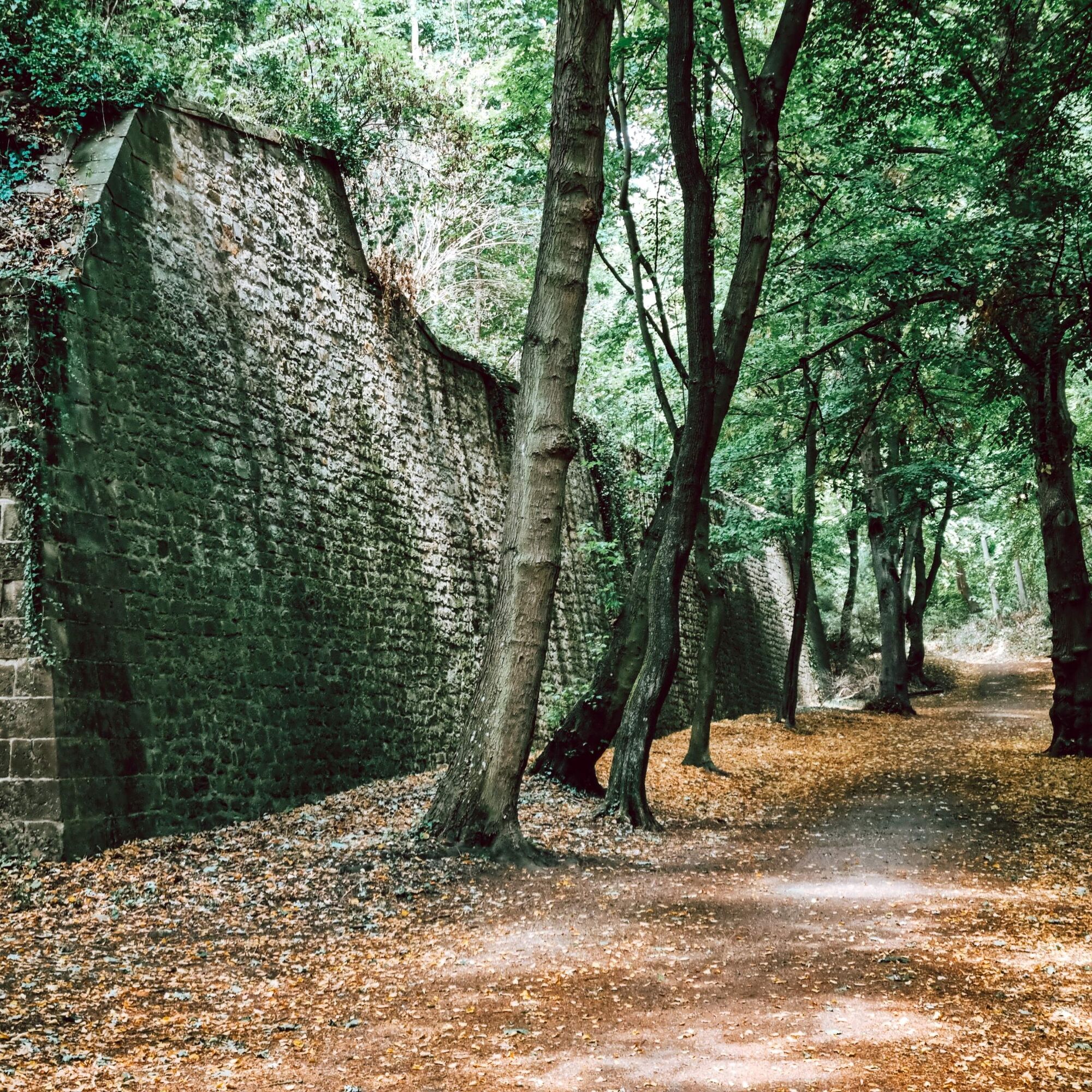
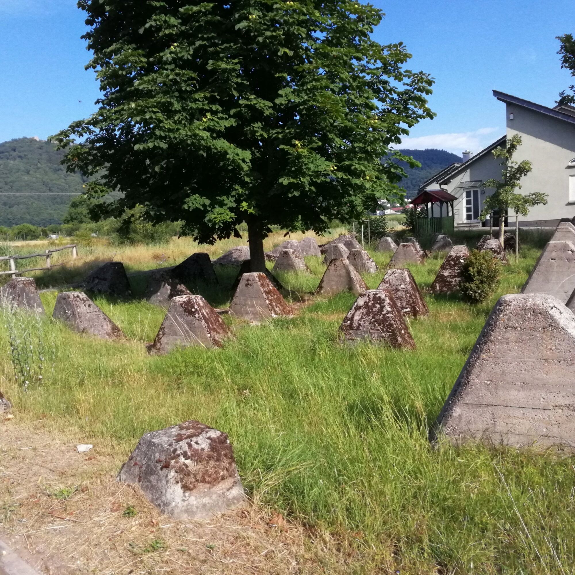
At the parking lot near the radio tower, the circular walking trail to the Ettlinger Linien begins (accessible only on foot). The Ettlinger Linien are historic fortifications from the 18th century stretching across the country. The defense lines were built in 1707 during the War of the Spanish Succession (1701–1713/14) and were meant to stop French troops advancing on the right bank territory. During the later War of the Polish Succession (1733–1735/38), in which France was again involved, the Ettlinger Linien gained great importance; they were reinforced and further expanded. The defense lines consisted of trenches about five meters deep with wooden palisades and several meters high earthen ramparts with oak stakes driven into the ground to hinder the advancing enemy. About 100 meters in front of the lines, approximately ten-meter-high watchtowers, called redoubts, stood at regular intervals.
From the Fortress Town of Rastatt to Kehl
Starting from the parking lot at the radio tower, continue toward Schluttenbach and take the K3546 downhill to the roundabout. Here you’ll meet the Baden Wine Cycle Route again and follow it along the L607, passing Oberweier, Sulzbach, and Malsch. After Malsch, the wine route leaves the main road and leads you through scenic green areas via Muggensturm to Rauental, where you follow Rastatter Straße toward Rastatt.
In Rastatt, turn from Rauentaler Straße onto Berliner Ring. After crossing the railway, follow Karlsruher Straße into the city center. Just past the train station, continue on “Am Schlossplatz” and turn right onto “An der Ludwigsfeste.” This road takes you behind the castle park to Lyzeumstraße, which you follow left alongside the park until you reach Herrenstraße. As a cyclist, you may turn left here against the one-way street. After about 150 meters, you’ll arrive at the entrance to Rastatt Castle, which also houses the Military History Museum. The museum displays around 2000 square meters of southwest German military history from the late Middle Ages to World War I.
Continue straight on Herrenstraße to the Rohrersteg bridge and cross the Murg River. At the end of Badstraße, turn left onto Josephstraße, then right onto Karlstraße. Follow this street to the Hopfenschlingel guesthouse—a good spot for a break. At the end of Militärstraße, you’ll reach Fortress Cavalier 1. During the Baden Revolution of 1849, it was a stronghold against Prussian besiegers and later a prison for about 700 freedom fighters. Externally a ruin, inside it hosts an exhibition and documentation. The fortress is only accessible via guided tours (contact: info@hist-ver-rastatt.de).
Your tour continues through the park past the entrance to the casemates—underground galleries with firing slits and mining tunnels used to defend the fortress moat. Rastatt also features a preserved Westwallbunker (Regelbau 10 from 1938), part of the border defenses against France.
Return to L77 (Lützower Straße) and follow the parallel bike path. After crossing the Ooser Landgraben and the industrial canal, turn right onto the Tour de Murg bike route and follow it along the canal to Kuppenheim. In Kuppenheim, turn right onto Favoritestraße, which leads directly to Schloss Favorite.
At the roundabout on L67, the Baden Wine Route turns right, leading you through Haueneberstein to Baden-Baden Oos station. From the station, follow the PAMINA Rheinpark-Süd bike route south alongside the railway to Sinzheim. After looping over the railway and highway, continue on PAMINA Rheinpark-Süd through Müllhofen, Liedelshof, Elzhofen, and Ottenhofen to Vimbuch, then via Balzhofen to Moos. From Moos, continue on the Zwerge Tour and Farm Shop Tour to Lichtenau.
From Lichtenau, the route takes you over quiet country roads and comfortable paths through Scherzheim to Helmlingen. Where you meet the Rhine Cycle Route / Eurovelo 15, a short detour right to the “Ritterloch” is worthwhile—legend says a whole cavalry troop drowned there during the Thirty Years’ War. Now follow the Rhine Cycle Route / Eurovelo 15 south past Freistett to the Honau harbor. Here, leave the Rhine Route and follow a local bike route to Leutesheim. In Leutesheim, turn right at the end of Poststraße onto Badener Straße. At the town’s edge, switch to the bike path left of county road K5373, which takes you to Kehl-Auenheim.
At Kehl’s entrance, follow signs for the “Forts Route / Piste des Forts” to the former Birkenhof golf course. Be careful crossing state road 75! From here, continue straight and leave the Forts Route toward Kehl-Neumühl. Cross the railway tracks, enter the town, and at the roundabout take the second exit. At the town’s end, take a short break at the camouflage bunker (Elsässer Straße 18). The bunker is open for groups by appointment and for individual visitors on museum days. Afterwards, head toward Kehl, cross the Kinzig river, and after a traffic light, carefully cross the busy ring road. Then, after a short stretch left, make a sharp right to follow the bike path parallel to the ring road. Just before Kehl’s center, pass the Ehrenfriedhof cemetery with its war graves—an audio box shares eyewitness accounts.
After crossing through Kehl’s center, the tour continues over the “Passerelle des deux Rives” pedestrian and bike bridge into Strasbourg. Leaving the “Jardin des Rives,” follow the Forts Route toward Strasbourg’s city center. Pass the “Clinique Rhéna,” cross “Avenue du Rhin,” and turn left toward “Bassin Starlette.” Following the tram tracks, cross the new bike bridge and continue to the “Phare Citadelle” cultural center, a nice summer spot for food and drinks. Leave the bike path, turn right, and follow the paved towpath along “Bassin Dusuzeau,” passing many moored sport boats. Next, you’ll pass the “Vaisseau,” a German-French interactive science museum well worth a visit. Just after “Vaisseau,” turn left onto the “Pont de Danube” bridge. After crossing, rejoin EuroVelo 15 – Véloroute Rhin and follow it back to the tour’s starting point.
Áno
For our cycling routes we recommend the following equipment as standard:
(touring) bike, on hillier tours more gears or electric assistance provide more comfort. bicycle helmet clothing suitable for cycling, also for bad weather Bicycle bag, for stowing equipment and provisions Sunglasses or goggles, which also protect against insects Smartphone with the Rhineland-Palatinate app for navigation and information on places of interest, places to stop along the route, etc. Most important tools and spare parts, charging accessories for e-bike if necessary Sun protection, especially for tours through fields & vineyardsPlease note that the tour partly runs on agricultural roads as well as on traffic roads. We ask for mutual consideration as well as careful and anticipatory cycling in road with traffic. In addition to asphalt cycle paths, there may be sections with gravel, with uneven concrete slabs, forest roads or dirt roads sections .
From Baden-Württemberg or Bavaria, take the A8 towards Karlsruhe or the A5 towards Rastatt.
From the north, either on the Baden side via the A5 towards Karlsruhe or on the Palatinate side via the A65 towards Bad Bergzabern and Landau.
From France, take the A4 and A340 to Haguenau, then the RD263 to Soultz-sous-forêt and Wissembourg, or the A35 to Drusenheim.
The circuit is accessible by train:
Karlsruhe Station, Bretten Station, Ettlingen Station, Rastatt Station, Baden-Baden Station, Kehl Station, Strasbourg Station, Drusenheim Station, Soultz-sous-Forêts Station, Wissembourg Station, Landau Station, Germersheim Station, Wörth StationFurther information for Baden-Württemberg at www.efabw.de, for Rhineland-Palatinate at www.vrn.de and for Alsace at www.sncf.com
There are several parking options along the route. There's free parking behind Wissembourg station or at the “Rue des Messageries” parking lot, about 50 meters away.
3
Cycling map :
Vis-à-Vis cycle map "Per Rad!"- Cycling map of Kraichgau-Stromberg "Tourentipps in der Südpfalz" - Cycling map "Cycling tours around Bühl and Achern" - cycle mapBike rental and services
Alsace :
https://www.cyclinginalsace.com/en/facilities/bike-rental.html
https://www.cyclinginalsace.com/en/facilities/bicycle-repair.html
Albtal:
https://www.albtal-tourismus.de/erleben/radfahren
Karlsruhe:
https://www.kvv-nextbike.de/de/karlsruhe/
Pfalz:
https://www.pfalz.de/de/pfalz-erleben/radfahren/verleih-und-ladestationen/ladestationen
https://www.pfalz.de/de/pfalz-erleben/radfahren/verleih-und-ladestationen/e-bike-und-fahrradverleih
Iffezheim:
Rastatt:
https://www.zweirad-koelmel.de/cms-wir-ueber-uns.asp
https://www.zweiradhaus-maerz.de/
The Baden-Elsass-Pfalz e.V. tourism association brings together around 60 members in Baden, the North Alsace and the South Palatinate. These include towns and municipalities, tourism organisations, accommodation providers and some businesses. The Baden-Alsace-Palatinate Tourism Association promotes cooperation between tourism stakeholders in the Franco-German PAMINA region. This cross-border cycle tour was developed on its initiative. The following tourist information offices are located along the route:
Office de tourisme de Strasbourg et se région
17 Pl. de la Cathédrale
67082 Strasbourg
+33 (0)3 88 52 28 28
Office de tourisme du Pays Rhénan
1, Rue des Ecluses
67760 Gambsheim
+33 (0)3 88 96 44 08
Office de Tourisme de l'Alsace Verte
11 place de la République
67160 Wissembourg
+33 (0) 3 88 94 10 11
Office de Tourisme du Pays de Haguenau
1 place Joseph Thierry
67500 Haguenau
+33 (0) 3 88 06 59 99
Touristinformation Rastatt
Herrenstraße 18 (amSchloss)
76437 Rastatt
+49 (0) 7222 9721220
Tourist-Info Bretten
Melanchthonstraße 3
75015 Bretten
+49 (0) 7252 583710
Tourist-Information Karlsruhe
Kaiserstraße 72 - 74 (am Marktplatz)
76133 Karlsruhe
+49 (0) 721 602997580
Büro für Tourismus Landau in der Pfalz
Marktstraße 50
76829 Landau in der Pfalz
+49 6341 138301
Südpfalz-Tourismus Landkreis Germersheim e.V.
Luitpoldplatz 1
76726 Germersheim
+49 (0) 727453300
Tourist-Information Bühl
Friedrichstraße 7
77815 Bühl
+49 (0) 7223 9353805
www.buehl-buehlertal-ottersweier.de
Dahner Felsenland
Schulstraße 29
66994 Dahn
+49 63 91 91 96 - 00
Kehl Marketing GmbH
Rheinstraße 77
77694 Kehl
+49 7851 881510
https://marketing.kehl.de/,Lfr/accueil
Tourismusverein SÜW Bad Bergzabern e. V.
Kurtalstraße 27
76887 Bad Bergzabern
+49 (0) 6343 989 66-0
https://badbergzabernerland.suedlicheweinstrasse.de/#
Öko Regio Tour https://regio.outdooractive.com/oarkraichgau-stromberg/de/tour/radfahren/kraichgaustromberg-oekoregio-tour/1507087/
Bruchsaler Ringroute https://regio.outdooractive.com/oar-kraichgaustromberg/de/tour/radfahren/bruchsalerringroute/1534407/
Schlösser Tour https://regio.outdooractive.com/oarkraichgau-stromberg/de/tour/radfahren/kraichgaustromberg-schloesser-tour/1536676
Kraichradweg https://www.outdooractive.com/de/route/radtour/baden-wuerttemberg/kraichradweg/13584036/
Panorama Tour https://regio.outdooractive.com/oarkraichgau-stromberg/de/tour/radfahren/kraichgaustromberg-panorama-tour/1491994/
For shorter tours, here are some suggestions for 3-day tours (see also Route description section):
Stage 1: Alsace Stage – "Maginot Line Fortifications, Historic Battlefield, and Fleckenstein Castle Ruins" (171 km)
https://www.outdooractive.com/en/route/bikepacking/alsace/stage-1-alsace-stage-maginot-line-fortifications-historic/807466647/
From Roeschwoog to Wissembourg, you follow the main route. In Wissembourg, you turn onto the Véloroute de la Vallée de la Lauter and ride to Lauterbourg on the banks of the Rhine. There, you join EuroVelo 15 (Rhine Cycle Route), which takes you south to Roppenheim station (Roppenheim Gare). From there, a new cycle path leads you past the Style Outlet in Roppenheim and continues along the Rhine to Fort Louis, where you return to your starting point.
Stage 2: Palatinate Stage – "Between Defensive Lines (Siegfried, Queich, Ettlingen) and Fortified Towns (Landau, Germersheim)" (169 km)
https://www.outdooractive.com/en/route/bikepacking/alsace/stage-2-palatinate-stage-between-defensive-lines-siegfried-queich-/807530186/
Between Wissembourg and Ettlingenweier, you follow the main route. Then you ride via Durmersheim and Rheinstetten to Neuburgweier, where you take the ferry across the Rhine to Neuburg am Rhein. You continue towards Berg, then rejoin the Véloroute de la Vallée de la Lauter to return to your starting point in Wissembourg. On this stage, you pass several defensive lines such as the Siegfried Line, Queich Line, and Ettlingen Line, and cycle through the fortified towns of Landau and Germersheim.
Stage 3: Baden Stage – "Strasbourg’s Fortress Belt, Maginot and Siegfried Lines, and Rastatt Fortress Town" (163 km)
https://www.outdooractive.com/en/route/bikepacking/alsace/stage-3-baden-stage-strasbourg-s-fortress-belt-maginot-and/807530239/
From Strasbourg to Drusenheim, you follow the main route. In Drusenheim, you take the ferry across the Rhine to Greffern and continue on EuroVelo 15 – Rhine Cycle Route – north to Plittersdorf. From there, you head to Rastatt, where you rejoin the main route that leads you back to Strasbourg.
Webové kamery z prehliadky
Obľúbené výlety v okolí
-
Cycling circuit: PAMINA Rhine Park loop Haguenau – Rastatt
ťažkéDiaľková cyklotrasa 133,6 km -
Transboundary cycling circuit "Remarkable natural spaces" (PAMINA area)
ťažkéDiaľková cyklotrasa 432,2 km -
Bike tour: “From forest to forest, from the Bienwald to the Haguenau Exceptional Forest”
ťažkéDiaľková cyklotrasa 171,6 km -
Bike circuit “Rhine Adventure”
strednáCyklistika 52,9 km -
Bike route: BL722 - Goethe and the potters' villages
svetloCyklistika 26,9 km -
Cross-border cycling route "Beer & Brewing Culture" (PAMINA area)
ťažkéDiaľková cyklotrasa 399,0 km -
Les hauts de Mothern
svetloTuristika 8,19 km -
Neujahrstour
svetloTuristika 15,2 km -
Neuburgweier - Fischerheim - Friedenskirche - Insel
ťažkéMountainbike 83,4 km -
Zur alten Schmiede - Abbatiale Saint-Pierre et Saint-Paul - Refuge de Pigeonnier - Temple
ťažkéCestný bicykel 83,8 km
Turistika a stopovanie


Nenechajte si ujsť ponuky a inšpiráciu na ďalšiu dovolenku
Vaša e-mailová adresa bol pridaný do poštového zoznamu.