


Mountain bike circuit no. 2 The St Brice circuit
Úroveň náročnosti: S1
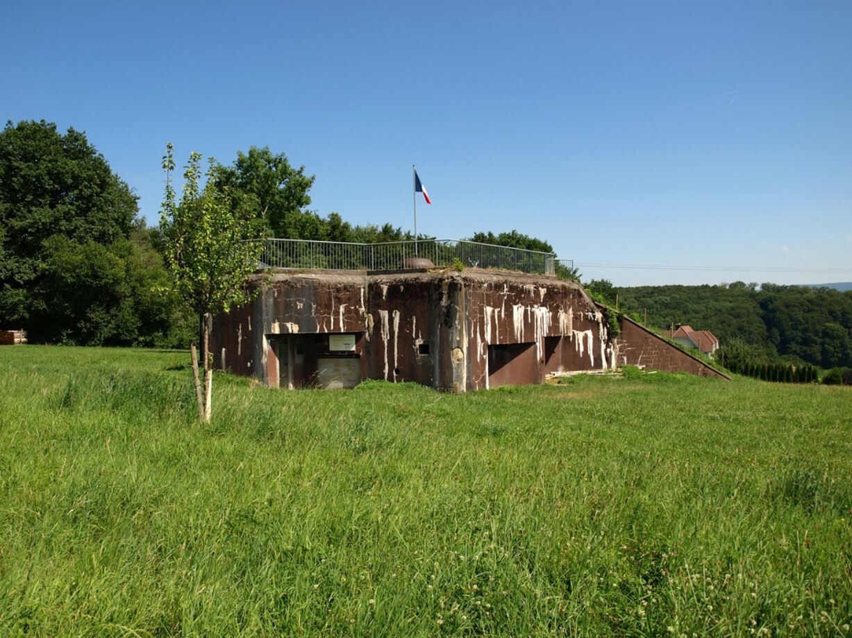
This route will immerse you in the history of the Second World War on the heights of Bettlach where you will discover the first remains of the Maginot line.

here is the detailed route :)
Wearing a helmet is strongly recommended
Safety instructions
Emergency number: 112
Mountain biking as you want! but…
Use the marked paths for your safety and respect the direction of the routes
Do not overestimate your abilities and stay in control of your speed
Be careful and courteous when overtaking or crossing hikers because pedestrians have priority
Check the condition of your mountain bike and plan for refreshments and repair accessories
If you go alone, leave your route with your contacts
Respect private property and cultivated areas
Beware of agricultural and forestry machines
Close the gates
Avoid wild picking of flowers, fruits, and mushrooms
Do not disturb the tranquility of wild animals
Take your rubbish with you, be discreet and respectful of the environment
Ferrette (68)
Access possible via Leymen station (4km away)
Free parking available on site
S1
SUNDGAU TOURIST OFFICE
13 rue du Château
68130 Altkirch
Tel: 03 89 40 02 90
Mountain-bike guidebook available at the Tourist Office!
Obľúbené výlety v okolí
-
5,0
Blauenpass - Renzenboden
strednáTuristika 9,86 km -
4,0
Rämelturm Burg i.Leimental
strednáTuristika 10,6 km -
The Tour of Sundgau by MTB (TDS)
strednáMountainbike 153,2 km -
5,0
Ferrette - The castle and the dwarfs' cave
strednáTuristika 4,56 km -
MTB Circuit no. 3 In the heart of the Alsatian Jura
ťažkéMountainbike 38,8 km -
MTB route no. 6 On the trail of the abbey of Lucelle
ťažkéMountainbike 47,8 km -
Tour La Lucelle & Grotte
strednáTuristika 8,25 km -
Oberlarg - Morimont castle
strednáTuristika 8,96 km -
Mythische Orte am Oberrhein - Oltingue – Ueberstrass
strednáCyklistika 59,8 km -
Rundwanderung Therwil - Flüh - Witterswil - Therwil
svetloZimná turistika 8,88 km

Turistika a stopovanie


Nenechajte si ujsť ponuky a inšpiráciu na ďalšiu dovolenku
Vaša e-mailová adresa bol pridaný do poštového zoznamu.