


Schanfigg high route, 1st stage, Chur - Tschiertschen
Úroveň náročnosti: T1
The starting point of the first stage is left to the hiker: directly from the station or by bus to Meiersboden. The signage for the Schanfigg high route starts at the St. Hilarienbrüggli. On the way, you...
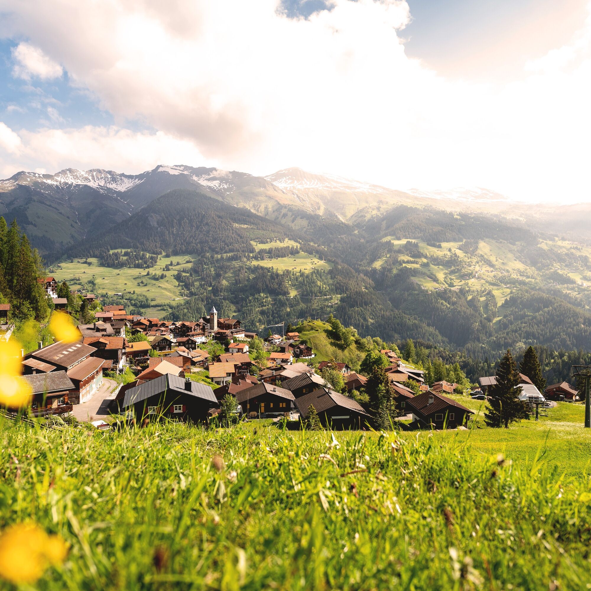
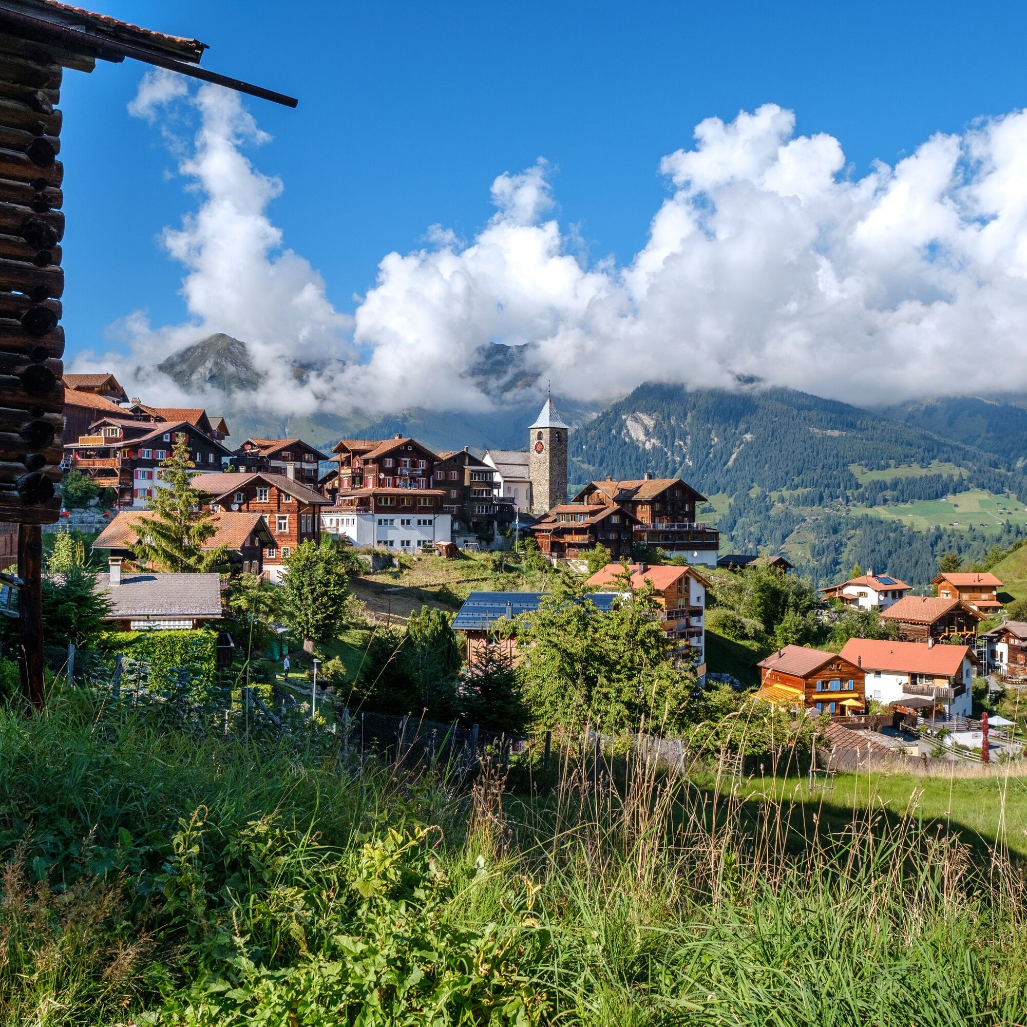
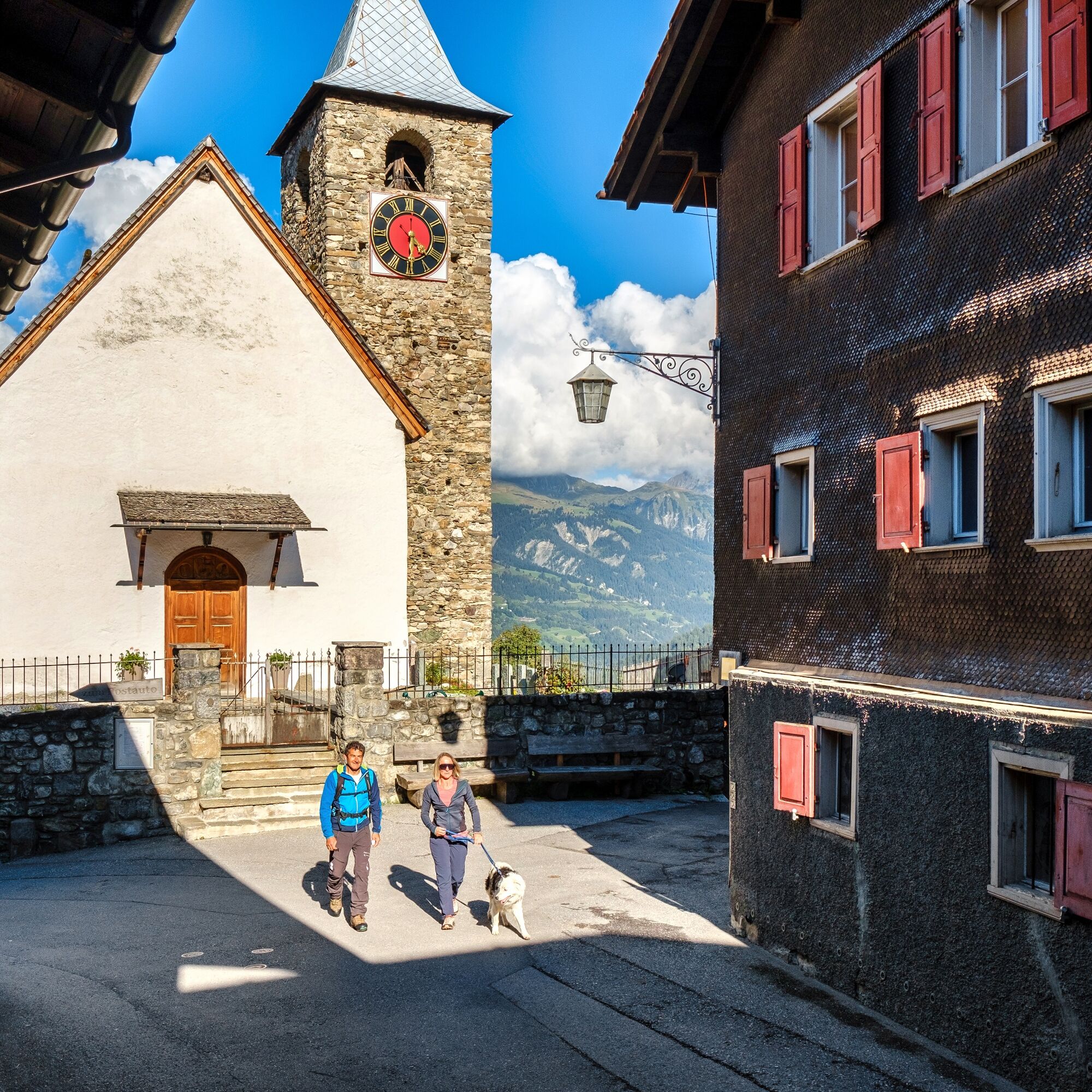
The starting point of the first stage is left to the hiker: directly from the station or by bus to Meiersboden. The signage for the Schanfigg high route starts at the St. Hilarienbrüggli. On the way, you pass the hotel management school in Passugg. The building of the former spa house is impressive. The section from Grida to Praden poses physical challenges, but the reward follows with wild romantic passages in the Steinbachtobel. Afterwards, you pass the village sawmill in Praden. Then you see the village church from the 17th century. Then you partly walk along the Chur alpine path (before 1890) past the larch forest to Tschiertschen. In the village centre stands the church from the 15th century with uncovered late Gothic frescoes and a listed Toggenburg organ from 1820. Those still with energy can visit Füxliweg. A special attraction is also the Tschiertschen sawmill, which is still powered by the water power of the Sagenbach.

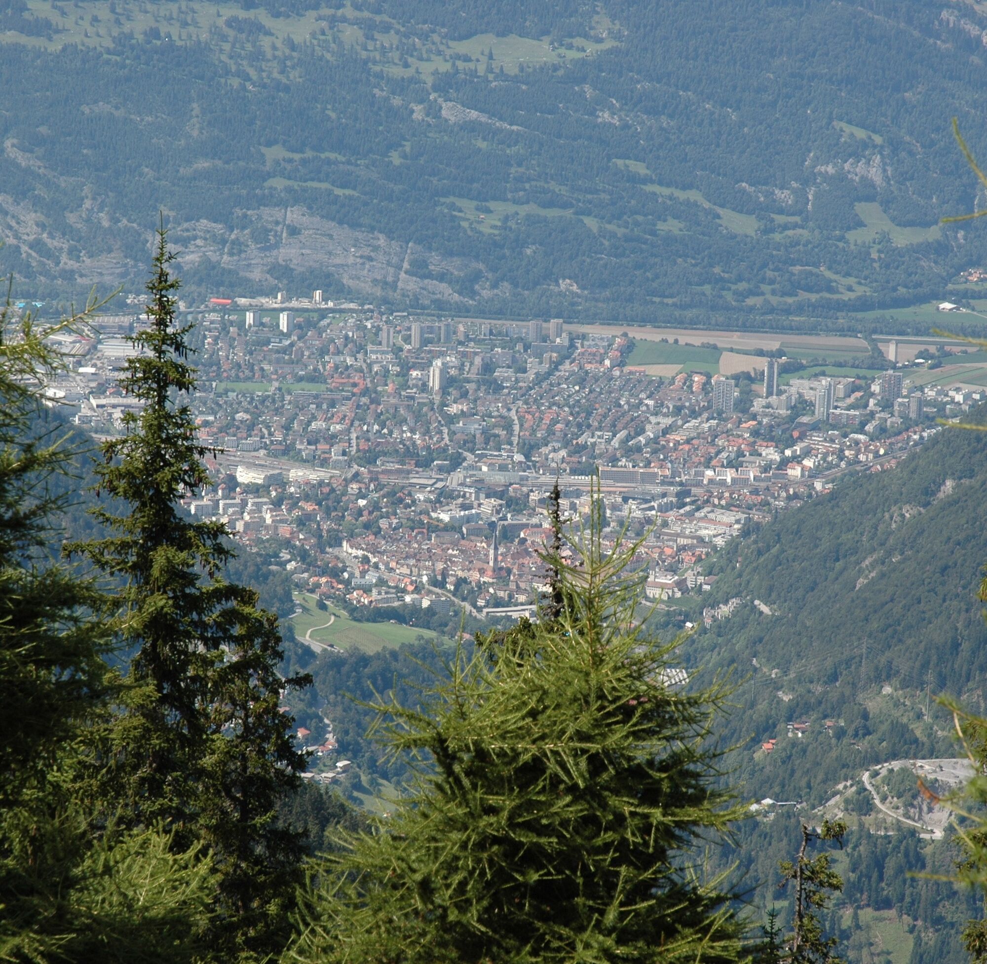
Chur train station - Chur Meiersboden - Passugg - Upper Grida - Maiensäss - Ricaldei - Usser Praden - Sagentobel - Inner Praden - Tschiertschen
Good footwear, rain jacket, possibly hiking poles, enough to drink, snack to eat.
In bad weather, the Steinbachtobel can be difficult to pass. Partly demanding physical requirements. Alternatively, parts of the route can be completed by public transport.
By car via the motorway or country road to the capital of the canton of Graubünden, Chur.
By train to the Alpine town Chur.
Various car parks in Chur.
T1
The route is especially steep and accordingly strenuous between Passugg and Upper Grida. After all, 850 meters of altitude have to be overcome upwards, as many as on no other stage. On the other hand, the route with just under 10 kilometers is also the shortest of the whole hike. Still, enough time should be planned. The hiking map (Arosa Tourism, 2009) estimates 4 hours.
Fireplace: Stampwald (after Praden)
Refreshments on the way: Passugg (opening times!)
Accommodation: various accommodations in Tschiertschen
Visit the Güdahof farm shop - The carefully curated range is complemented by honey from the region, syrup and jams made from seasonal fruit or herbs from the farm garden, Filisur ice cream, and gift items. Take a piece of holiday home with you!
Webové kamery z prehliadky
Obľúbené výlety v okolí
-
3,9
Arosa-Medergen-Tritt-Latschüelfurgga-Strelapass-Davos
strednáTuristika 22,5 km -
Arosa-Schwellisee-Älplisee-Parpaner Rothorn
Turistika 12,3 km -
4,5
Drachenloch
ťažkéTuristika 9,72 km -
4,7
Arosa-Hörnli-Parpaner Rothorn-Lenzerheide
Turistika 11,9 km -
5,0
Arosa-Hörnli-Urdenfürrgli-Alp Scharmoin-Lenzerheide
strednáTuristika 15,3 km -
5,0
Eichhörnliweg Arosa
svetloTematická trasa 1,72 km -
5,0
Arosa-Erzhornsattel-Arosa
Turistika 14,9 km -
Haldensteiner Calanda
ťažkéTuristika 16,9 km -
2,0
Arosa-Furclettapass-Alvaneu
Turistika 21,8 km -
5,0
767 Alteinsee Schiesshorn
strednáTuristika 11,9 km

Turistika a stopovanie


Nenechajte si ujsť ponuky a inšpiráciu na ďalšiu dovolenku
Vaša e-mailová adresa bol pridaný do poštového zoznamu.