


Vilan round tour
Úroveň náročnosti: T2


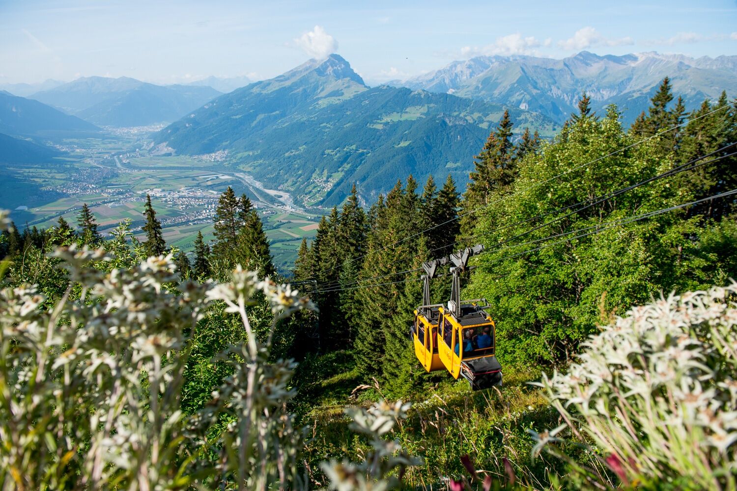
You can reach the starting point of the hike from Malans on the Älplibahn, which is operated and supported by volunteers. The aim is not to make a profit, but to maintain the cable car for summer operation....
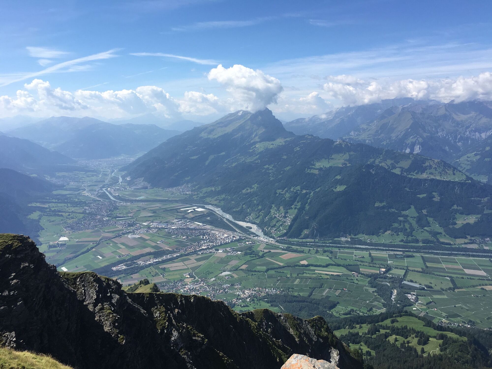
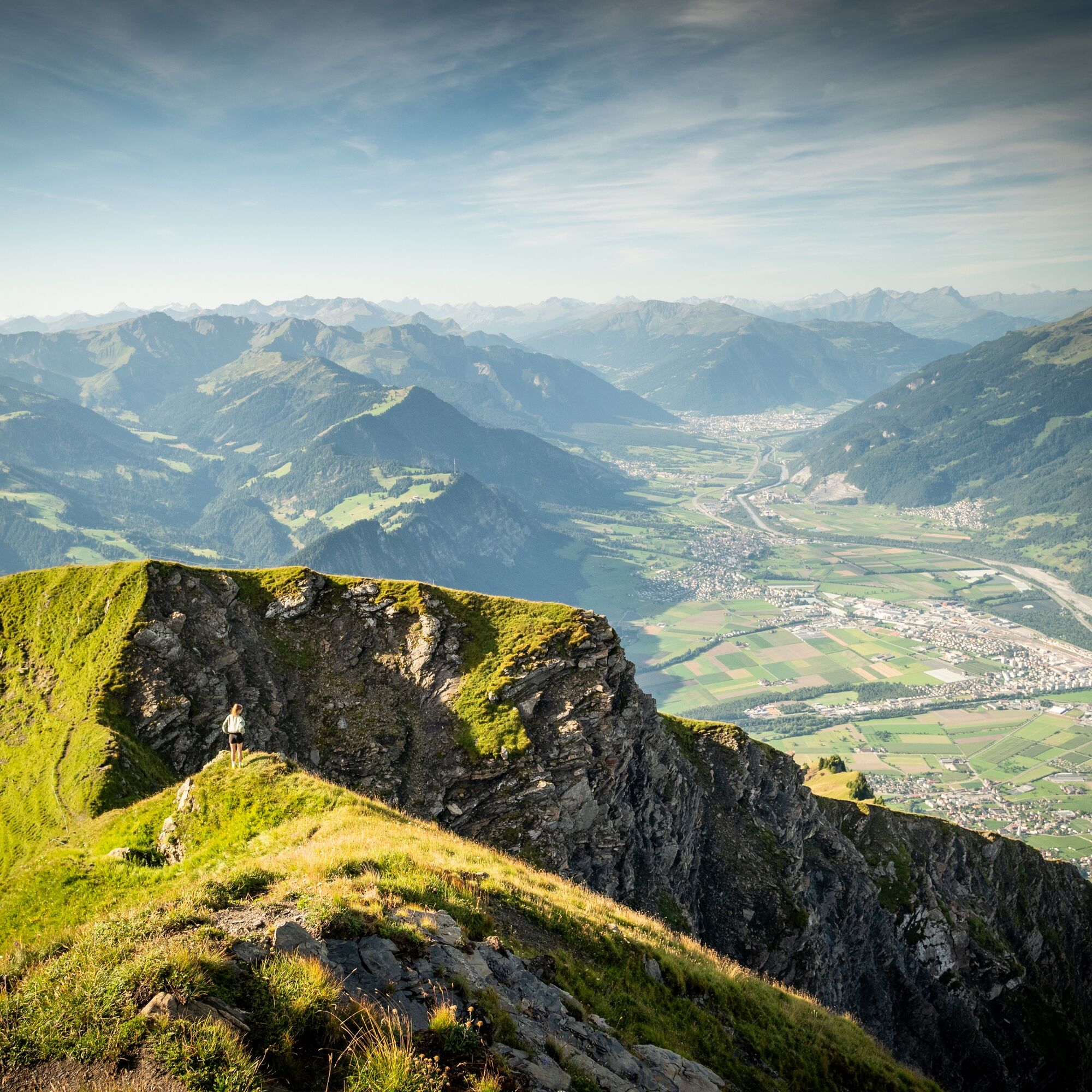
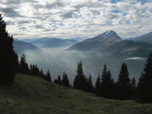
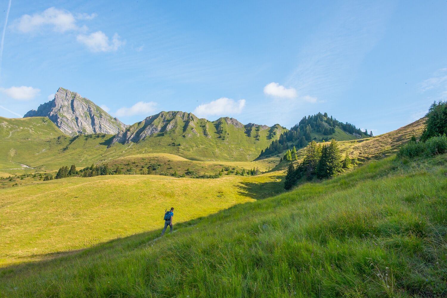
You can reach the starting point of the hike from Malans on the Älplibahn, which is operated and supported by volunteers. The aim is not to make a profit, but to maintain the cable car for summer operation. The ascent to the Vilan summit first takes place through a wooded section, soon over picturesque alpine landscapes and later on a beautiful mountain path. The popular summit destination offers a magnificent panorama of the Rhine Valley, the Churfirsten and other well-known mountains such as Piz Bernina, Piz Kesch, Piz Linard and Ringelspitz. From the summit, the descent and return is along the well-marked path on the ridge eastwards to Sadreinegg and on via Alp Sadrein to the Luvadina pasture fountain with a magnificent view over the Prättigau. The hiking trail later leads through sparse forest to the alpine road, which climbs up to Jeninser Obersäss and from there leads back to the Älplibahn mountain station.


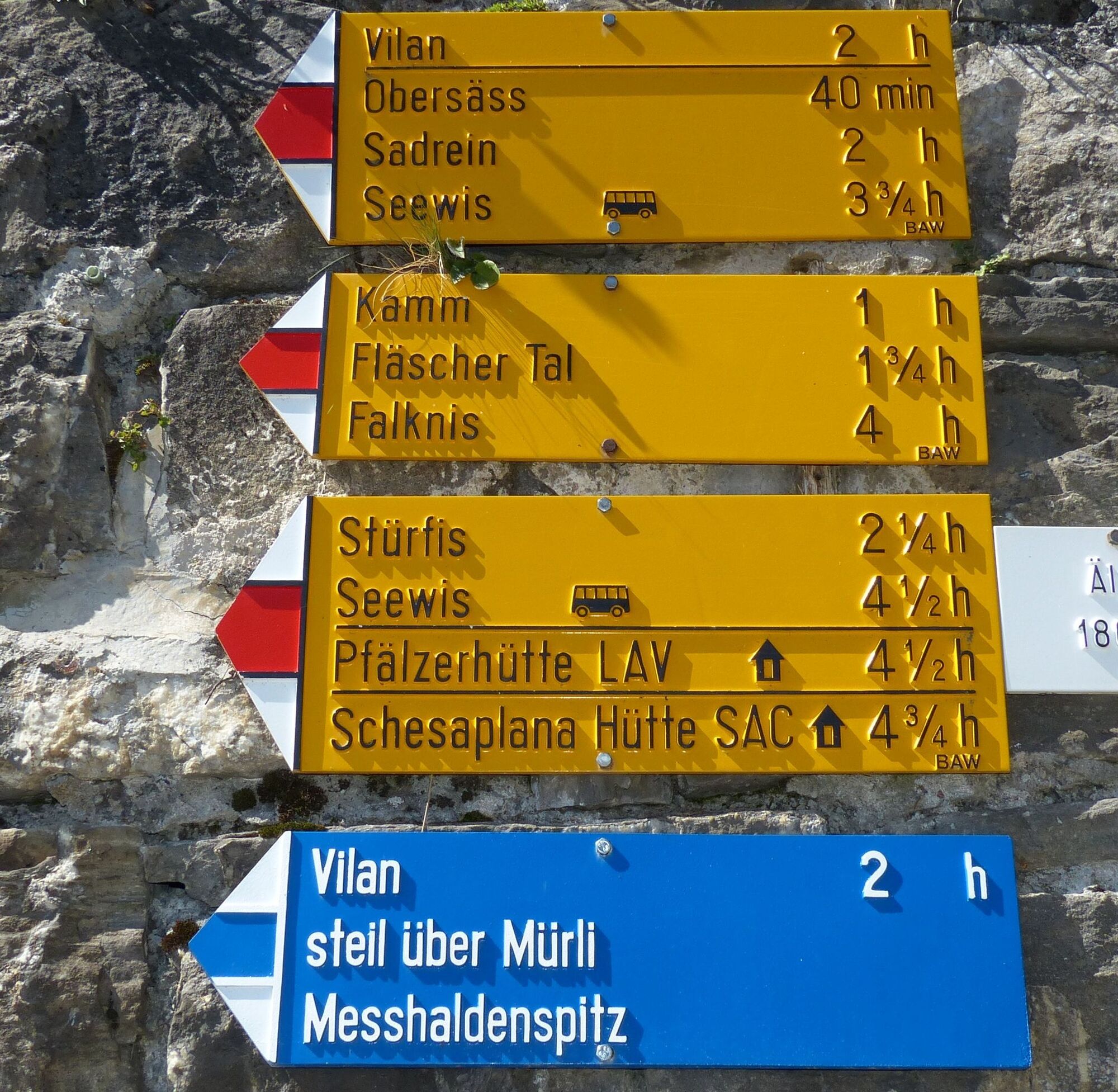

Älplibahn mountain station - Vilan turn-off (before Jeninser Obersäss) - Vilan summit - Sadreinegg - Alp Sadrein - Luvadina - Jeninser Obersäss - Älplibahn mountain station
Although the Vilan is relatively easy to hike, sturdy shoes and a jacket are essential (it can quickly get windy and chilly on the summit).
A white-blue hiking trail also leads to the summit, which is only suitable for sure-footed hikers and should only be attempted in good visibility and dry conditions.
Take the Landquart highway exit, then the main road to Malans. The route to the Älplibahn is signposted in the village.
Take the train to Malans, from there continue by bus to the "Älplibahn" stop
There are plenty of parking spaces at the Älplibahn.
T2
The Älplibahn runs every 15 minutes. It has 2 cabins for 4 people each. It is essential to book in advance by calling +41 (0)81 322 47 64. The cable car is operated on a non-profit basis by the Älplibahn Association. www.aelplibahn.ch
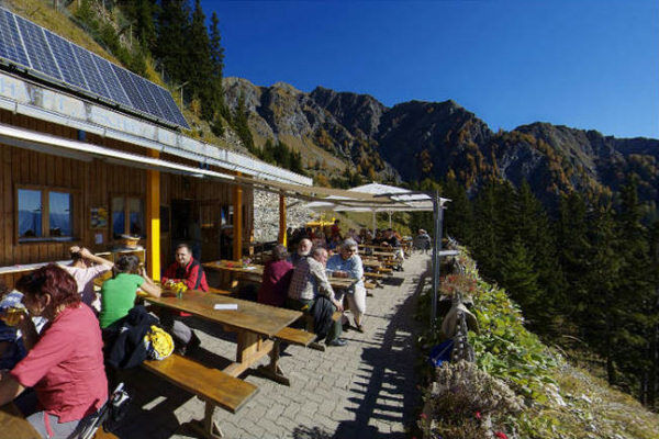
Before heading downhill again, a stop at the mountain restaurant at the Älplibahn mountain station is a must. The view and barley soup are a real treat.
Obľúbené výlety v okolí
-
5,0
Douglasshütte, Lünersee, Gafalljoch Brand bei Bludenz, Vorarlberg
svetloTuristika 9,16 km -
4,6
To the Alpspitz summit cross
svetloTuristika 6,27 km -
4,5
Fürstin-Gina-Weg
strednáTuristika 12,0 km -
4,8
From Malbun to the Schönberg
strednáTuristika 12,4 km -
4,8
Pizalun circular route
svetloTuristika 7,18 km -
4,6
Wanderung Malbun - Sass-Seeli - Sassförkle - Drei Kapuziner - Schönberg - und Talstation Täli wieder zurück nach Malbun
strednáTuristika 10,8 km -
5,0
Schesaplana (15.07.2018)
ťažkéTuristika 8,68 km -
3,7
Sassweg - von Malbun zum Sass-Seelein
Turistika 4,14 km -
4,8
BLUDENZ | Lünersee
svetloTuristika 6,20 km -
4,5
Vandans - Heinrich Hueter Hütte über Gipsköpfle
svetloTuristika 7,97 km
Turistika a stopovanie


Nenechajte si ujsť ponuky a inšpiráciu na ďalšiu dovolenku
Vaša e-mailová adresa bol pridaný do poštového zoznamu.