


Hike through moor landscapes from St. Antönien to Stels

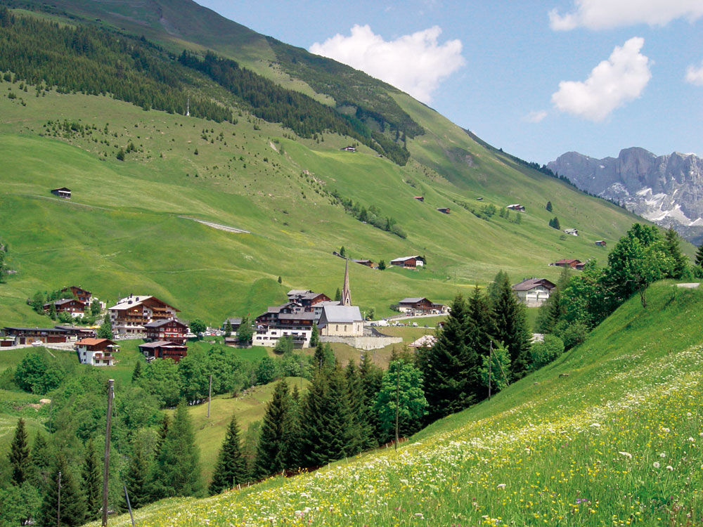
In the Walser village of St. Antönien at the Platz bus stop, you can refresh yourself before the ascent in the two hotel restaurants. Head uphill from here towards Stels/Salfsch along Schwendistrasse until...
In the Walser village of St. Antönien at the Platz bus stop, you can refresh yourself before the ascent in the two hotel restaurants. Head uphill from here towards Stels/Salfsch along Schwendistrasse until the Michelschhofstrasse junction. Then follow the road slightly uphill to the left towards Aschüel. At Aschüel, veer slightly left towards Valpun, then off towards Stels. Beautiful meadow path and a first swamp area (walk in the middle of the boardwalk; the boards are mostly loosely laid).
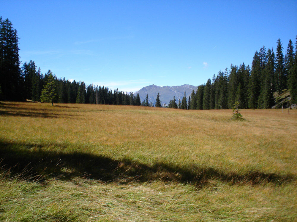
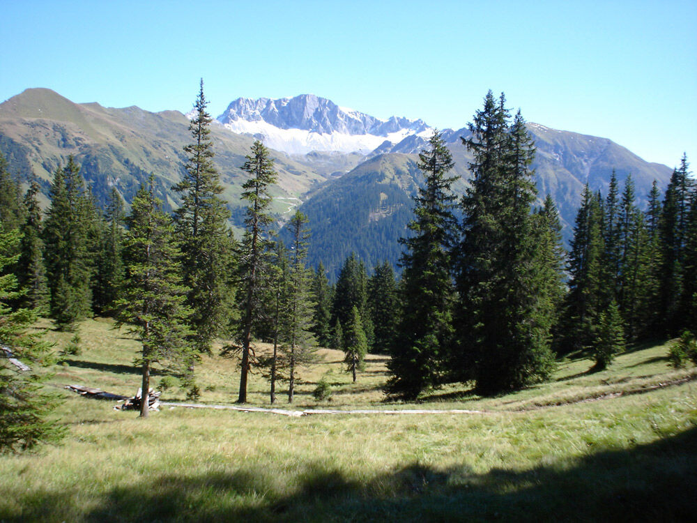
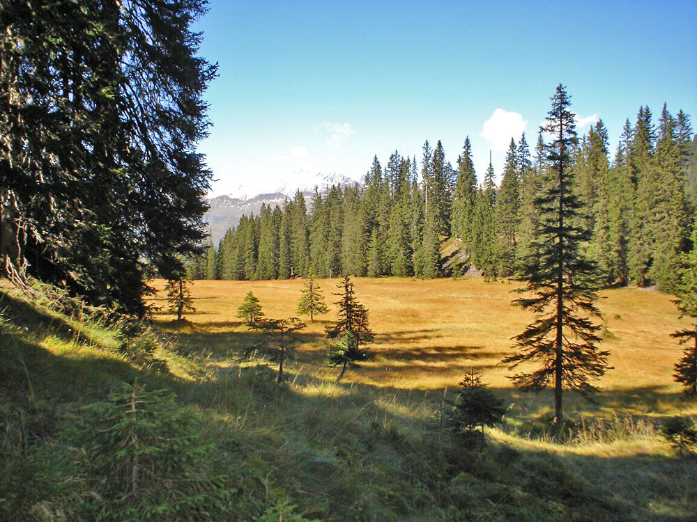
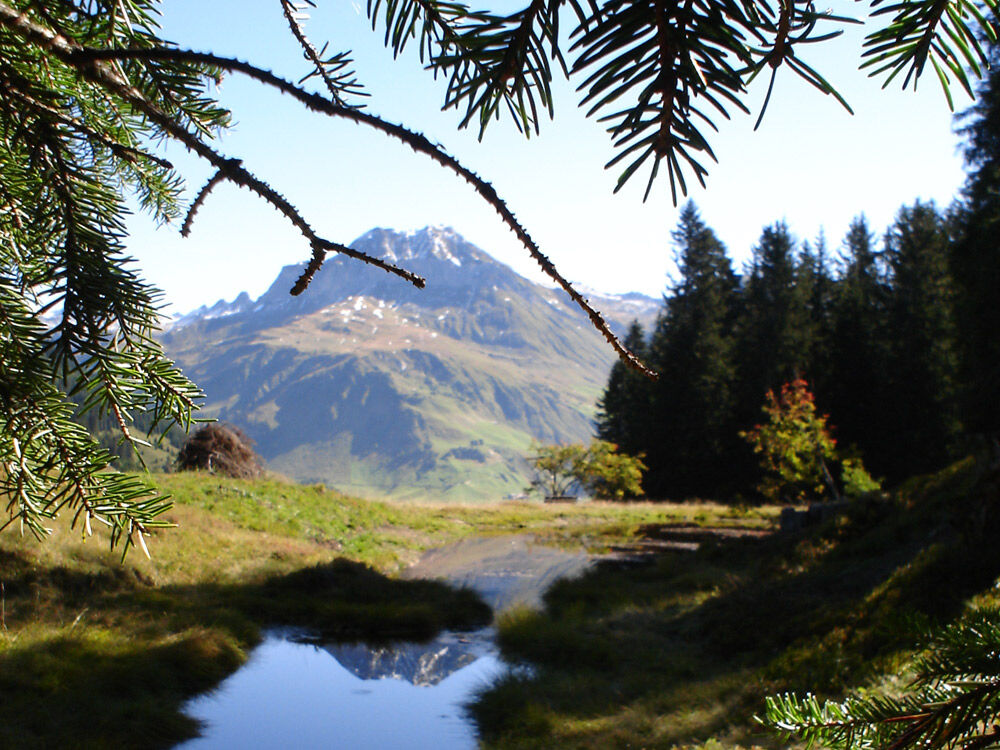
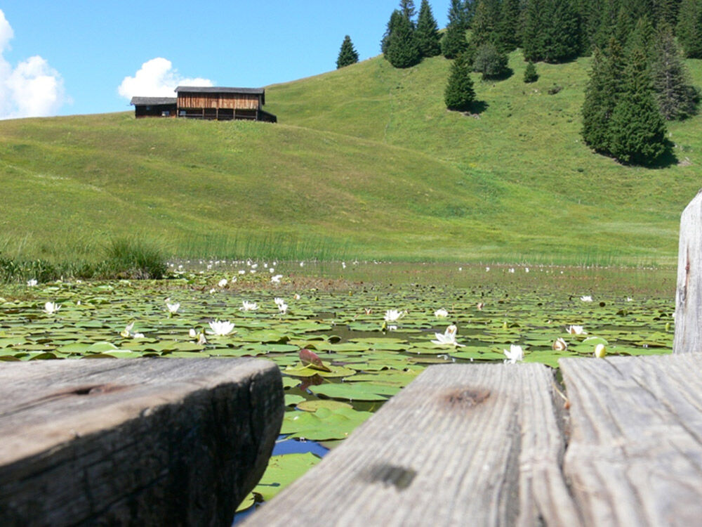
Continue towards "Stels". Loose forest with fern plants, berry bushes, and in between beautiful reed beds that glow golden in autumn. The path is well marked with posts and signs. The first mountain peaks appear in the background. Balancing over the boards and the many roots in the forest requires appropriate attention. At the forest exit at the top, enjoy the panorama from the Schesaplana to the Austrian mountains! The path leads gently uphill to the gravel road towards Alp Valpun. Continue hiking along this road to point 1826. Here a soft meadow ridge path leads down to the first houses of the Stelserberg. A detour to the left to Stelsersee (2 minutes) is always worth it. The water lilies bloom higher at Stelsersee than anywhere else in Europe.
Back at the gravel path, continue past the mountain guesthouse by the lake. To reach the "Mottis" bus stops, take the direct route along the paved road.

St. Antönien Platz 1414m - Aschüel 1610m - Untersäss 1774m - 1826m - Stelsersee 1668m - Stels Mottis (Stelserberg) 1460m
The path follows the hiking trail marking "white-red-white" and is not specially signposted.
On the A13 and B28 to just before the tunnel at Küblis, take the right exit Conters/Küblis, straight on at the roundabout and then turn left to Luzein, Pany, St. Antönien.
Take the Rhaetian Railway RhB to Schiers or Küblis and then the post bus to St. Antönien. (Timetable fields 90.218 or 90.222).
In St. Antönien all parking lots are subject to fees. Payment can be made in cash, via the Parkingpay app, or Twint. Parking lot P2 is located in the village center slightly above the church.
Pany-St. Antönien Tourism
Panyerstrasse 39
CH-7243 Pany
Tel. +41 81 300 32 22
info@pany-stantoenien.ch
www.pany-stantoenien.ch
Prättigau Marketing
Feldweg 19
CH-7233 Jenaz
Tel. +41 (0)81 325 11 11
info@praettigau.info
www.praettigau.info
Obľúbené výlety v okolí
-
5,0
Ski tour to the Lindauer Hut (1,744 m)
svetloSkitour 14,0 km -
4,8
Smuggler’s path
strednáTematická trasa 8,60 km -
4,4
Golm-Rundwanderweg im Rätikon
strednáTematická trasa 7,28 km -
4,9
Douglasshütte, Lünersee, Gafalljoch Brand bei Bludenz, Vorarlberg
svetloTuristika 9,16 km -
4,2
Golmerbahn Bergstaion Grüneck - Golmer Höhenweg - Geißspitze - Lindauer Hütte - Latschau
strednáTuristika 11,5 km -
4,8
Douglashütte - Schesaplana
strednáTuristika 7,31 km -
3,0
Bergstation Grüneck Golmerbahn - Alpe Latschätz - Lindauer Hütte - Latschau
svetloTuristika 11,1 km -
3,3
Wanderbares Zalimtal
strednáTuristika 12,2 km -
4,0
Golmer Höhenweg
strednáTuristika 13,8 km -
5,0
Around the Kirchlispitzen (2,552 m)
ťažkéTuristika 14,8 km
Turistika a stopovanie


Nenechajte si ujsť ponuky a inšpiráciu na ďalšiu dovolenku
Vaša e-mailová adresa bol pridaný do poštového zoznamu.