


Alpine hike Segnes Pass
Úroveň náročnosti: T3
You start comfortably in Flims with the cable car and ride up to the mountain station Nagens Sura, where the panorama of the surrounding mountains already opens impressively. From there, the hike begins...
You start comfortably in Flims with the cable car and ride up to the mountain station Nagens Sura, where the panorama of the surrounding mountains already opens impressively. From there, the hike begins with a first section leading you over the Grauberg – a scenic high path with magnificent views of the Rhine Gorge and the Tschingelhörner.
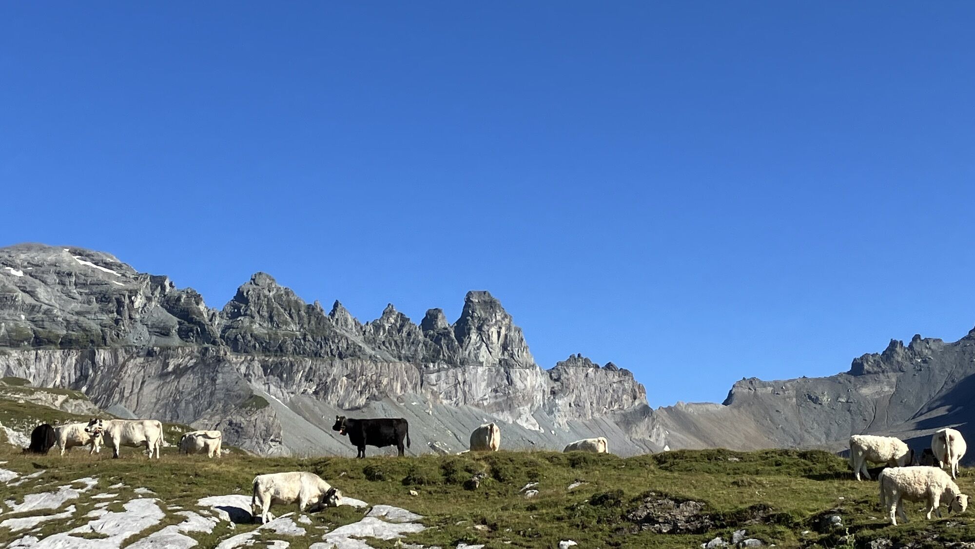
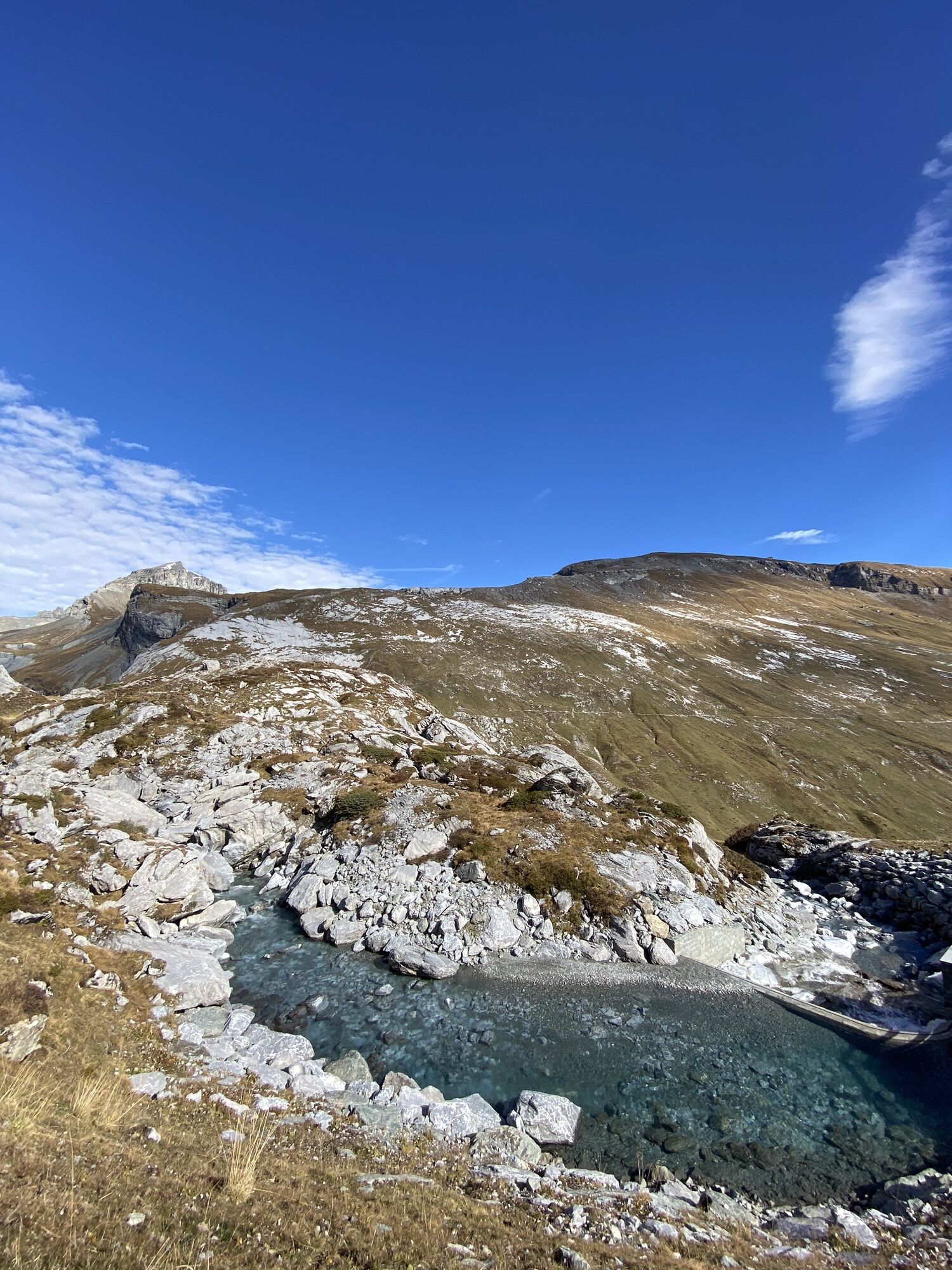
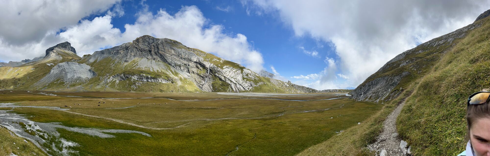
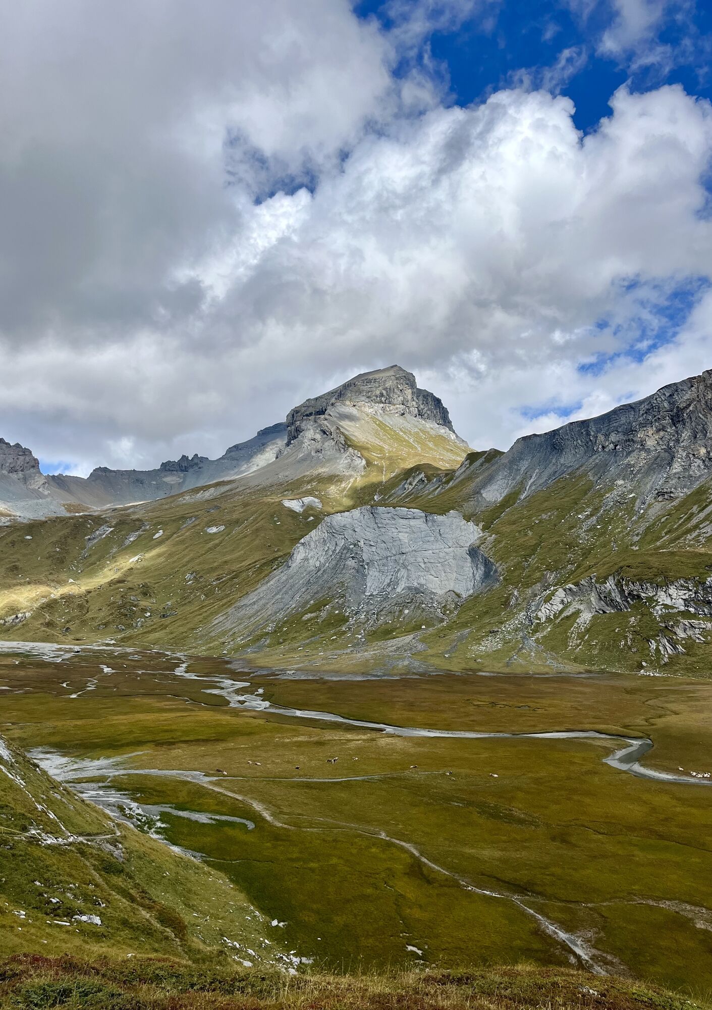
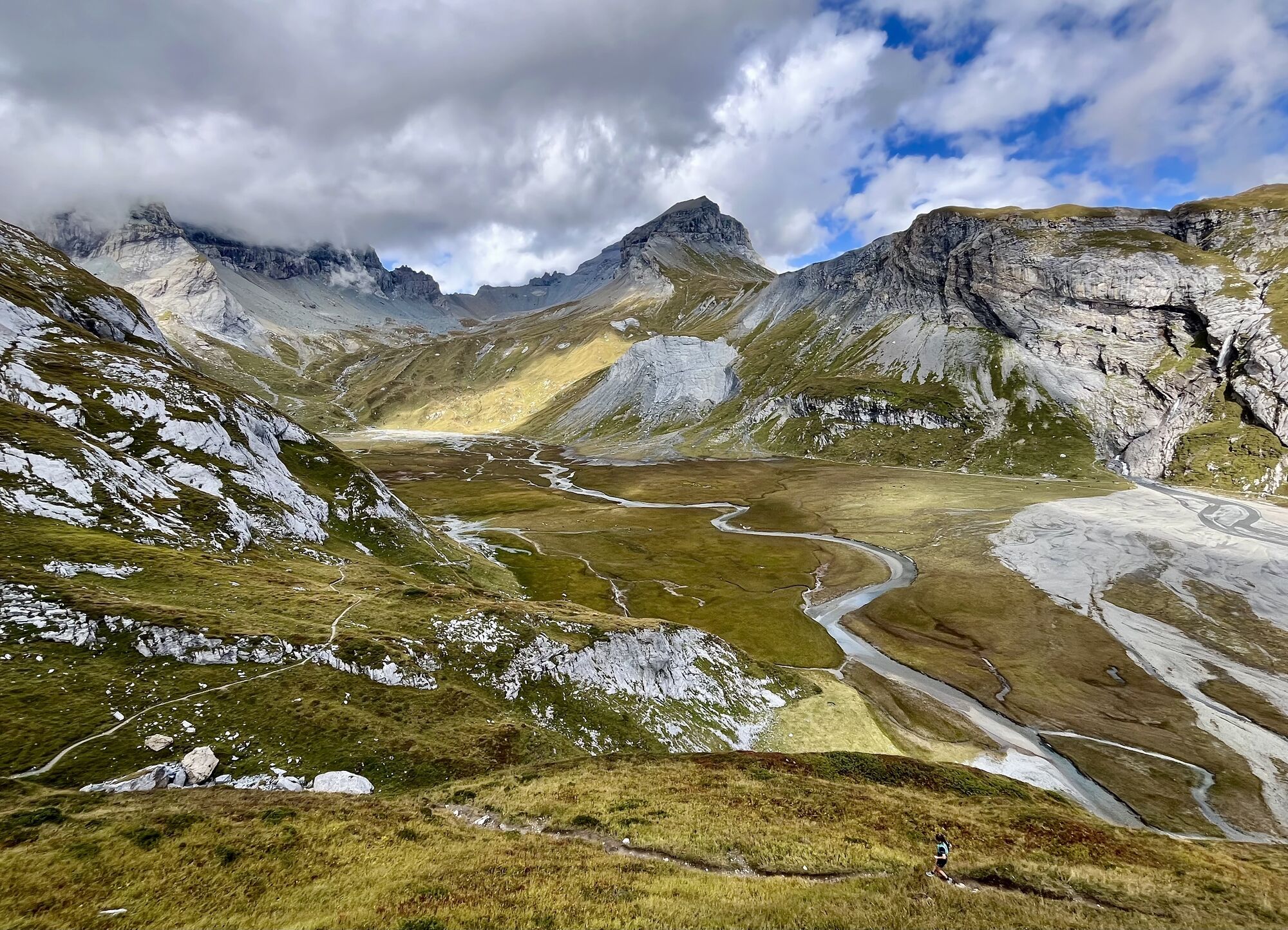
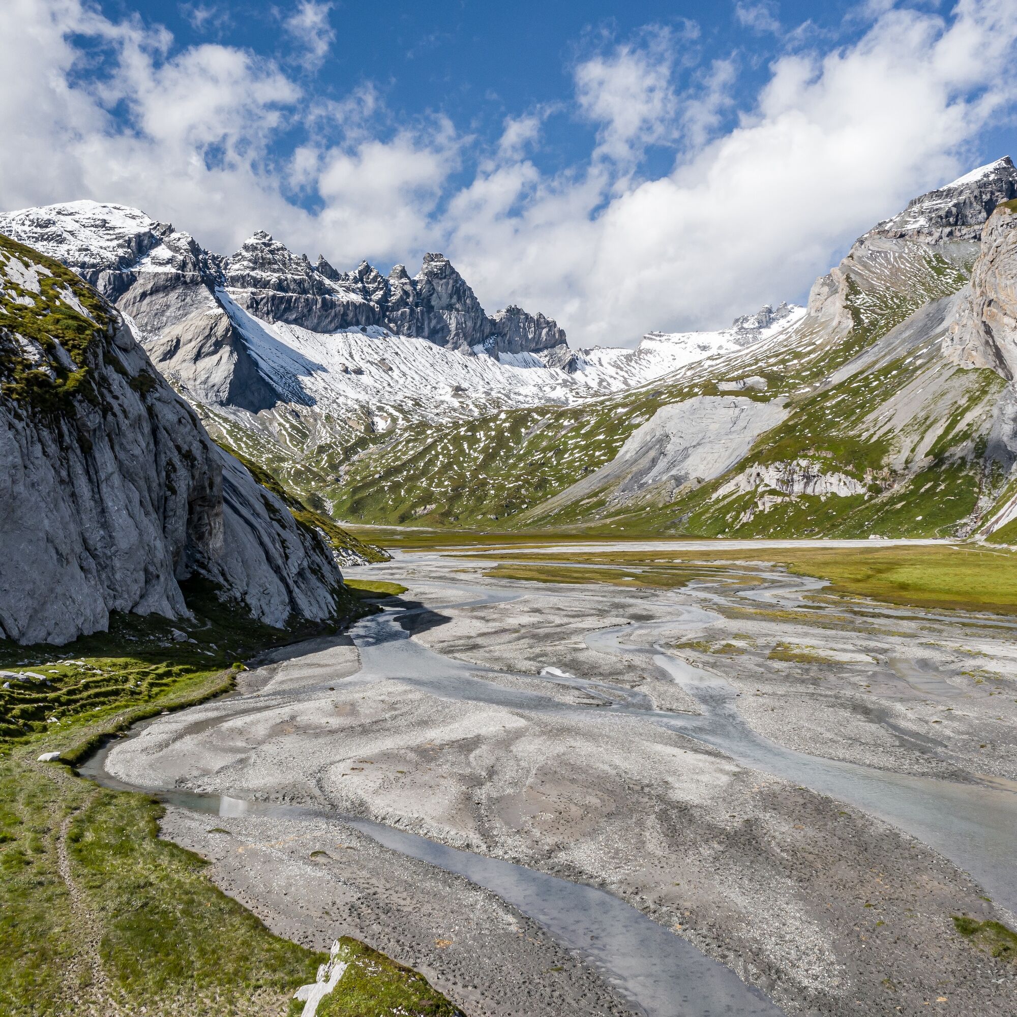
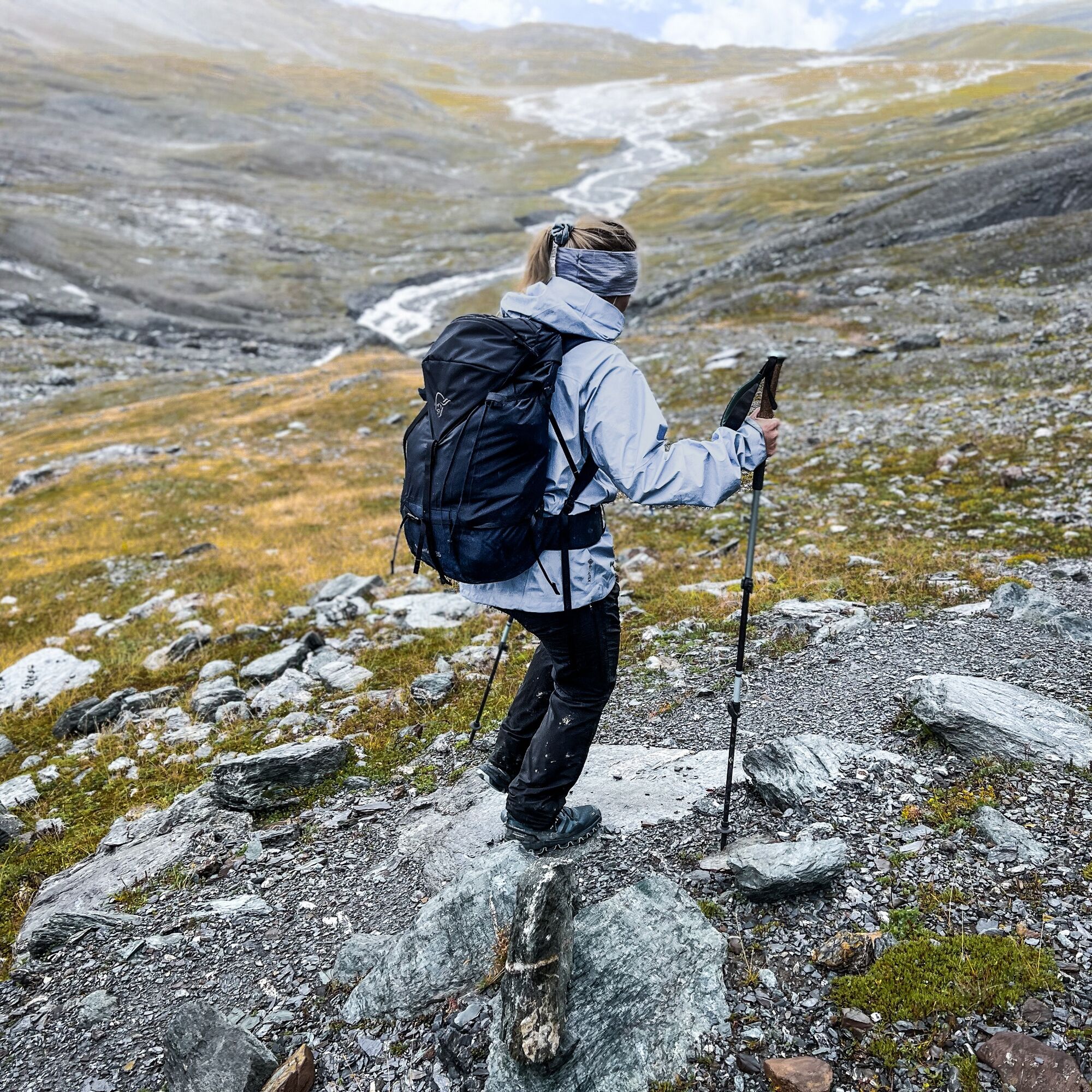
After the Grauberg, the path continues to the Lower Segnesboden, a fascinating high plateau crossed by alpine streams, impressive both geologically and scenically. From here begins the ascent below the Tschingelhörner – the distinctive rock formation that is part of the UNESCO World Heritage “Tectonic Arena Sardona.” The path leads over well-developed mountain trails steadily uphill for about two hours to the Segnes Pass.
Once at the top, a beautiful viewpoint at 2,627 m above sea level awaits you with views of the Sernftal and the Glarus Alps. Directly at the pass, a small hut invites you to a well-deserved rest – ideal for a refreshment or a strengthening snack.
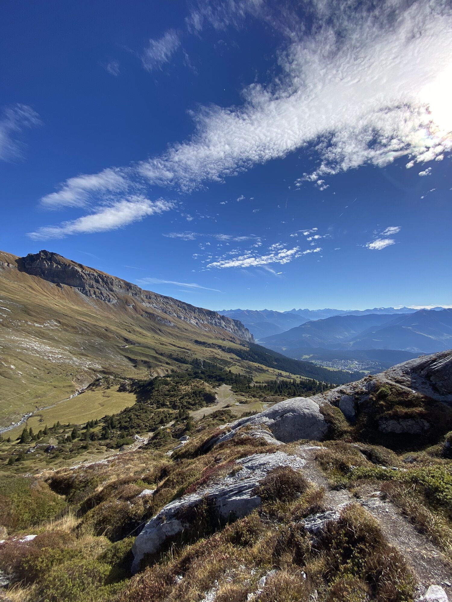
After the break, the descent begins, crossing below the Atlas summit. You gradually switch sides of the valley and hike toward La Siala, where you reach the crossing to the Upper Segnesboden. This wide, impressive plateau is characterized by alpine moor landscapes and the typical shale soil which gives the region its character.
The last section brings you to the Segnes hut, a popular place to stop for regional specialties with a view of the impressive Flimserstein. From there, you can, depending on your mood and desire, start the return trip to Flims on foot via a well-marked hiking trail – or you can choose again the cable car that comfortably brings you back down to the valley.


Áno
Mountain-suitable footwear
By car to Flims village cable cars
By bus to Flims village cable cars
Stenna parking garage
T3
Guest information Flims Laax Falera
Via Nova 62
CH-7017 Flims
Tel: +41 (0)81 920 92 00
E-mail: info@flimslaax.com
Web: www.flimslaax.com
Webové kamery z prehliadky
Obľúbené výlety v okolí
-
4,5
4-lake hike: Caumasee - Crestasee - Felsbach Gorge
strednáTuristika 12,8 km -
4,8
Rheinschlucht: From Ilanz to Versam into the heart of the Rheinschlucht
strednáTuristika 11,4 km -
4,8
Rhine Gorge Hike: Senda Ruinaulta (659)
svetloTuristika 9,39 km -
4,7
The Water Trail: Trutg dil Flem 764
ťažkéTematická trasa 8,56 km -
5,0
Caumasee tour: Flims - Caumasee - Conn - Flims
svetloTuristika 7,94 km -
4,7
Mountain hike to the Strudeltöpfe on Alp Mora: Bargis-Trin
ťažkéTuristika 18 km -
4,5
Waterfall Arena Batöni
strednáTuristika 8,24 km -
5,0
Lower Segnesboden: Nagens Sura - Lower Segnesboden - Segnes hut - Alp Nagens
strednáTuristika 6,66 km -
4,5
St. Martin - Alp Sardona - St. Martin
strednáTuristika 14,2 km -
4,3
Circular hike: Falera-Curnius-Alp Dadens-Falera
strednáTuristika 11,4 km
Turistika a stopovanie


Nenechajte si ujsť ponuky a inšpiráciu na ďalšiu dovolenku
Vaša e-mailová adresa bol pridaný do poštového zoznamu.