







Butzmühlenweg near Frankenberg (Eder)
Úroveň náročnosti: T2
The Butzmühlenweg is ready for a surprise! A weir leads over the mill channel to the meadow from the nearby inn Zur Mühle. With some luck, you will meet the famous Nuhne geese here. Past an enchanted,...
The Butzmühlenweg is ready for a surprise! A weir leads over the mill channel to the meadow from the nearby inn Zur Mühle. With some luck, you will meet the famous Nuhne geese here. Past an enchanted, almost black pond and the deserted settlement of Guntershausen, it goes down into the Nuhne valley. Through a wild romantic small stream valley, you reach the plateau of Hommershausen, which offers a wonderful view over the landscape. Over heathland, the path leads into the Nienze valley. An attraction along the way is the church of Hommershausen, which was relocated here from the Nuhne valley.


Start the route clockwise.
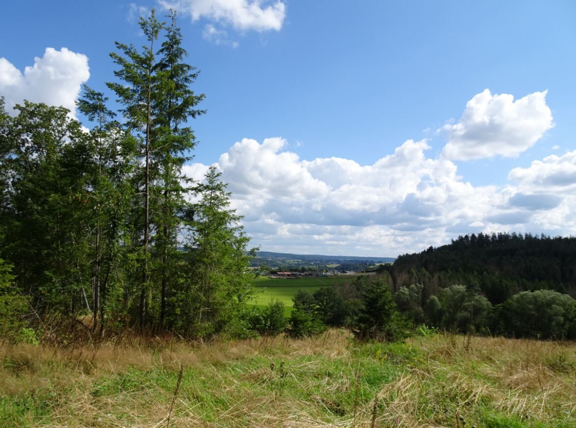
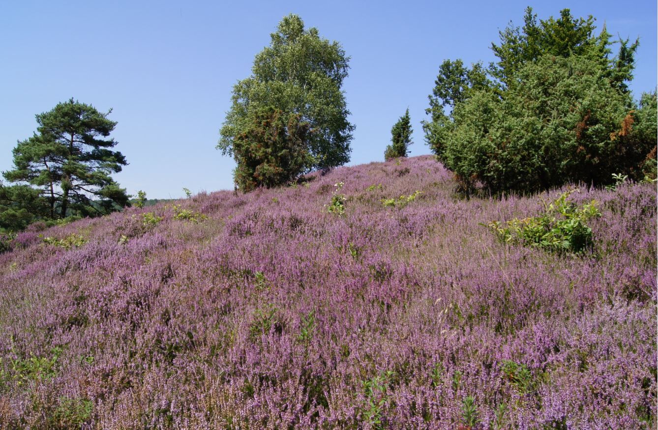
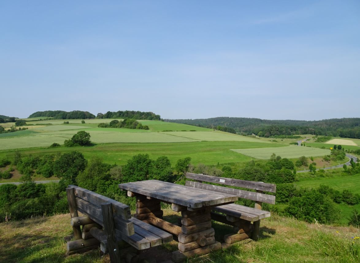
After just a few meters, turn right, with the Nienze babbling beside you. A first rest area soon comes into view, beautifully situated under an old beech tree. Or do it like the shepherds? Not far from here you reach the Shepherd's Beech. Here the shepherd let his sheep graze. He himself had the ideal place to rest and shelter from sun and rain under this magnificent tree. Now you have to cross the road leading to Hommershausen. Do you already see the young beeches to the left and right of the path, joining together like a natural canopy? A bench invites you to relax and enjoy. Now you reach the Hommershäuser Heath, which unfolds a symphony in violet in late summer. The maintenance of this valuable natural monument is carried out traditionally with sheep through annual grazing once or twice a year. The path goes uphill towards Schmitteberg. Once at the top, you will be rewarded with a magnificent view. The path then leads you towards Hommershausen. The small forest village is a district of the Philipp-Soldan town Frankenberg (Eder).
TIP: Make a detour here into the village and visit the Butz Church. The half-timbered church used to stand on the left bank of the Nuhne near the Lower Butzmühle and was the parish church of Hommershausen, which lies up on the hill and on the other side of the valley. Hiking through the forest was part of the villagers' daily routine. By order of the authorities, the church was dismantled on the Nuhne, the beams were carried up the hill, and rebuilt in Hommershausen in 1818.
Back at this point, the path leads you towards the forest, where soon a steeply descending path of about 500 m lies ahead of you.
NOTICE: For hikers who prefer not to walk this section, an alternative route is signposted that takes a wide detour around this stretch.
The Knappbach accompanies you for a part of your route and also appears after the next short descent. Stones help you cross. Now the path leads past the Upper and Lower Butzmühle. The village of Butzebach was destroyed around 1360 during the Sternekrieg and was not rebuilt. The two mills were spared during the wars because they were needed for grinding bread grain and the troops had to be supplied. Today, both mills are privately owned. Two footbridges set due to the renaturation of the Nuhne lead you to the road towards Schreufa-Sachsenberg, which you must cross. Almost directly opposite, the path continues to the "Wüstung Guntershausen." The word "Wüstung" refers to settlements of the Middle Ages that were abandoned for various reasons. An information board along the path tells the story. A wonderful view of Schreufa awaits you after the next turn. Following the path, the marking points left. Here, it goes steeply downhill for about 40 meters.
NOTICE: For hikers who do not want to walk this section, an alternative route is also signposted here, which takes a small detour around this stretch.
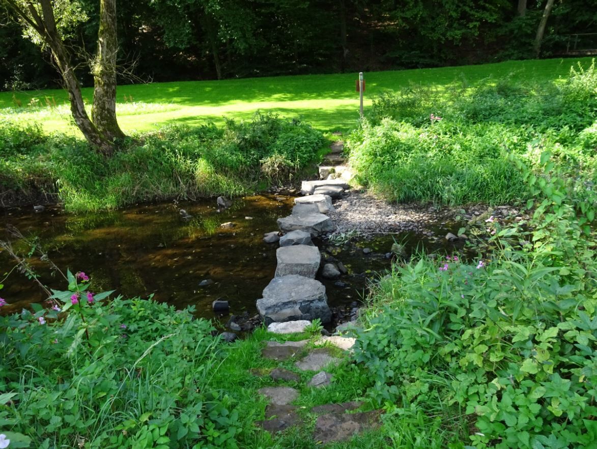
Soon you reach the old festival ground of Schreufa. Here, the bird shooting event takes place once a year. Now turn left and then walk past the barrier through the forest. This path is open to hikers and you now walk parallel to the road towards Schreufa-Sachsenberg. Almost done – but now come two absolute highlights. The path leads you to the Weather Museum, which offers a lot even outside opening hours: for example, a phenological seasonal clock, a climate fence, and a weather and climate garden with many information boards explaining climate change and weather phenomena. Now it continues towards the Nuhne – perhaps you will meet the famous Nuhne geese here! Now it gets sporty. Over five large fieldstones, you reach the other bank of the Nuhne. On the left, you see the inn "Zur Mühle" – you certainly deserve a refreshment now. After crossing the meadow area and the sluice of the mill channel, you return to the starting point.
NOTICE: If you shy away from walking over the fieldstones or if the water level of the Nuhne is too high, follow the signposted alternative route through the village, which also leads you back to the starting point.
Back at the hiking portal, a rest area with a footbath is right in front of you – ideal to cool tired feet and pause for a moment to reflect on what you have seen and experienced.
Sturdy hiking boots, packed lunch, especially drinks (no refreshment options on the way)
Footbath installation Frankenberg (Eder)-Schreufa, Sachsenberger Straße, turnoff at inn Zur Mühle.
From Frankenberg (Eder) station take line 530 to Schreufa Nuhne Bridge, then about 500 m to the footbath installation
or call-collect taxi (AST) at least 30 minutes before departure from Frankenberg station.
From Marburg station take RE97 to Frankenberg (Eder) station.
Infos: www.nvv.de or AST service phone 0800-939-0800 (toll-free)
Free parking available at the hiking portal
Áno
T2
Ederbergland Touristik e.V.
Tourist Information | Untermarkt 12 | 5066 Frankenberg (Eder)
www.ederbergland-touristik.de | info@ederbergland-touristik.de
Tel.: +49 6451 7717672
Finally, visit the Weather Museum in Schreufa, exciting and informative for young and old.
www.schreufa.de/wettermuseum


Obľúbené výlety v okolí
-
5,0
Der "Fabelhafte Elfensteig" in Winterberg-Züschen
Turistika 4,45 km -
Cliff path near Allendorf (Eder)-Rennertehausen
svetloTuristika 10,3 km -
5,0
Edersee / Camping Teichmann kleine schöne Runde
svetloTuristika 6,47 km -
Ringelsberg-Route - Wandern im Nationalpark Kellerwald-Edersee
strednáTuristika 10,0 km -
Kirchen am Eder-Radweg
strednáCyklistika 108,7 km -
4,0
Medebach, Center Parcs trail
strednáZimná turistika 5,88 km -
Orke water trail - nature experience trail
strednáTuristika 9,53 km -
Entdeckerpfad Hasenkammer mit Motorikpfad
svetloTuristika 3,22 km -
Eder-Radweg ****
ťažkéDiaľková cyklotrasa 166,2 km -
Orketalrundweg (Medebach: Medelon-Berge-Dreislar)
strednáTuristika 16,0 km
Turistika a stopovanie


Nenechajte si ujsť ponuky a inšpiráciu na ďalšiu dovolenku
Vaša e-mailová adresa bol pridaný do poštového zoznamu.





