







W13 - MTB - Panorama Trail

Úroveň náročnosti: S2
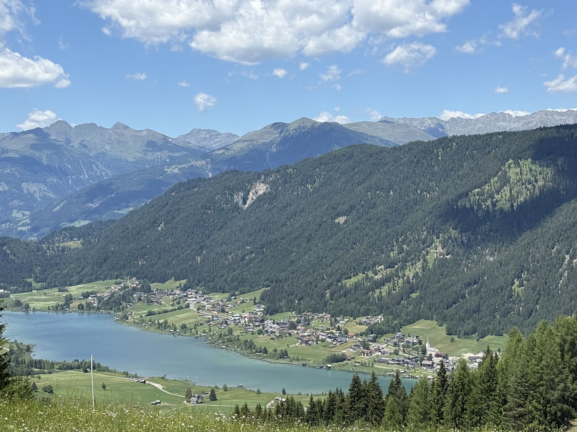
The trail entrance is located directly below the mountain station of the "Weissensee Mountain Railway". You can reach it comfortably by lift, which has its own mountain bike transport chairs, or optionally...
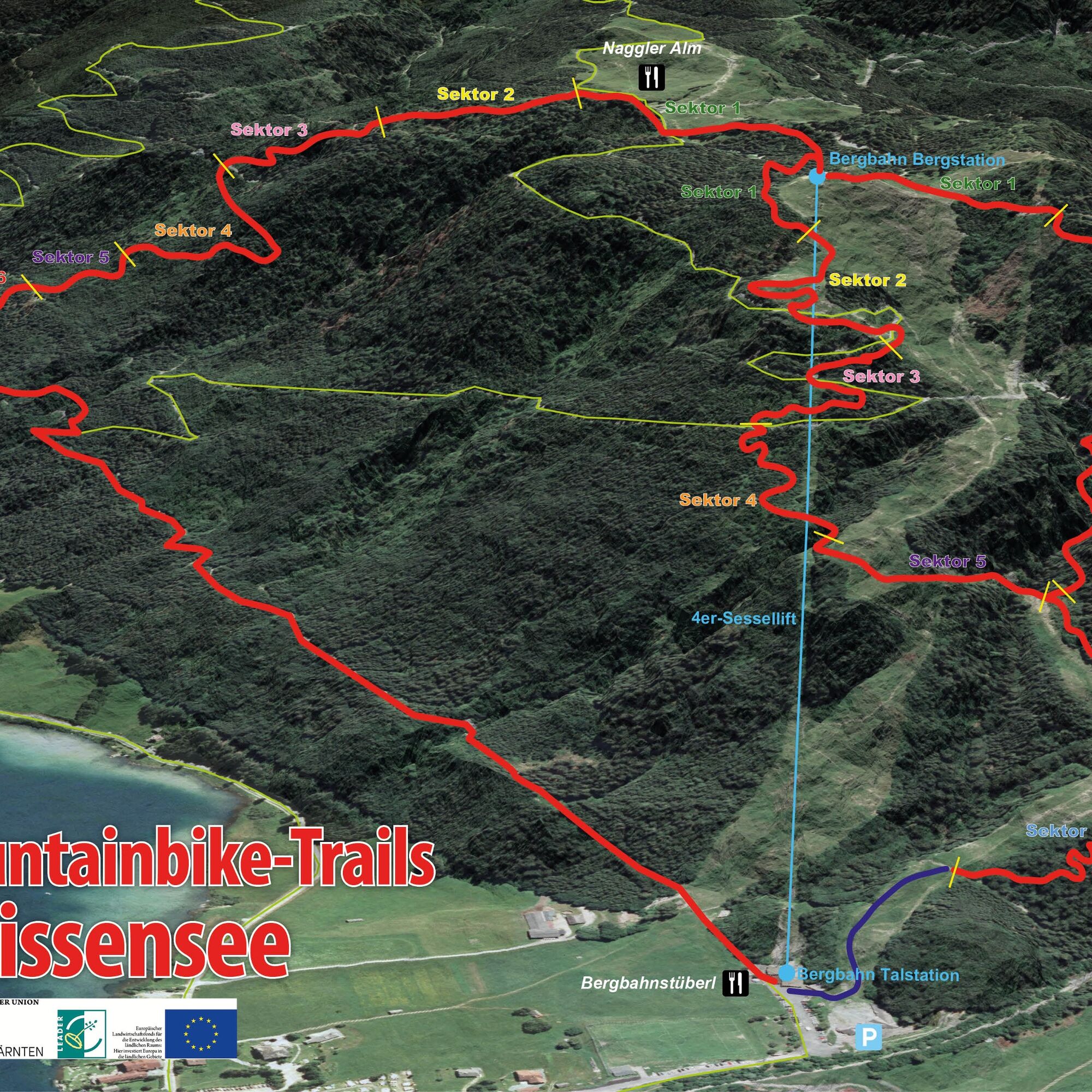
The trail entrance is located directly below the mountain station of the "Weissensee Mountain Railway". You can reach it comfortably by lift, which has its own mountain bike transport chairs, or optionally via the mountain bike route MW5 (Naggler Alm). The second built MTB single trail in the region with an exercise course offers a demanding 3 km long downhill route (380 meters altitude) and is a special kind of bike experience with root paths, switchbacks, steep curves, and roller-coaster sections. The route is suitable for advanced riders as it requires more technical skill and is hardly flowy to ride. The route impresses with unique lake views. At the end of the single trail, in the area of the mountain railway valley station, there is also an MTB exercise course. Various stations test and train skills and techniques on the mountain bike here. Watch the trail HERE as a video.
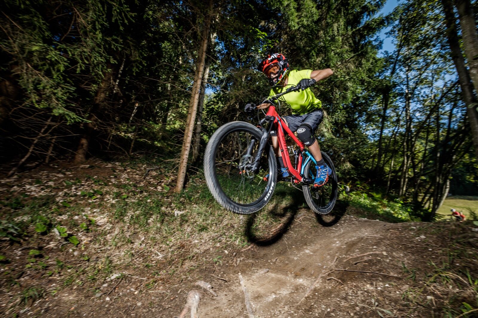
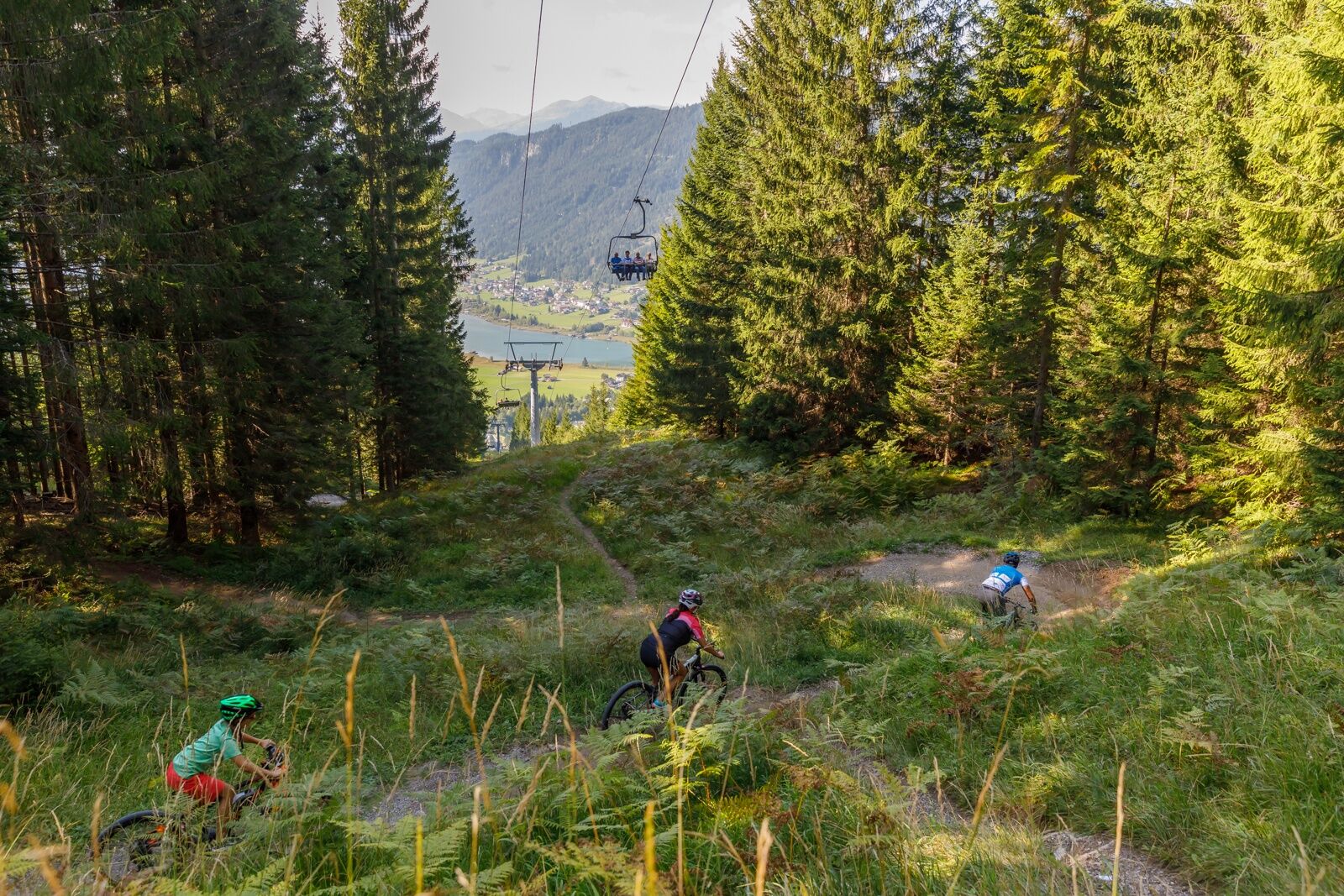
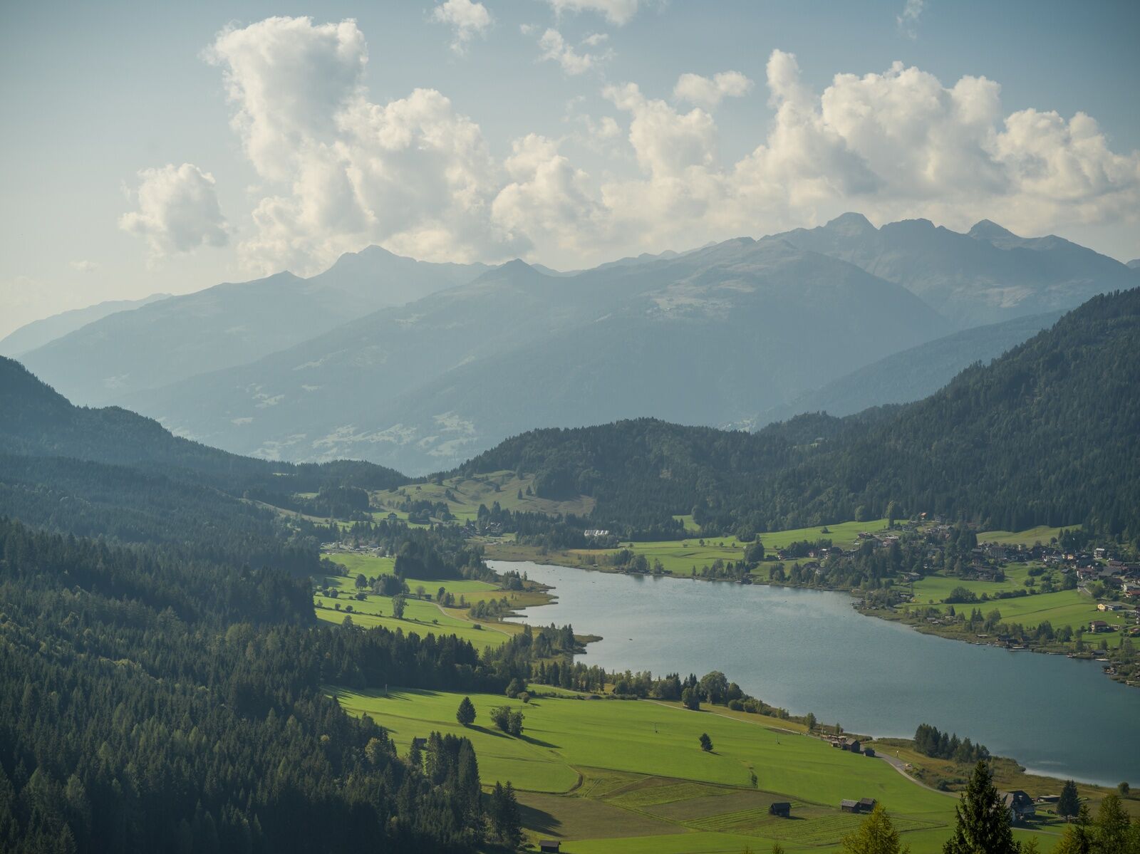

The trail leads down to the valley over root paths, switchbacks, steep curves, and roller-coaster sections.
Áno
Always wear a helmet as helmet use is mandatory.
For your own safety, also wear protectors, protective gear, and a full-face helmet.
Ride only with a suitable mountain bike.
Rules of conduct
Fair play rules for orderly coexistence:
Please stay on the marked and signed routes Use of the cycling routes is at your own risk Observe the bike maps and route descriptions Forest roads are work areas. Expect machinery, wood or potholes on the road, livestock, and motor vehicle traffic Particular attention must be paid to motor vehicles and pedestrians Ride at a controlled speed. If unexpected obstacles appear, dismount and push your bike past the obstacle No riding at dusk to protect wildlife Opening hours: May 1 - August 31 from 9 am to 8:30 pm; September 1 – October 31 from 9 am to 5 pm Camping, staying overnight in the forest at night, making fires, disturbing wildlife, or entering forest cultures under 3 m tree height is legally prohibited Always close pasture gates and doors. Beware of forestry work! Hikers always have priority over mountain bikers Keep the environment clean and avoid noise Observe traffic regulations and provide first aid if necessary Regularly check your sports equipment and always wear a helmet Please also communicate these fair play rules and thus raise awareness. Thank you!Arrival:
From the north (D, NL, B, L, DK, SK): 1) Munich - Salzburg - Tauern motorway (A10) - Spittal junction - Greifenburg - Weissensee
2) Munich - Salzburg - Bad Gastein (train loading - Tauern tunnel) - Mallnitz - Möllbrücke - Greifenburg - Weissensee
3) Munich - Großglockner High Alpine Road - Heiligenblut - Winklern - Iselsberg - Oberdrauburg - Greifenburg - Weissensee
4) Munich - Mittersill - Felbertauern Road - Lienz - Oberdrauburg - Greifenburg - Weissensee
From the west (CH, F, I): Innsbruck - Mittersill - Felbertauern Road or Brenner motorway - Lienz - Oberdrauburg - Greifenburg - Weissensee
From the east (A, H): 1) South motorway (A2) - Villach - Spittal - Greifenburg - Weissensee or Villach - toward Italy to Hermagor/Gailtal exit - Hermagor - Weissensee 2) West motorway (A1) - Salzburg - Tauern motorway (A10) - Spittal junction - Greifenburg - Weissensee
From the south (I, SLO, HR): 1) Udine - Tarvisio - Hermagor/Gailtal exit - Hermagor - Weissensee 2) Ljubljana - Karawank tunnel - Villach - toward Italy to Hermagor/Gailtal exit - Hermagor – Weissensee
...by train
Arrive comfortably and stress-free by train! Use the station shuttle service - it takes you from Greifenburg station to the 10 km distant Weissensee Nature Park. Shuttle reservations at: www.naturparkshuttle.com (reservation by 6 pm the day before at the latest)
Near Weissensee Mountain Railway valley station - fee required
S2
Webové kamery z prehliadky

Obľúbené výlety v okolí
-
5,0
W10 - Large lake round - Weissensee
ťažkéMountainbike 31,5 km -
4,7
W5 - Naggler Alm Round Weissensee
strednáMountainbike 15,8 km -
4,9
Slow Trail Weissensee
strednáTuristika 6,69 km -
4,5
RW_N9 Weißenbachklamm
strednáTuristika 7,49 km -
4,9
Weissensee Ost- nach Westufer
svetloTuristika 10,2 km -
4,9
Parkplatz Seetal - STAFF und retour
strednáTuristika 13,2 km -
4,8
Weiße Wand - Alm hinterm Brunn
Mountainbike 22,1 km -
4,6
Bergstation Weißensee bis Golz
strednáTuristika 14,8 km -
4,7
Drau Cycle Path R1
svetloCyklistika 75,9 km -
5,0
Bodenalm - Ostufer - mit dem Schiff zurück
Mountainbike 19,1 km

Turistika a stopovanie


Nenechajte si ujsť ponuky a inšpiráciu na ďalšiu dovolenku
Vaša e-mailová adresa bol pridaný do poštového zoznamu.





